Hello everyone and good day to you! Welcome to the CCN Weather Update for Wednesday May 21, 2025.
This weather update is sponsored by Freedom Insurance of Whiteville. When severe weather strikes, with Freedom Insurance you will always be prepared. For home, car, boat, or whatever you need, Freedom can provide customized coverage to keep you and your family safe. Contact Freedom today at 910-640-2828!
STATISTICS for Tuesday 5/20/2025
High: 88.8°F at 3:37 PM (Normal 81)
Low: 67.0°F at 5:13 AM (Normal 58)
Precip: 0.00 in
Precip – Month: 6.37 in
View real-time data from the weather station at College Street Weather Station.
Here’s today’s Bottom Line
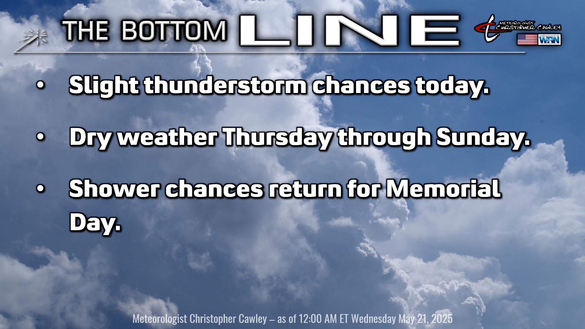
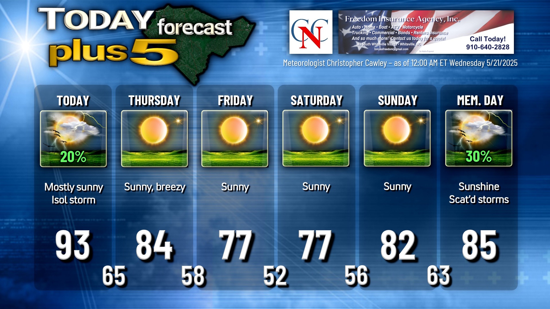
A warm front did indeed lift north across the area Tuesday, and the frontal passage was remarkable unremarkable, and underperformed in every way. A cold front will cross the county later this afternoon, and the more I look over the information, the more I think this frontal passage will be pretty boring as well. By far the most aggressive model is the NAM3k (which is usually the case), and that is only showing widely scattered thunderstorm activity for this afternoon. In short, carry an umbrella with you today but you probably won’t need it.
A word of caution though, any storm that does develop could be on the strong side.
Thunderstorm threat shuts down completely this evening, and we’re high-and-dry through late Sunday night thanks to high pressure ridging in. A second cold front sweeps across the area Thursday but rain chances are almost zero with this. Colder air pushes in Thursday night, and we’re going to see rather unseasonably cool temps Friday through Saturday. It’s going to be refreshingly beautiful Friday and Saturday with temps running some 5-8 degrees below seasonal averages by day, and even more so by night. Low temps early Saturday could dip to as low as 48-49 degrees in some of the outlying areas of the county.
Thunderstorm chances return for Memorial Day, but that’s going to be on the low side honestly as modeling tends to break down high pressure ridges a bit too soon. Memorial Day should be dry for the most part, but again, thunderstorm chances during the afternoon/evening.
TROPICAL WEATHER FORECASTS are returning as of June 1st, the official start of hurricane season.
Here is your Freedom Insurance Today-plus-Five Forecast:
That’s going to do it for today’s report. As always, thank you for reading and for supporting Columbus County News. Have a great day!
–Meteorologist Christopher Cawley