
Columbus County NEWS Weather Update for Wednesday July 22, 2026.
This weather update is sponsored by Freedom Insurance of Whiteville. Trust Freedom Insurance to give you clear blue skies when it comes to home, car, boat, or whatever insurance you need. Let Freedom provide customized coverage to keep you and your family safe. Contact Freedom today at 910-640-2828!
Here’s today’s Bottom Line
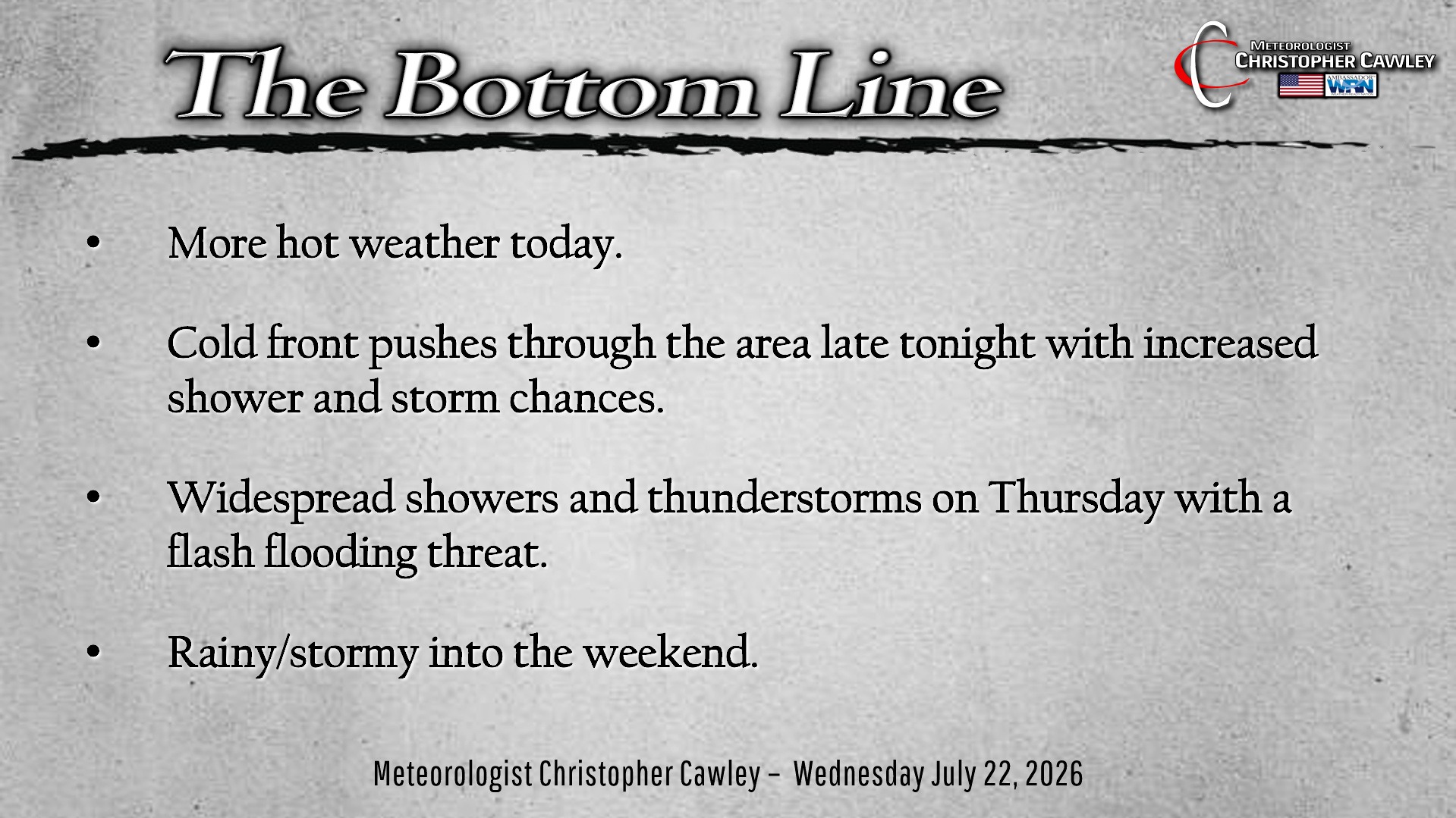
Stop me if you’ve heard this already… but it’s going to be hot again today. Yeah, yeah, I know. NWS will likely issue another heat advisory. I’ve honestly lost track of the number of heat advisories we’ve had this season, but it’s got to be some kind of record.
A few isolated storms may pop late this afternoon or this evening… but a better chance for thunderstorms tonight as some moisture pushes into the area.
Model guidance has dramatically slowed the forward progression of the cold front that will bring relief from the heat… with the front now slated to cross the area early Thursday. This front will stall near the coast and bring a prolonged period of rainy conditions to the area. This will create a huge dent in the drought… modeling suggests rainfall of 2-5 inches is possible over the area.
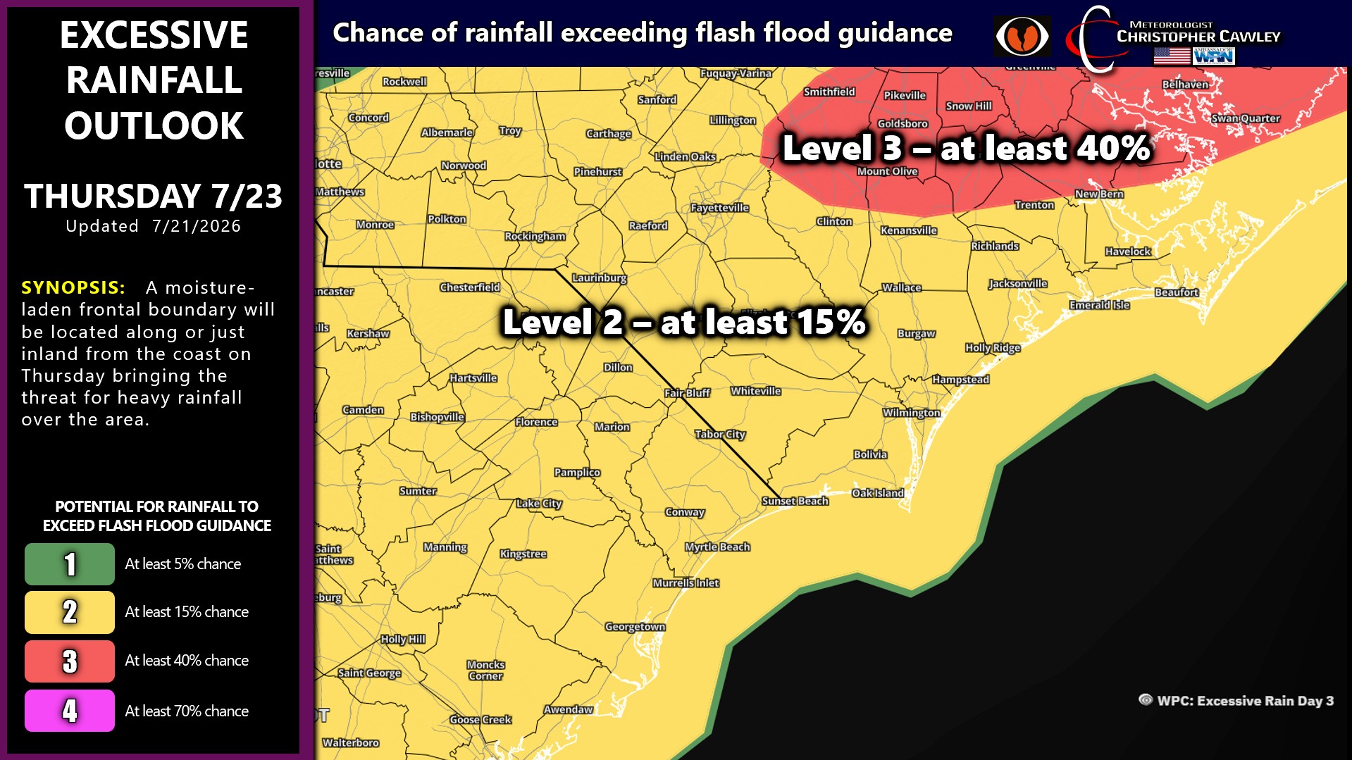
The NWS WPC has placed nearly all of eastern North Carolina under a 15% risk for rainfall exceeding flash flood guidance … primarily later Thursday afternoon through Thursday night. We’re also in the 15% risk for Friday. It would take 3-4 inches of rain in a 3-hour time period to trigger flash flooding, according to various metrics. However, as little as 1-2 inches of rain in 1 hour will cause flooding in Whiteville.
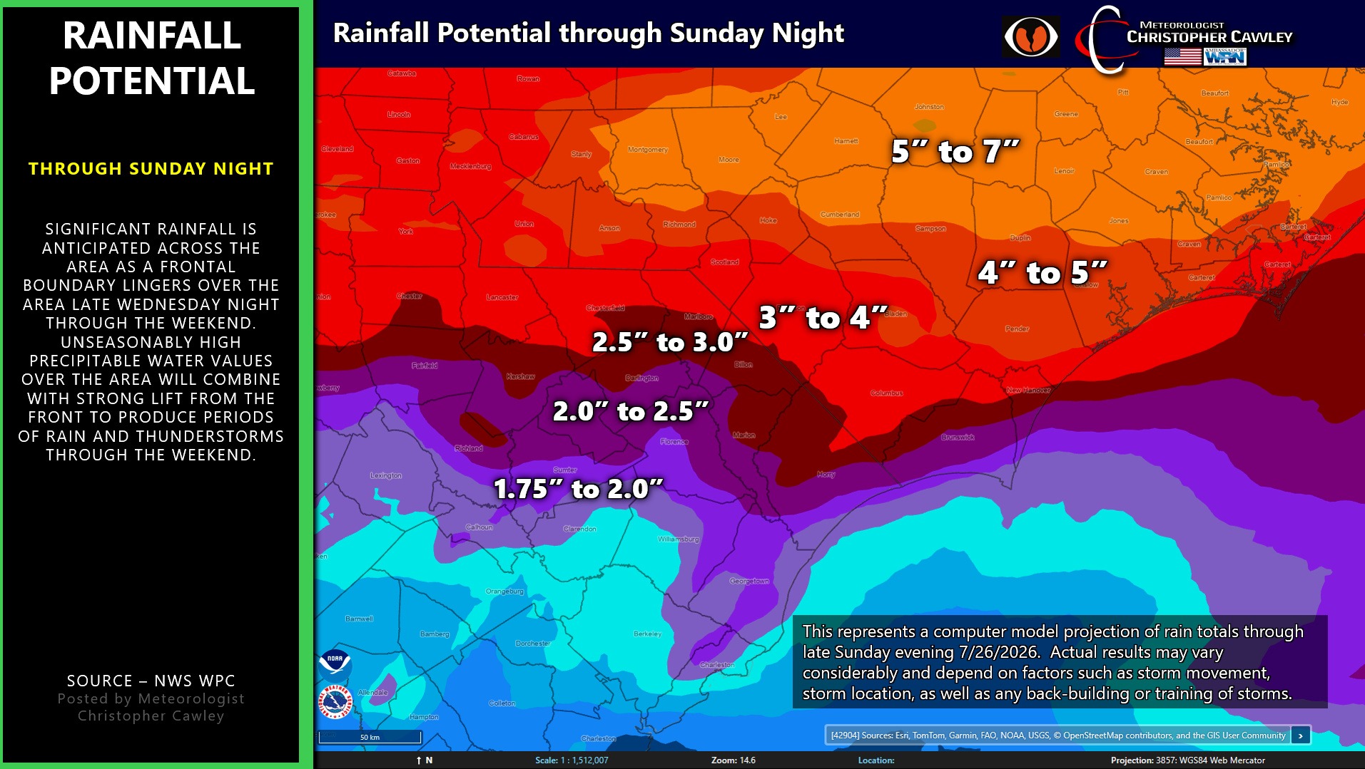
I don’t care how good the drainage system is, when you get sudden heavy rainfall, there will be flooding.
The front should dissipate by the end of the weekend bringing a return to the heat and sunshine by early next week.
TROPICS: Tropical storm Bertha continues to creep ever so slowly due-west along the Gulf coast. She will make a first landfall south of New Orleans later this evening before picking up speed and making a beeline for the Texas coast just south of Houston by Thursday evening. No threat to the Carolinas, and therefore I did not create a graphic.
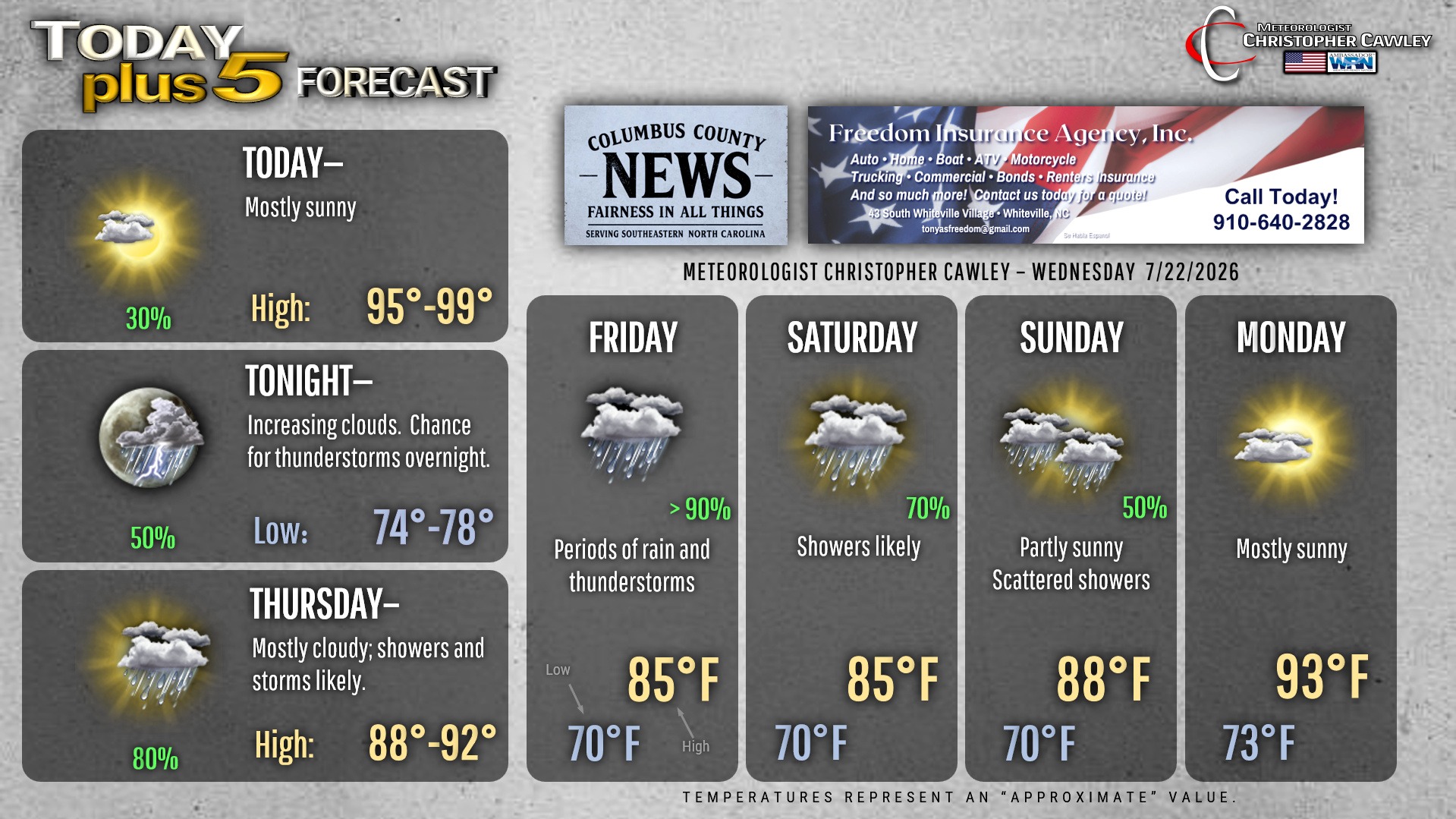
Here is your Freedom Insurance Today-plus-Five Forecast:
–Meteorologist Christopher Cawley