
Columbus County News Weather Update for Friday September 4, 2026.
This weather update is sponsored by Freedom Insurance of Whiteville. Trust Freedom Insurance to give you clear blue skies when it comes to home, car, boat, or whatever insurance you need. Let Freedom provide customized coverage to keep you and your family safe. Contact Freedom today at 910-640-2828!
Here’s today’s Bottom Line
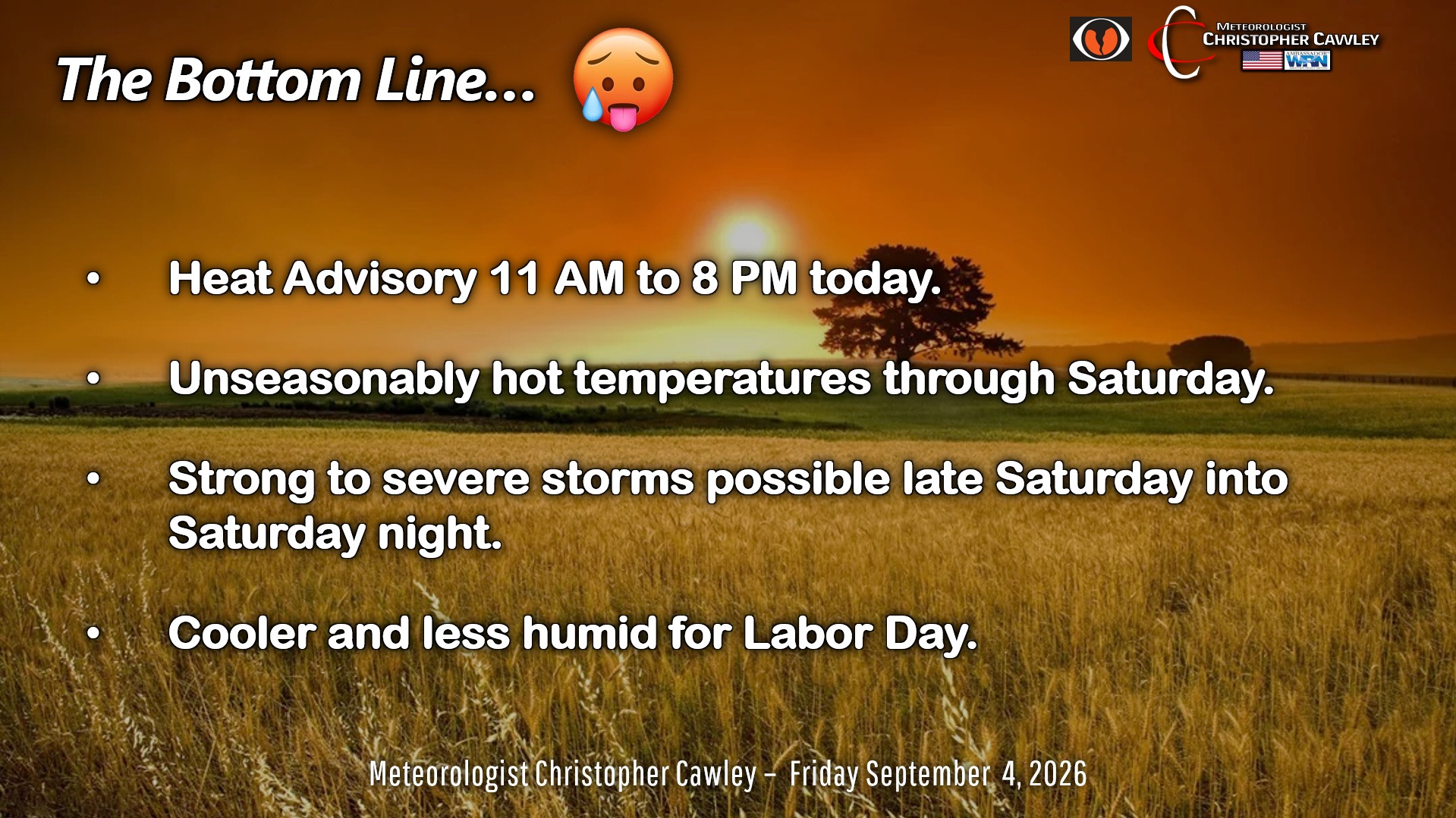
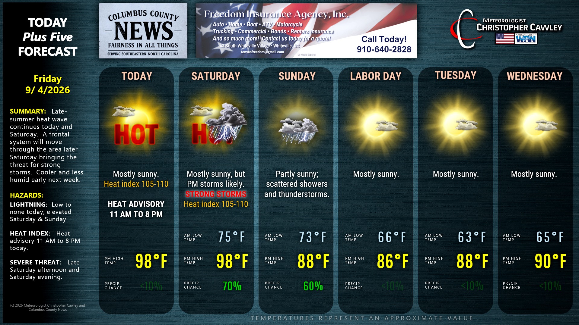
Another day, another heat advisory. A strong high pressure ridge is essentially overhead for today. Sinking/compressing air will lead to temps flirting with the 100-degree mark, and heat index values pushing toward 110.
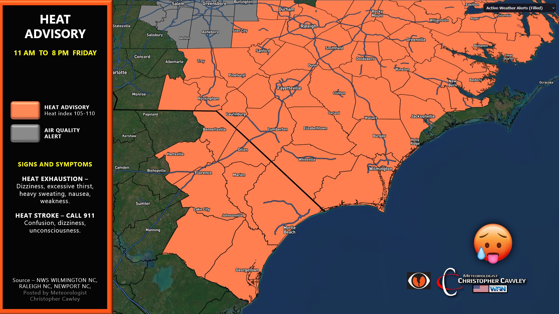
Another heat advisory will likely be issued on Saturday… but that will be the last one maybe for the season.
Next up… a cold front. The first glorious early-fall cold front. Ahead of this, the high pressure ridge will push southwestward toward the great plains.
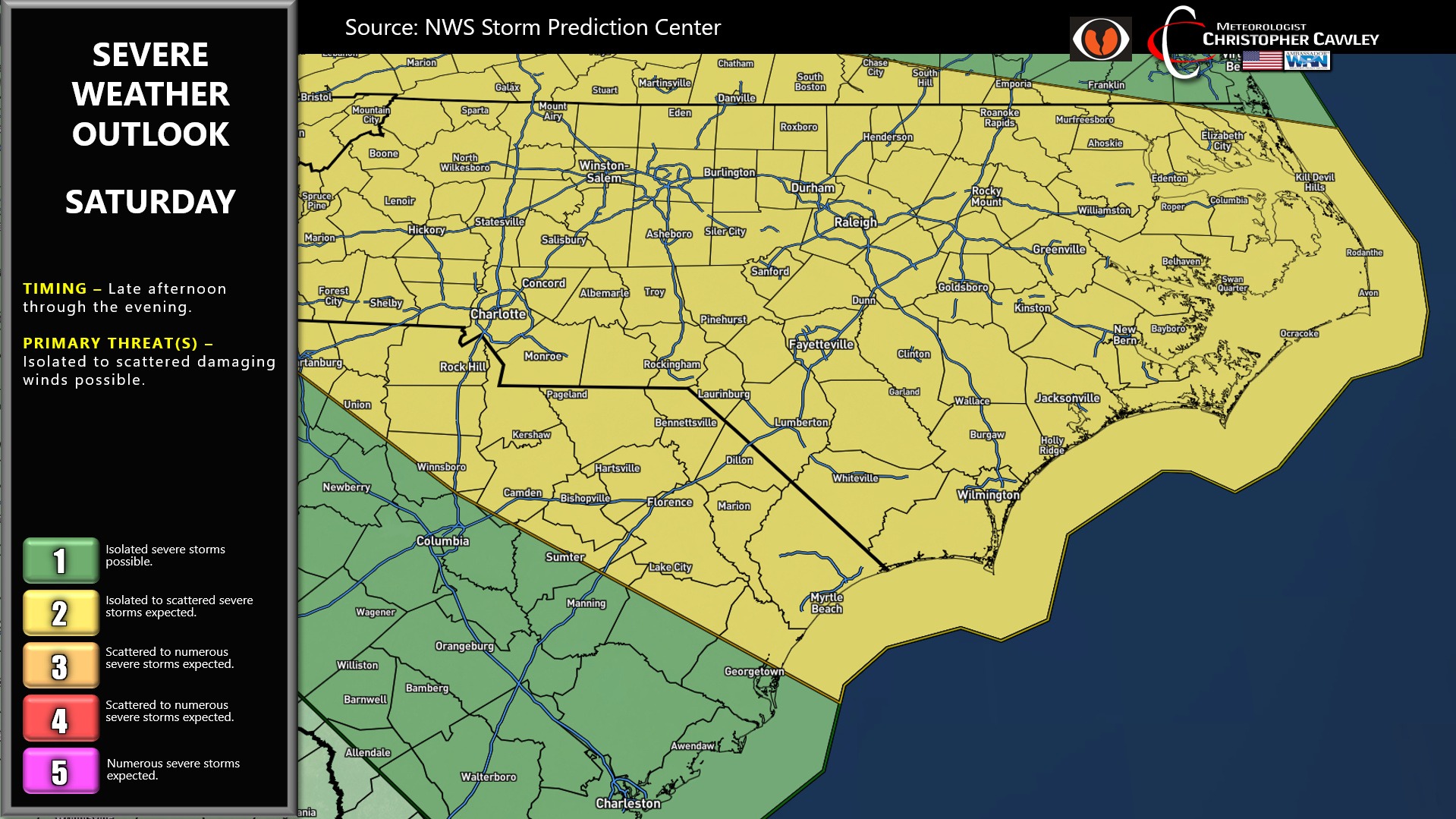
So again, one more round of heat on Saturday. The surface front pushes down from the north. Showers and thunderstorms are likely to develop late in the afternoon and last through the evening. Conditions are expected to be favorable for severe storms, with damaging winds being the primary risk.
The front should clear the area by Sunday, but a wave of low pressure is likely to form on the front. This will bring at least scattered showers and storms on Sunday.
This is all done by Labor Day. We’ll enjoy bright sunny skies and MUCH LOWER HUMIDITY values for Labor Day and Tuesday. Early morning lows may fall to the lower and middle 60s for the first time in a LONG time. The refreshing air mass may be short-lived as indications point to temps rising back into the 90s for the second half of NEXT week.
TROPICS: No threats.
Here is your Freedom Insurance Today-plus-Five Forecast:
–Meteorologist Christopher Cawley