
Columbus County News Weather Update for Friday October 9, 2026.
This weather update is sponsored by Freedom Insurance of Whiteville. Trust Freedom Insurance to give you clear blue skies when it comes to home, car, boat, or whatever insurance you need. Let Freedom provide customized coverage to keep you and your family safe. Contact Freedom today at 910-640-2828!
Here’s today’s Bottom Line
All eyes are focused on the rain that is likely to occur this weekend. Moisture from Hurricane Isaias will combine with an onshore flow from the Atlantic to produce copious rainfall.
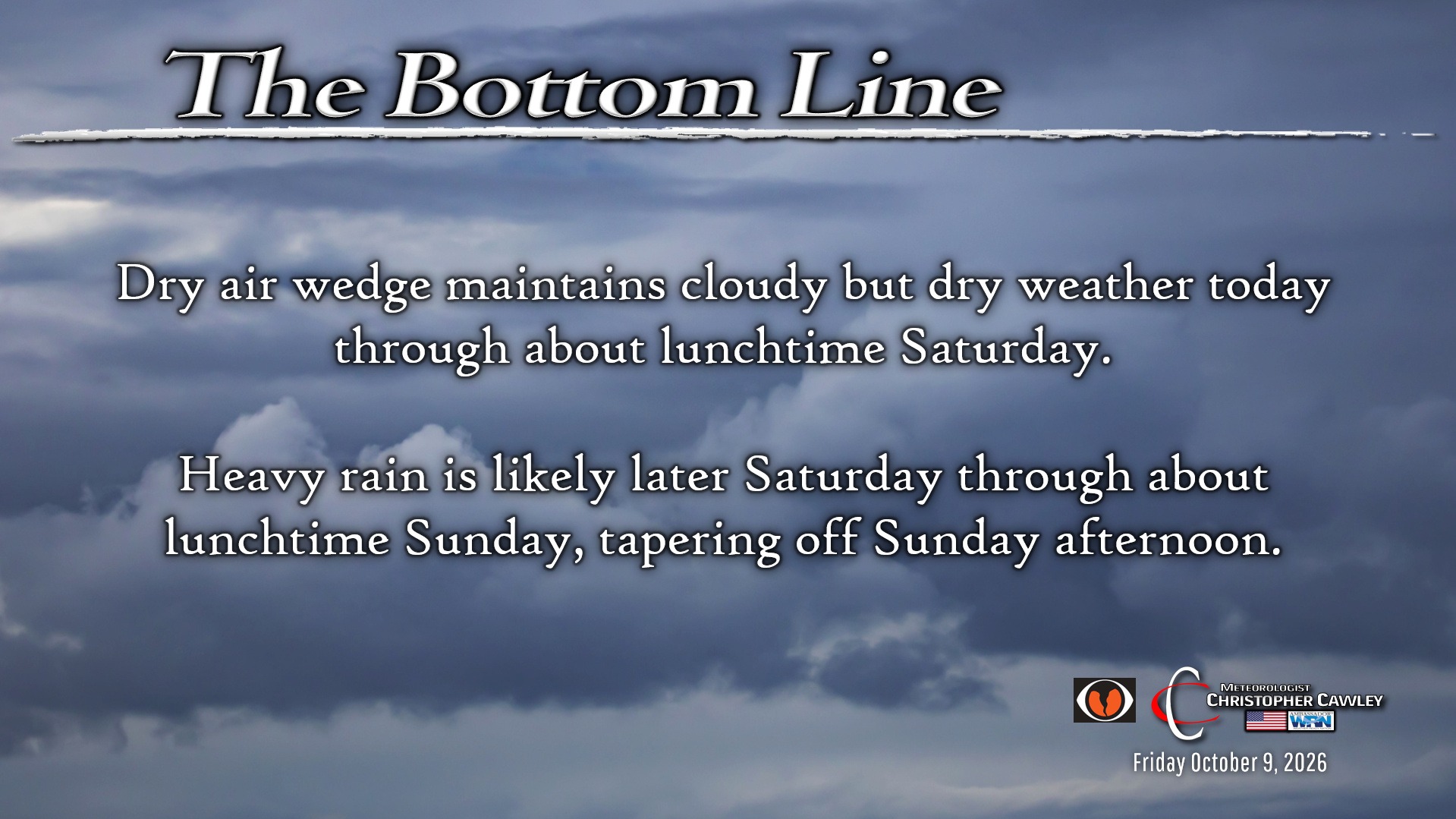
A bit of a dry high pressure wedge will keep us very cloudy today… but dry. We’ll stay dry through about lunchtime on Saturday before the moisture from the rapidly expanding Isaias moves up the coast.
Rain becomes steadier and heavier later Saturday afternoon into the evening, with periods of heavy rain likely Saturday night, gradually tapering off through the day on Sunday.
The storm comes to an end Sunday night with increasing sunshine on Monday, and dry weather Tuesday through Wednesday.
RAINFALL:
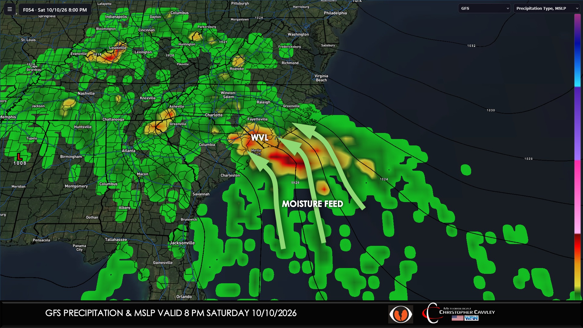
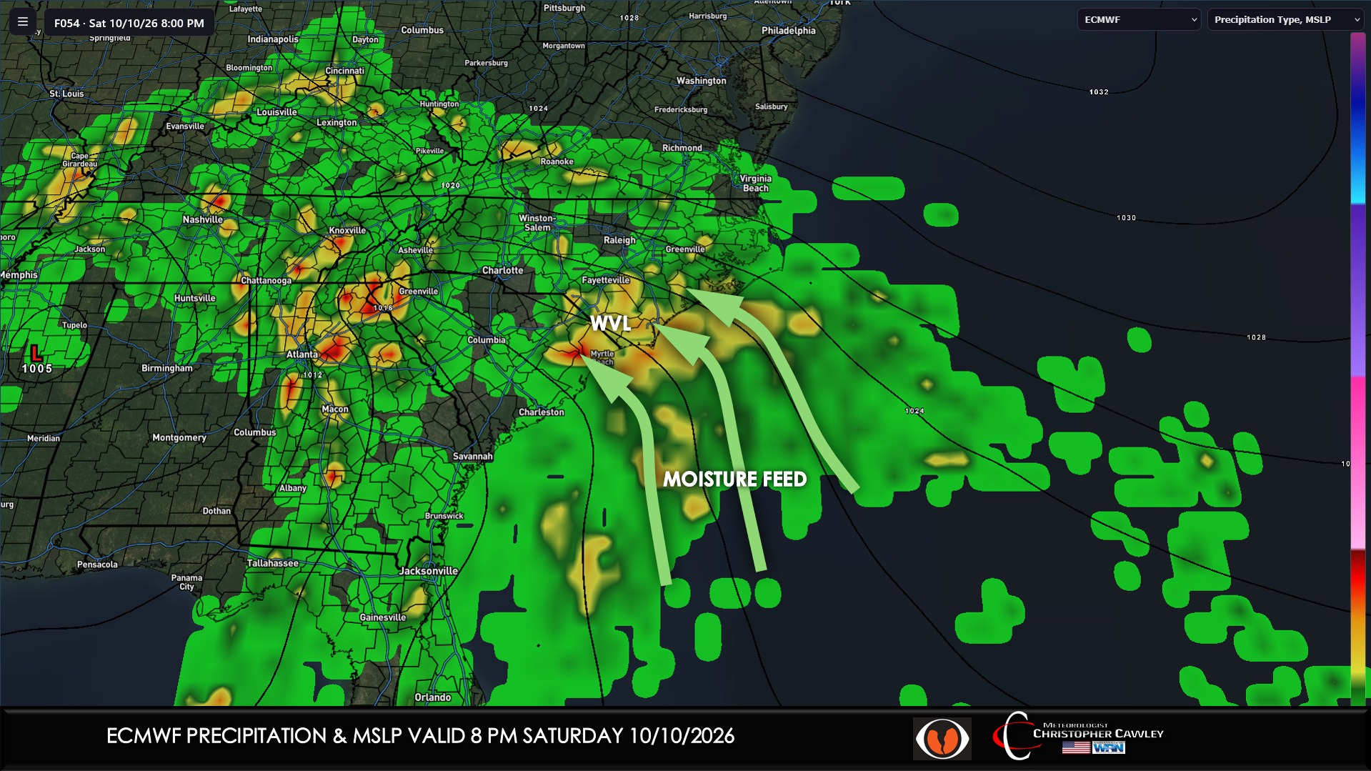
European and GFS guidance is in very good agreement about the southeasterly flow off the Atlantic as the remnants of Isaias lifts north through the deep south.
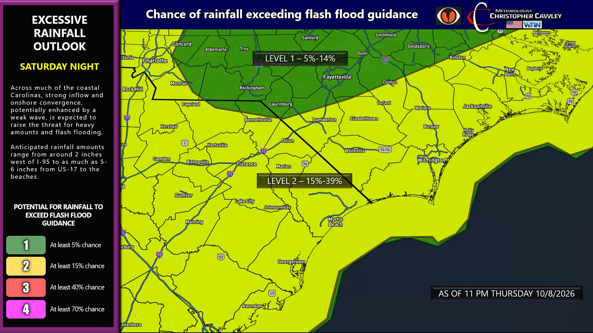
“Streams” of enhanced rainfall are likely to develop but it is impossible to predict where these bands will establish. While rainfall amounts of 2-4 inches are likely, where these enhanced areas of rain set up could see 6+ inches of rain … and flash flooding.
Flash flooding will be extremely difficult to see at night so extreme caution should be used if you have travel plans Saturday night into early Sunday.
The rain should become more intermittent as we move through the day Sunday, likely tapering off completely during the evening hours.
The National Weather Service is considering issuance of a Flood Watch for the area for the storm period.
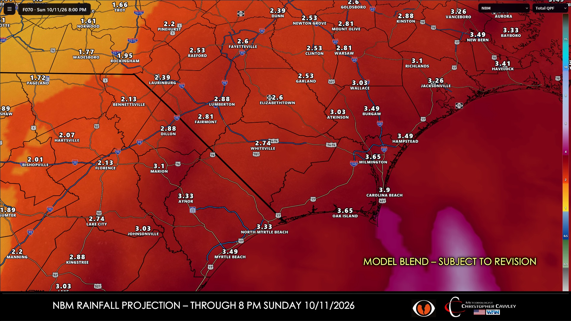
SEVERE WEATHER:
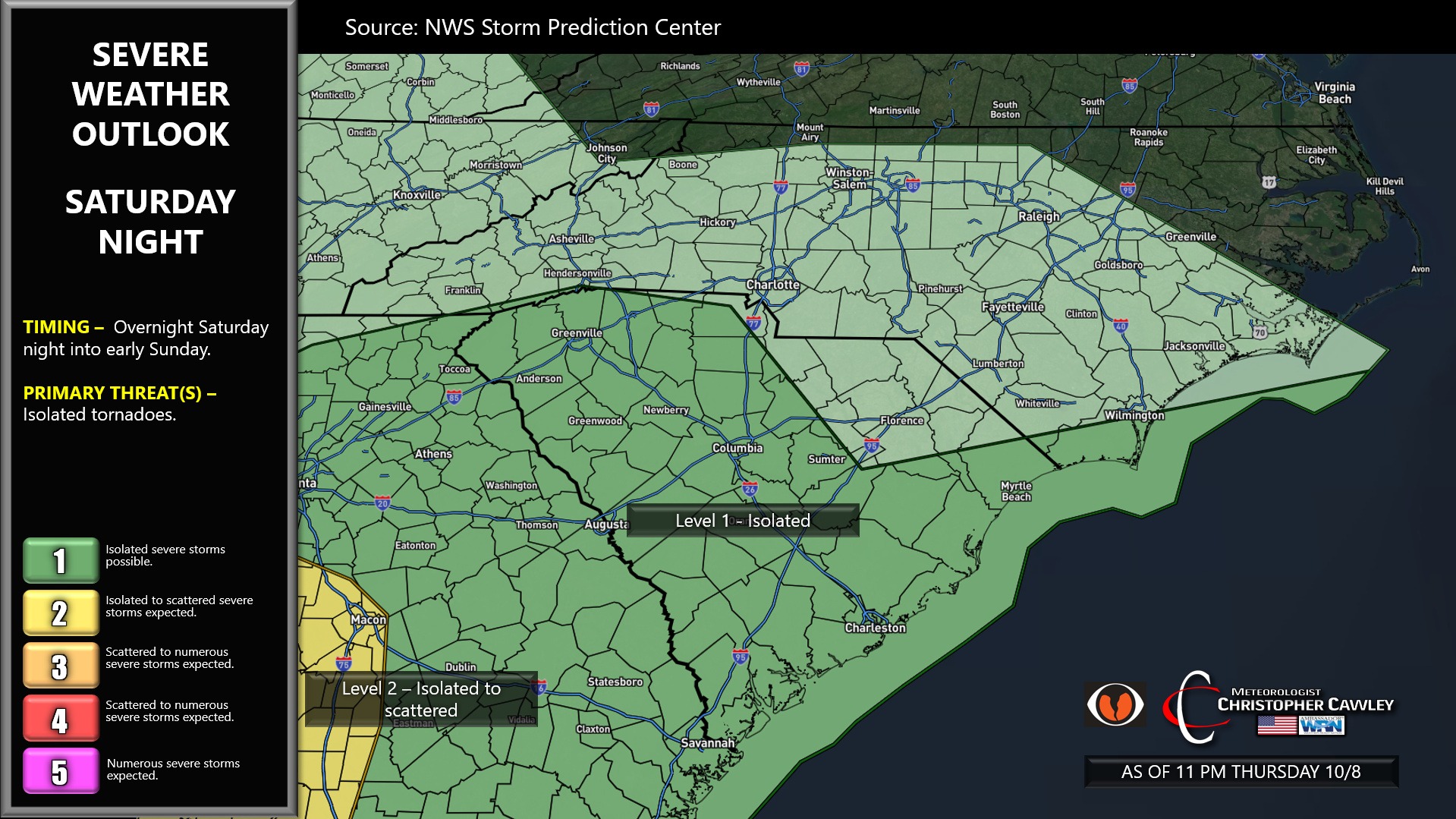
There is the potential for ISOLATED spin-up tornadoes as rain bands push northwest off the Atlantic. The highest threat for tornado development, as of right now, should be south of a line from Wilmington westward through Sumter, S and points west.
WIND: Breezy conditions are likely Saturday afternoon through Sunday afternoon. Winds won’t be extreme by any means; sustained winds out of the southeast 15-25 mph with occasional higher gusts.
The overall impacts from this system will be moderate, primarily in the form of heavy rainfall … which is honestly much needed. It’ll be a great weekend for staying in.
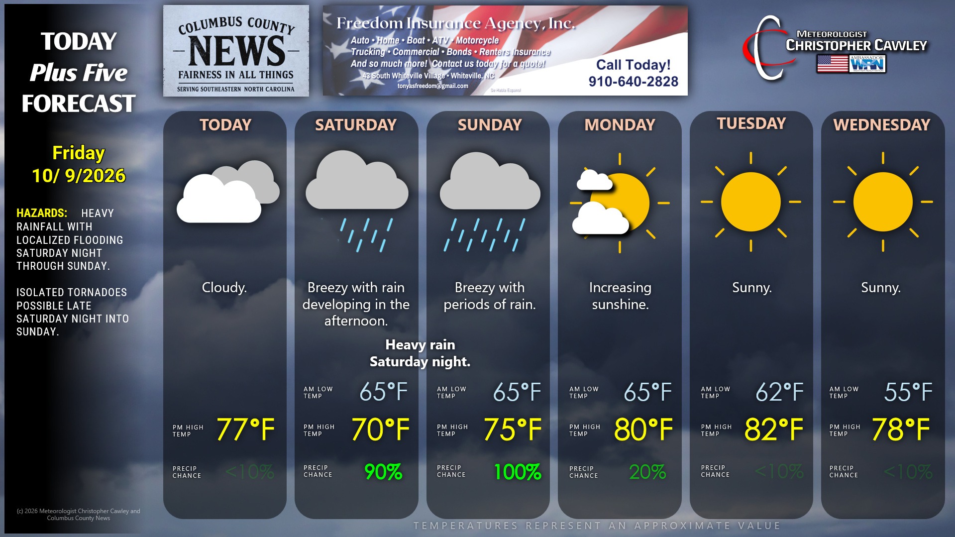
Here is your Freedom Insurance Today-plus-Five Forecast:
–Meteorologist Christopher Cawley