

Columbus County News Weather Update for Saturday November 21, 2026.
This weather update is sponsored by Freedom Insurance of Whiteville. Trust Freedom Insurance to give you clear blue skies when it comes to home, car, boat, or whatever insurance you need. Let Freedom provide customized coverage to keep you and your family safe. Contact Freedom today at 910-640-2828!
Here’s today’s Bottom Line
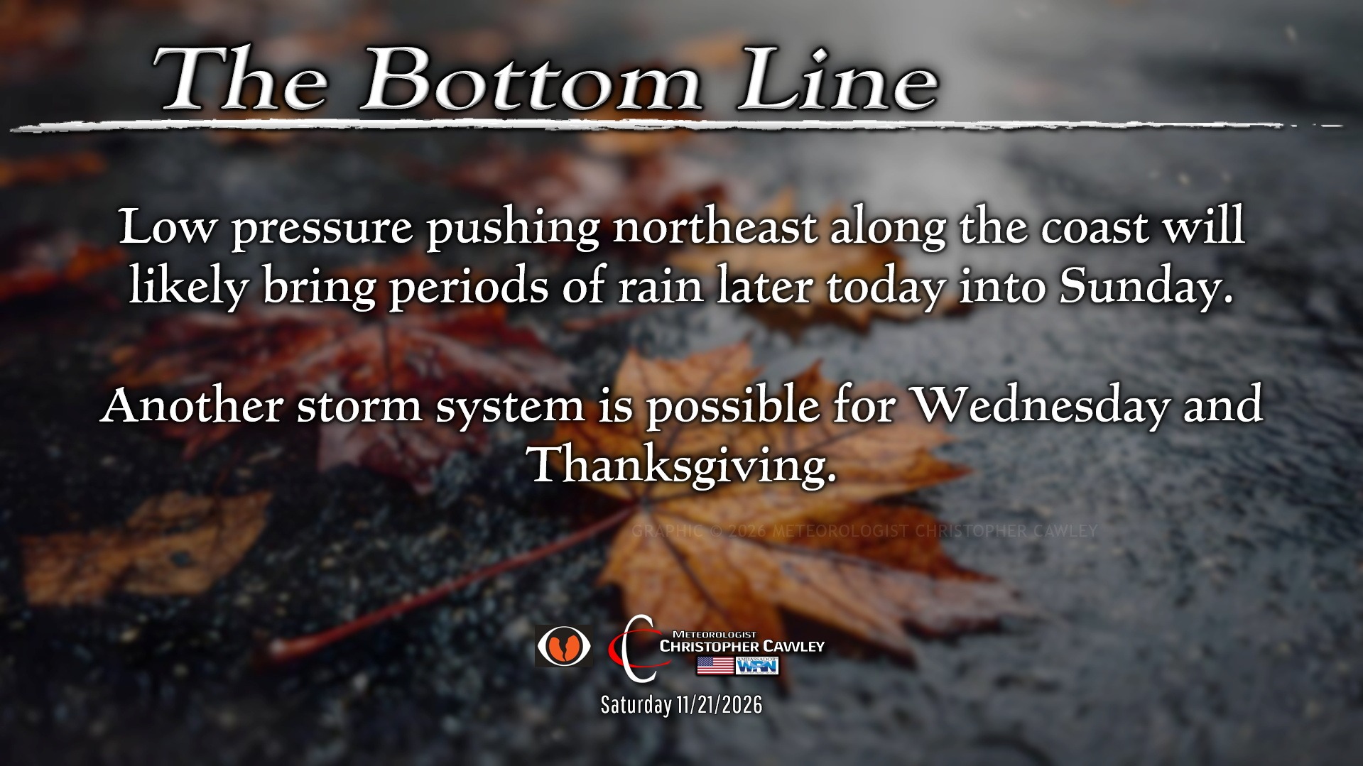
Low pressure offshore is still expected to bring SOME rainfall to the area this afternoon through tonight and into Sunday. The highest rainfall totals will be farther east, toward the coast…… and there is STILL some uncertainty on the eventual storm track.
This really is going to be a “nowcasting” event; so follow my page, @MeteorologistChristopherCawley for updates throughout the duration.
If you’re traveling toward the beaches from Myrtle Beach northward through Wrightsville Beach, there is a very slight risk for an isolated tornado (waterspout moving onshore).
This system, at this time, is highly unlikely to become tropical or subtropical. Surface analysis shows a warm front extending from the Gulf into the western Atlantic. There are actually THREE prominent spins (low pressure). These three areas of low pressure will “dance” while lifting northeast along the coast. Ensemble modeling continues to show several distinct “clusters” where each of these lows could progress over the weekend. My confidence in any of these solutions … isn’t great to be honest.
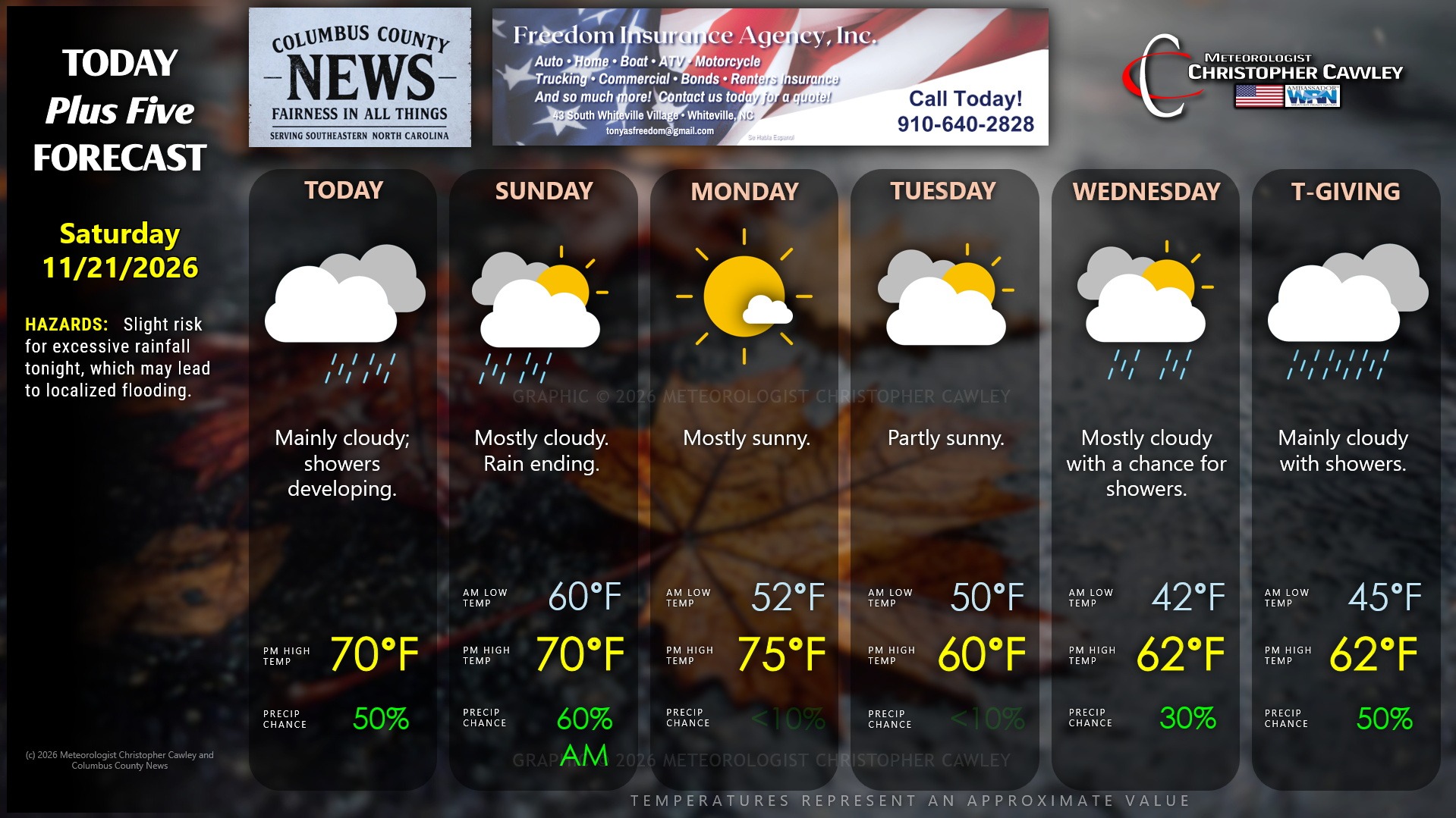
So in “normal people terms,” what you can expect is an increasing threat for showers this afternoon, transitioning to periods of rain tonight, tapering off during Sunday morning. Now… depending on where any one of these three low centers travels, could mean the difference between a few tenths of an inch of rain, or maybe an inch-plus.
If a particular setup occurs, like threading a needle, a “firehose” of rather heavy rain could extend from offshore at Myrtle Beach north-northwest through central Columbus County. If THAT happens (and that’s a huge “IF”), within the “firehose” we could experience several inches of rainfall, while areas outside of that axis would receive much lower amounts.
Again… it’s all “nowcasting,” and what ultimately occurs won’t be known until it’s actually happening.
Then attention turns to next week. A strong (dry) cold front will cross the area late Monday with some breezy conditions. Surface low pressure is likely to organize on the southern edge of that front. Modeling suggests the front hangs up along the coast, forming a conduit for the prospective low center. The modeling is waffling a bit on the storm track…. but right now I’m going ahead and forecasting showers for Wednesday and Thanksgiving, but we’ll have to wait and see on that one.
Here is your Freedom Insurance Today-plus-Five Forecast:
–Meteorologist Christopher Cawley
Copyright 2026 © Columbuscountynews.com and Southeastern Community News LLC. All rights reserved. No material may be commercially reprinted, copied or reused from this site without the express written permission of the publisher.