Meteorologist Christopher Cawley with your Monday evening weather update. I hope everyone had a fantastic weekend and a good start to the week.
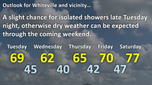
A cold front moved through the area today and we’ll see cooler temperatures through the middle part of the week. Another weak frontal boundary drops across the area late Tuesday night / early Wednesday, and this may bring a few scattered light rain showers during the overnight Tuesday night, but even chillier temps can be expected on Wednesday. Strong high pressure ridges over the eastern half of the country for the rest of the work week and into the weekend with sunny days and clear, cool nights.
Average highs are in the lower to middle 70s for this time of year, but we’ll run a good 10 degrees below that especially on Wednesday and Thursday. Lows Wednesday night will drop to the lower 40s in town… but I wouldn’t be surprised if some backyard thermometers had readings in the upper 30s especially north of town toward Clarkton or out toward the Charter School. No frost is expected at this time.
Temperatures start to warm back up as we go into the weekend as the high slips off the coast. We’ll approach the 80-degree-mark by early next week. No significant rainfall in sight.
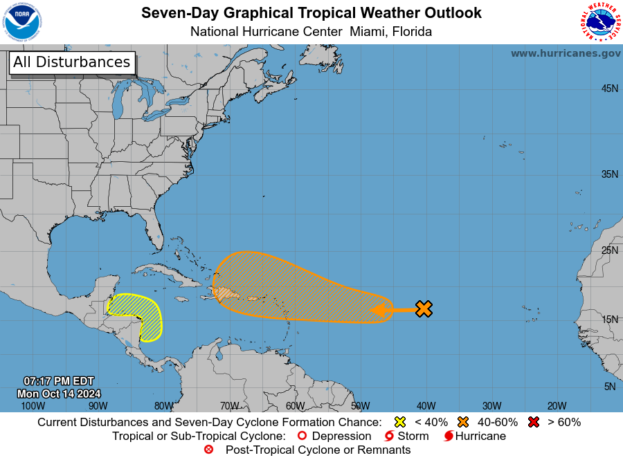
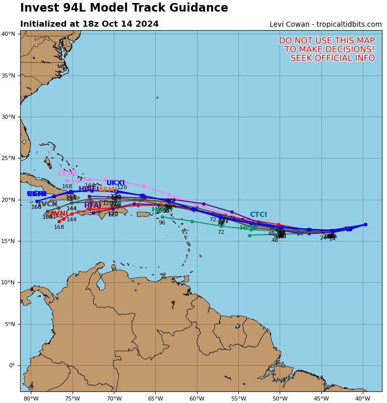
TROPICS: The National Hurricane Center is watching a disturbance (known as “invest 94L”) over the central tropical Atlantic ocean. The system is basically a disorganized area of thunderstorms, and it’s located in an area that has a ton of dry air thrown in, so short-term development isn’t likely. The system will drift westward into an area more favored for development, and the NHC gives it a 60% chance of developing into a tropical system over the next 7 days. It’s too early to make any kind of all on where it’s going to go, but the strong ridge(s) of high pressure to the north should keep this system well south and NOT coming up the east coast, as shown by the modeling. I’ll be watching it carefully.
Ok that’ll do it for this update, thanks for reading, and take care!