Hello friends, Meteorologist Christopher Cawley here with today’s weather update, for Tuesday evening October 22, 2024.
We’re starting to approach record levels of dryness… and there’s a chance that we go the entire month of October with little to no rainfall AT ALL for most of southeast North Carolina. The latest drought numbers will be published on Thursday, and it wouldn’t surprise me to see our area under low-level drought conditions. This could raise fire weather concerns as we go into November, which is typically the driest month of the calendar year.
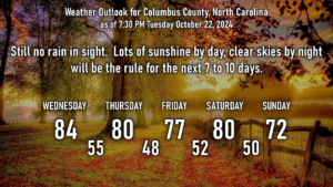
The forecast is very straightforward thanks to the ridge of high pressure that just isn’t budging. There are a few dry cold fronts that will drop through our area — one on Thursday and a stronger one later on Saturday. These fronts will have little fanfare — perhaps some cloudiness (and even that is a bit of a stretch). Temps remain above seasonal normal values until the weekend when they cool down briefly behind the Saturday cold front… but longer-range modeling shows our highs jumping back up to around the 80-degree mark during the first week in November.
Looking at the tropics, Oscar has essentially fallen apart and has become just a remnant low. He will continue to drift northeastward and that’ll be it for him.
I’m watching modeling that hints at some kind of tropical development in the time-frame of October 30-November 2nd. The models are all over the place so there’s nothing definitive at this time, but I think there will be some kind of development in the next 2 weeks.
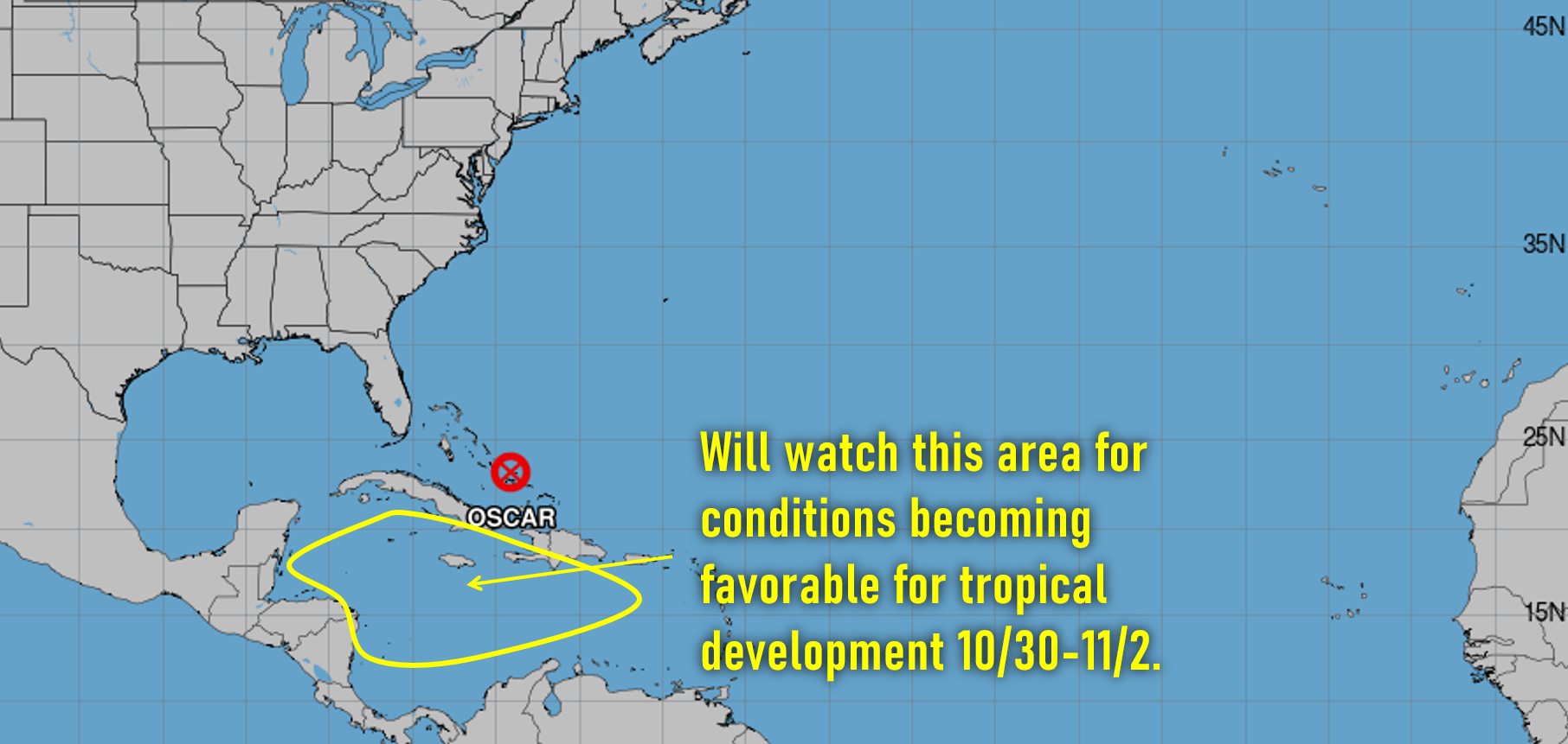
Outside of that, nothing is expected in the short-term as far as tropical development goes.
That’ll be all for this update, thanks for reading and take care!