Hi everyone, Meteorologist Christopher Cawley here with your weather update for Wednesday October 30, 2024.
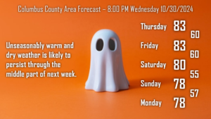
It’s going to feel more like the end of August than the end of October with warm temperatures, a bit of humidity in the air, and mainly dry weather … through at least the middle of next week.
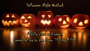
For the ghouls and goblins on Halloween, expect mainly clear skies with warm temps into the early evening hours on Thursday. Look for temps to fall from around 80 at 5 PM to the lower 70s by 9 PM. No weather worries at all.
Unseasonably warm conditions continue on Friday ahead of a dry cold front, which will move through Friday night and bring “slightly cooler” temps for the weekend. Temps will still run quite a bit above where they should be for the first of November.
The ridge(s) of high pressure will shift offshore early next week, and a bit of a “Bermuda high” pattern will take place. This is something typically seen in the summer months, and will bring increasing temperatures and humidity to the area through the middle of next week. It’s a safe bet that our highs by next Tuesday and Wednesday will be deep into the 80s… and we may even be talking heat index values around the 90-degree mark the middle of next week. In November.
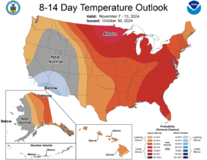
The Climate Prediction Center’s outlook calls for above-normal temperatures to persist into the middle of November.
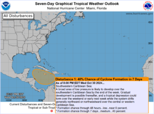
Tropics: The National Hurricane Center continues to monitor an area of low pressure in the southern Caribbean Sea. The system is likely to drift generally northward through the weekend, perhaps pushing more toward the Yucatan as we go into next week. Some modeling suggests this becomes a tropical system, and the NHC continues a 40% probability within the next 7 days.
That’s it for tonight my friends, thank you for reading, and as always, take care!

