Good evening, Meteorologist Christopher Cawley here with today’s local weather update and an update on Hurricane Milton.
Hurricane Milton will make landfall around 9 PM just south of Sarasota, FL, as a category 3 storm. This was outstanding forecasting by the National Hurricane Center from the beginning, as the original storm track had landfall as a cat-3 near Tampa. Sarasota is about 40-ish miles south of Tampa so, again, that’s outstanding forecasting from the NHC.
Some TikTok folks are sharing posts that the storm will ride up the coast and ravage the Carolinas. Unless all of the laws of physics and nature are violated, that just isn’t going to happen. A frontal boundary draped across northern Florida and southern Georgia, extending east off the coast, combined with strong high pressure just to our north, will keep Milton to our south and “steer” him eastward across the state of Florida. He will then emerge into the Atlantic, and continue on an eastward trek eventually becoming a memory.
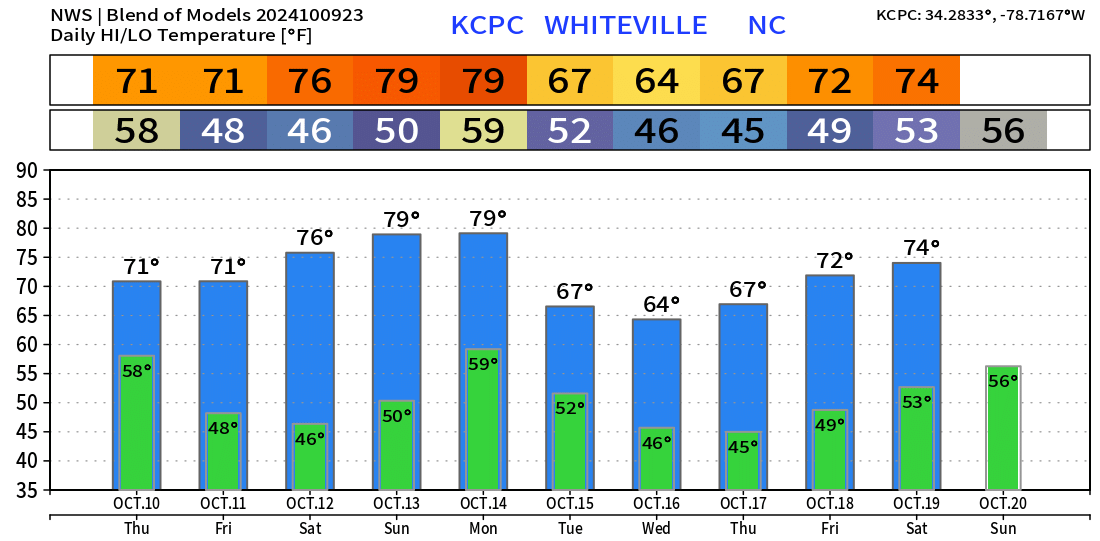
As for us, cloudiness tonight (from Milton) will gradually give way to sunny skies on Thursday. The aforementioned high pressure to our north will remain firmly in control of our weather right through the weekend. You can expect bright sunshine Friday through Monday, with highs rising from the lower 70s on Friday to around 80 by Sunday and Monday.
A strong cold front moves through late Monday night but there will be nothing for the front to work with… we may see a few clouds but that’ll be about it. By next Tuesday we likely won’t even get out of the 60s for high temps. NWS model blend projects highs in the 60s for the middle part of next week with no rain in sight.
That’ll do it for tonight, folks. Thanks for reading!