Hello and Happy New Year’s Eve! Meteorologist Christopher Cawley here with your CCN Weather Update.
The blogs the past few days have been quite lengthy; I’ll keep today’s short and sweet.
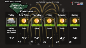
Quiet weather straight through the coming weekend with chilly temps (after today, that is).
Today should actually be quite nice. There are some areas of fog and low clouds thanks to moisture trapped at the lowest levels of our atmosphere. I believe this will “mix out” as the day wears on. We should end up with a mix of sunshine and clouds on the whole. A cold front will cross the area this evening. A few isolated light rain showers might pop up this afternoon ahead of the front. The latest HRRR and NAM3k modeling only has a few spots of green on the map, so whatever we get, it won’t be much at all.
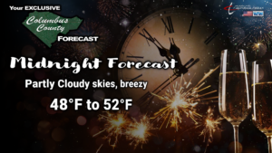
If you have any plans this evening (such as the New Year’s Eve Party at Y’Vull Axes & Ales), or if perhaps you’re headed to the beach … the weather should be just fine. Slightest chance for a spotty shower during the evening hours should give way to a partly cloudy sky at midnight. It’ll be a bit breezy, and temps will be around 50°F here in Whiteville… lower 50s at the beaches.
Our weather is completely dry through Saturday. Our temperatures will be seasonable on New Year’s Day, highs in the upper 50s. Then we drop just a touch below normal for Thursday-Sunday… nighttime temps dipping below freezing.
Long-term… modeling is still strong on polar air plunging southward over the eastern half of the country next week. Some indications are that temperatures could run as much as 20 to 30+ degrees below seasonal normal values. This still appears to be one of the coldest snaps we’ve seen in recent memory. NOW is the time to winterize your vehicle and your home (and your animals) to protect against this pipe-bursting cold.
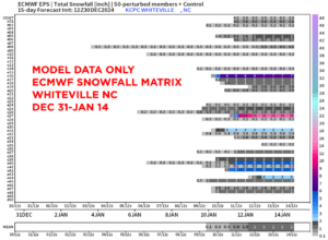
And there’s still the potential for some snowfall. It’s too early to call … and there are certainly NO guarantees … but the majority of ensemble models point to some accumulating snow here around the 9th to the 10th.
**IF** a storm forms on the southern jet stream and turns up the coast (as being depicted by the GFS modeling), frozen precipitation chances are pretty good. No guarantees.
That’ll do it for today’s report, and for the year 2024. I wish everyone all the best for 2025. Thank you for reading, and take care.


