Greetings friends, welcome to the Monday edition of the CCN Weather Update.
This weather update is brought to you by our friends at Freedom Insurance Agency here in Whiteville. Call them today at 910-640-2828 for all of your insurance needs. Freedom’s excellent customer service representatives’ top priority is meeting your needs through top-tier customer service. Contact them today!
Our climate statistics for Sunday, January 26 at my weather station in Whiteville shows that we had a high temperature of 56.8°F at 3:02 PM and a low of 27.1°F at 7:38 AM, and no precipitation was recorded. You can check out the conditions in Whiteville in real-time by clicking on this link — https://www.wunderground.com/dashboard/pws/KNCWHITE8
The Bottom Line–
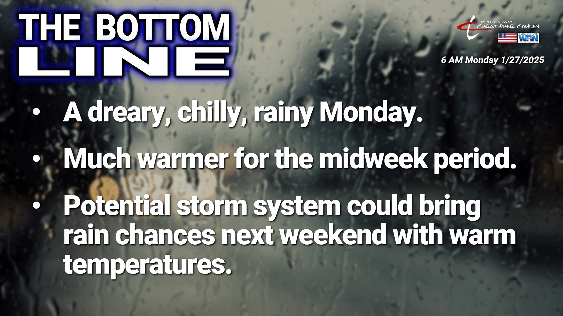
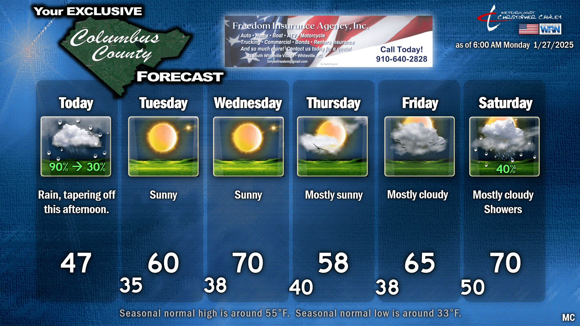
Folks, today is not going to be a very nice day. Light rain is expected through much of the morning hours, likely tapering off this afternoon, as low pressure and a frontal boundary cross the state today. There is a good bit more moisture with this than originally anticipated, and I think our rainfall amounts are going to be between a third and half an inch. This will effectively wipe out any lingering snowpack, and could cause some minor ponding of water in some places.
It’s going to be a dreary day with highs generally in the upper 40s across the county. Add in the clouds and rain… like I said, it’s just not going to be a nice day. Unless you like the rain.
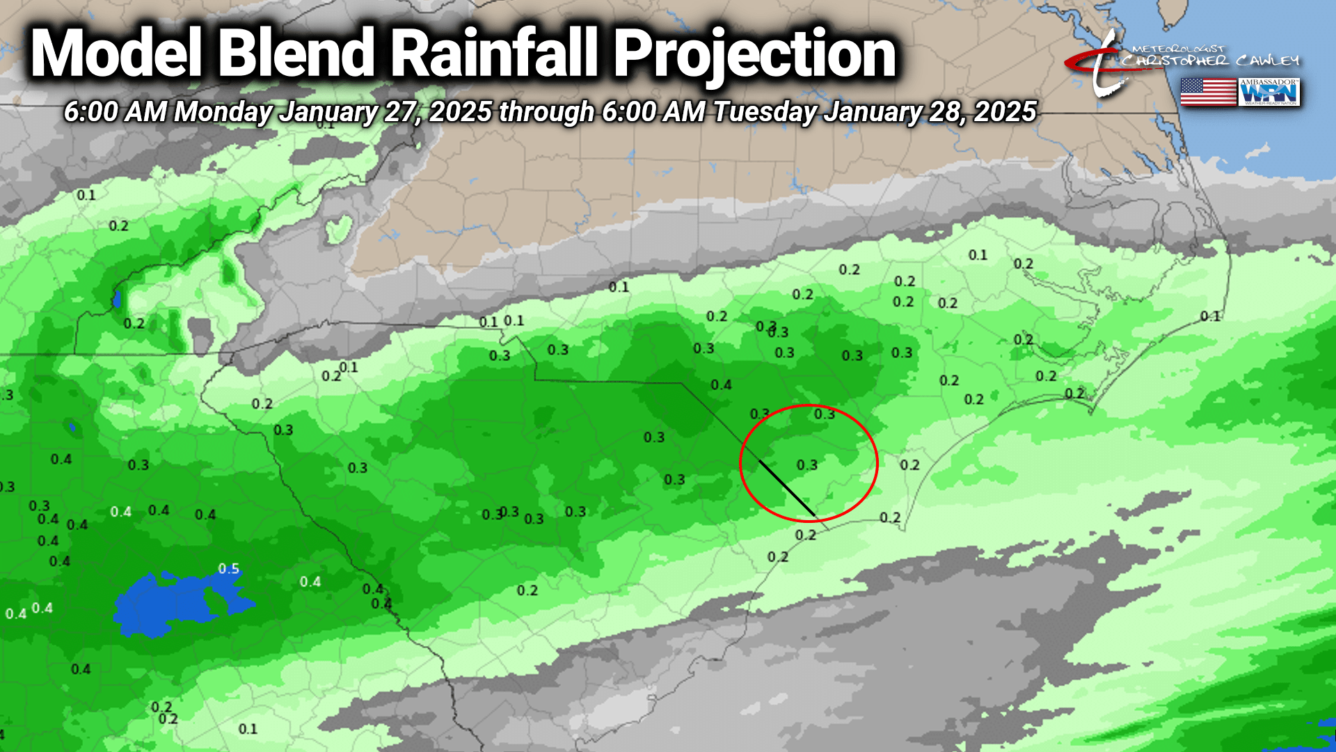
Here’s the National Blend of Models rainfall projection for today. The chart says 0.3″ for Whiteville… I think there’s enough moisture here that we could go, like I said, a third to half an inch over the county.
This all clears out of here tonight. We’ll have slowly clearing skies, and I wouldn’t be surprised to see a good bit of fog development during the overnight hours. We’ll stay above freezing, though, with lows generally in the middle and upper 30s.
It’ll seem like a totally different world on Tuesday as full sunshine and westerly winds push our highs to around 60… and it’s even warmer on Wednesday with “downsloping winds” pushing our highs to near 70. This is a completely different season in contrast to LAST Wednesday when we had 6 inches of fresh snow and temps in the 20s.
A “backdoor front,” a cold front dropping down from the north, will cross the area Wednesday night. This is going to be a remarkably unremarkable frontal passage, maybe a few clouds floating by as you sleep, but it will knock our temps down to the upper 50s on your Thursday, which is, well, NORMAL for this time of year.
For the past few days I have highlighted forecast uncertainty about the end of the week. Things are becoming clearer … or at least “less uncertain” … with the latest guidance. A cutoff low over southern California this morning will slowly — and mercy do I mean SLOWLY — roll its way eastward and then eventually across the country by this coming weekend.
These are called “bowling ball” lows, because if I were to put the below map into motion (which I can’t do on this platform), it would appear to “roll,” like a bowling ball.
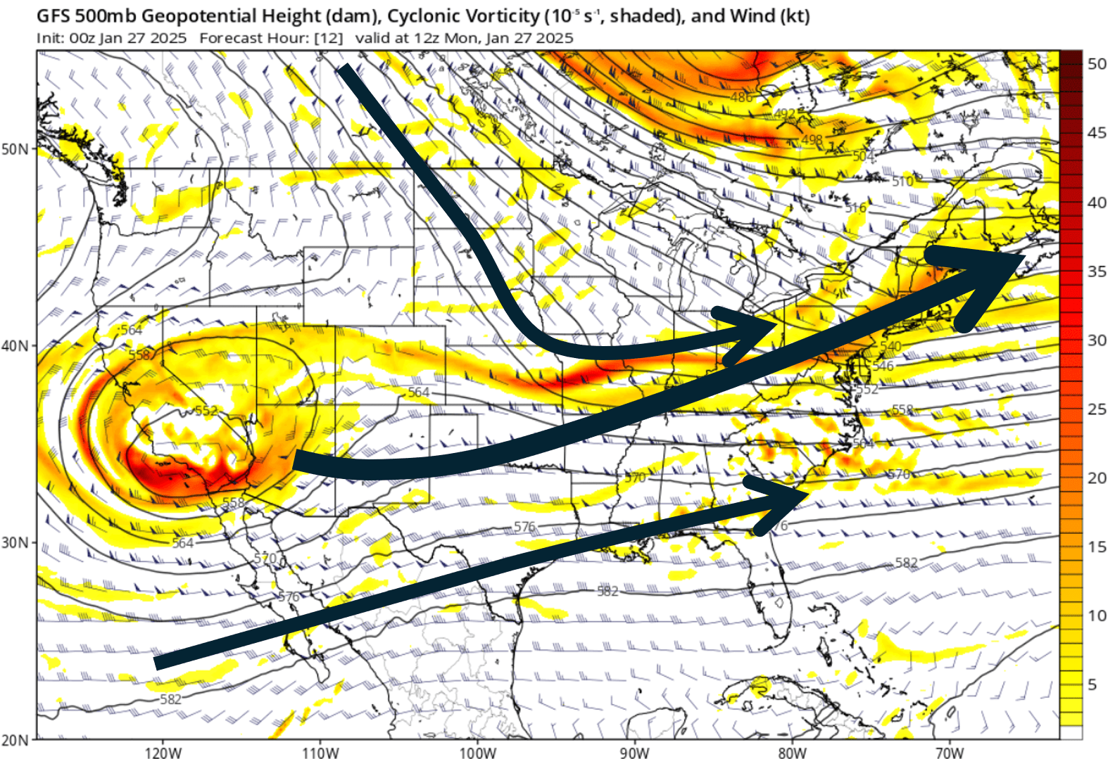
Anyway… it is likely that this low will “open up” and phase with a frontal system crossing the midsection of the country by Friday, with the front crossing our area this weekend. Our air will be from a southwesterly source during this time meaning it is likely to be unseasonably warm (for a change!) next weekend.
Guidance suggests the front drags through sometime Saturday, but that’s still a bit iffy as there’s some difference between the global deterministic models … I’m just going to introduce shower chances into my forecast for the county with warm temps.
Here’s your Freedom Insurance “Today Plus Five” Outlook…
That brings us to an end to another edition of the CCN Weather Update. Thank you for reading, thank you for supporting Freedom Insurance and Columbus County News, and as always, take care.
~Meteorologist Christopher Cawley