Greetings friends, it’s FRIDAY and it’s time for the CCN Daily Weather Update.
Sponsoring your CCN Weather Update is Freedom Insurance in Whiteville. Freedom believes that life is full of surprises, but that doesn’t mean you have to face them unprepared. Whether it’s your home, car, health, or future, Freedom Insurance is here to give you the peace of mind that comes with knowing you’re covered. With affordable plans, personalized service, and a team that truly cares about your well-being, Freedom Insurance has your back when it matters most. Contact Freedom at 910-640-2828 or stop in today!
STATISTICS FOR WHITEVILLE – Thursday February 20, 2025.
High: 31.8°F at 5:01 PM (normal is 59)
Low: 24.7°F at 11:59 PM (normal is 34)
Precip: 0.00 in (trace snowfall)
View live, real-time weather data for Whiteville on my College Street Weather Station.
Y’all, I did not type that wrong. Yesterday’s high was 31.8 degrees… 28 degrees below normal.
Here’s your Bottom Line for today…
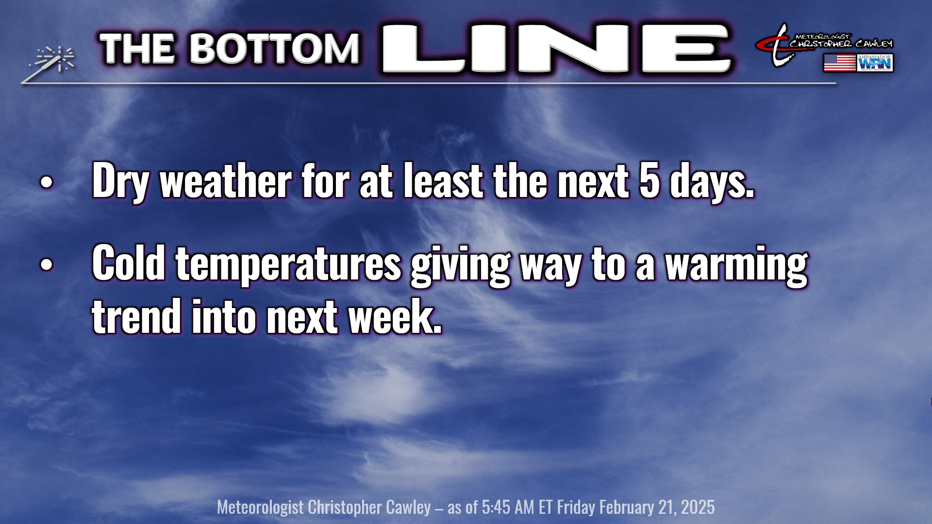
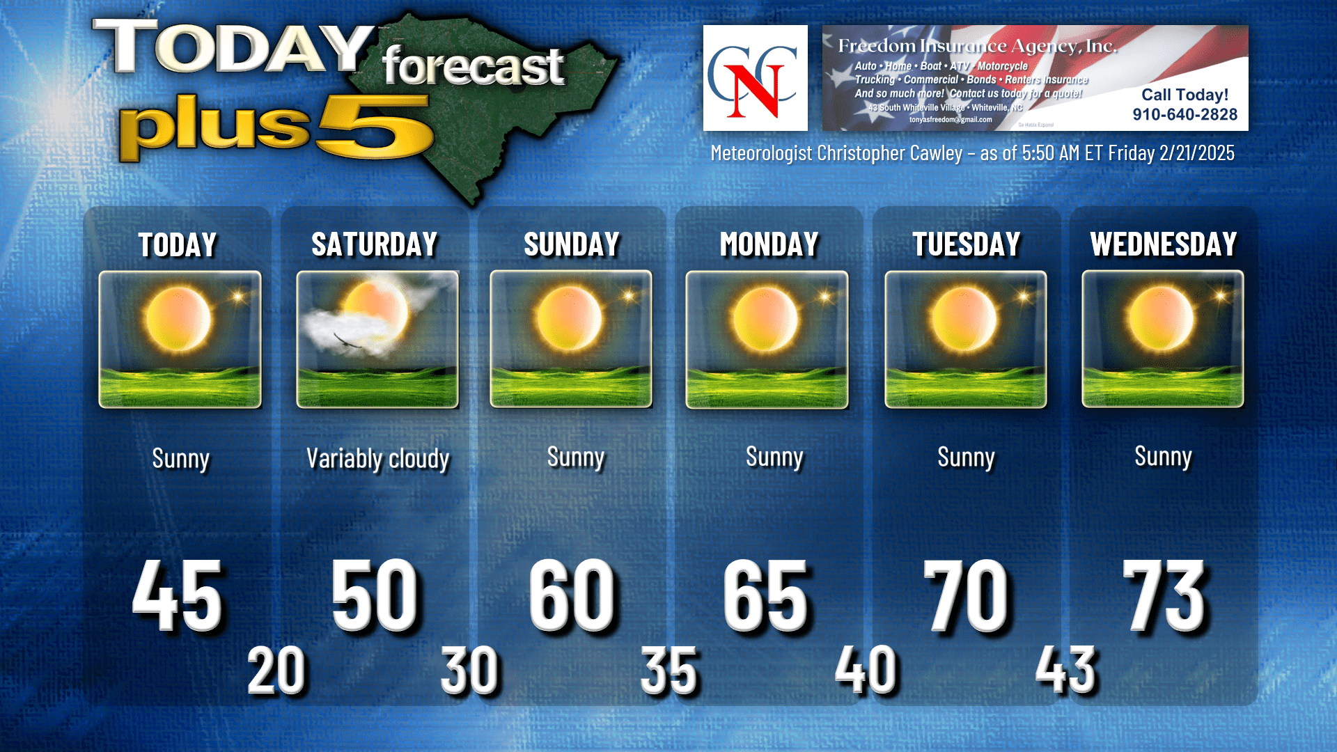
There’s not much to talk about this morning. Bitterly cold temps this morning will climb to the mid 40s this afternoon, a good 10-15 degrees below normal.
Arctic high pressure remains in control into Saturday. Tonight will be very cold once again, but I don’t think NWS will be issuing any advisories, as it is expected that wind chills will remain above the 15-degree threshold. I’m expecting lows a degree or so either side of 20.
Variably cloudy skies for Saturday as the axis of the high pushes toward the coast. A weak little trough wants to break through the dome of high pressure and that is what will cause some cloudiness Saturday afternoon. No precipitation.
High pressure pushes off the coast Sunday into next week, bringing a southerly component to the air flow and warming temperatures. We’ll be in the 70s by Tuesday-Wednesday with dry weather continuing. In fact, very dry air is likely to be in place and even clouds will be hard to come by.
A frontal system takes aim on the east coast by Thursday-Friday next week with shower and thunderstorm chances and slightly cooler temps behind the system NEXT weekend.
Longer range shows a generally quiet weather pattern with temperatures averaging out around seasonal normal values going into the first week of March.
Here’s your Freedom Insurance Today-Plus-5 forecast for Columbus County.
That’ll do it for today. Thanks for reading, and as always, take care!
~Meteorologist Christopher Cawley