Welcome to another work week, and welcome to the Monday edition of the CCN Weather Update!
This weather update is brought to you by our friends at Freedom Insurance in Whiteville. For car, home, or future, Freedom Insurance has your back. Stop in or give them a call at 910-640-2828 and their professionals will put together the best policy for you!
STATISTICS FOR WHITEVILLE – Sunday February 23, 2025.
High: 64.8°F at 3:51 PM (normal is 60)
Low: 30.0°F at 6:46 AM (normal is 35)
Precip: 0.00 in
View live, real-time weather data for Whiteville on my College Street Weather Station.
Here’s your Bottom Line for today…
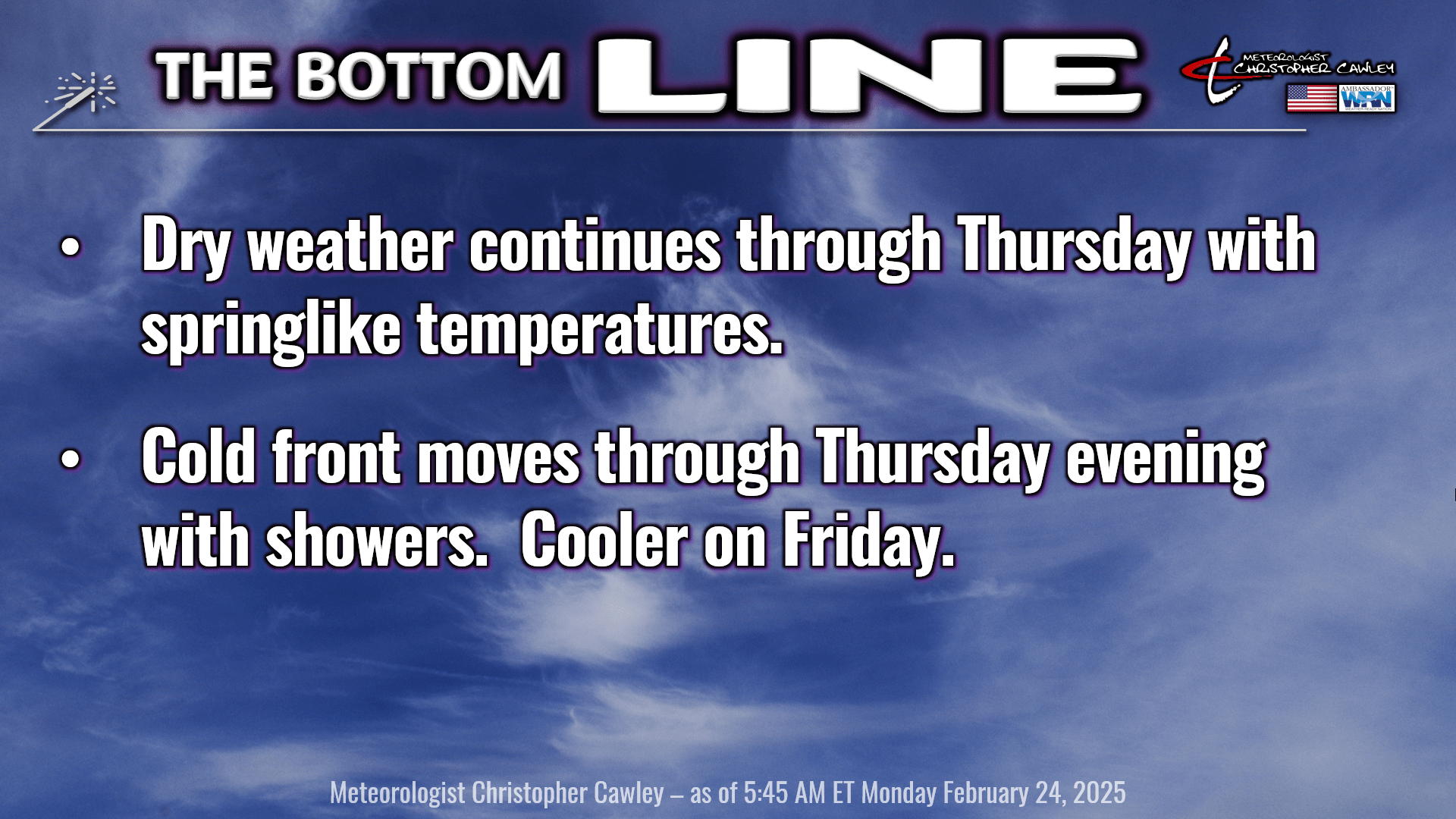
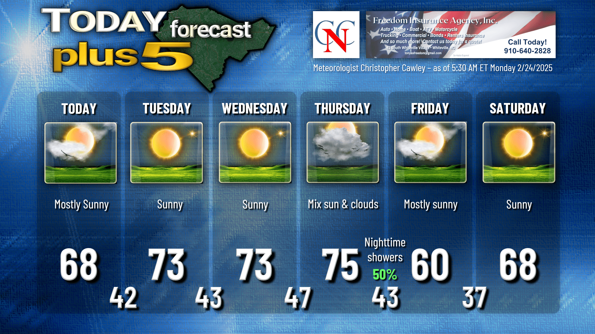
Weak surface high pressure will bring us a nice day today, a few clouds from time to time but otherwise nothing worrisome. Our highs should climb into the middle and upper 60s today.
Quiet conditions tonight with perhaps some areas of fog developing by daybreak, and maybe some high clouds moving through. Lows in town should be in the lower 40s but the colder spots will probably drop back into the upper 30s.
Springlike conditions will delight our area for Tuesday and Wednesday. There’s a mid-level disturbance that will push through here on Tuesday but that’s going to be quite unremarkable. Just offshore lurks a more significant frontal boundary and some waves of low pressure, but I don’t think they’ll have any influence on our conditions in Columbus County. I’m expecting bright sunshine on Tuesday with highs in the lower 70s… maybe even mid 70s.
Stronger high pressure ridging takes charge for Wednesday bringing us another spectacular day with bright sunshine and highs in the lower to middle 70s.
The cold front that I have been talking about for a few days now… that’s still expected to approach by Thursday. I think we’re going to squeak by with a dry day on Thursday, albeit with much more cloudiness. Southwesterly winds are likely to become somewhat gusty on Thursday, especially in the afternoon, as low pressure to our north rapidly strengthens. Highs deep into the 70s on Thursday.
The cold front pushes through Thursday night. Winds will turn sharply to the northwest and colder air comes rushing into the area. *Colder as in… back to where temps SHOULD be for the end of February.
There are some question-marks with regards to the strength of the front and a deeper upper-level trough that may pivot toward the eastern U.S. on Thursday night. I do think we’ll have better rain chances with this, looking at the assorted guidance. I’m going with a 50% chance for rain Thursday night… and since it’s going to be a relatively strong cold front, I’m not going to completely rule out the threat for some thunder.
That mess is all gone by Friday and we’ll have a return to bright sunshine and seasonable temps — highs around 60. The cooler temps don’t last long, however, as more ridging takes place on Saturday. That, too, probably won’t last long as it looks like another strong cold front pushes through on Sunday.
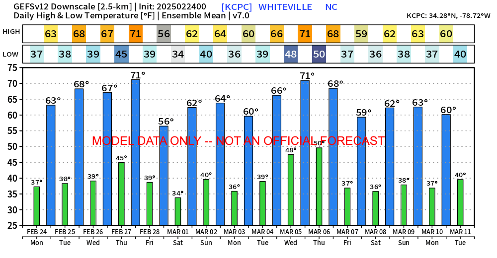
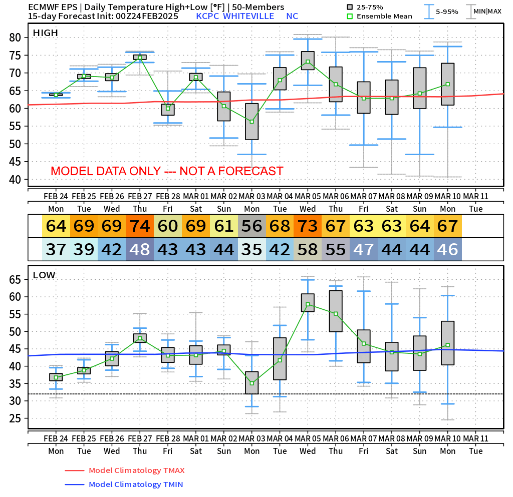
Longer term temperatures, at this point, appear to be normal per the latest ensemble guidance. Attached below include the GFS ensemble temperatures — the values shown are the AVERAGE of all 31 of the ensemble members. Below that I have attached the European ensemble box plots, which is a better visual reference of where the 50-odd models are leaning. Looking at the “big picture,” temperatures are likely going to average out near-normal through about March 10th. I don’t foresee any deep Arctic “blasts” in the near future.
Here’s your Freedom Insurance Today-Plus-5 forecast for Columbus County.
That’ll do it for today. Thanks for reading, and as always, take care!
~Meteorologist Christopher Cawley