Greetings folks, welcome to your CCN Daily Weather Update for Saturday February 1, 2025.
This weather update is sponsored by Freedom Insurance of Whiteville. Contact Freedom today for all of your insurance needs. Their professionals are 100% committed on providing outstanding customer service and working with you to establish the best policy to meet your needs.
Our climate statistics for Friday, January 31 at my weather station in Whiteville shows that we had a high temperature of 79.3°F at 3:06 PM, and the low was 48.1°F at 12:48 AM. There was 0.02 inch of precipitation recorded. You can check out the conditions in Whiteville in real-time by clicking on this link — https://www.wunderground.com/dashboard/pws/KNCWHITE8
Here’s today’s Bottom Line
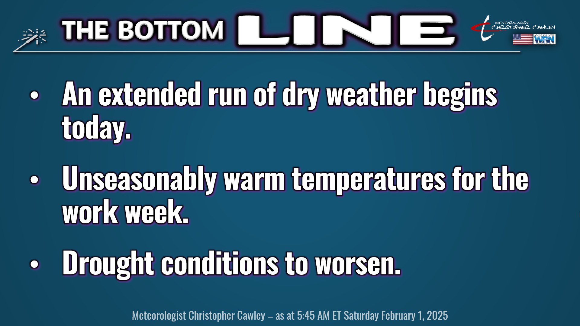
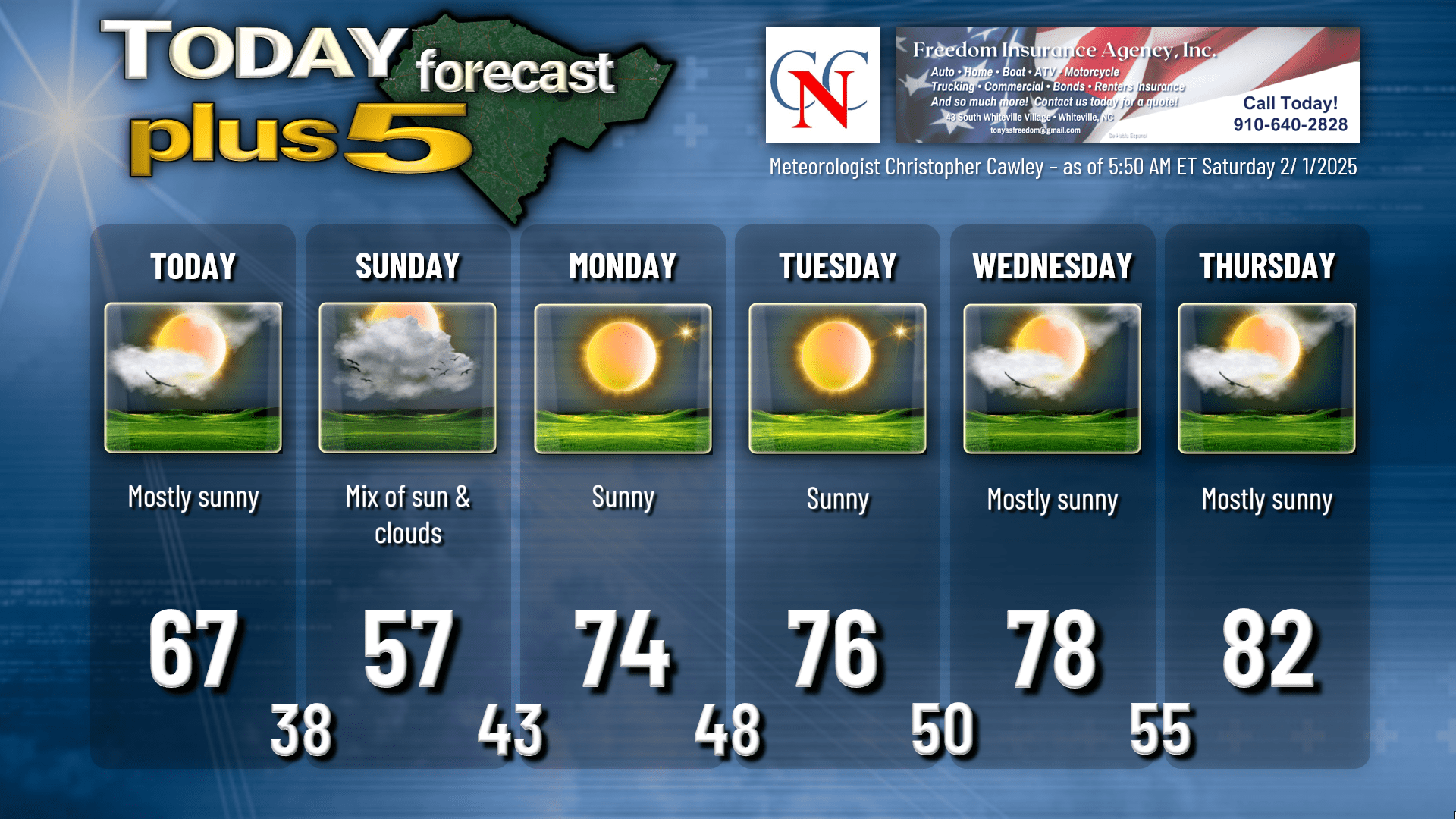
We’re going to begin an extended period of dry weather that will likely last into NEXT weekend. Today is going to be a very nice day with lots of sunshine, deep blue skies with some white cumulus clouds, and highs reaching the upper 60s.
High pressure will shift off of the New England coast by tonight. A weak frontal boundary forms along the coast, and that will cause some northeast winds to develop. This means winds will be coming from the north-central Atlantic ocean, and friends, those are some cold waters. While we will have a decent amount of sunshine on Sunday, our highs will “only” be in the upper 50s…. which is STILL a touch above normal for the first few days of February.
As we begin the work week, unseasonable warmth takes place, with near-record highs possible in the late-week period. That being said, two “cold” fronts move through the area. The first one comes through on Tuesday afternoon or Tuesday night, and then says, “naah, never mind, let’s crank up the heat instead” and lifts back to the north as a warm front… opening the door for the near-record high temps.
The next front might come through Friday… question-mark? There are timing differences in the modeling. The deterministic Euro does paint some rain across the area by NEXT Saturday morning as the front gets slung out west-to-east. Deterministic GFS wants the front to come through sooner, but has very weak dynamics with minimal, if any, rain.
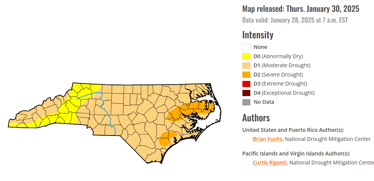
DROUGHT CONDITIONS: Nearly the entire state of North Carolina is under a “moderate drought,” including Columbus County. Now, you might be thinking, “bruh… what about all that snow?” The liquid equivalent to the snow that fell was only about half an inch, and that’s not going to cut it in drought conditions.
The coming week will be dry, and relative humidity values are likely to remain quite low each afternoon. There may be some breezy conditions on Tuesday with the frontal passage, which will lead to increased wildfire risk.
Please be very careful if you’re doing any burning this coming week.
The weather we’re going to experience next week is “fake spring.” Resist the temptation to start some of the spring yard work during the unseasonable warmth this week. We’re in no way, shape, or form done with winter.
GFS ensembles in the longer-range still suggest a rather significant cool-down by Valentine’s Day. The Euro ensembles tend to keep our temps generally at or above normal values. There is the potential for a more active pattern taking shape by mid-month, which could bring some decent rain chances to the area.
Now that the calendar has turned to February, let’s take a look at some normals and sunrise/sunset times for Whiteville:
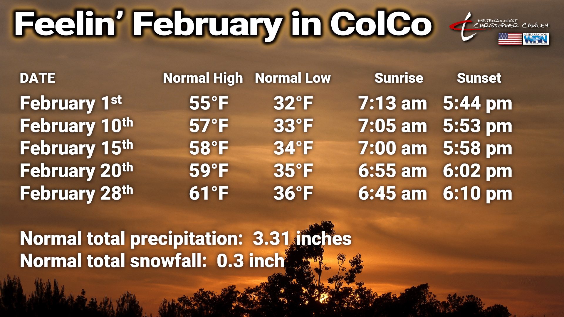
We gain 6 degrees in our normal high temperature over the month, with a 4-degree gain in normal lows. We’ll gain over an hour in daylight through the month.
Without further ado, here is your Freedom Insurance Today-plus-Five forecast for Columbus County.
That will conclude today’s report, my friends. Thank you for your time, thank you for supporting CCN, and thank you to Freedom Insurance for sponsoring our daily reports. I hope you have a wonderful day, and as always, take care.
~Meteorologist Christopher Cawley