Hello friends, welcome to the Sunday edition of the CCN Daily Weather Update, brought to you exclusively by Freedom Insurance of Whiteville. Freedom insurance can provide you with all of your insurance needs, from auto to boat to homeowners to life insurance. Their friendly and professional staff are laser-focused on customer service and will work with you to write the perfect policy for your needs. Contact Freedom today at 910-640-2828.
STATISTICS: Saturday 2/1/2025 at Whiteville–
High: 68.7°F at 2:38 PM
Low: 47.4°F at 11:45 PM
Precip: 0.02 in
View live, real-time weather data for Whiteville on my College Street Weather Station.
Here’s your Bottom Line for today…
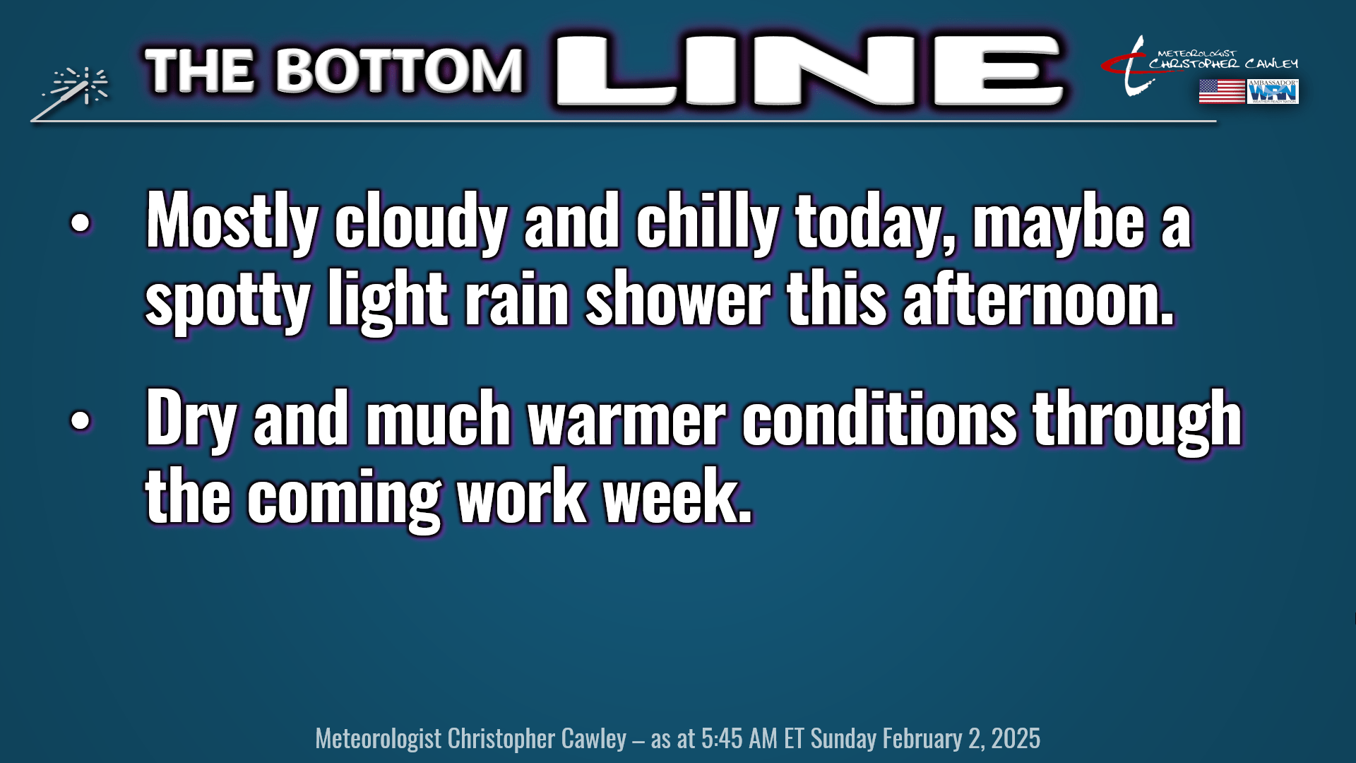
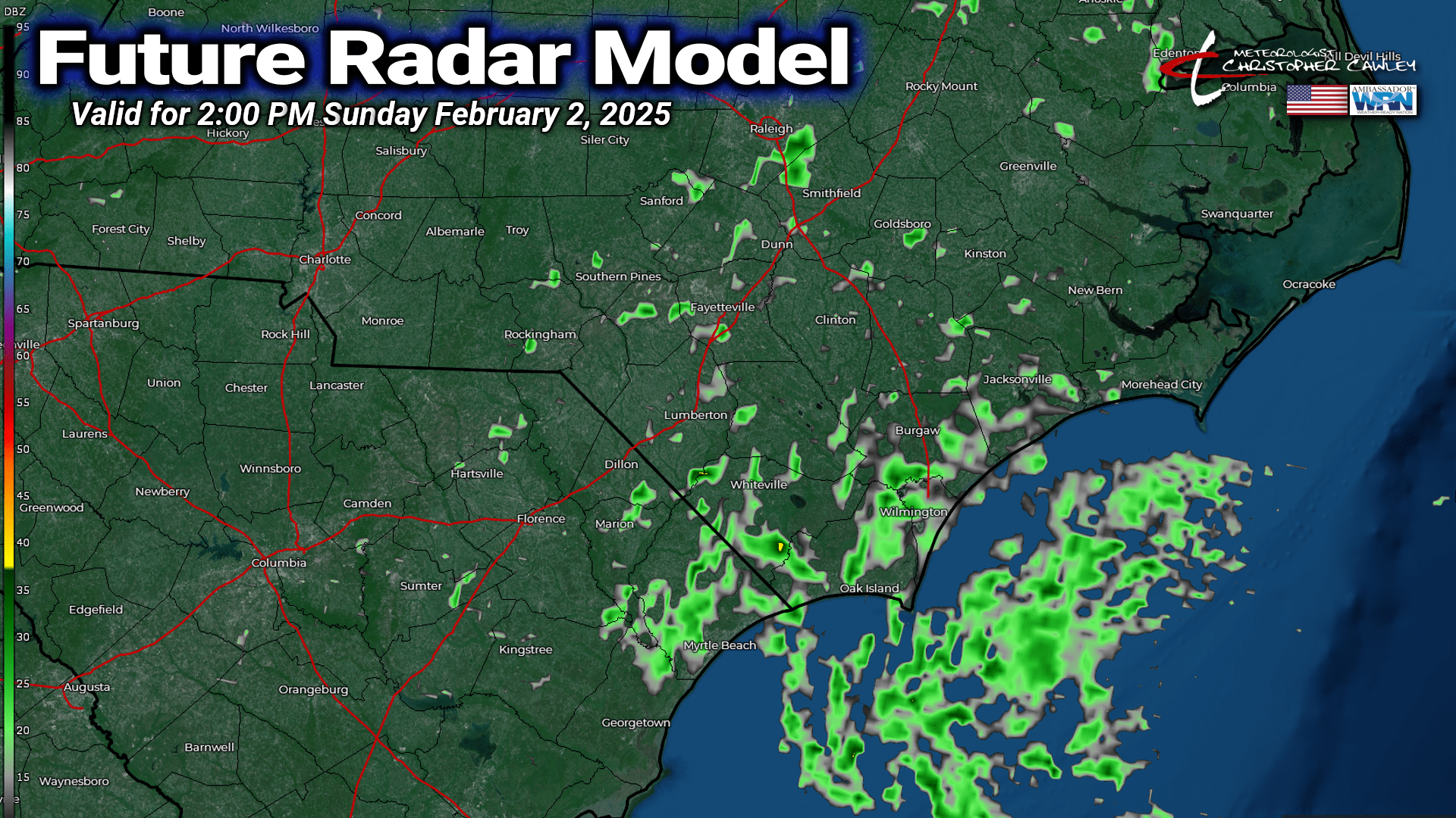
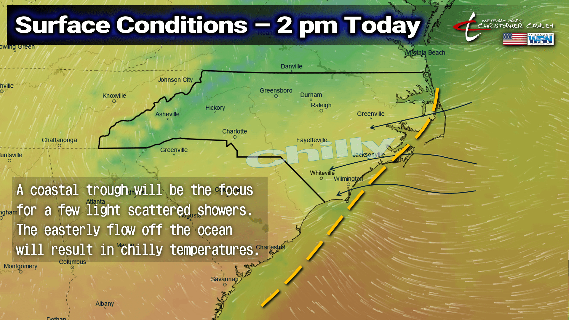
A coastal trough is becoming established this morning, and high pressure will drop down from off the New England coast. The combination of the two paint a picture of mostly cloudy skies, chilly temps, and some spotty light rain showers this afternoon. There won’t be much rain (many areas should remain dry), and the future radar model shown is, in my opinion, a little “aggressive,” but keep an umbrella within reach if you have any outdoor plans this afternoon. This afternoon will be perfect for a nice nap.
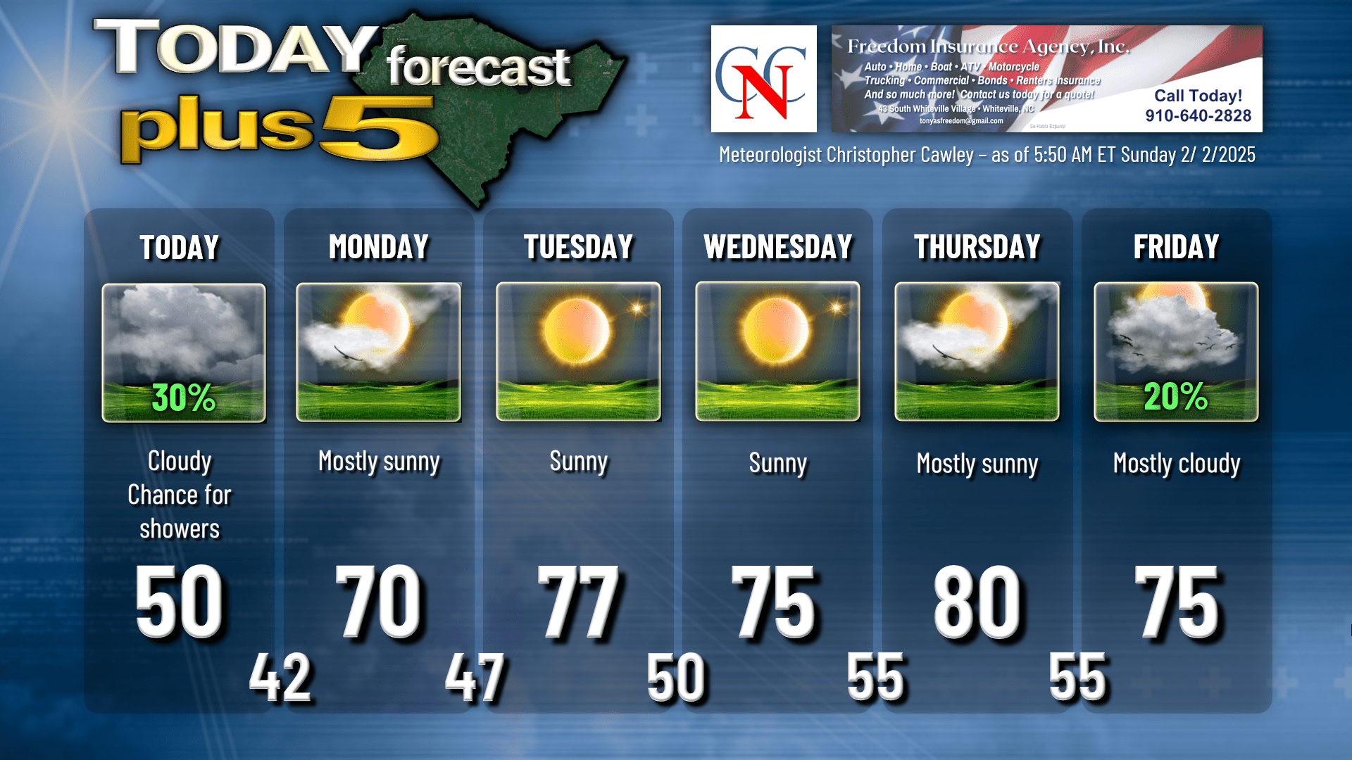
The high pressure ridge will shift even farther offshore tonight, and a southwesterly wind flow develops after midnight. The coastal trough should slowly dissipate through Monday. I expect lots of sunshine for the county on Monday, but if you’re traveling to Wilmington or Southport, there may be some lingering clouds first thing in the morning.
Warm air pushing in from the southwest will bump our temps to around 70 on Monday afternoon.
The warming continues on Tuesday as we jump into the upper 70s. A weak, dry “cold” front will pass Tuesday night into Wednesday. This will bring a few clouds Tuesday night, and only slightly cooler temps on Wednesday. The front will stall just south of our area before a passing low pressure to the north “captures” the front and “pulls” it back to the north as a warm front. This takes place Wednesday evening.
With full sunshine and an uninterrupted west-southwest flow on Thursday, our highs should be around 80 across the county. If we can get enough downsloping, 85 isn’t out of the question.
Another frontal boundary wants to approach on Friday. Moisture does increase a little bit but honestly not by much. The latest European guidance paints some rain showers in here on Friday. GFS brings the front in here a little sooner — late Thursday night — with little, if any, precipitation. Therefore my forecast for Friday will be partly sunny/mostly cloudy and for now just a 20% chance for rain.
Here’s your Freedom Insurance Today-Plus-5 forecast:
LONG RANGE: GFS, Euro, and Canadian longer-range modeling all still point to a period of cooler weather around the middle of the month. How MUCH cooler is still up to some debate. Model ensemble averages are generally around normal, but the model spreads are HUUUUGE. For example, on February 14th, the Euro ensembles have a high temperature ranging from 35°F to 82°F, and the low ranging from 18°F to 65°F. So…. yeah.
Basically, I’m just saying what everyone already knows: The weather we will experience this coming week is “false spring number 1.” Enjoy it… but it ain’t gonna last.
FIRE DANGER: Relative humidity values should be modest through much of the week (30% to 50% in the afternoon hours), and by-and-large our winds should generally be light throughout the week. However, with the ongoing drought and lack of precipitation this week, wildfire danger will still be on the increase. Please use extreme caution if you’re planning on any yardwork and burning.
Ok friends, that’ll wrap up today’s report. Thank you for reading and for supporting Columbus County News. I hope you have a fantastic day, and as always, take care.
~Meteorologist Christopher Cawley