Hi everyone, welcome to the Thursday edition of the CCN Daily Weather Update!
This weather update is brought to you by our friends at Freedom Insurance in Whiteville. For car, home, or future, Freedom Insurance has your back. Stop in or give them a call at 910-640-2828 and their professionals will put together the best policy for you!
STATISTICS FOR WHITEVILLE – Wednesday February 26, 2025.
High: 79.7°F at 3:09 PM (normal is 60)
Low: 39.7°F at 6:59 AM (normal is 35)
Precip: 0.00 in. Total for the month: 2.49 in
View live, real-time weather data for Whiteville on my College Street Weather Station.
Here’s your Bottom Line for today…
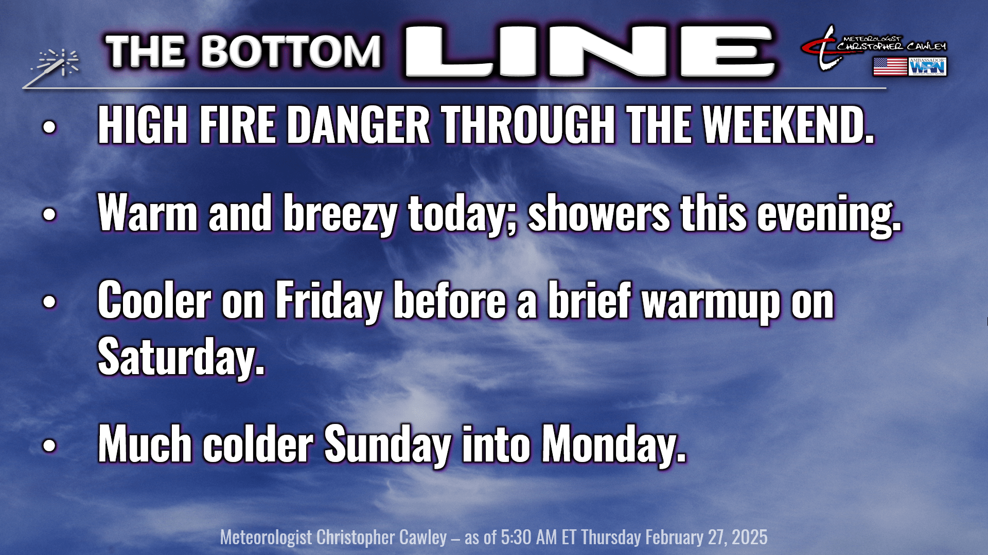
HIGH FIRE DANGER.

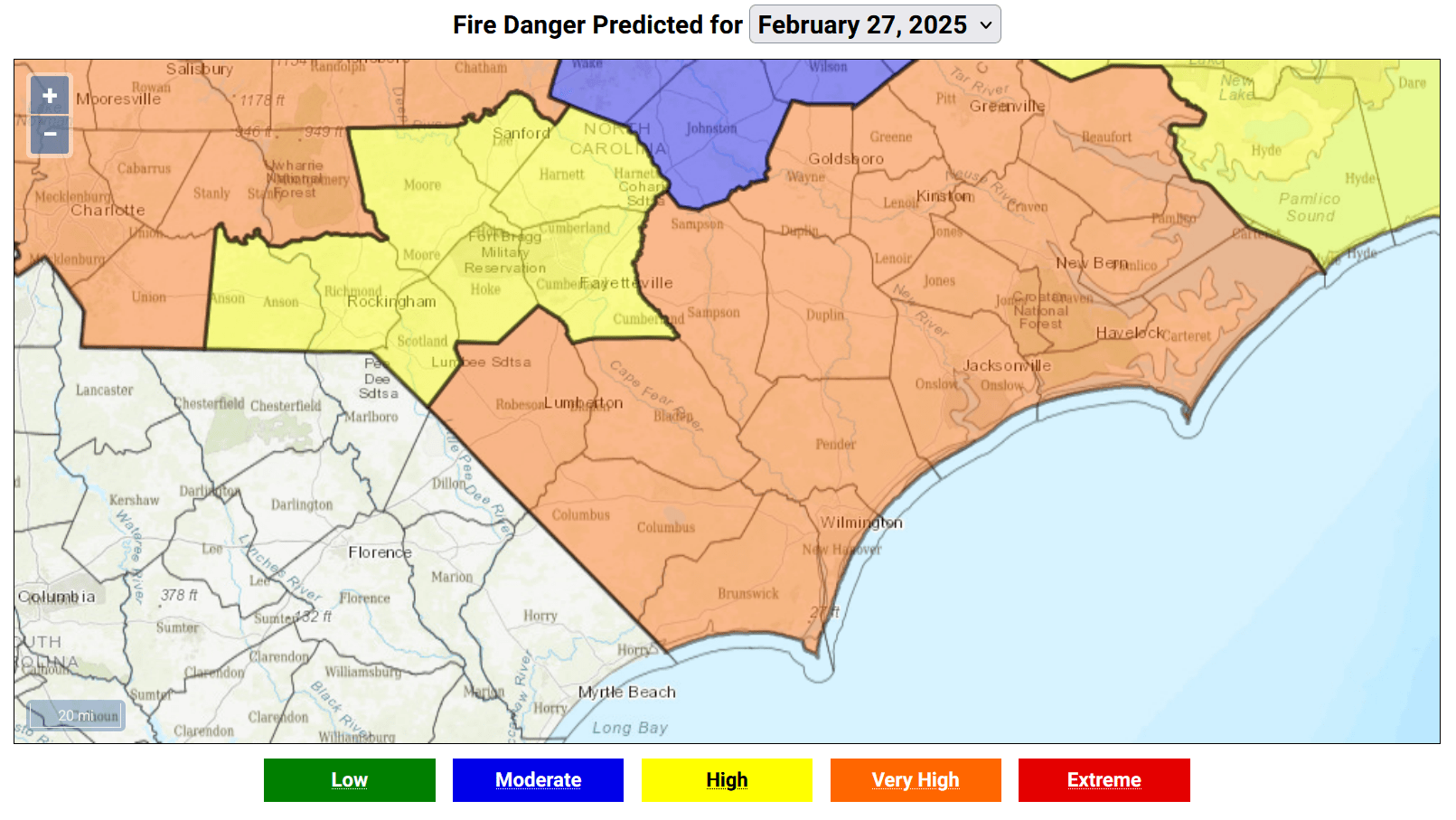
There were 16 – sixteen – reported fires across the county on Wednesday, according to fireresponse.com. Quite a few of these were likely “controlled burns,” such as burning off of fields, which became completely out of control in a matter of minutes. Two large ones, one just south of 74 near Evergreen, and then another just north of the “old 74” near Evergreen, involved a total of just under 180 acres of woodland.
High fire danger continues on Thursday and runs through the coming weekend. Soil conditions are BONE DRY area-wide. The latest drought monitor has Columbus County in a D1 “moderate drought.” We are running several inches below normal for the year to date in precipitation, after coming up 7-9 inches below normal for 2024.
Backyard burning and careless debris burning are the leading causes of wildfires in North Carolina. Don’t add to these statistics.
Also, a reminder that burning is not allowed within the Whiteville city limits, in accordance with state statutes.
Ok… that’s out of the way… let’s turn to the weather.
It’s going to be breezy and quite warm today ahead of a cold front, which will crash across the area later this evening. Gusty southerly winds ahead of the front will push our highs up near 80 once again.
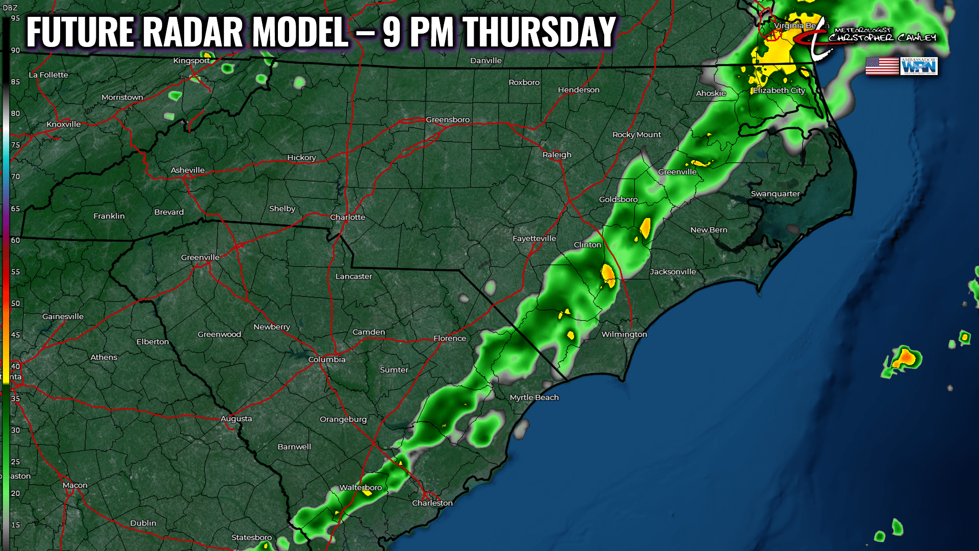
Front pushes through this evening, with a line of showers. Folks, this isn’t going to be anything to get too excited about. I was hoping for a little more rain out of this, but the dynamics and forcing are going to our north. That being said, maybe a tenth of an inch of rain is possible between 7 and 10 PM this evening. And that’s it until deep into next week.
Here’s your future radar model for 9 PM this evening.
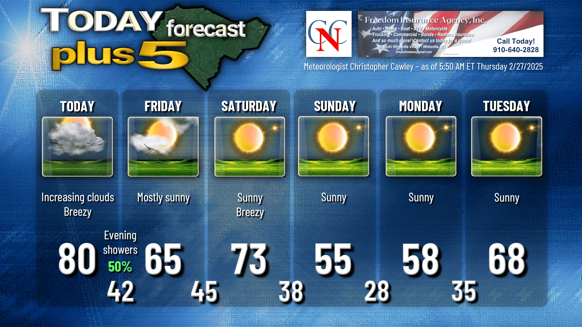
A roller-coaster temperature ride takes place Friday, Saturday, Sunday, and Monday. Cooler high pressure builds in Friday; we’ll have lots of sunshine with highs in the 60s. We warm back up into the 70s on Saturday ahead of a STRONG … but dry … cold front Saturday night. A secondary “reinforcing” push of colder air arrives on Sunday, and as of the latest NBM guidance, we’re likely to drop below freezing Sunday night/early Monday, with outlying areas / typically colder spots of the county dropping deep into the 20s early Monday morning.
Chilly temps on Monday give way to dramatically warmer temps by the mid-week period.
Guidance is in very good agreement that a powerful storm system develops over the central part of the country next week. The main low pressure centers (with Euro showing a 980-mb low!!) lifting northeast over the Great Lakes and into Ontario and Quebec toward the latter half of next week. This drags a very powerful frontal boundary over the area sometime between late Wednesday and early Friday next week, bringing our first severe weather threat for the season.
In the meantime, the ONLY precipitation chances between now and later next week come this evening. And what we get will be … not much.
Next week is Severe Weather Awareness week, and I will be posting a series of videos on my Youtube channel and my socials talking about severe weather in the Carolinas. The 2025 Statewide Tornado Drill is scheduled for 9:30 AM on Wednesday March 5th.
Here’s your Freedom Insurance Today-Plus-5 forecast for Columbus County.
That’ll do it for today. Thanks for reading, and as always, take care!
~Meteorologist Christopher Cawley