

Greetings folks, welcome to your CCN Daily Weather Update for Sunday March 16, 2025.
This weather update is sponsored by Freedom Insurance of Whiteville. Contact Freedom today for all of your insurance needs. Their professionals are 100% committed on providing outstanding customer service and working with you to establish the best policy to meet your needs.
STATISTICS FOR WHITEVILLE – Saturday March 15, 2025.
High: 79.5°F at 4:26 PM (normal is 65)
Low: 53.3°F at 2:14 AM (normal is 40)
Precip: 0.00 in
View live, real-time weather data for Whiteville on my College Street Weather Station.
Here’s today’s Bottom Line
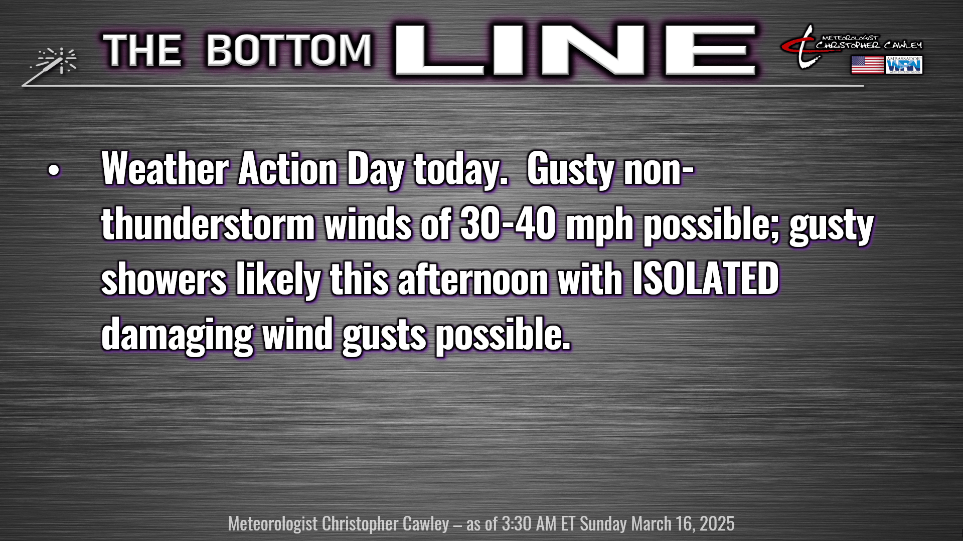
Short and to the point folks. Weather Action Day for today. A strong cold front will cross the state late this afternoon through this evening. Showers and thunderstorms are expected ahead of and along the frontal boundary, mainly this afternoon through tonight.
A strong low-level jet of 60-70 mph will exist over the county, developing by mid-morning and lasting until the frontal passage this evening. This will result in gusty south winds of 30-40 mph today… this is outside of any thunderstorm development.
Short-term guidance suggests that a relatively broken line or area of convective showers will be pushing toward the I-95 corridor by early this afternoon, and then inching its way toward the coast by late in the evening. I don’t expect this will be a “nice and neat” line of storms, but a rather spread-out area of mainly convective showers.
I don’t think we’ll see an awful lot of lightning with these cells thanks to the lack of significant instability, and a marine air layer that I anticipate will be over the county at about 2,000 to about 5,000 feet. This cold, stable layer of air is likely to put quite the lid on any overall / organized severe weather threat.
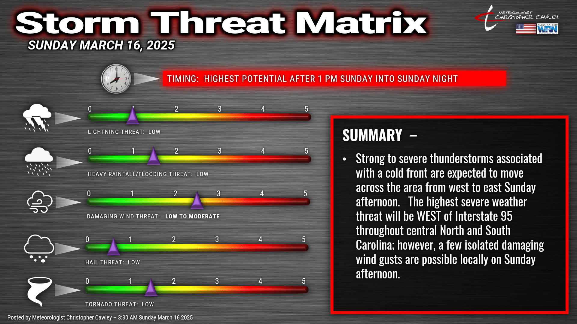
That being said, however, the Storm Prediction Center has the county under a level 2 out of 5 overall risk for severe weather, with a 5% to 9% risk of isolated tornadoes, and a 15% to 29% risk for isolated or widely scattered damaging wind gusts. The main threat time for the county would be between 1 PM and 8 PM.
I expect that a severe thunderstorm watch or tornado watch will be issued later this afternoon, but that’s not a certainty.
Here’s the storm threat matrix for today. This would represent a worst-case scenario.
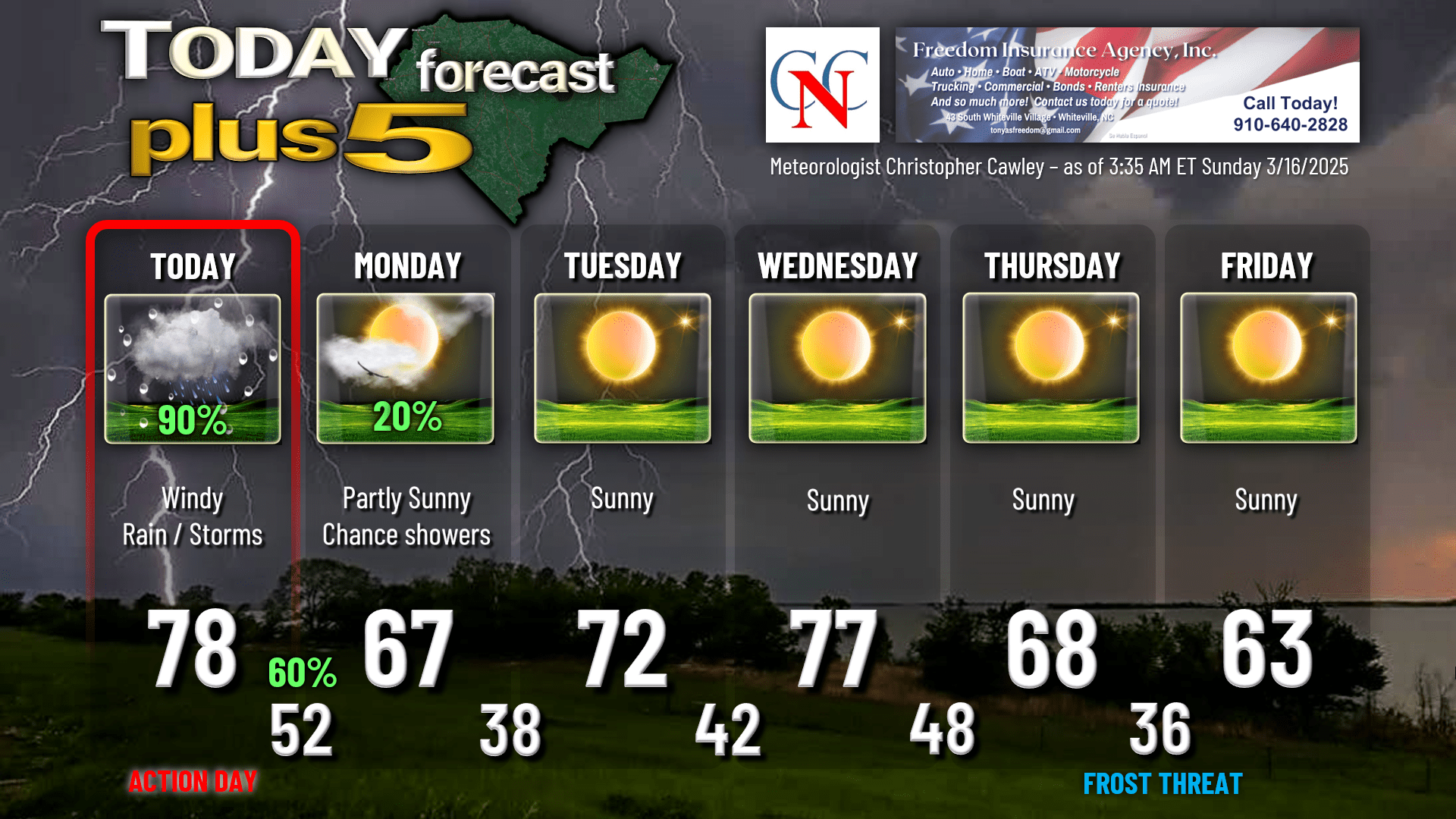
Showers linger during the overnight tonight into Monday as the associated deep trough pinwheels off the coast later on Monday. We’ll have dry conditions through the rest of the work week.
Here is your Freedom Insurance Today-plus-Five forecast for Columbus County.
That will conclude today’s report. Stay weather-aware this afternoon, and as always, take care.
~Meteorologist Christopher Cawley