Greetings folks, welcome to your CCN Daily Weather Update for Sunday March 23, 2025.
This weather update is sponsored by Freedom Insurance of Whiteville. Protect what matters with Freedom Insurance. Life is full of surprises, but with Freedom Insurance, you’ll always be prepared. Whether it’s your home, car, business, or health, we provide customized coverage to keep you and your loved ones secure. Contact Freedom today at 910-640-2828!
STATISTICS FOR WHITEVILLE – Saturday March 22, 2025.
High: 74.7°F at 4:41 PM (normal is 67)
Low: 42.2°F at 4:34 AM (normal is 42)
Precip: 0.00 in
View live, real-time weather data for Whiteville on my College Street Weather Station.
Here’s today’s Bottom Line
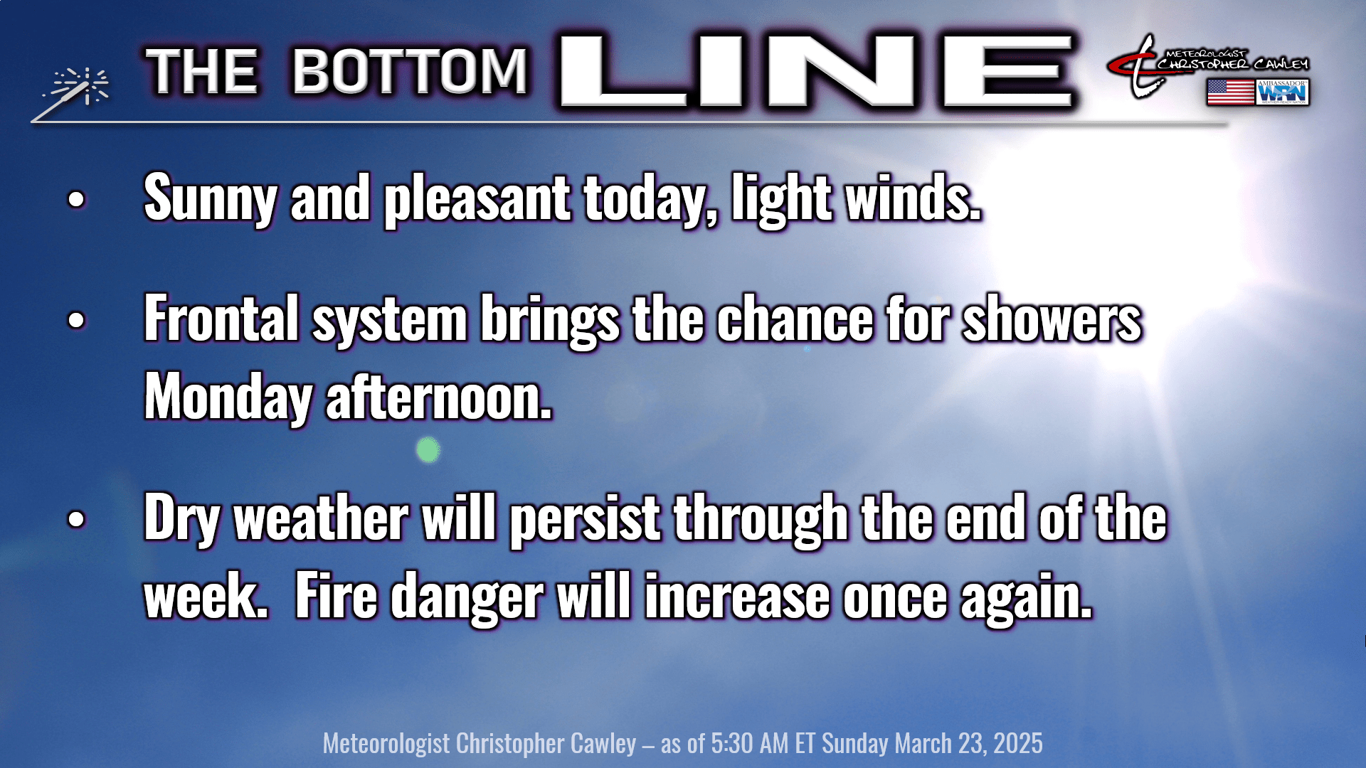
No red flag warning for today but remember, there is a statewide burn ban until further notice.
High pressure slips off the coast today allowing a southerly wind flow to become established.
A frontal system will cross the area Monday afternoon. There is very limited moisture with this frontal passage, but instability numbers have bumped up just enough that I can’t rule out a thunderstorm Monday afternoon or evening.
After that, we’ll be dry the rest of the week. A dry cold front will cross the area Wednesday night. That will result in cooler temps on Thursday, and early morning lows in the upper 30s on Friday. Temps rebound Friday into NEXT weekend — some of the guidance suggests highs well into the 80s by Sunday and Monday of NEXT week.
Note — increased fire danger will continue Tuesday through at least next Sunday.
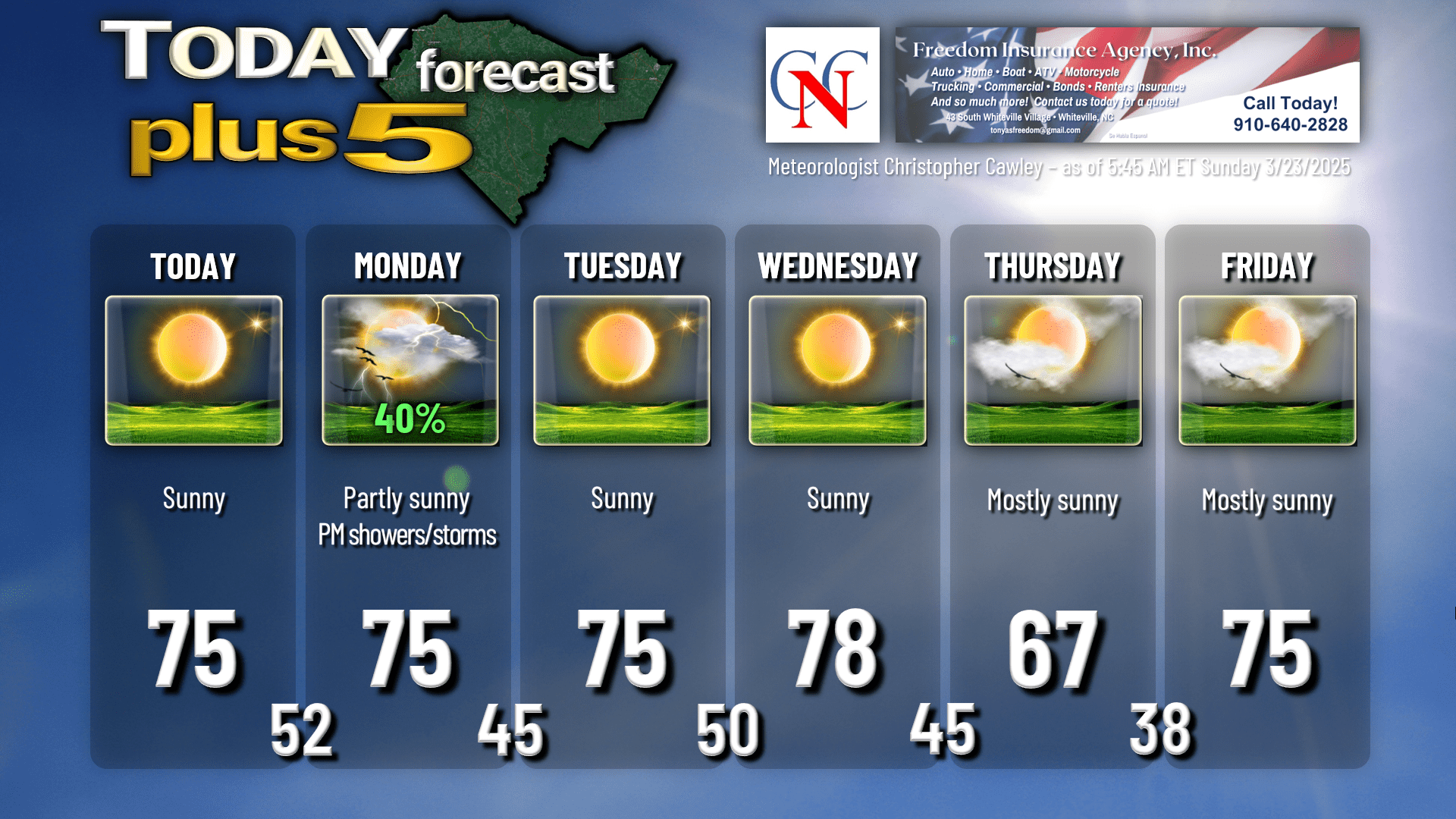
Here’s your Freedom Insurance Today-plus-Five forecast:
That will conclude today’s report. Thanks for reading, and as always, take care.
~Meteorologist Christopher Cawley