Greetings folks, welcome to your CCN Daily Weather Update for Thursday March 20, 2025.
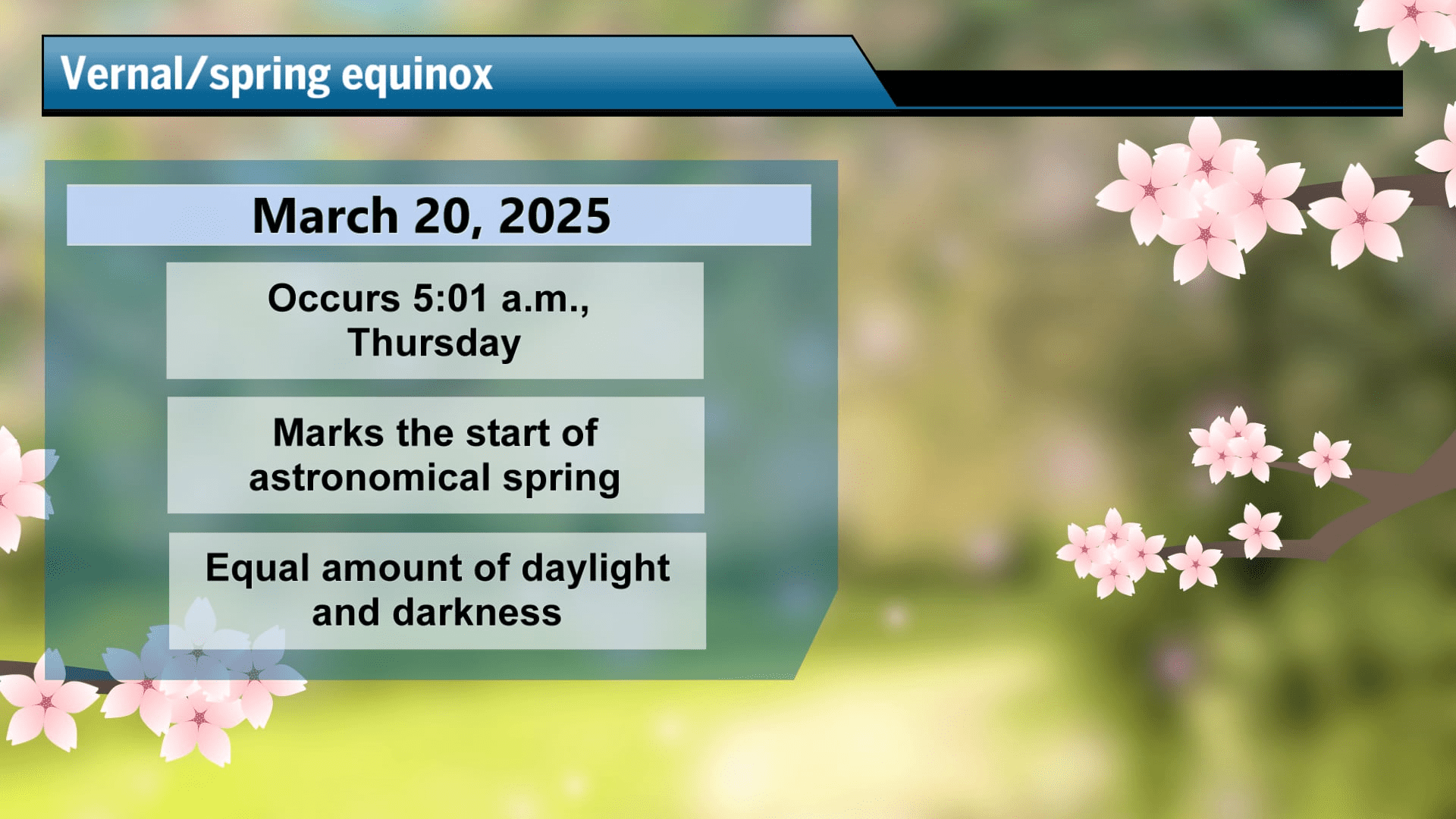
Happy SPRING! The Spring Equinox occurred at 5:01 AM this morning. The sun’s rays are directly on the equator, and there are equal amounts of daylight and darkness. After today, until the fall equinox, we will have more daylight than darkness.
This weather update is sponsored by Freedom Insurance of Whiteville. Contact Freedom today for all of your insurance needs. Their professionals are 100% committed on providing outstanding customer service and working with you to establish the best policy to meet your needs. Call 910-640-2828 today!
STATISTICS FOR WHITEVILLE – Wednesday March 19, 2025.
High: 82.1°F at 4:15 PM (normal is 66)
Low: 41.5°F at 7:30 AM (normal is 42)
Precip: 0.00 in
View live, real-time weather data for Whiteville on my College Street Weather Station.
Here’s today’s Bottom Line
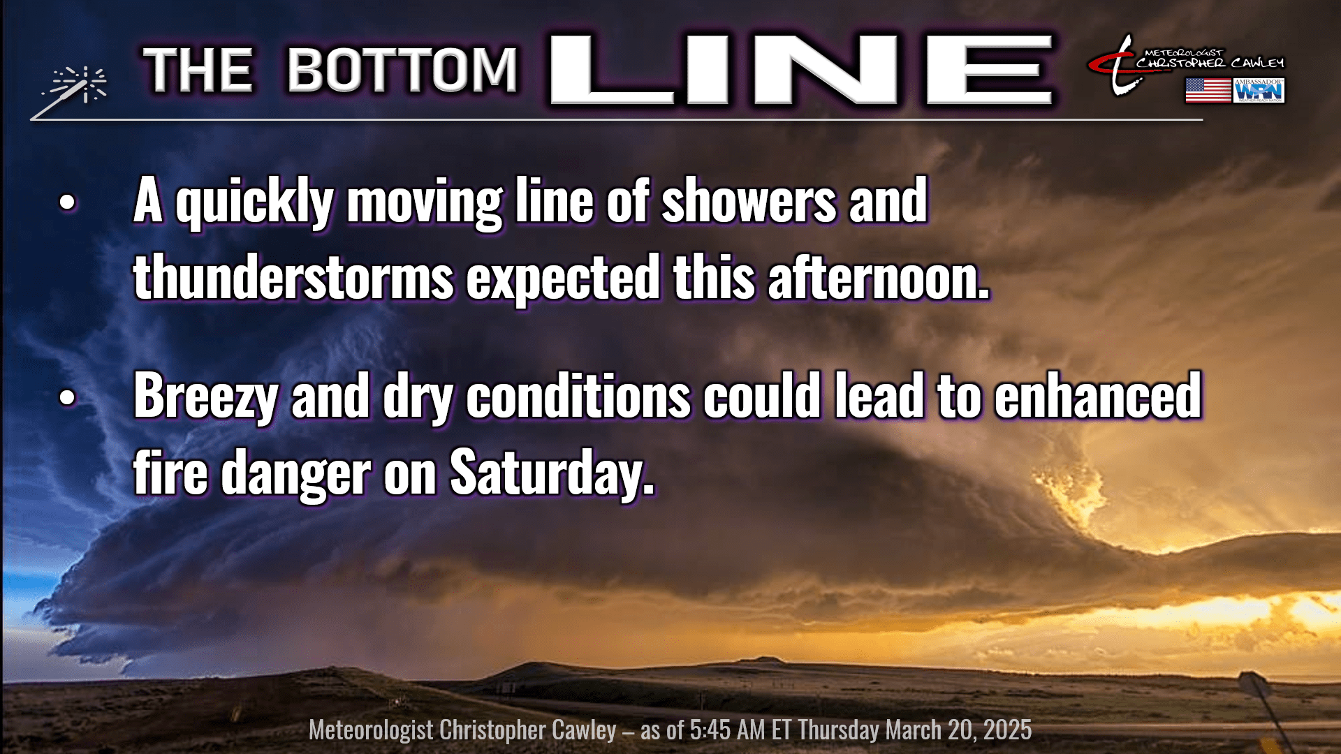
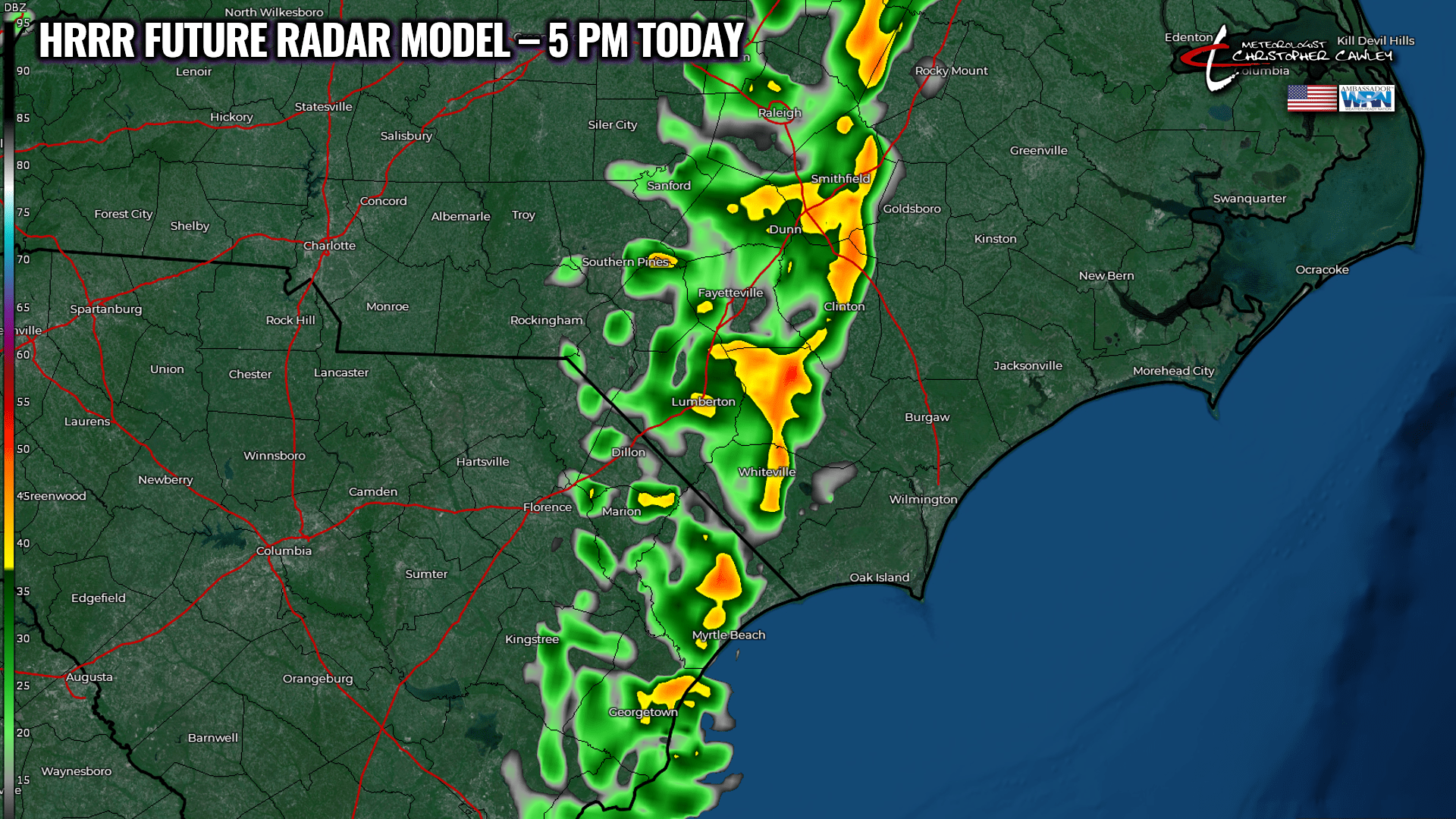
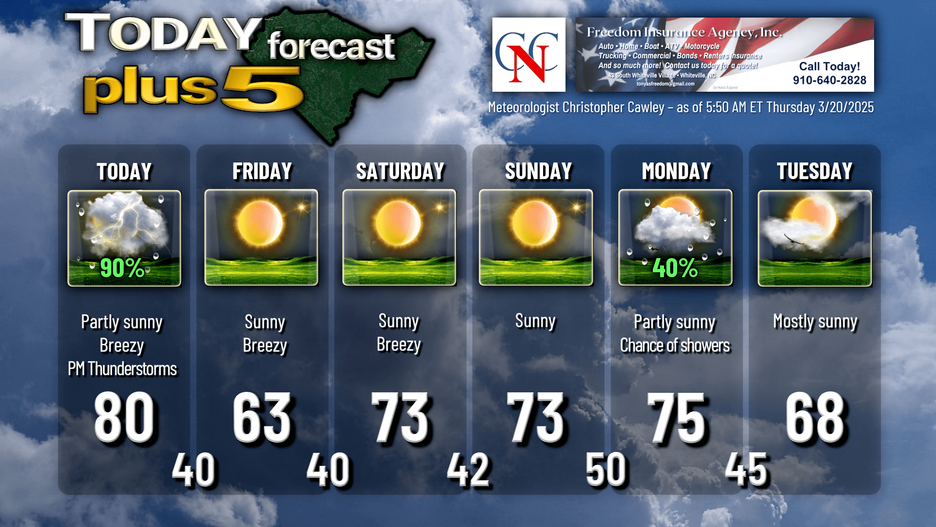
Warm and breezy is the call for today. We’ll have sunshine this morning but clouds will move in, and then a line of showers and possibly thunderstorms will quickly move across the area later this afternoon into the early evening hours.
Absolutely no severe weather is expected with this line, and it’s going to be a pretty quick hit.
While it may rain cats-and-dogs for a while this afternoon, it’s going to be such a fast-moving line that total accumulated rainfall will likely be a few tenths of an inch at most. The instability numbers look rather meager, so don’t expect a whole lot of lightning/thunder with this convective line.
That pushes offshore tonight and we turn blustery and sharply colder once again, especially Friday and Friday night. Despite full sunshine the day after the equinox, our highs will struggle to reach the lower 60s and there will be a rather stiff northwest breeze.
High pressure slides overhead Friday night into Saturday. Friday night will have nearly perfect radiational cooling conditions… but at this point I think that here in town we’ll stay around 40 for the low. Outside of town, in typically colder/sheltered locations, temps will likely drop to the 38-40 range. I think frost is going to be so isolated that I’m not even going to reference it in the forecast graphic.
The weekend will be picture perfect, fine spring weather with highs in the lower 70s and lows in the 40s. A dry cold front slips across the area late Saturday night. We are likely to experience breezy conditions on Saturday, and that, combined with relative humidity values in the 20% to 30% range, will bring another round of very high fire danger.
Looking into next week, yet another frontal boundary crosses our area on Monday bringing the chance for some showers. I don’t think this will be anything widespread… it should be similar to what we get today.
However, the same cannot be said for midweek next week. The model guidance is pretty consistent (!) on a rather robust rain system that may impact our area along about Wednesday or more likely Thursday of next week.
Here’s your Freedom Insurance Today-plus-Five forecast:
That will conclude today’s report. Thanks for reading, and as always, take care.
~Meteorologist Christopher Cawley