Hello everyone and welcome to your CCN Daily Weather Update for Thursday March 27, 2025.
This weather update is sponsored by Freedom Insurance of Whiteville. Protect what matters with Freedom Insurance. Life is full of surprises, but with Freedom Insurance, you’ll always be prepared. Whether it’s your home, car, business, or health, we provide customized coverage to keep you and your loved ones secure. Contact Freedom today at 910-640-2828!
STATISTICS FOR WHITEVILLE – Wednesday March 26, 2025.
High: 70.6°F at 4:19 PM (normal is 68)
Low: 46.1°F at 7:46 AM (normal is 43)
Precip: 0.00 in
Average Humidity: 33%
View live, real-time weather data for Whiteville on my College Street Weather Station.
Here’s today’s Bottom Line
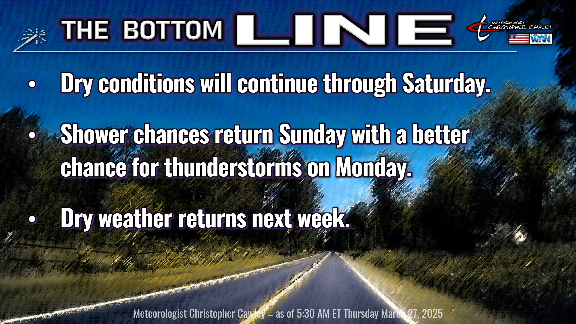
Dry high pressure will continue over the area. The high will slip offshore by tomorrow and bring much warmer, and more humid conditions for Friday and Saturday. The additional humidity will help lower the fire danger risk, but we continue to be very dry.
Thing things finally get somewhat interesting again for Sunday and Monday. Interesting in that we have something to talk about other than sunshine and dry weather. A few “ripples” (disturbances — technically known as shortwave troughs) will impact the area on Sunday. We’ll have lots of clouds about the area and a few scattered showers from time to time. No washouts, no soaking rainfall, but enough to dampen the ground a little bit.
A developing low over the Texas panhandle on Saturday will move quickly to the northeast US by Monday, bringing our next real cold front to the area. This front is going to bring moisture, wind shear, and instability… everything needed for an outbreak of thunderstorms. The timing is still kind of in question; it’s really too soon to pin down the exact timing of things on Monday, so I’m only going with a 40% chance on the forecast graphic. The Storm Prediction Center has our area under a 15% severe risk for Monday, and that is rather significant, so I’m going to be watching it very carefully. Monday may end up being a “Weather Action Day,” as we could see a squall line of thunderstorms move across the area.
As we turn the calendar into April, we enter the peak of severe weather season in the Carolinas.
We’ll probably be running the air conditioning Sunday and Monday, but once the front moves through Monday evening, we’ll cool off to the 70s for the middle part of next week.
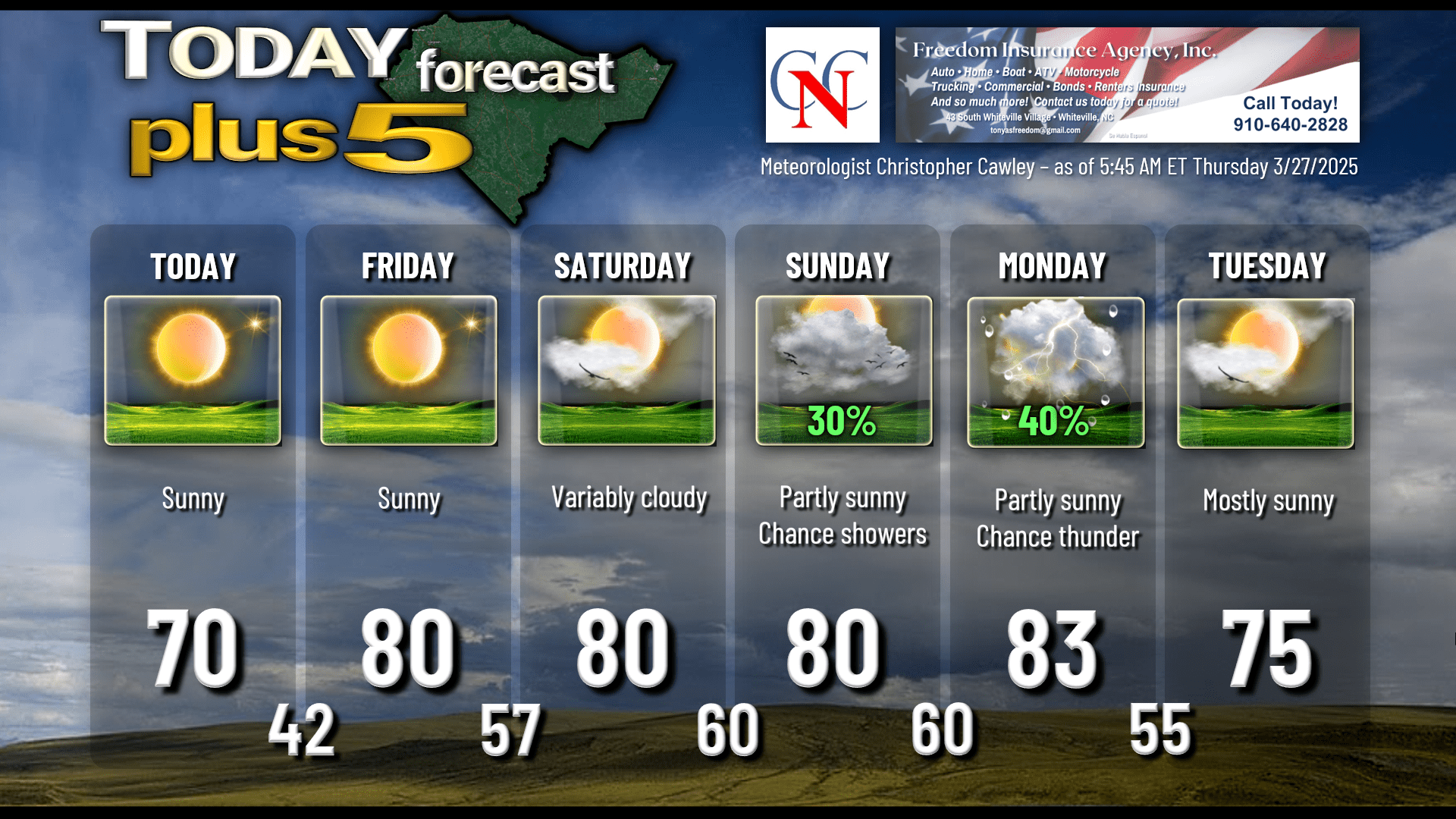
Here’s your Freedom Insurance Today-plus-Five forecast:
That will conclude today’s report. Thanks for reading, and as always, take care.