Hello everyone and welcome to your CCN Daily Weather Update for Tuesday March 25, 2025.
This weather update is sponsored by Freedom Insurance of Whiteville. Protect what matters with Freedom Insurance. Life is full of surprises, but with Freedom Insurance, you’ll always be prepared. Whether it’s your home, car, business, or health, we provide customized coverage to keep you and your loved ones secure. Contact Freedom today at 910-640-2828!
STATISTICS FOR WHITEVILLE – Monday March 24, 2025.
High: 77.1°F at 1:03 PM (normal is 68)
Low: 52.7°F at 4:03 AM (normal is 43)
Precip: 0.00 in
View live, real-time weather data for Whiteville on my College Street Weather Station.
Here’s today’s Bottom Line
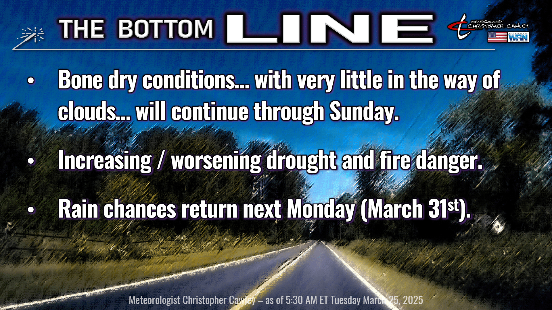
Dry, dry, dry conditions are going to continue through Sunday. There is nearly zero chance for any rain whatsoever during this time period. Afternoon relative humidity values will drop to between 20% and 30%, especially Wednesday, Thursday, and Friday with dangerous fire conditions and worsening drought conditions.
A fairly strong — but entirely dry — cold front will cross the area Wednesday night. This will drop our temperatures a little bit through Thursday into Thursday night. High pressure will dominate our weather through the weekend; as this high moves offshore on Friday, our temperatures are going to jump back up quite a bit above seasonal normal values.
Our next weather system arrives late Sunday night, but more likely on Monday. Unfortunately the optimism that I had yesterday for some decent rainfall has been weakened a bit as the guidance, especially the GFS, is coming in much less enthusiastic with this system. The high pressure ridge, the Bermuda high, is going to have some influence on this and the offshore low that was being advertised 24 hours ago is no longer there, according to the GFS. The European deterministic model paints a wetter picture, with just under an inch of rain for Monday into Tuesday, while the GFS says yeeaahhh no… coming in with about half an inch of liquid next Monday. Still plenty of time to watch this; hopefully we can get more Gulf moisture to pump northward ahead of the front. There appears to be a good bit of moisture available to tap from the Gulf; if wind fields can transport some of that moisture northward, we could see some potentially higher rain totals.
LONG TERM DROUGHT – April is looking deadly dry across the entire southeast US. One of my colleagues sent out the European model projection through the month of April, with much of NC running several standard deviations below normal for rainfall….. the normal total rainfall for April 3.53 inches. We’re already coming in at a deficit (we’ve had only 1.74 inches of rain this month, and the monthly normal value is 3.73 inches).
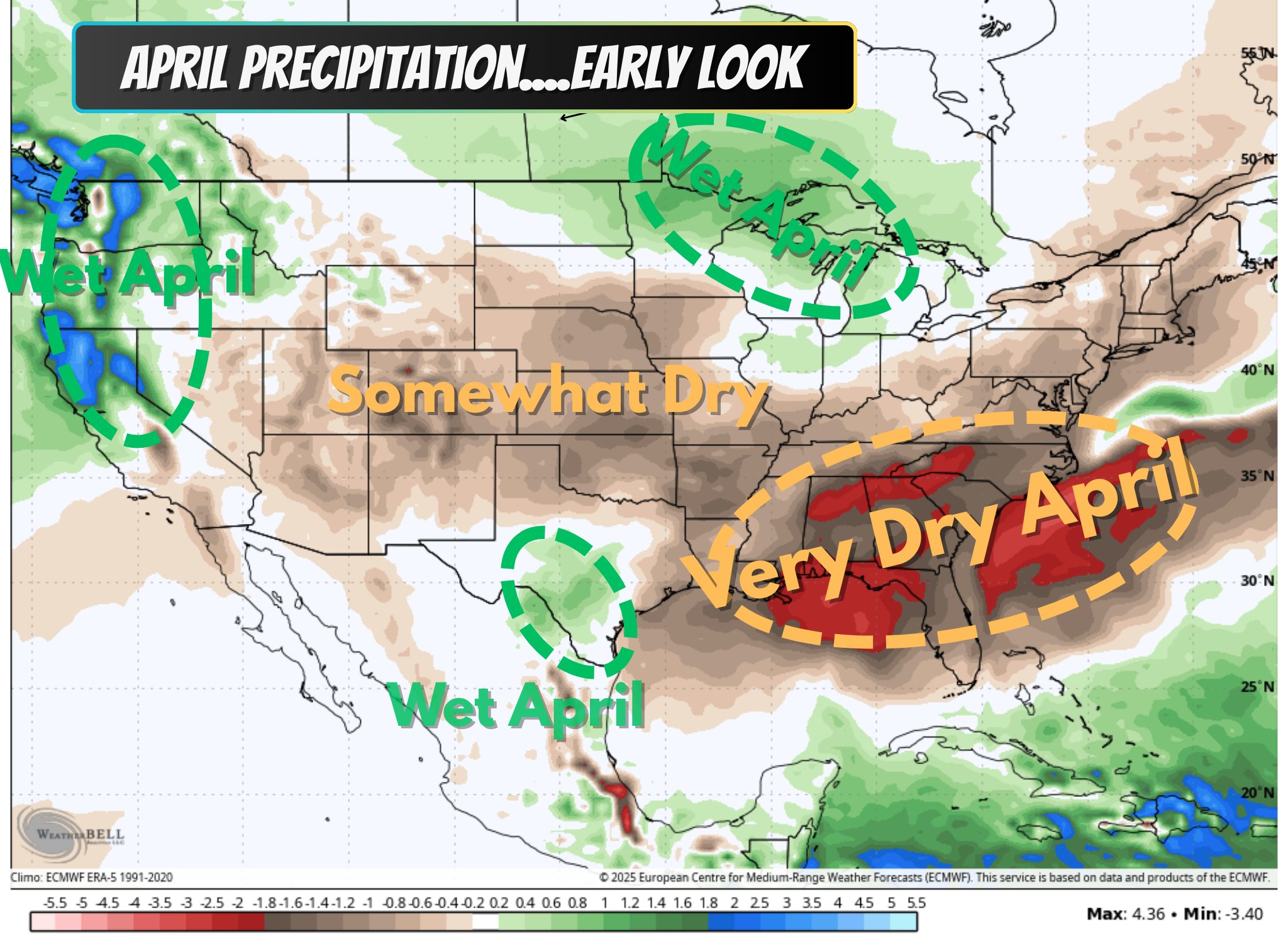
Again, this is just one model projection, and the latest NWS Climate Prediction Center outlook has “equal chances” (for above- or below-normal rainfall) for April. The monthly drought outlook, issued by the NWS Climate Prediction Center, indicates “drought persists” across the eastern Carolinas through April… and the trend doesn’t change when advancing the forecast out through the end of June. We’re likely going to have to initiate active water conservation practices on top of the persistent burn ban. I fear that we’re going to get into a situation where it will take a tropical system to really put a dent into the dry conditions. Let’s hope not.
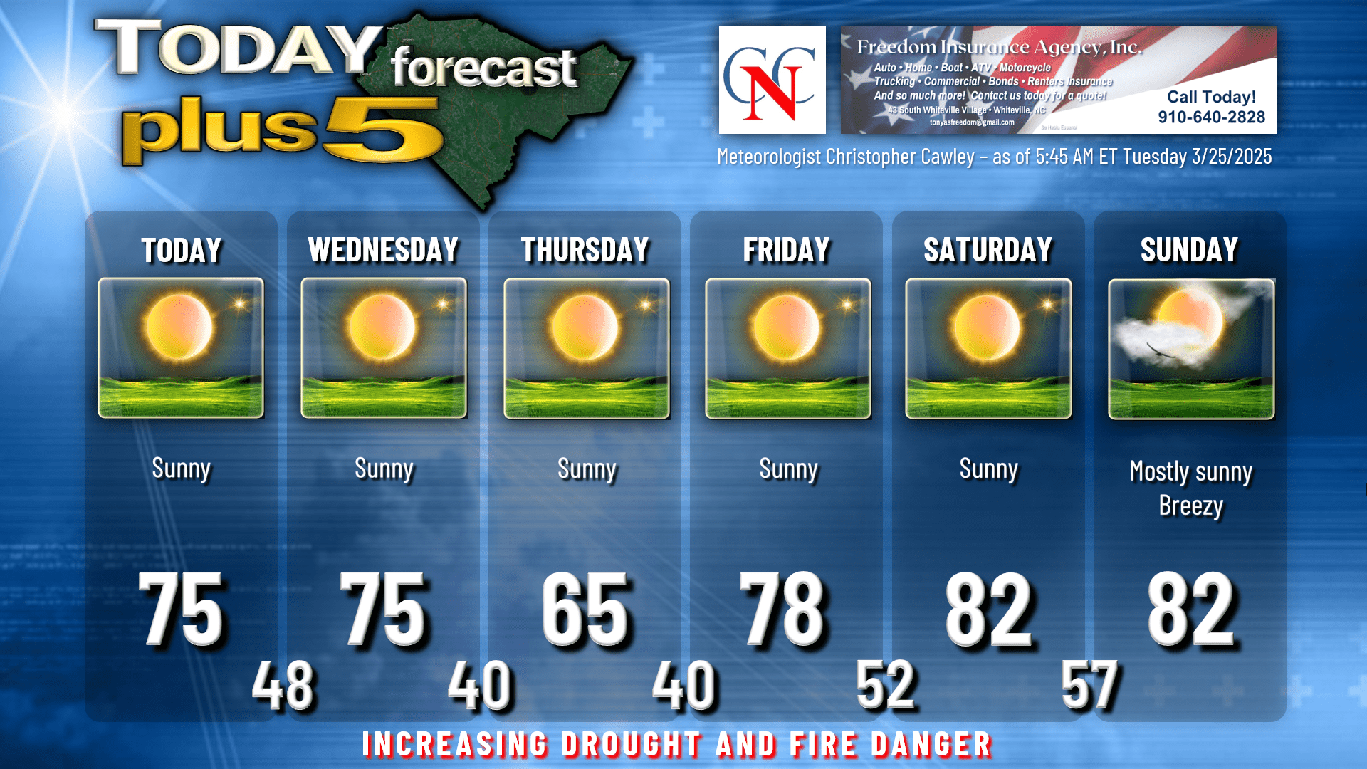
Here’s your Freedom Insurance Today-plus-Five forecast:
That will conclude today’s report. Thanks for reading, and as always, take care.
~Meteorologist Christopher Cawley