Hello friends and followers, a good day to you. Here is your CCN Daily Weather update for Thursday April 10, 2025.
This weather update is brought to you by Freedom Insurance of Whiteville. Safeguard what is important with Freedom Insurance. Life can be unpredictable, but with Freedom Insurance, you will always be ready. Whether it’s your home, vehicle, business, or health, we offer tailored coverage to ensure you and your family are protected. Reach out to Freedom today at 910-640-2828!
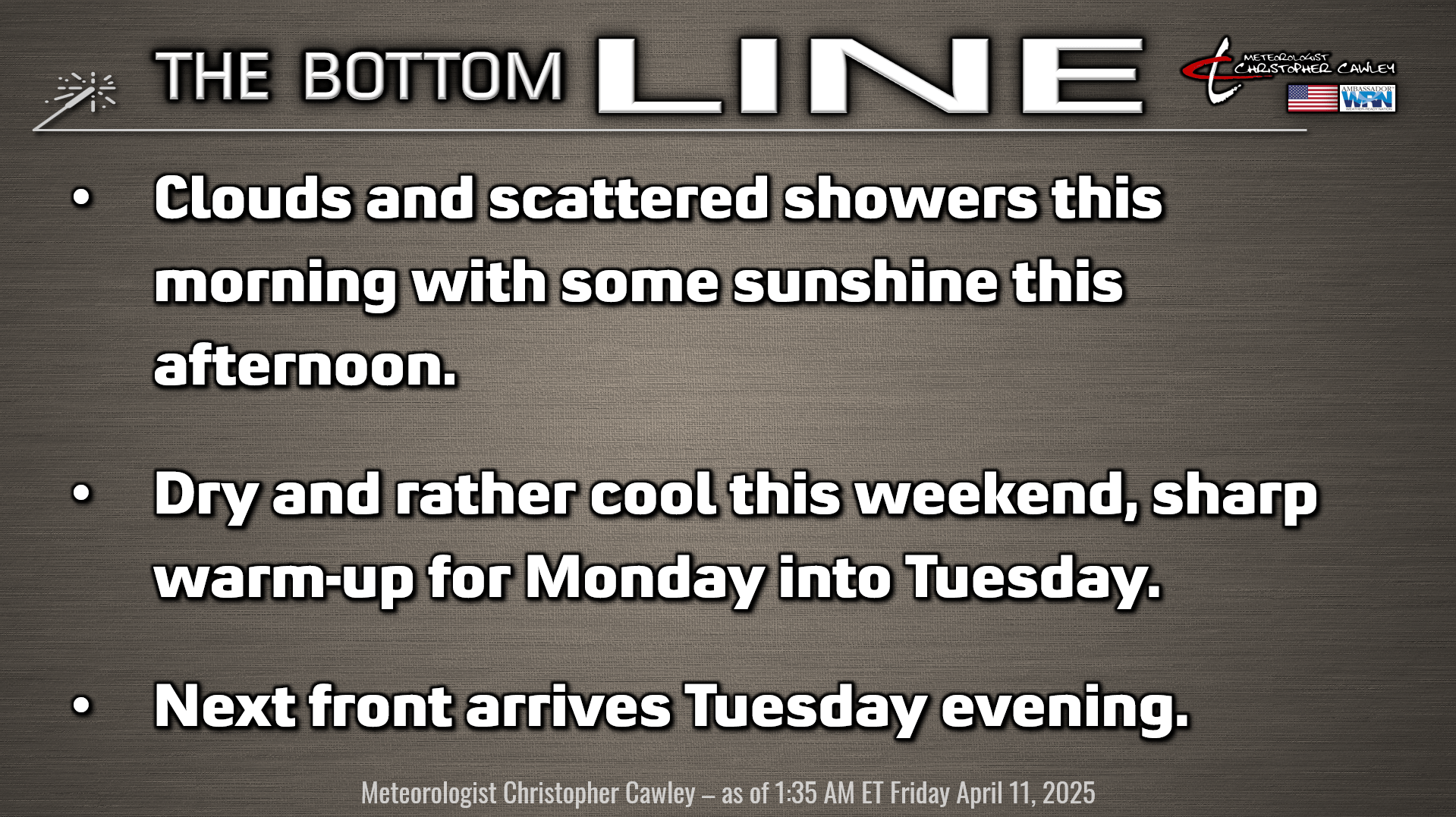
Here’s today’s Bottom Line
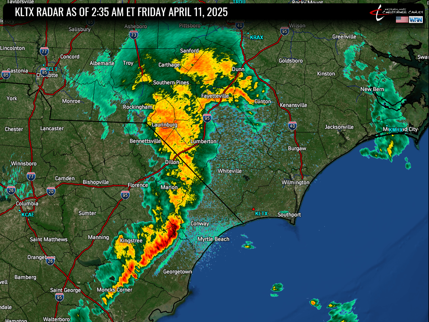
A line of convective showers and thunderstorms moved across the area during the overnight hours. This was not modeled very well by the HRRR while the NAM3 did render the event somewhat better (but still rather messy). This is highly unusual for the often-reliable guidance to act in that way, but it is what it is. This was the radar as of 2:35 AM.
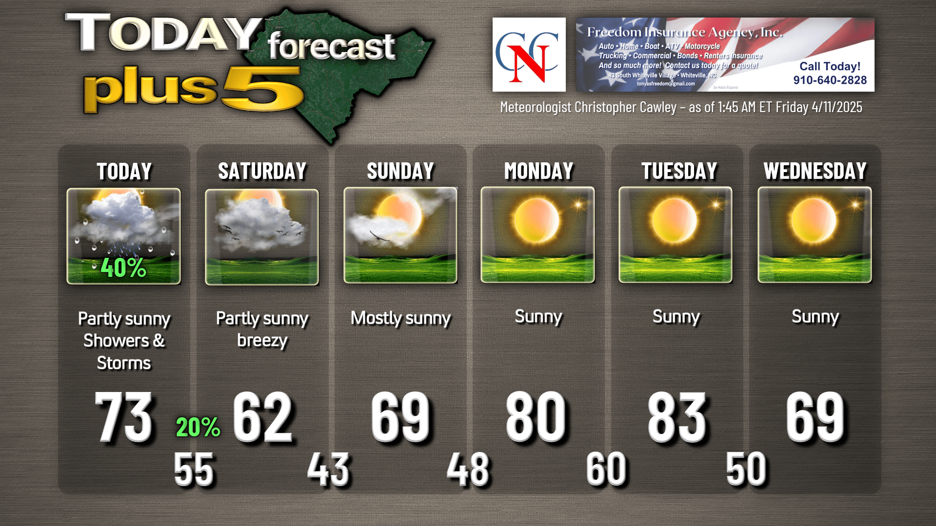
Low pressure will pinwheel along the NC/VA line today. We’ll see lots of clouds and occasional showers and maybe some thunder this morning. As we progress through the day, we should see more in the way of sunshine … but still the chance for some passing rain showers.
The Storm Prediction Center is maintaining a marginal risk (at least as of this writing). I think that’s a longshot at best. The best chance for anything “severe” was with the QLCS that pushed through during the middle of the night. There is still some instability across the area, and as that low rotates to our north, one or two thunderstorms could pop this morning that generate an isolated damaging wind gust. But I highly doubt it.
Aside from a lingering shower or two this evening, we’ll have a drying trend through the evening and overnight. Some spotty areas of fog are possible. A large, upper-level “closed low” (one that is completely detached from the westerly winds higher in the atmosphere) will pivot along the coast through Saturday. This will lead to a mix of sunshine and clouds (I still think it’ll be more cloudy than anything) and the possibility for some real brief isolated spotty light rain showers… not enough to warrant putting rain on the graphic… and rather chilly temps for mid-April. Much nicer conditions on Sunday as that upper low drifts northeastward over the ocean allowing high pressure to build in from the west.
Big warm-up for Monday and Tuesday. A weak cold front will move through late Tuesday afternoon or Tuesday evening. This is going to be a moisture-starved frontal boundary, but it will knock our temps down quite a bit for Wednesday and Thursday next week.
Here is your Freedom Insurance Today-plus-Five Forecast:
That’s going to do it for today’s report. As always, thank you for reading and for supporting Columbus County News. Have a great day!
–Meteorologist Christopher Cawley