Hello friends and followers, it is now time for the CCN Daily Weather Update for Friday April 4, 2025.
This weather update is sponsored by Freedom Insurance of Whiteville. Protect what matters with Freedom Insurance. Life is full of surprises, but with Freedom Insurance, you’ll always be prepared. Whether it’s your home, car, business, or health, we provide customized coverage to keep you and your loved ones secure. Contact Freedom today at 910-640-2828!
STATISTICS FOR WHITEVILLE – Thursday April 3, 2025.
High: 84.4°F at 2:53 PM (normal is 71)
Low: 69.7°F at 7:30 AM (normal is 45)
Precip: 0.00 in
View live, real-time weather data for Whiteville on my College Street Weather Station.
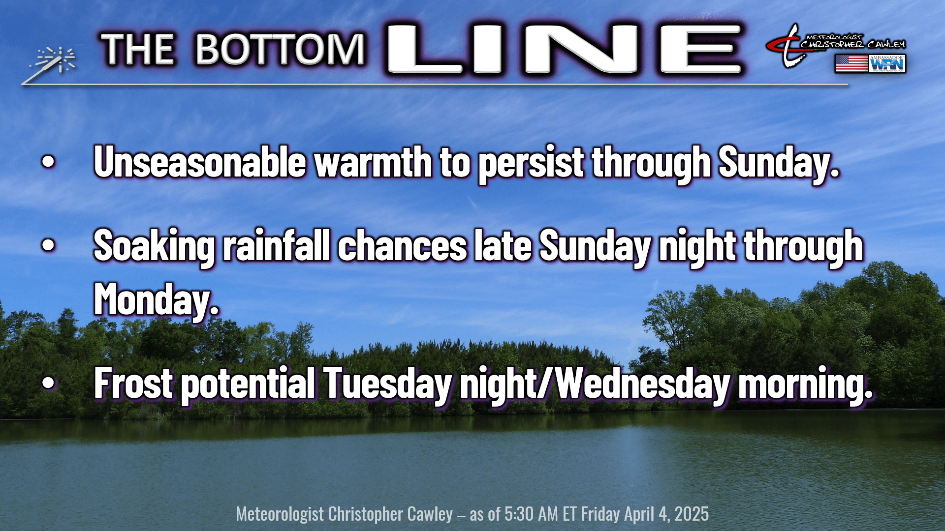
Here’s today’s Bottom Line
Abnormally strong high pressure ridge offshore will continue to bring unseasonably warm and humid conditions to the area through Sunday. While there’s the outside chance for a pop-up shower or storm, we’re going to be dry and very warm through the period. Highs in the upper 80s to around 90, heat index into the lower 90s, with morning lows in the mid to upper 60s.
SOAKING RAINFALL SUNDAY NIGHT THROUGH MONDAY: A complex storm system will push a cold front through the area Sunday night into Monday. As I suspected yesterday (read yesterday’s report for all the details), I had a feeling low pressure would develop on the front. Alas, today’s modeling points to that very scenario. There’s very high confidence in this solution… the only question now is timing.
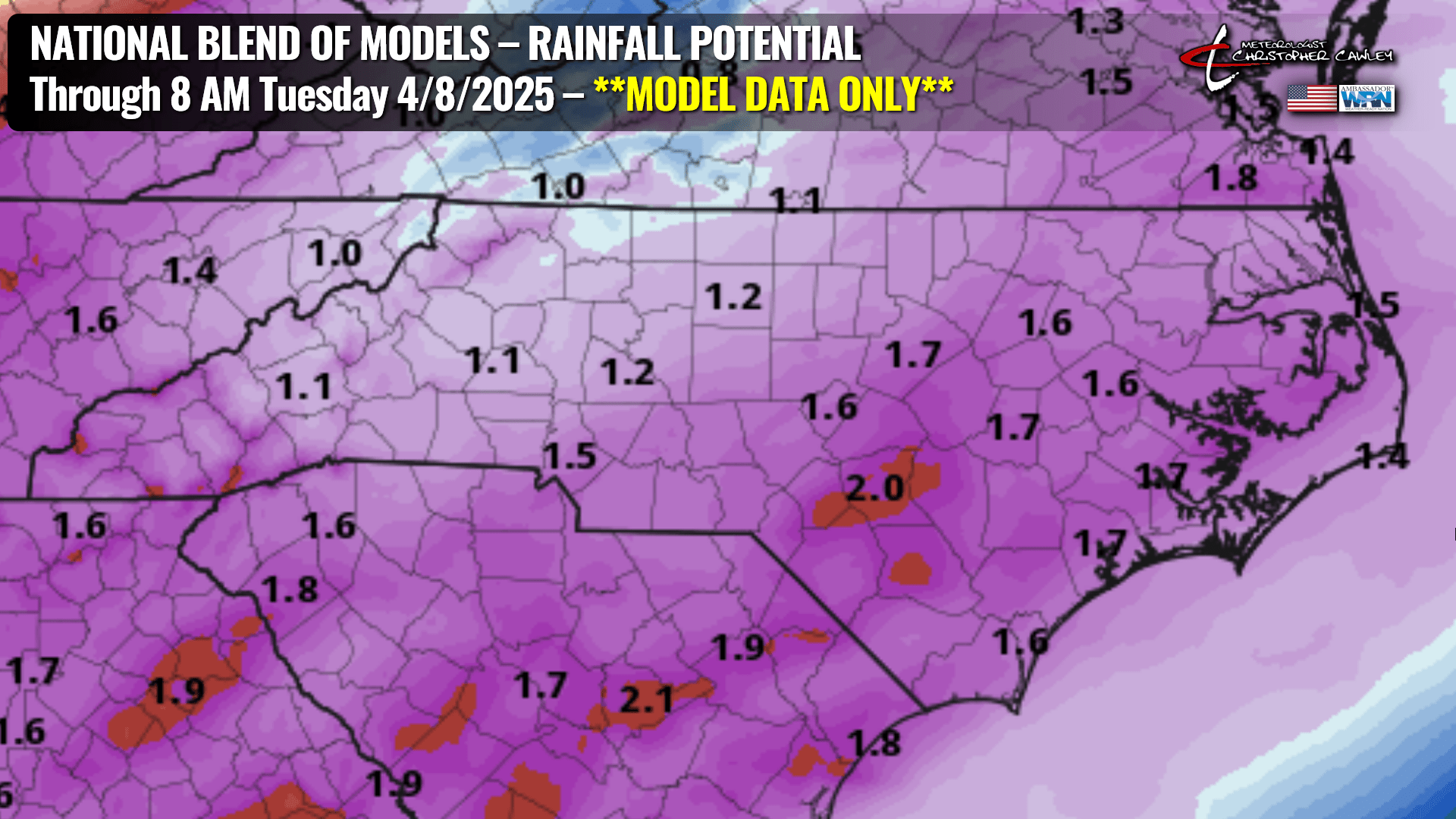
The National Blend of Models has our area receiving over an inch of much-needed rainfall Sunday night through Monday night.
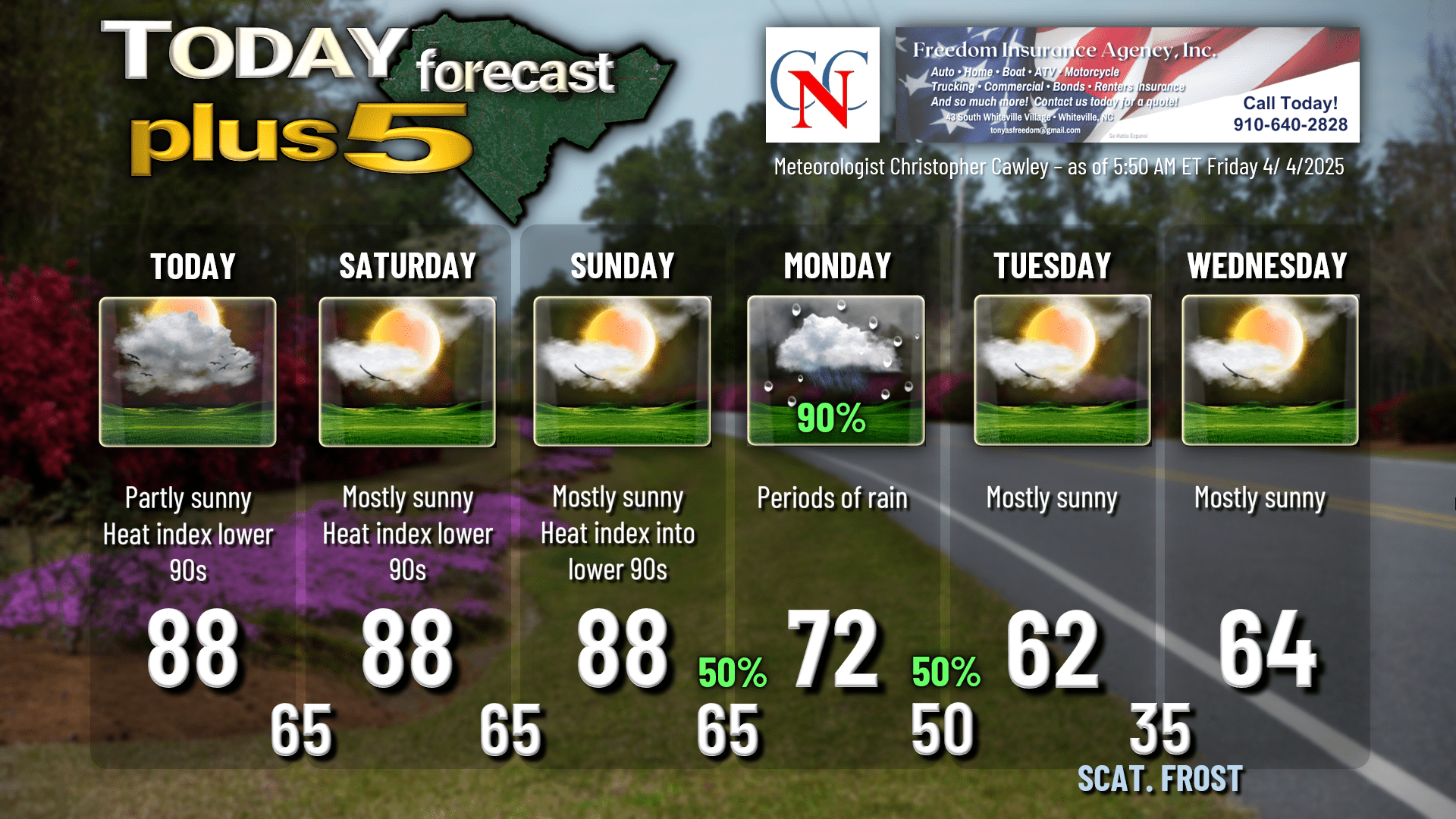
Monday will be cloudy with periods of rain, and the rain could be heavy at times during the daytime on Monday. I’m putting a 90% chance on the graphic. This soaking rainfall will be so beneficial to the area, but even THAT won’t be a complete drought-buster.
FROST POTENTIAL NEXT WEEK: Unseasonably hot temperatures will quickly give way to unseasonably cold temperatures Tuesday through Thursday. A secondary cold front will push through the area early Tuesday morning, followed by a ridge of high pressure of Canadian origin. This high reaches a strength of 1020 mb at the surface and moves essentially overhead Tuesday night into Wednesday morning. This will lead to picture-perfect radiational cooling and, therefore, a frost potential. Temperatures will drop deep into the 30s for most areas. Now the air is going to be extremely dry–desert dry. So whatever frost we get should be patchy in nature… so that’s one saving grace in that regard. We’re going to be close, but I don’t think we’ll have any sub-freezing temperatures. Although one or two isolated spots may fall to 33-35 degrees.
Dry weather to persist through the end of the week with slowly moderating temperatures.
Here’s your Freedom Insurance Today-plus-Five forecast:
That will conclude today’s report. Thanks for your time, and as always, take care!
~Meteorologist Christopher Cawley


