Hello friends and followers, a good day to you. Here is your CCN Daily Weather update for Saturday April 12, 2025.
This weather update is brought to you by Freedom Insurance of Whiteville. Safeguard what is important with Freedom Insurance. Life can be unpredictable, but with Freedom Insurance, you will always be ready. Whether it’s your home, vehicle, business, or health, we offer tailored coverage to ensure you and your family are protected. Reach out to Freedom today at 910-640-2828!
STATISTICS are back! The weather station is back online. Here are your stats for Friday 4/11/2025:
HIGH: 73.0°F at 5:14 PM
LOW: 51.4°F at 10:53 PM
PRECIP: 0.57 IN
View real-time data from the weather station at College Street Weather Station.
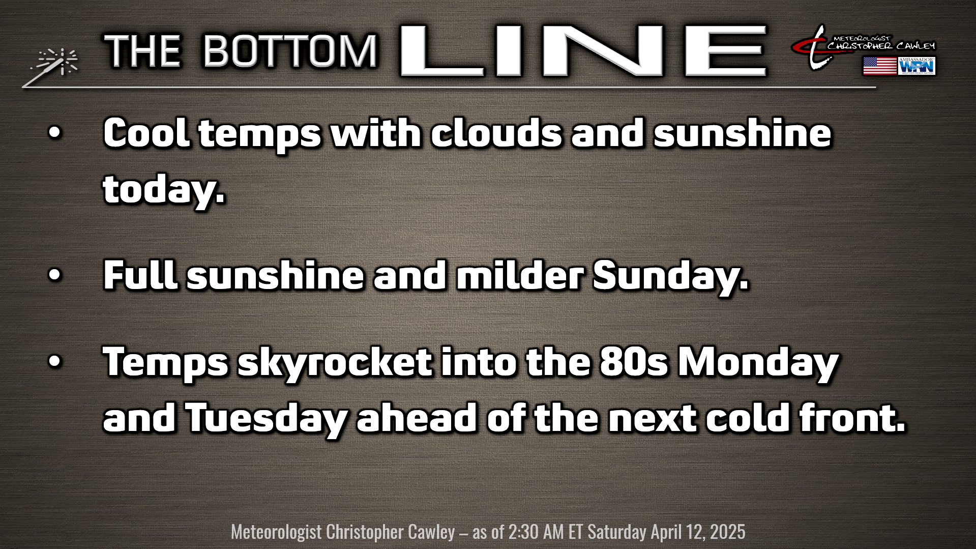
Here’s today’s Bottom Line
Our story will be one of a roller-coaster temperature ride over the next 5-8 days. Nearly zero precipitation chances, though, which will result in an increasing wildfire danger once again as we go through next week.
An upper-level area of low pressure, stacked on top of a surface low, located off the VA/NC coast today will keep cool temperatures and some cloudiness in our area. We may see some sprinkles or even perhaps a light rain shower from time to time, but that will be the exception and not the rule. Our highs will struggle to the mid 60s… which will be more likely if we get more in the way of sunshine.
High pressure gains firm control of our weather for Saturday night through Sunday. The apex of the high moves overhead Saturday night leading to clear skies and light winds, with “almost perfect” radiational cooling. I’m going with lower 40s but some of the outlying areas may drop to 39-40 degrees.
As the high pushes eastward to the coast on Sunday, we begin to see a southerly turn in the air flow and our temps start to climb. We should be near the 70-degree mark on Sunday.
High moves off the coast Sunday night into Monday, and our next frontal system starts to approach. As the high moves offshore, a deep, moist southerly flow becomes established, and with near-full sunshine on Monday, expect highs to skyrocket into the mid 80s.
By Tuesday the cold front pushes into the area. We’ll jump into the 80s once again ahead of the front, which is slated to cross the area late in the afternoon or early evening. The frontal passage itself will be remarkably unremarkable … clouds will even be hard to come by … but we’ll have dramatically colder temps once again for Wednesday. Temps start to return to seasonable normal levels by Thursday, and looking at the model blend, we’re back into the 80s by Friday into NEXT weekend.
Here is your Freedom Insurance Today-plus-Five Forecast:

That’s going to do it for today’s report. As always, thank you for reading and for supporting Columbus County News. Have a great day!
–Meteorologist Christopher Cawley