Greetings friends, and good day to you! Here is your CCN Weather update for Saturday April 26, 2025.
This weather update is sponsored by Freedom Insurance of Whiteville. Protect what matters most with Freedom Insurance. Life can be full of surprises, but with Freedom Insurance, you will always be prepared. Whether it’s your home, car, business, or health, we provide customized coverage to keep you and your family safe. Contact Freedom today at 910-640-2828!
STATISTICS for Friday 4/25/2025
High: 86.5°F at 4:57 PM (Normal 77)
Low: 62.8°F at 6:15 AM (Normal 52)
Precip: 0.00 om
View real-time data from the weather station at College Street Weather Station.
Here’s today’s Bottom Line
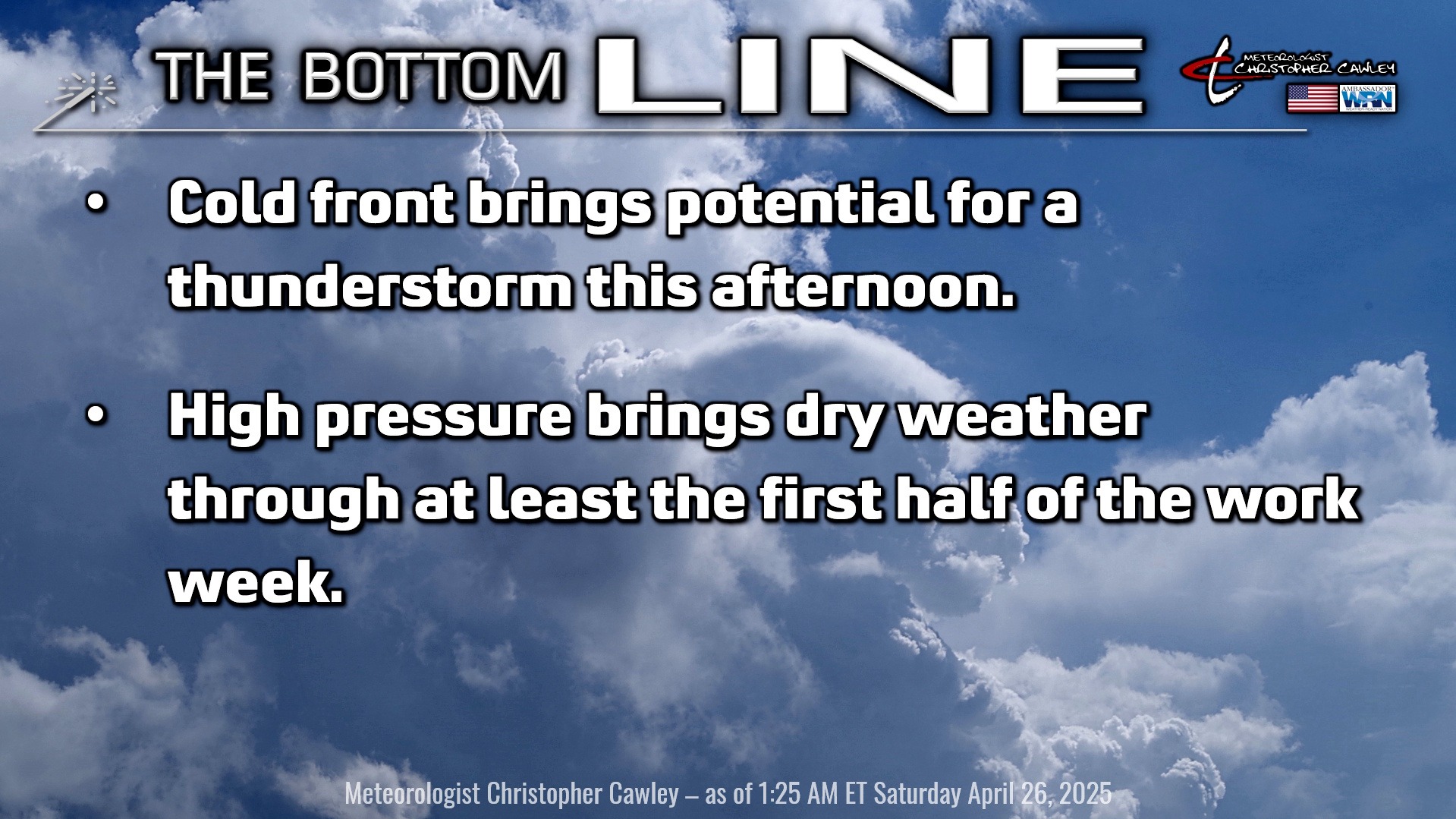
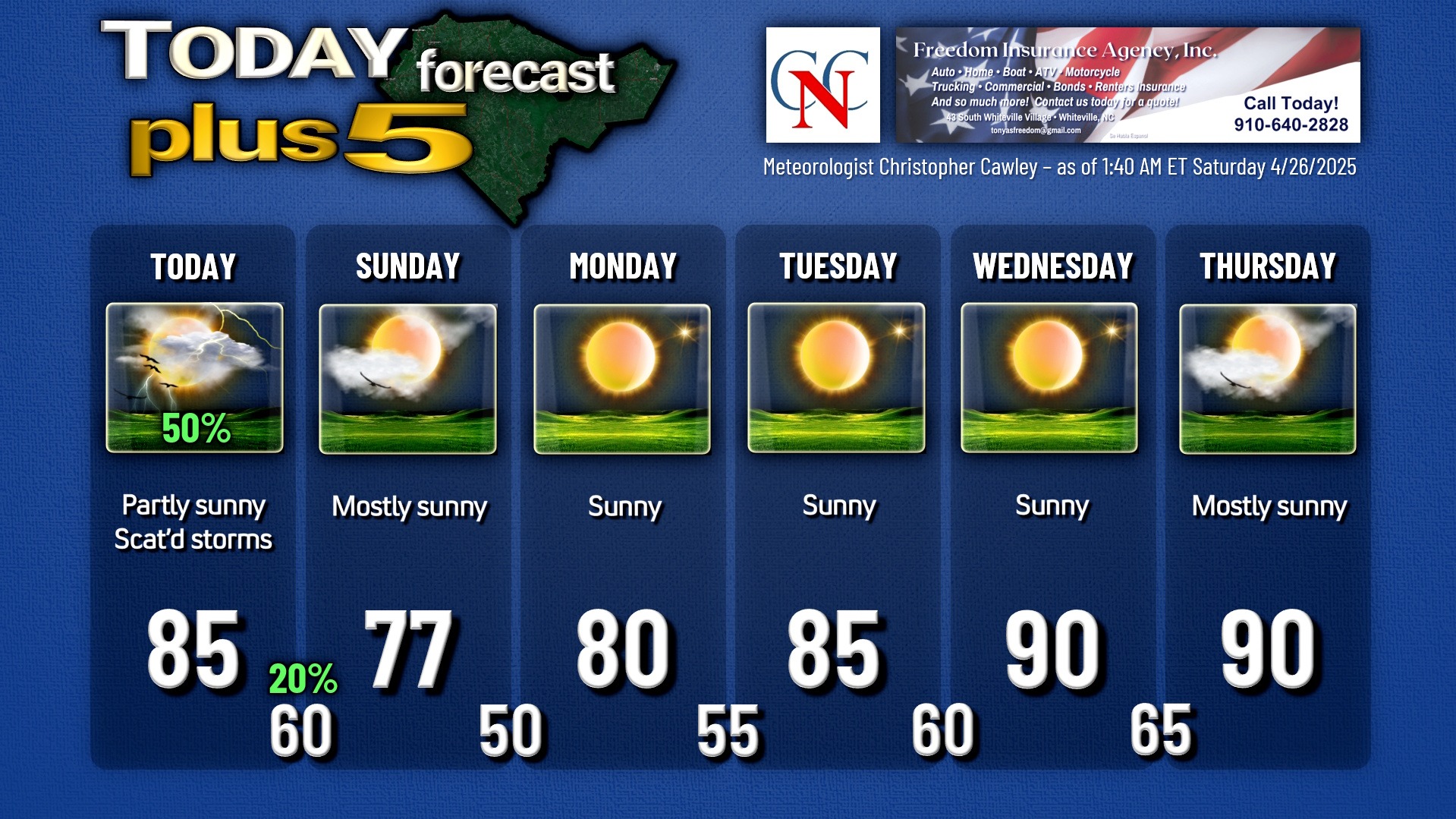
A cold front will drop southeastward across the state today, resulting in a 50/50 chance for a thunderstorm this afternoon. It’s going to be warm and humid ahead of the front, a little breezy at times as well, and our highs will reach the mid 80s. Thunderstorm coverage will be spotty at best this afternoon, and again, the odds are 50/50. Any storm that does develop will have the potential to produce a brief period of intense rainfall, some gusty winds, and frequent lightning. No severe risk, according to the Storm Prediction Center.
Once the front clears the coast, all rainfall chances end and we’ll have a noticeable drop in temps and humidity going into tonight. Our lows will be around 60.
Sunday is going to be an absolutely spectacular spring day across the area with bright sunshine, a few fluffy cumulus clouds from time to time, and highs in the mid to upper 70s. Get out and enjoy it!
Strong high pressure ridge then stretches offshore as we move into next week. We’ll remain quite dry through at least Wednesday with temps increase to the upper 80s/around 90 by Wednesday and Thursday.
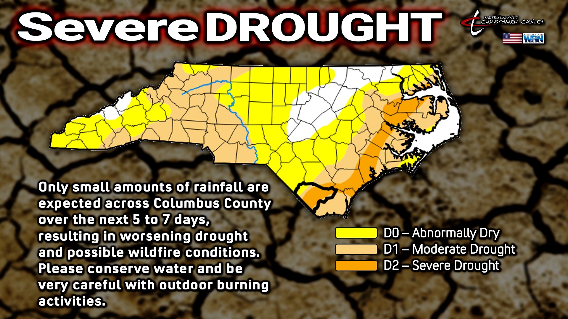
There’s a slight chance for some thunder late Thursday afternoon, and model guidance is still pretty insistent on a frontal boundary dropping southward over the state for Friday into Saturday. It looks like our next threat for thunderstorms will come Friday into Saturday… keep that in mind for Strawberry Festival plans. I’m not quite sold yet on all of this because modeling nearly always prematurely breaks down these high pressure ridges… but I can’t discount the persistence/consistency with the guidance for late next week. Until then, the drought continues.
Here is your Freedom InsuranceFreedom Insurance Today-plus-Five Forecast:
That’s going to do it for today’s report. As always, thank you for reading and for supporting Columbus County News. Have a great day!
–Meteorologist Christopher Cawley