Hello friends and followers, a good day to you. Here is your CCN Daily Weather update for Thursday April 10, 2025.
This weather update is brought to you by Freedom Insurance of Whiteville. Safeguard what is important with Freedom Insurance. Life can be unpredictable, but with Freedom Insurance, you will always be ready. Whether it’s your home, vehicle, business, or health, we offer tailored coverage to ensure you and your family are protected. Reach out to Freedom today at 910-640-2828!
Here’s today’s Bottom Line
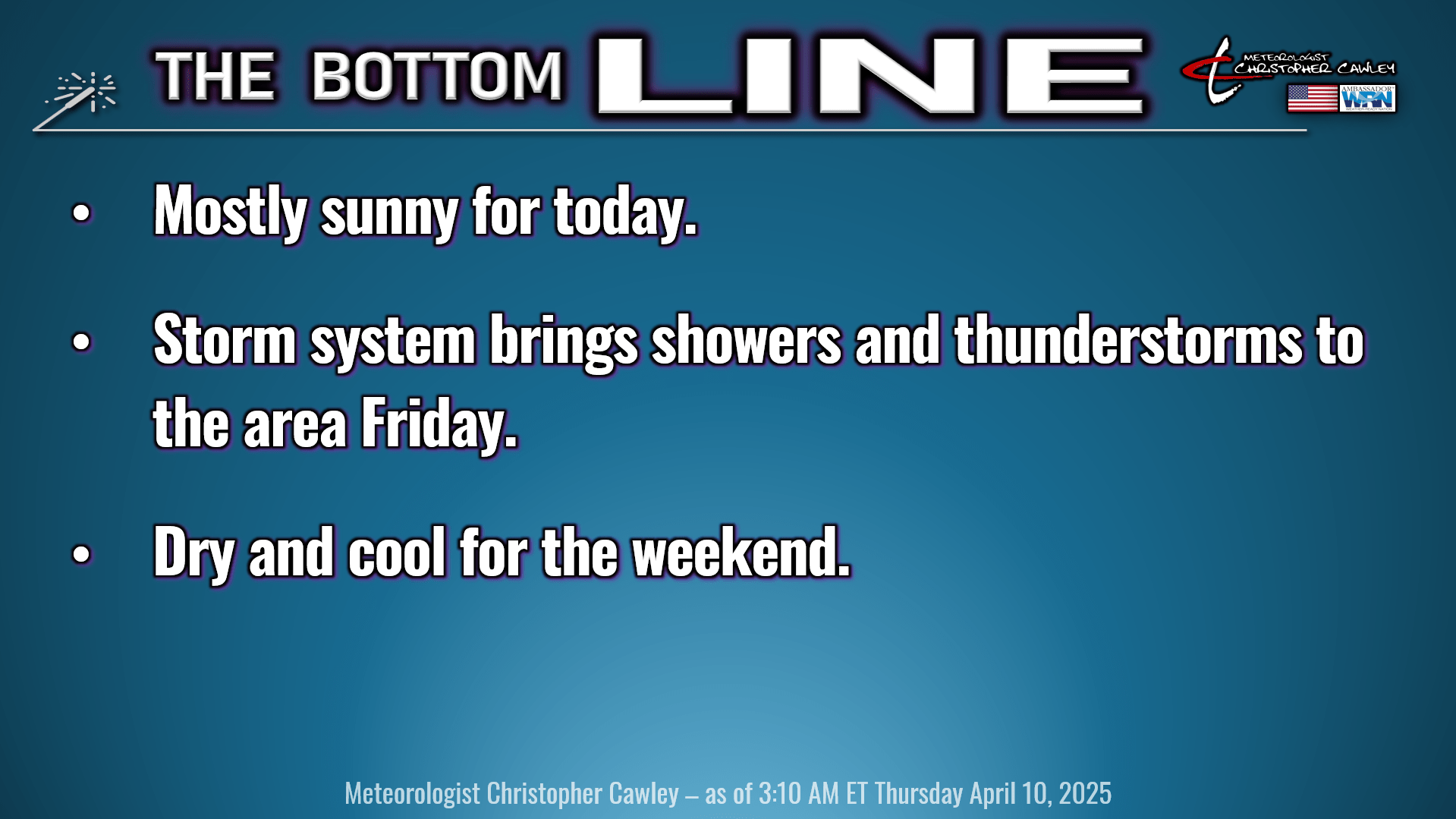
High pressure will hang on for one more day before giving way to an advancing storm system, which will drop by for a visit late tonight through Friday.
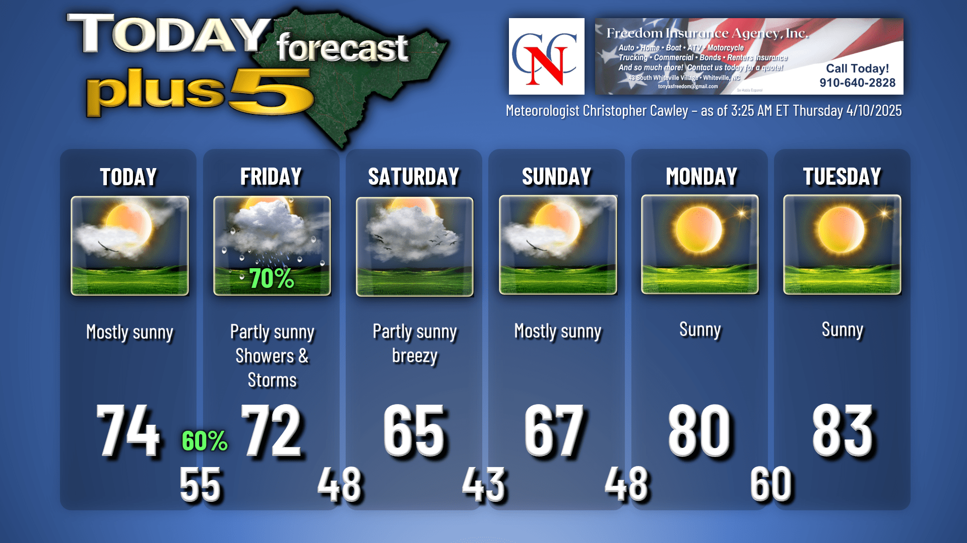
Today should be quite nice with lots of sunshine, on the whole, but perhaps some cloudiness increasing late this afternoon. Temperatures today should be within seasonable normal values, in the mid 70s. If you’re headed to the beach, though, temps will be in the lower to middle 60s.
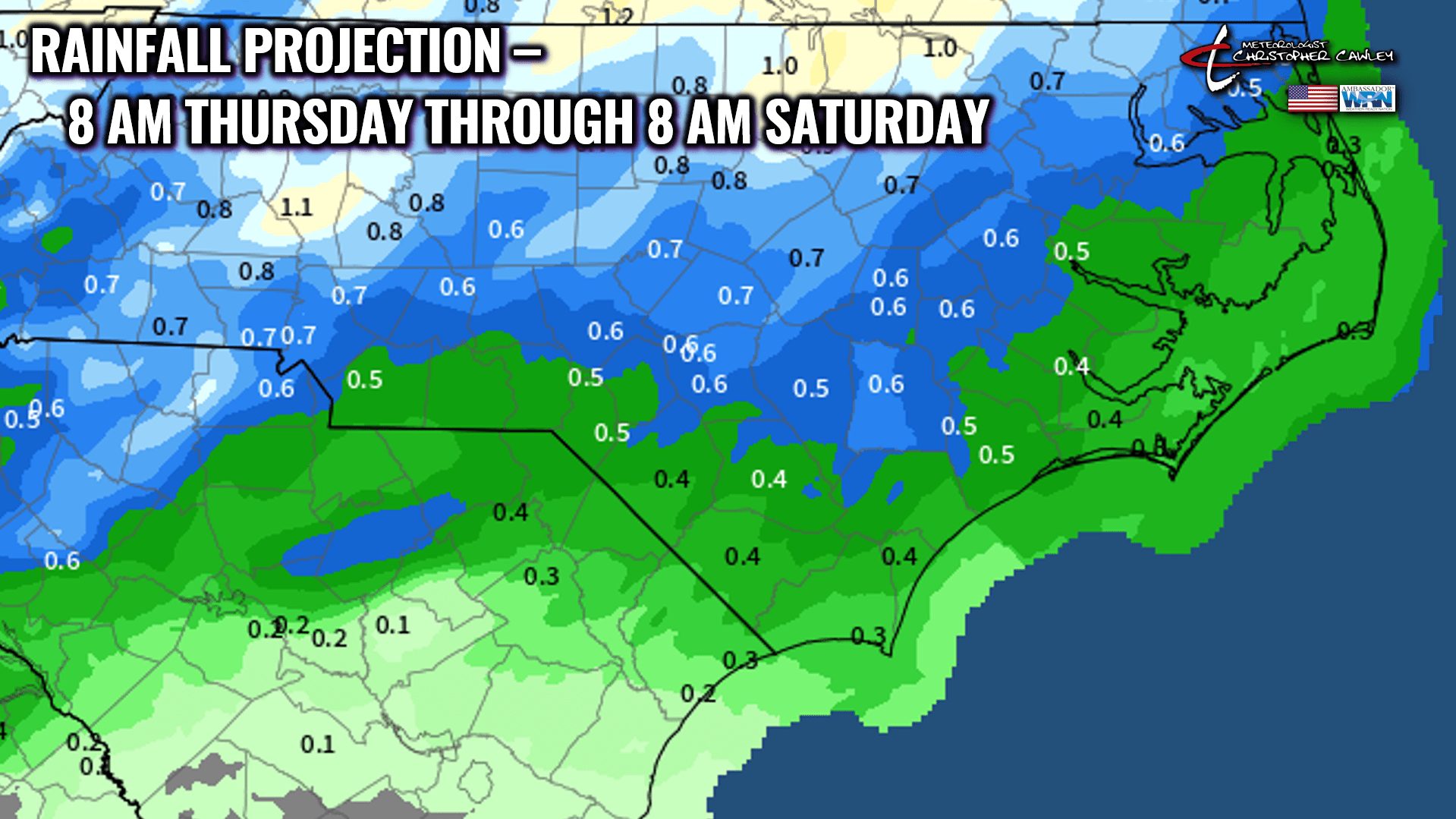
The next storm system that will impact our area starts to advance in this direction tonight. Clouds will be on the increase through the evening with scattered showers developing after midnight. Emphasis is on SCATTERED showers for tonight.
Your Friday will feature a mix of clouds and some sunshine, along with scattered to numerous showers and thunderstorms. The brunt of the precipitation will likely take place through the morning, with more sunshine and “spotty” showers in the afternoon hours.
This isn’t going to be a widespread heavy rain event; in fact, latest modeling guidance suggests half an inch of rain or less from this system.
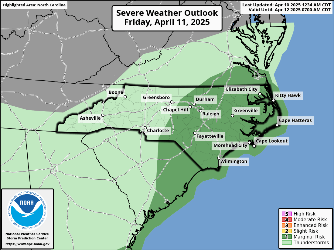
We do have a severe threat for Friday. Dynamics are very favorable for large hail and damaging winds Friday MORNING. The reason that large hail is a threat is because there will be a TREMENDOUS temperature drop as one goes up in the atmosphere from the ground surface. In Meteorology terms, this is known as a “steep lapse rate.” The lapse rate is the rate that the temperature falls with height (for instance, a “normal” lapse rate is usually about 6.5°C per kilometer, or 3.6°F per 1000 feet). Lapse rates early Friday ahead of the cold front will be much greater than those numbers, bringing the zero-degree (Celsius) level quite low in the atmosphere. There will also be very strong deep layer shear. So any thunderstorm that develops Friday morning will need to be watched carefully for large hail and damaging wind threats.
The cold front crosses the area by later Friday afternoon, and the precipitation becomes “spotty” in nature, as mentioned. Friday night features clearing skies and dropping temps.
There will be plenty of residual moisture over the area on Saturday. The guidance has backed way off on the wedge pattern, but I’m not sold on that… as of right now I think we’ll see a 50/50 mix of clouds and sun on Saturday, rather cool temps for this time of year, but no rainfall. Much more sunshine likely on Sunday, but our temps won’t really warm up until we go into next week.
The next cold front targets our area late Tuesday or Wednesday. Right now it looks uneventful, but I’ll watch it.
Here is your Freedom Insurance Today-plus-Five forecast:
That’s it for today’s report. Thank you for your time, and as always, take care!
~Meteorologist Christopher Cawley.