Hello friends and followers, good day to you, welcome to the CCN Daily Weather Update for Tuesday April 8, 2025.
This weather update is sponsored by Freedom Insurance of Whiteville. Protect what matters with Freedom Insurance. Life is full of surprises, but with Freedom Insurance, you’ll always be prepared. Whether it’s your home, car, business, or health, we provide customized coverage to keep you and your loved ones secure. Contact Freedom today at 910-640-2828!
STATISTICS FOR WHITEVILLE – Monday April 7, 2025.
High: 87.8°F at 1:56 PM (normal is 72)
Low: 63.9°F at 11:34 PM (normal is 45)
Precip: 0.48 in
View live, real-time weather data for Whiteville on my College Street Weather Station.
Before getting to today’s Bottom Line, a little note. Quite frankly, I blew the call for yesterday. It turned out to be a fairly nice, albeit windy day, when I called for showers and thunderstorms to be in the area during the afternoon. Indeed we did see some beneficial rainfall, but nowhere near what was expected… but everything held off until the evening. I apologize.
Here’s today’s Bottom Line
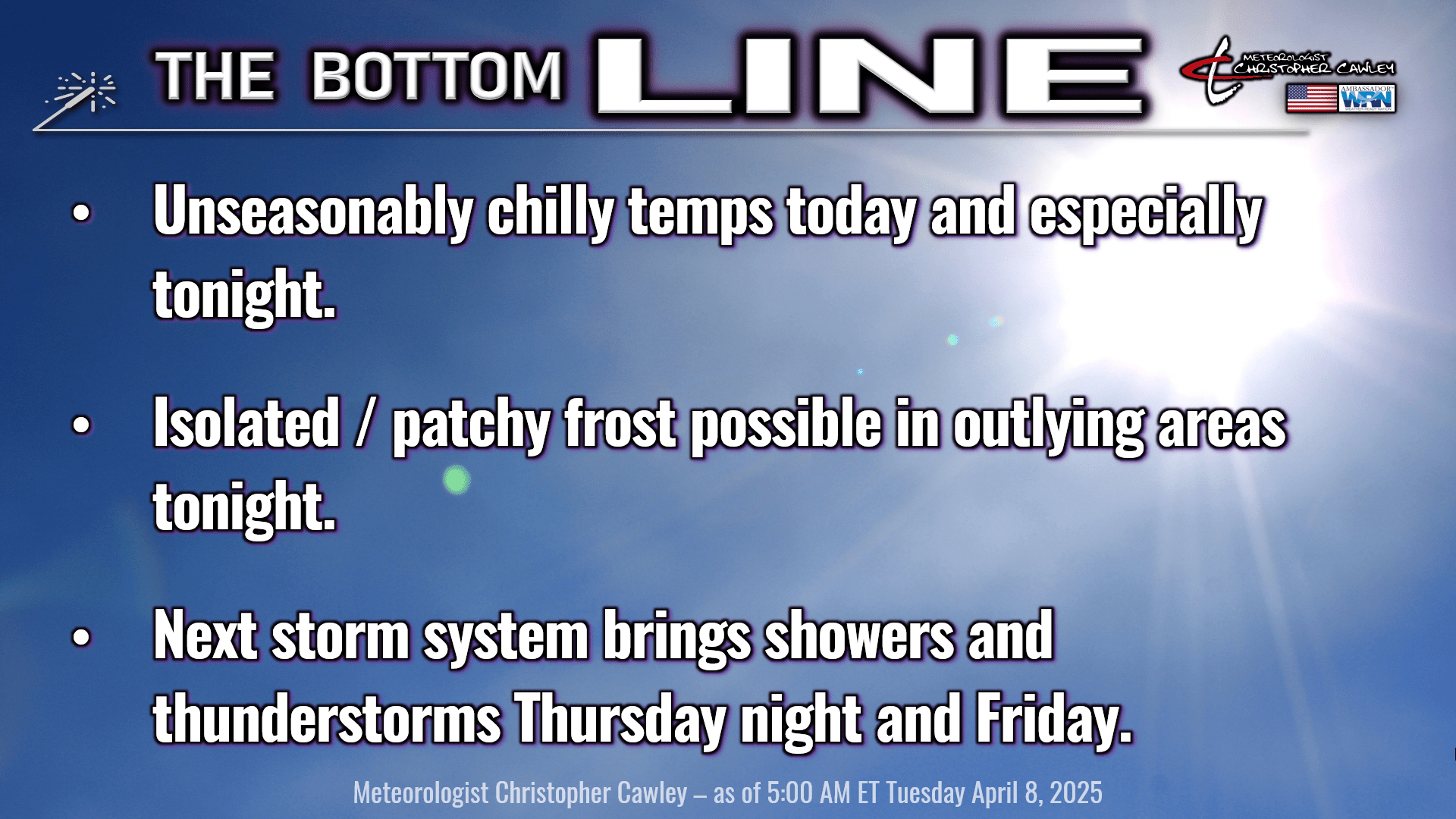
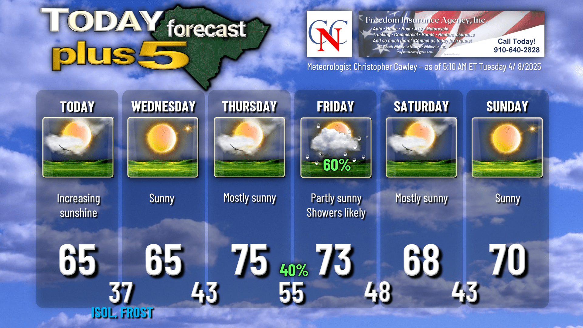
High pressure building in will bring us dry but unseasonably cool temperatures today and Wednesday.
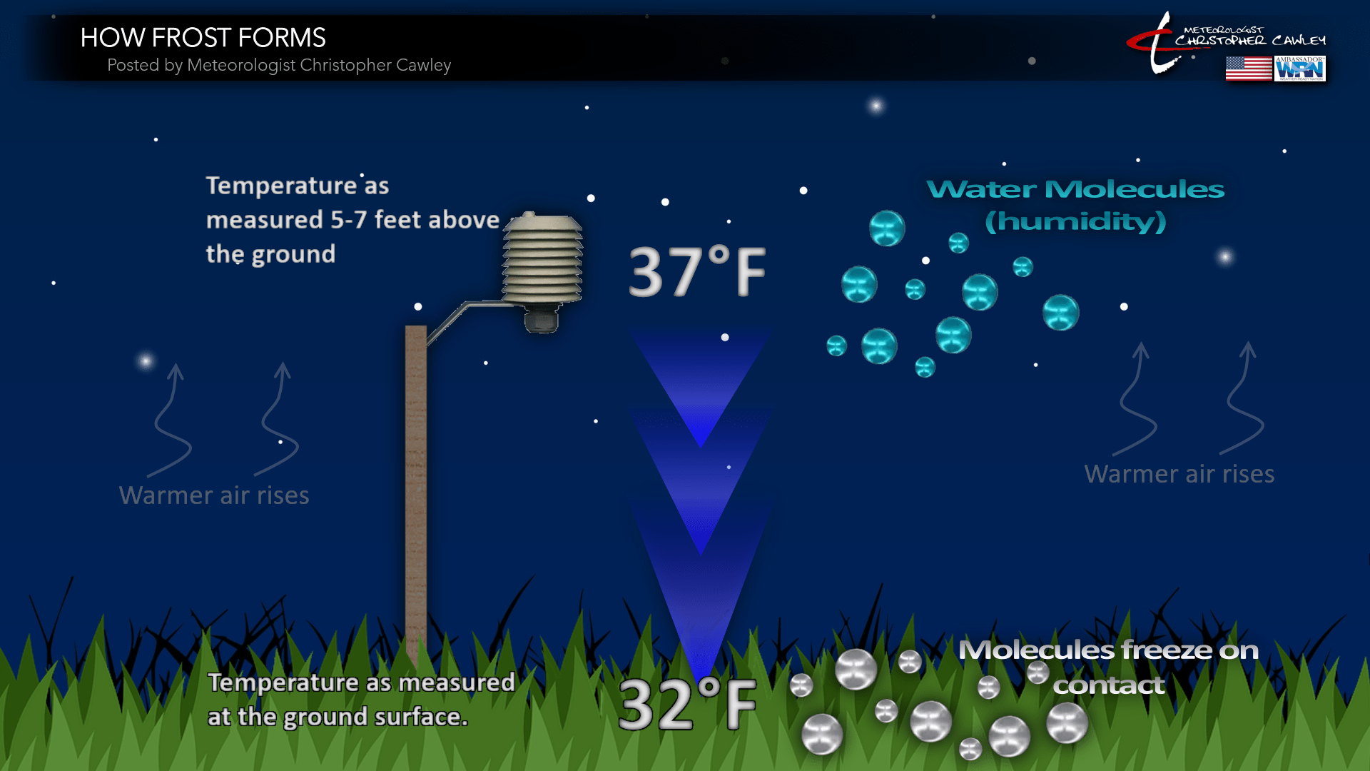
As the high builds just to our north tonight, there is at least the possibility of some isolated to scattered frost in the outlying areas as temps drop to the upper 30s.
You might ask, “how can frost form if the temps are above freezing?” A temperature of 37 degrees at eye level is pretty much the ‘trigger point’ for frost formation on the ground surface. The graphic below explains how frost forms on a clear night in southeast North Carolina.
If there’s any wind at all, even light winds of 5 mph, that can inhibit frost formation as those molecules don’t quite “stick” to the ground surface. I believe we’ll have juuuust enough breeze tonight to keep things from getting too stable, but again, at least isolated to patchy areas of light frost can be expected. No sub-freezing temps here locally.
The high pressure center pushes offshore on Thursday allowing for a southerly flow to resume, bringing our temps back to where they should be for mid-April. The next frontal system also approaches the area Thursday night.
An area of low pressure is expected to move along the NC/VA state line, to a position off the coast by Friday afternoon. A warm front will lift north over the area late Thursday night bringing the potential for some showers and thunderstorms. This will be followed by dry and rather breezy conditions Friday before a line of showers and thunderstorms associated with a cold front moves across the area. Sound familiar?
That pushes off the coast by Friday night and a large, sprawling high pressure ridge extending from the Great Lakes to the Gulf will bring us absolutely sparkling weather for the coming weekend with abundant sunshine, low humidity, and temps just slightly below seasonal norms.
Longer-range modeling suggests our next weather-maker (yet another cold front) pushes through around midweek next week.
Here’s your Freedom Insurance Today-plus-Five forecast:
That will conclude today’s report. Thanks for your time, and as always, take care!
~Meteorologist Christopher Cawley