Greetings, and good day to you! Happy(?) Tax Day! Here is your CCN Weather update for Tuesday April 15, 2025.
This weather update is brought to you by Freedom Insurance of Whiteville. Safeguard what is important with Freedom Insurance. Life can be unpredictable, but with Freedom Insurance, you will always be ready. Whether it’s your home, vehicle, business, or health, we offer tailored coverage to ensure you and your family are protected. Reach out to Freedom today at 910-640-2828!
STATISTICS for Monday 4/14/2025:
HIGH: 87.2°F at 4:41 PM (Normal 74)
LOW: 46.7°F at 6:15 AM (Normal 48)
PRECIP: 0.00 IN
View real-time data from the weather station at College Street Weather Station.
Here’s today’s Bottom Line
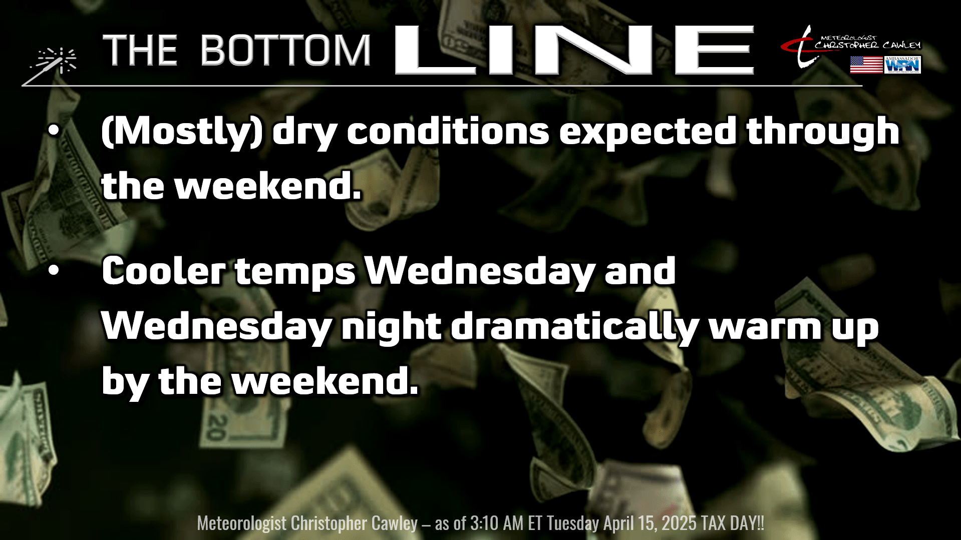
Today’s story is one of a cold front that will whisk across the area late this afternoon. This is going to bring some cloudiness… and maybe a light rain shower. We will have a deep southwesterly flow in place today, bringing warm and rather humid air into ColCo. That wind flow will also push in what is known as “shallow moisture” between 3,000 and 8,000 feet off the ground, but that is if you’re really looking hard at the sounding chart. This will result in a good deal of cloudiness, but I don’t think it will be enough moisture to produce any meaningful rainfall … any showers we do get should be brief, light, isolated, spotty, and barely enough to wet the ground. Most places won’t get anything other than lots of clouds this afternoon. There might be that one location, though, that gets a “real” rain shower. I put a “10%” notation on the graphic.
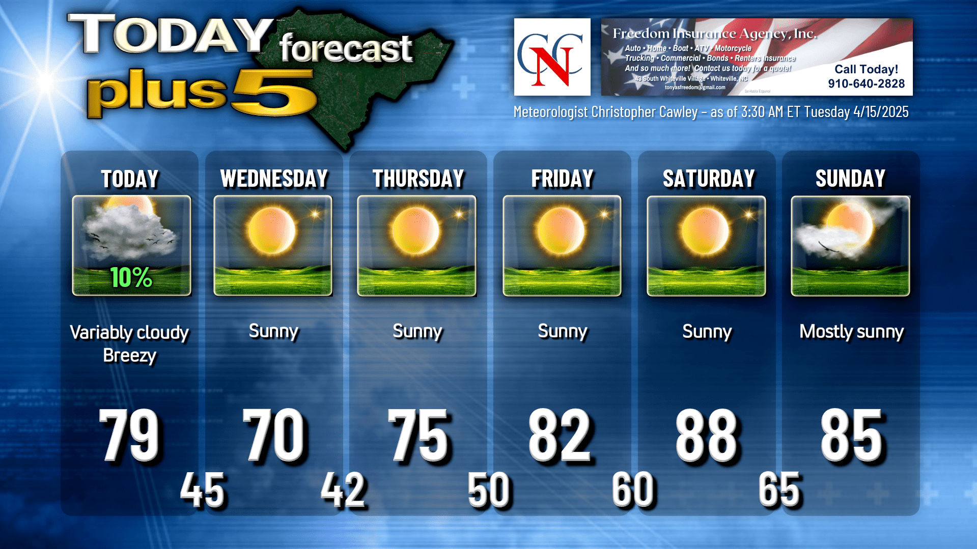
Cold air pushes in behind the front, and our lows by early Wednesday morning should fall generally into the lower and middle 40s across the county.
High pressure just to our west on Wednesday will slowly move overhead and then to the east by later Thursday, and then offshore by the weekend. This will result in quite the warming trend going into the weekend.
Fortunately they can’t tax the sunlight (yet…) and we’re going to get TONS of it Wednesday through Sunday. Wednesday and Thursday (especially Thursday) will be gorgeous with sunny, clear skies and highs around 70 on Wednesday, in the mid 70s on Thursday. Then, as that high moves offshore, a southerly flow of more humid air develops and while we remain abnormally dry, we’ll feel that temperature climb… around 80 or in the lower 80s Friday, upper 80s on Saturday.
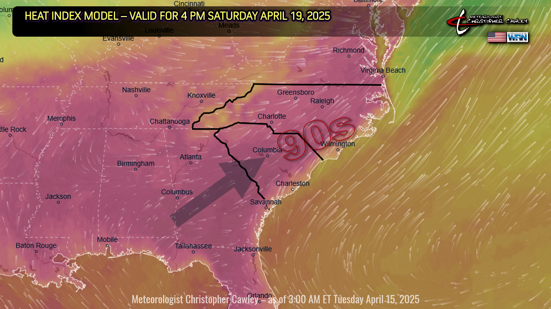
Saturday will be a hot day by April standards, with heat index values well into the 90s.
A dry cold front drops down from the north for Easter, and this will knock our temps back a few degrees… but will knock the dewpoint down considerably more (making it feel much nicer outside). All indications are that we remain dry into next week with highs running in the 80s and a return to more humid conditions. Easter Sunrise church services should have mainly clear to partly cloudy skies with humid temps in the upper 60s.
Here is your Freedom Insurance Today-plus-Five Forecast:
That’s going to do it for today’s report. As always, thank you for reading and for supporting Columbus County News. Have a great day!
–Meteorologist Christopher Cawley