Greetings friends and neighbors, and good day to you! Welcome to the CCN Weather Update for Friday May 2, 2025.
This weather update is sponsored by Freedom Insurance of Whiteville. Protect what matters most with Freedom Insurance. Life can be full of surprises, but with Freedom Insurance, you will always be prepared. Whether it’s your home, car, business, or health, we provide customized coverage to keep you and your family safe. Contact Freedom today at 910-640-2828!
STATISTICS for Thursday 5/1/2025
High: 86.5°F at 2:20 PM (Normal 78)
Low: 62.0°F at 6:59 AM (Normal 55)
Precip: 0.00 om
View real-time data from the weather station at College Street Weather Station.
Here’s today’s Bottom Line
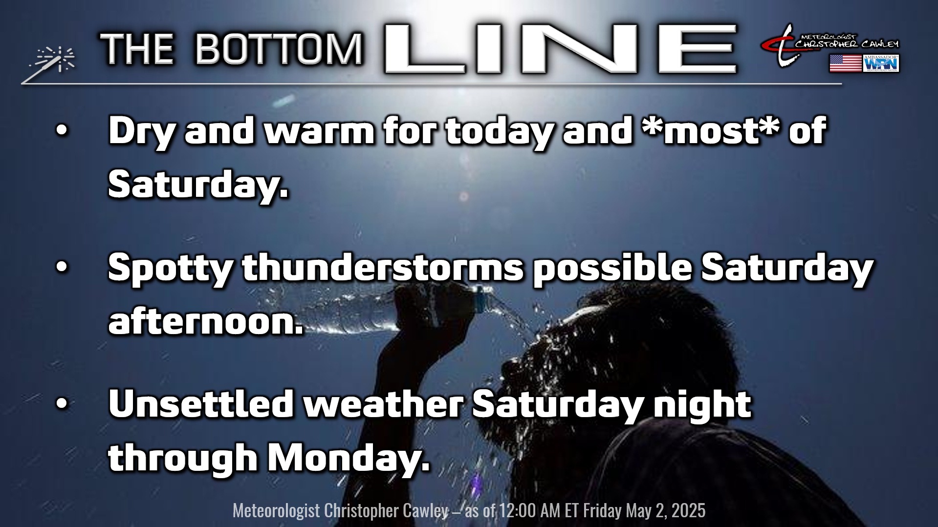
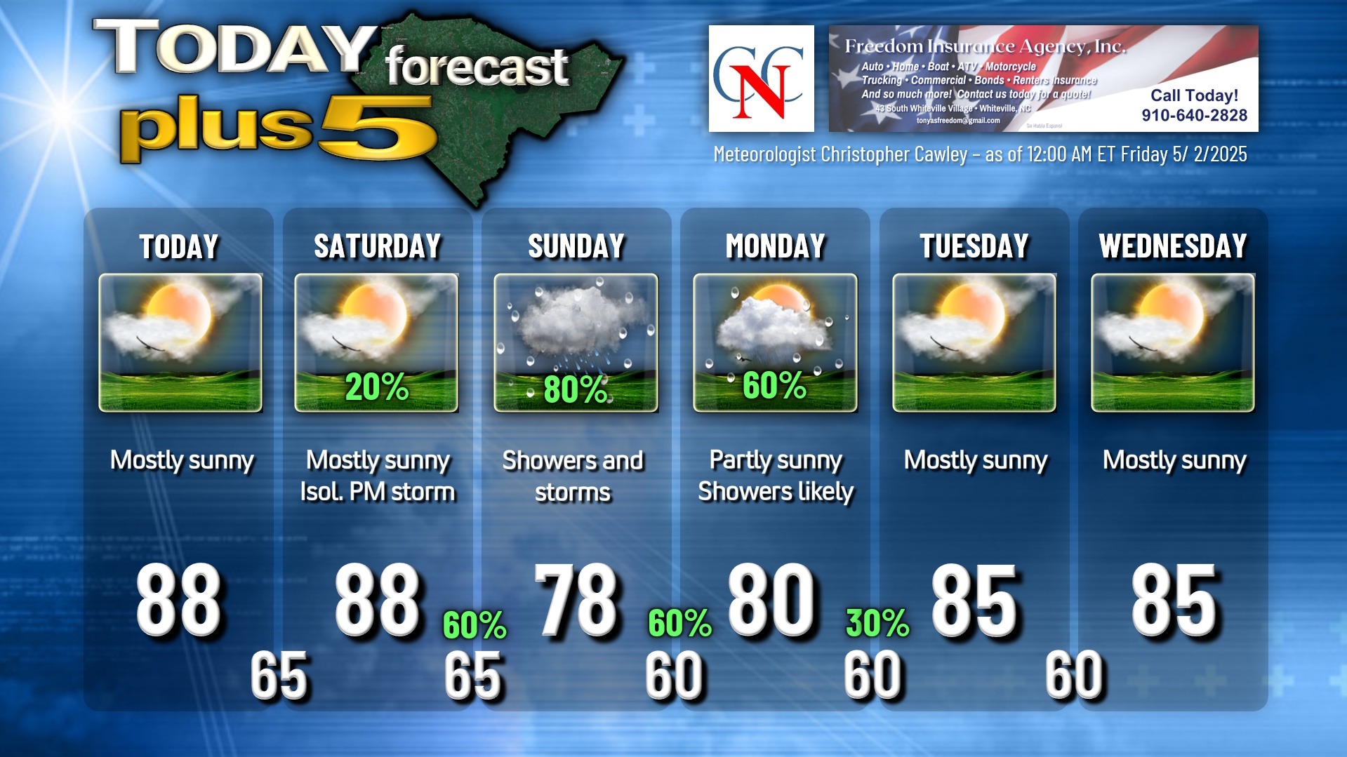
Another dry and warm day across the area for today, with a good deal of sunshine and highs in the mid to upper 80s.
A rather challenging forecast focusing on the Strawberry Festival activities this weekend. The much-advertised frontal system is still expected to impact our weather this weekend, but modeling is once again slowing things down… now holding off the majority of the precipitation to Saturday night through Sunday night. Saturday, therefore, should be mostly sunny on the whole, but I’m not going to rule out a spotty / isolated shower or thunderstorm in the afternoon… I’m just not confident enough to go with a completely dry forecast. So keep the umbrella at your side, but you probably won’t need it.
Shower and thunderstorm chances ramp up Saturday night through Sunday… with scattered to numerous showers and storms expected. Rainfall amounts are going to vary quite widely… some spots may receive very little, while others receive a significant amount of rain. I’m going with an 80% chance for Sunday as I think the coverage will be pretty good, but model blends show an average of about half an inch of rainfall.
Shower and storm chances continue Sunday night through Monday as the frontal boundary hangs up and dissipates along or just inland from the coast. There’s a higher-than-normal level of uncertainty with how quickly this front fades away… shower changes may linger into Tuesday, even though I don’t have a percent listed on the graphic below.
Don’t expect any huge, drought-busting rainfall through the weekend event. Given the scattered nature of what is expected, the average values, as mentioned, are expected to be half an inch or less… although someone’s back yard may get several inches of rainfall. It’s impossible to pin down where that will be.
Dry weather should be the rule for Wednesday, with the next frontal system approaching by the end of next week.
Here is your Freedom Insurance Today-plus-Five Forecast:
That’s going to do it for today’s report. As always, thank you for reading and for supporting Columbus County News. Have a great day!
–Meteorologist Christopher Cawley