
Hello friends and neighbors, and good day to you! Welcome to the CCN Weather Update for TGIF Friday May 30, 2025.
This weather update is sponsored by Freedom Insurance of Whiteville. When severe weather strikes, with Freedom Insurance you will always be prepared. For home, car, boat, or whatever you need, Freedom can provide customized coverage to keep you and your family safe. Contact Freedom today at 910-640-2828!
STATISTICS for Thursday 5/29/2025
High: 88.1°F at 1:02 PM (Normal 83)
Low: 67.6°F at 4:03 AM (Normal 61)
Precip: 0.33 in
Precip – Month: 7.50 in
View real-time data from the weather station at College Street Weather Station.
Here’s today’s Bottom Line
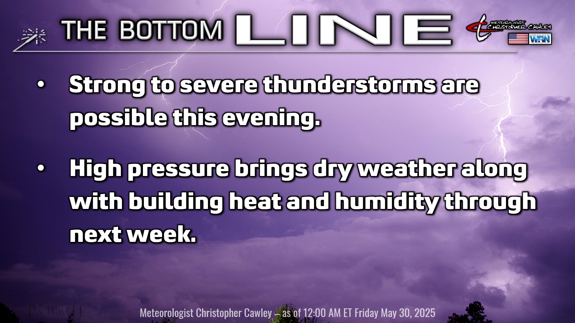
Weather Action Day today (well, more like this afternoon through this evening) as a strong cold front crosses the area. All available guidance suggests that a squall line, or a broken/segmented squall line, moves across the county sometime between 5 PM and 8 PM.
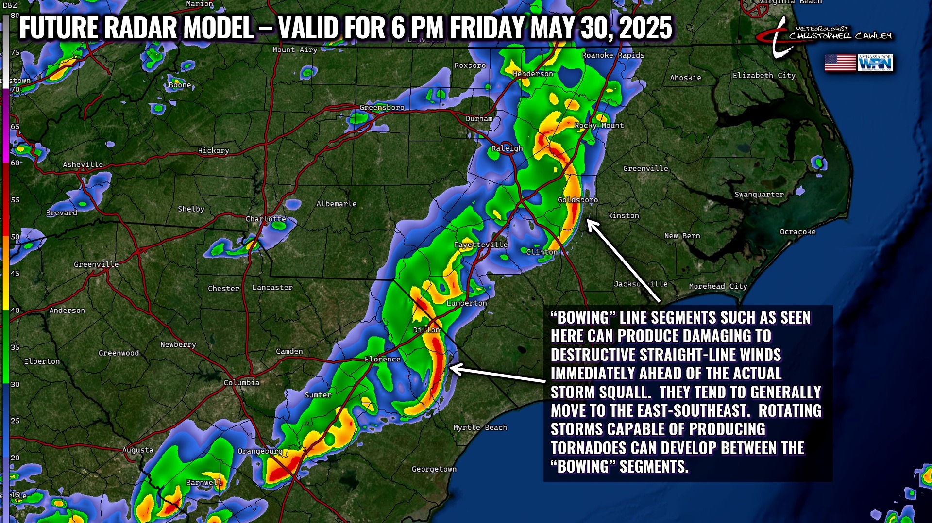
The future radar model here (one of quite a few) shows “bowing” line segments. These are capable of producing destructive straight-line winds at the apex of each bowed segment as surface winds rush outward from the storm. An impressive shelf cloud is oftentimes observed ahead of these types of storms as well.
In between each bowing segment, you can get discrete cells that exhibit some rotation, which implies a tornado threat. Those are hard to predict, and may or may not form at all.
There is some indication that the highest severe potential is along and west of Interstate 95, and the storms could be in a weakening phase by the time they arrive in Columbus County.
The NWS Storm Prediction Center has outlined our area under a level 2 out of 5 “slight” risk for severe weather this afternoon/evening, with the primary threats being that of damaging wind. Large hail is also possible, according to the hazardous weather outlook from NWS Wilmington, along with that isolated tornado threat. Stay weather-aware if you have outdoor plans later this afternoon.
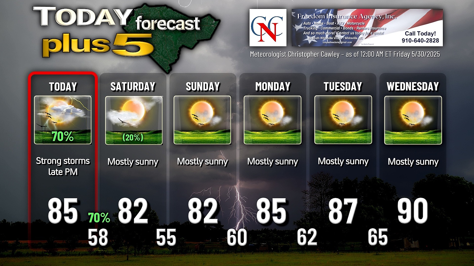
Colder air comes rushing in late tonight/early Saturday, and we wake up with temps in the upper 50s on Saturday. A second cold front moves through on Saturday, and this frontal passage should be remarkably unremarkable, save for a few isolated showers (and I think even that is a stretch).
Sunday will be a spectacular day — get out and enjoy it — as we have bright sunshine, temps in the lower 80s, with dewpoint values in the comfortable 50s.
That’s not going to last long as we will have building heat and humidity through next week. Our weather should be dry… although “air mass” thunderstorms may become a thing by Wednesday as our temps push the 90-degree mark, with dewpoints in the 60s to around 70 during the afternoon. Heat index values at or above 100 likely for the 2nd half of the work week.
TROPICAL WEATHER FORECASTS are returning Sunday June 1st, the official start of hurricane season.
Here is your Freedom Insurance Today-plus-Five Forecast:
That’s going to do it for today’s report. As always, thank you for reading and for supporting Columbus County News. Have a great day!
–Meteorologist Christopher Cawley