Greetings friends and neighbors, and good day to you! Welcome to the CCN Weather Update for Tuesday May 6, 2025.
This weather update is sponsored by Freedom Insurance of Whiteville. Protect what matters most with Freedom Insurance. Life can be full of surprises, but with Freedom Insurance, you will always be prepared. Whether it’s your home, car, business, or health, we provide customized coverage to keep you and your family safe. Contact Freedom today at 910-640-2828!
STATISTICS for Monday 5/5/2025
High: 83.2°F at 1:19 PM (Normal 80)
Low: 60.7°F at 6:25 AM (Normal 57)
Precip: 0.08 in
View real-time data from the weather station at College Street Weather Station.
Here’s today’s Bottom Line
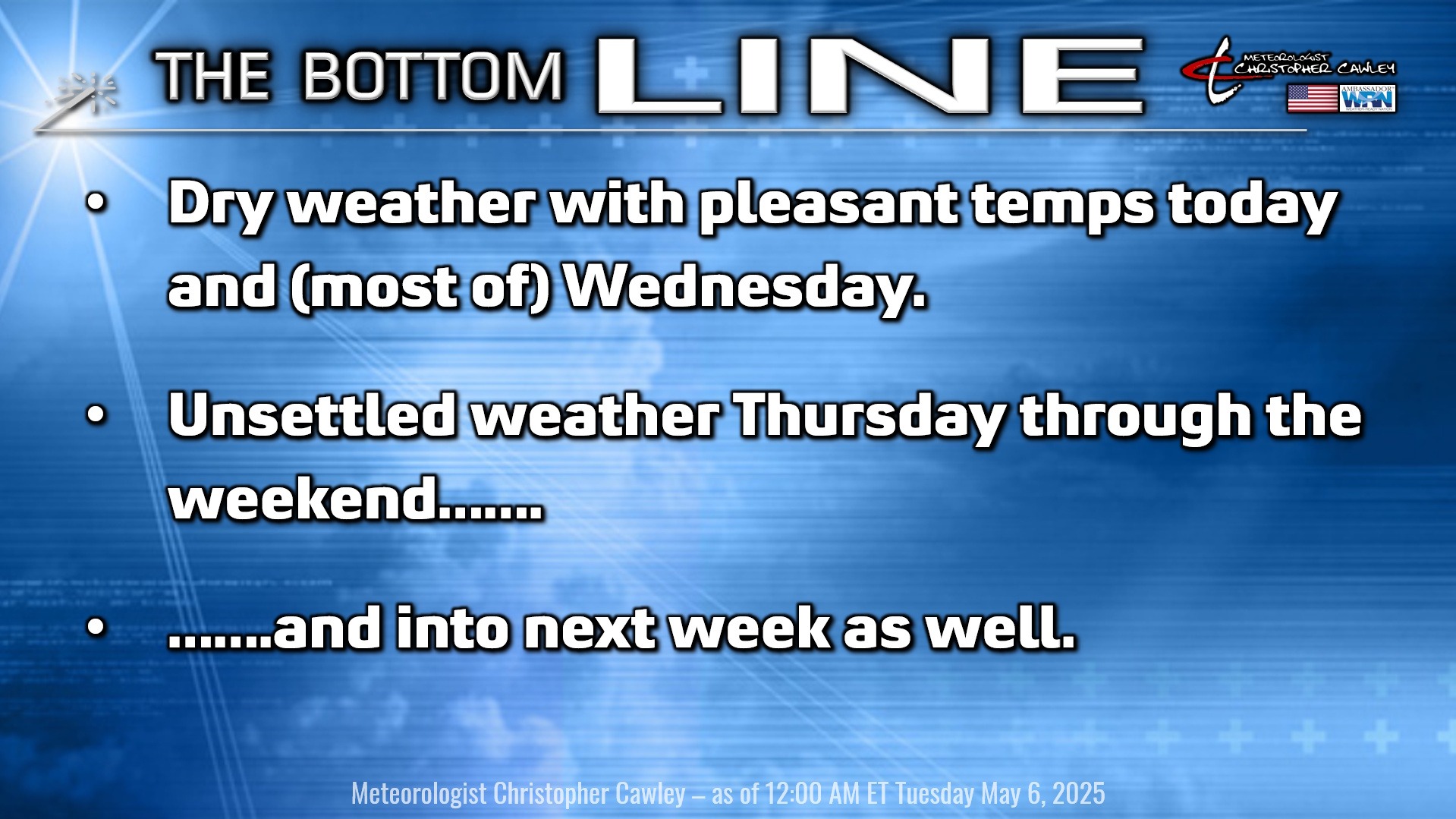
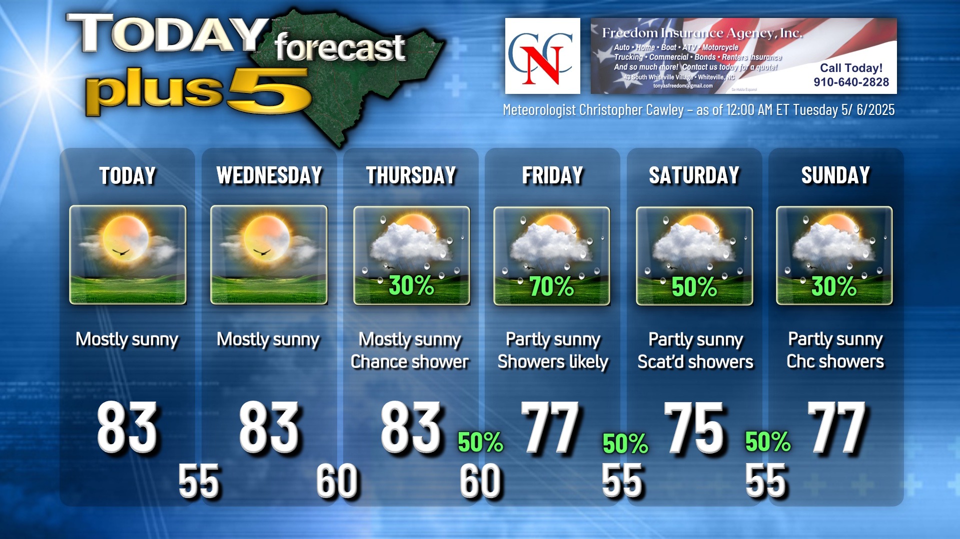
High pressure will be in control of our weather for today through Wednesday bringing dry weather, low humidity, warm temperatures by day and comfortable temps by night. There’s the ever-so-slight chance for a spotty rain shower later Wednesday afternoon, but it’s not worth putting in the graphic.
A slow-moving frontal boundary will approach the area Thursday, move over the county Thursday night, and then stall in a west-to-east orientation for your Friday. This will be the focus for showers and thunderstorms over the county once again.
Thursday’s rain chances are low/isolated, pinned to the afternoon. Variably cloudy with scattered to numerous showers is the expectation for Thursday night, Friday, and Friday night, with scattered showers lingering through the weekend… and into next week as well.
This is all caused by a “closed low” drifting aimlessly about the Ohio valley. There are multiple “shortwaves” (or frontal boundaries) pinwheeling around this closed low. The front that will impact our area later this week will be oriented parallel to the wind flow, which will not enable it to move really anywhere. This front should drop south, just south of the state line for Friday allowing cooler temps in here (along with the clouds and showers). There is still some indication in the modeling that the front will orient along the coast by the weekend with a wave of low pressure forming along it. I’m not really ready to go “all in” on that solution but my unsettled forecast continues through the weekend.
In short, Thursday through at least next Tuesday will feature more clouds than sunshine along with shower chances. The best chance for rainfall will come late Thursday night through Friday night, and the model blend shows the potential for SIGNIFICANT additional rainfall (in the order of 2-3 inches) for today through 8 AM on Tuesday (May 13th).
Here is your Freedom Insurance Today-plus-Five Forecast:
That’s going to do it for today’s report. As always, thank you for reading and for supporting Columbus County News. Have a great day!
–Meteorologist Christopher Cawley