CCN Weather Update for Monday June 23, 2025.
This weather update is sponsored by Freedom Insurance of Whiteville. You won’t need to sweat over the details when there’s heat in your world. For home, car, boat, or whatever you need, Freedom can keep you cool with customized coverage to keep you and your family safe. Contact Freedom today at 910-640-2828!
High temperature at College Street in Whiteville on Wednesday was 96.4°F. The highest heat index was 108.8°F.
View real-time data from the weather station at College Street Weather Station.
Here’s today’s Bottom Line
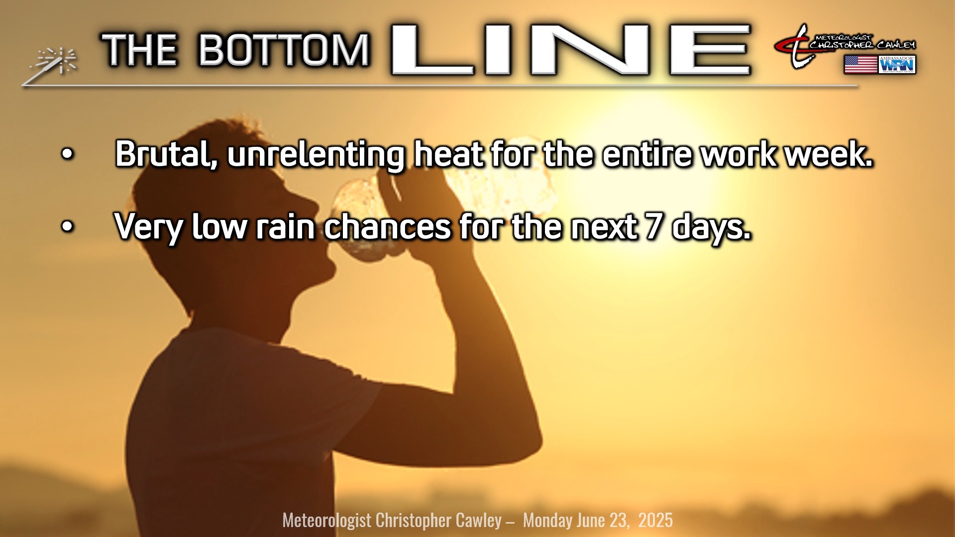
HEAT ADVISORY for today, as airport heat index values reach 105°F or higher for 2 or more hours. Heat index values where people actually live will be much higher, probably pushing 110°F or higher later this afternoon.
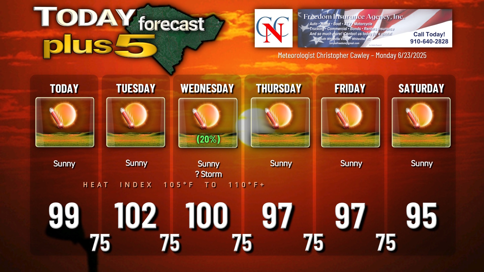
EXCESSIVE HEAT FOR TUESDAY AND WEDNESDAY. Highs (not the heat index) will be in the 100-102 range, with airport heat index values possibly touching 110°F; downtown heat index values may be as high as 112-115. This is EXTREME heat, and very dangerous even for the most fit, even for the most “old school,” for everyone.
Heat-related illnesses won’t discriminate and can impact anyone, of any age, of any physical fitness level. However, the most vulnerable will be those in poor health and the elderly.
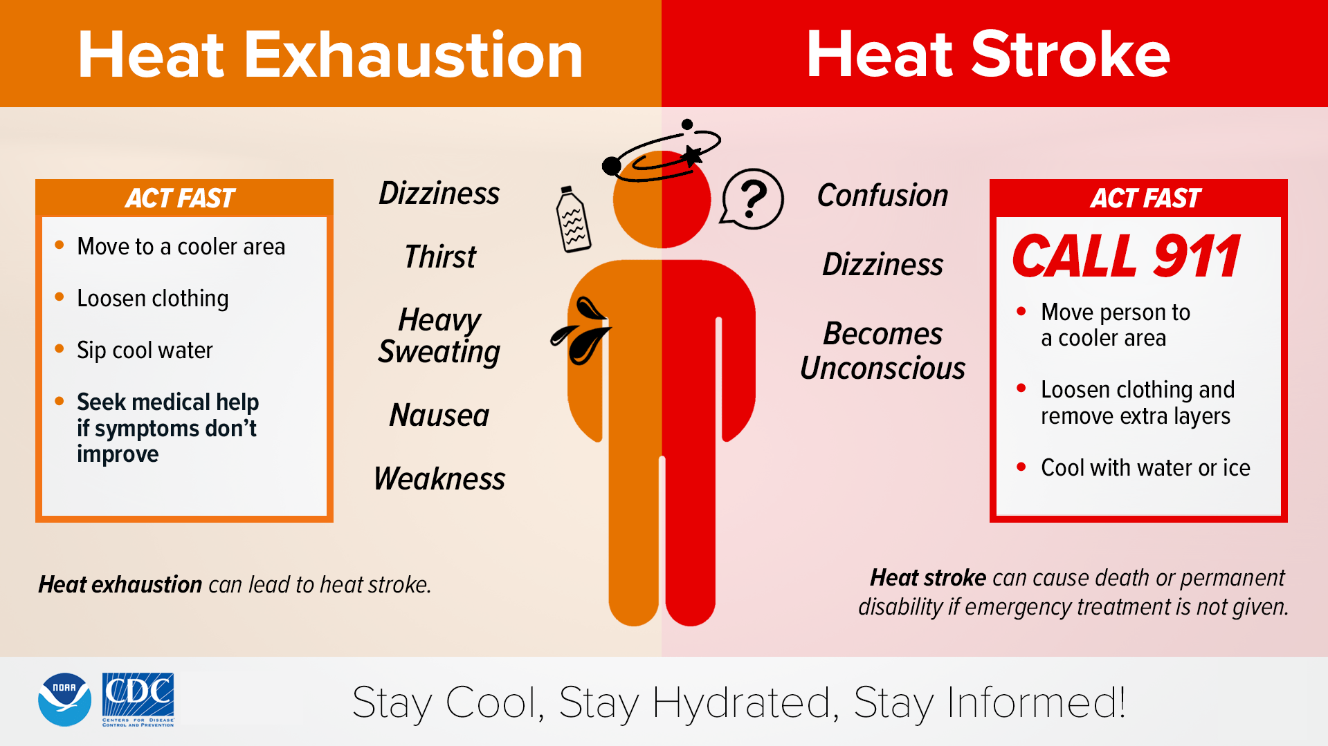
Please understand the symptoms of heat exhaustion and heat stroke. Heat stroke is a medical emergency, and the first course of action should be to call 911.
Outdoor activities between 11 AM and 7 PM Tuesday should be avoided if all possible. If you must be outdoors, please take frequent breaks, drink plenty of water or Gatorade, and wear loose-fitting, lightweight clothing.
It should also go without saying… but for whatever reason it needs to be said… check the back seat of the vehicle before closing the door. Yes, toddlers have succumbed to heat exposure being locked in the car, apparently “forgotten” by the people responsible for their safety. An outdoor temperature of 100°F will rise to about 135°F to 140°F or higher inside an enclosed vehicle, especially a dark-colored vehicle. Please do not make Mr. Weaver write an article about a child who dies in a hot car this week.
Finally, pets. Please, if the pets can be brought indoors, bring them indoors. If not, make sure they have a constant supply of fresh, cool water and plenty of shade. Remember the paws of your dog, when going for walks. If the asphalt is too hot for your bare feet, it’s too hot for their paws.
There’s the slight chance… very, very slight chance, that the high pressure ridge responsible for this shifts just a little bit northeastward on Wednesday. Some of the modeling even indicates that a thunderstorm could pop during the afternoon. That would bust my temperature forecast, but would be a welcome cooling (but brief) downpour. If anything, it would jack the humidity even higher, resulting in higher heat index values despite the cooler actual temperature.
No relief if you want to go to the beach. Highs will be in the mid 90s and heat index values will be just as high. Pack the sunscreen, the UV index will be off the top of the chart.
*Slightly* cooler temps are possible for the rest of the work week, but I suspect that heat advisories will still be issued by the NWS. Rain chances 10% or less through Sunday.
TROPICAL OUTLOOK: A weak low pressure system has formed about 450 miles east-southeast of Bermuda. The associated showers and thunderstorms remain disorganized, but some slow development is possible during the next day or so while the low moves northeastward over the central Atlantic. The system is expected to move over cool waters and into a region of strong upper-level winds, ending its opportunity for development.
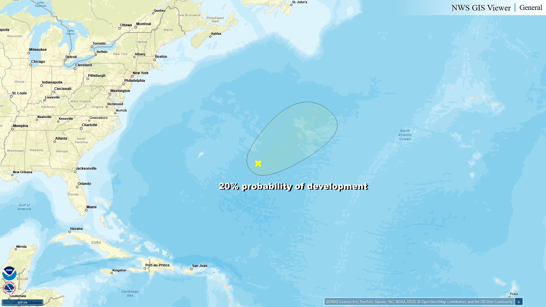
This system, whatever becomes of it, will have no impact on the continental United States.
Here is your Freedom Insurance Today-plus-Five Forecast:
–Meteorologist Christopher Cawley