CCN Weather Update for Monday June 30, 2025.
This weather update is sponsored by Freedom Insurance of Whiteville. Don’t let the heat make you sweat your insurance policies… Freedom Insurance will always keep you cool, calm, and collected. For home, car, boat, or whatever you need, Freedom can provide customized coverage to keep you and your family safe. Contact Freedom today at 910-640-2828!
Here’s today’s Bottom Line
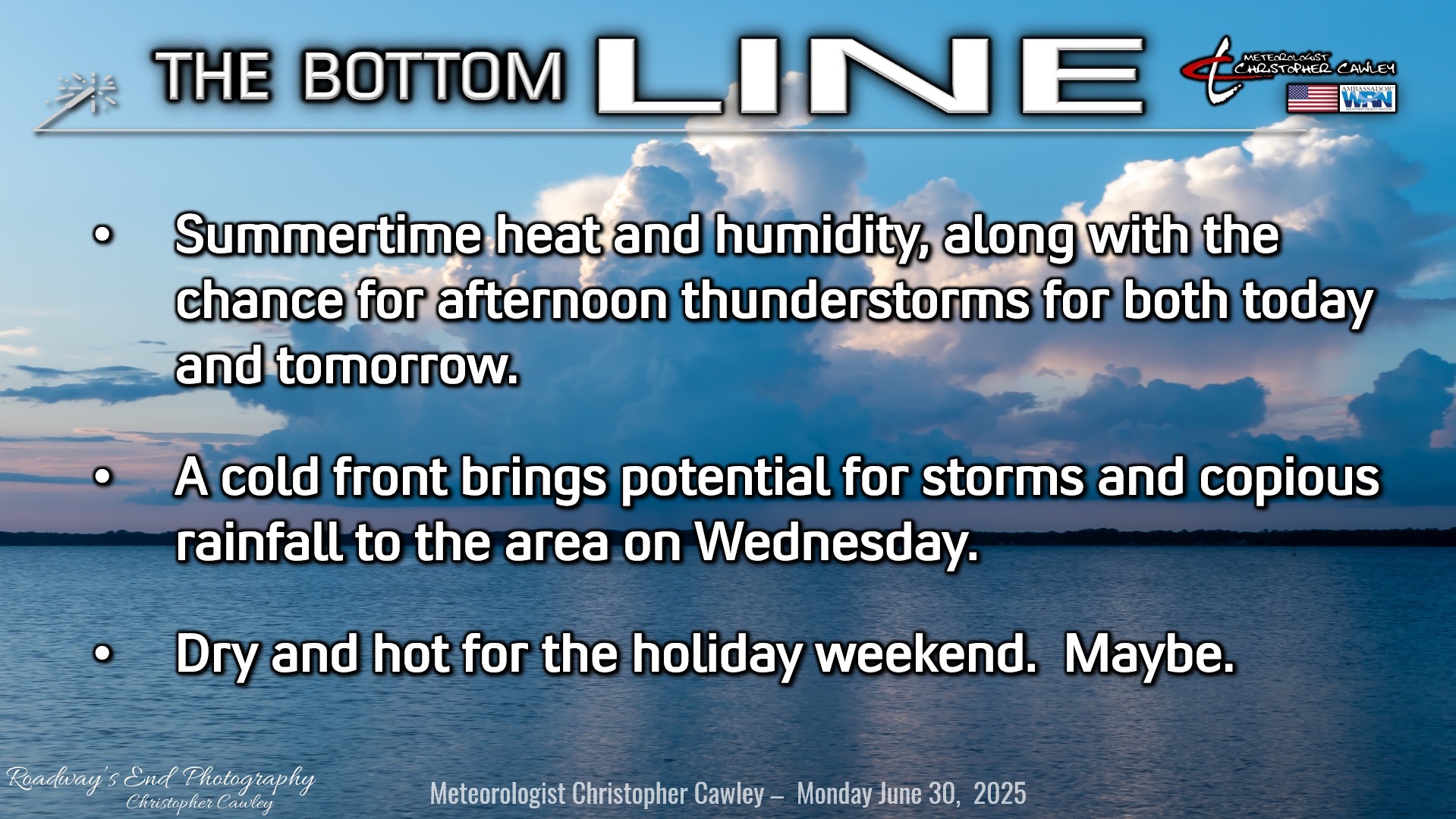
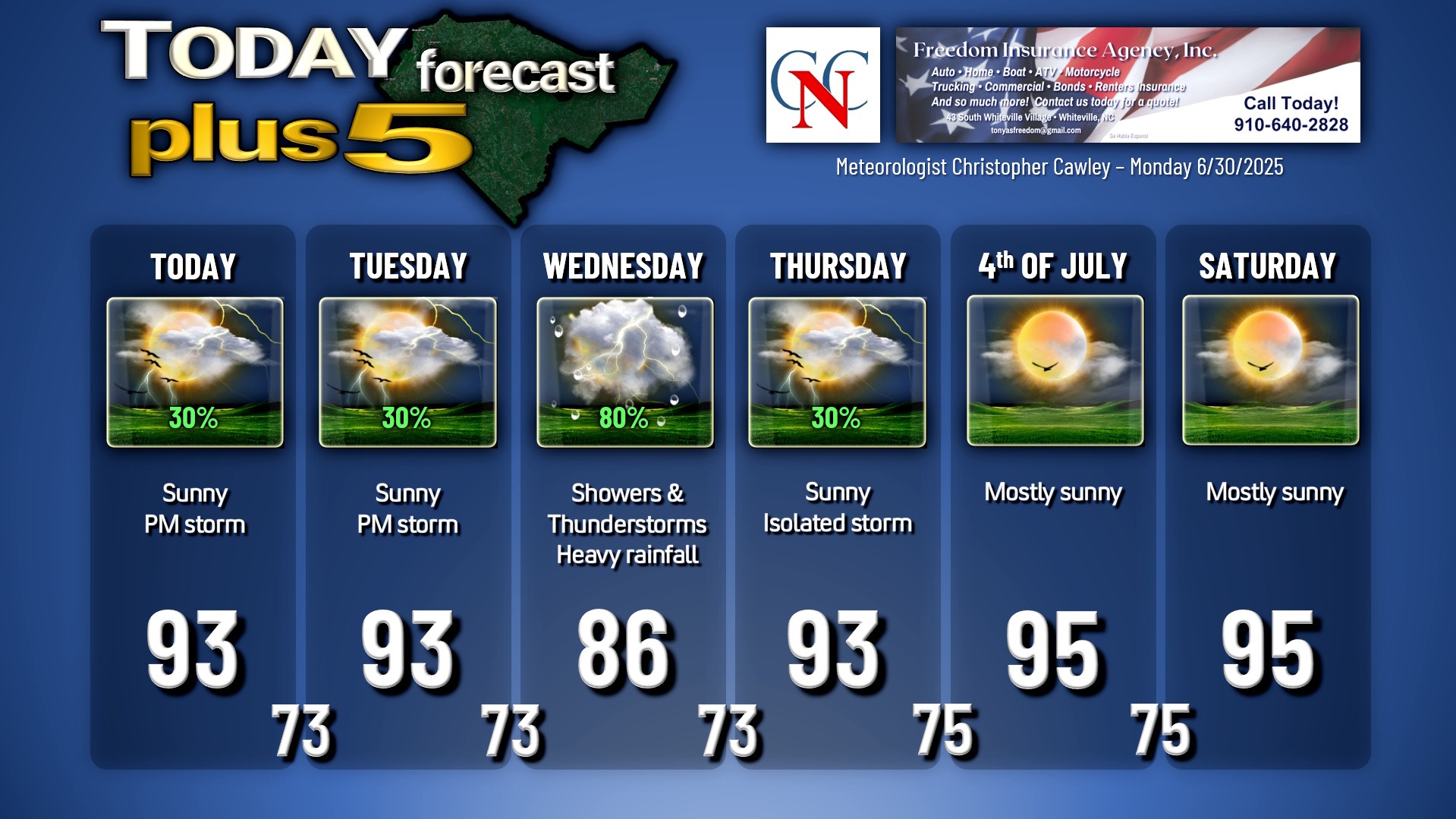
More typical summertime weather for today and tomorrow. We’ll experience lots of heat, lots of sunshine, and isolated to widely scattered thunderstorm activity in the afternoon and evening hours. Tuesday actually presents a better thunderstorm risk than today, as a cold front starts to approach the region and more moisture and instability pump up from the south.
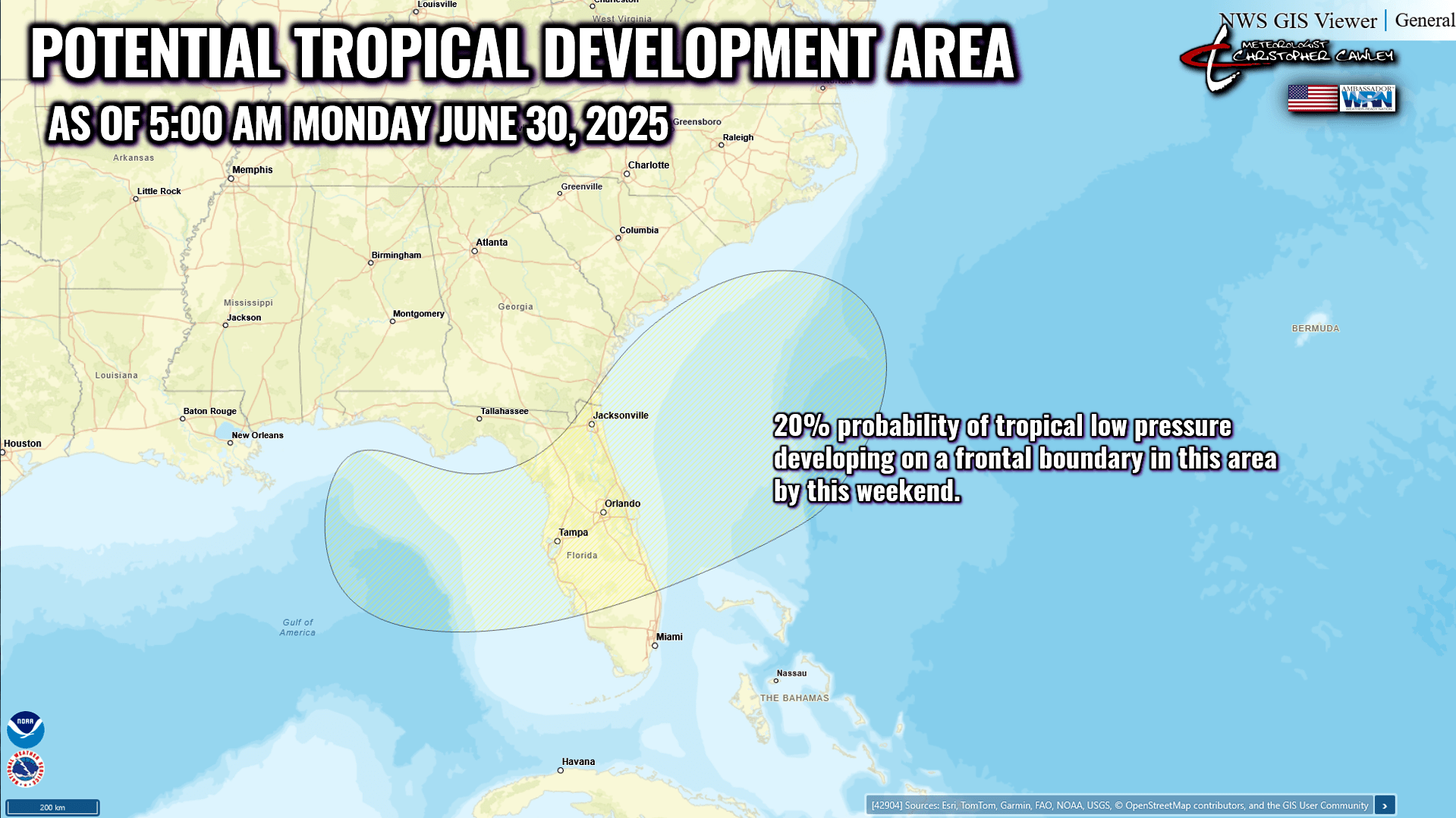
The cold front will approach our area on Wednesday, slowing down, and then pumps the brakes hard as it clears the coast sometime Thursday. The front (or its remains) will then lie offshore on the Fourth into the weekend. The European and Canadian models both indicate low pressure spinning up on this frontal boundary, somewhere between the northern Gulf and the GA/SC coast by the weekend, and this low could take on tropical characteristics — see below in the tropical outlook section.
Anyway, this front should bring a sharp uptick in shower and thunderstorm activity on Wednesday. Storms on Wednesday are likely to produce intense rainfall and significant amounts of lightning. They will also be very slow-moving, and therefore will pose a flash flooding risk for Wednesday, similar to what was seen in Wilmington on Sunday where 2-5 inches of rain fell on parts of the city.
Unknowns at this time include where the storms will set up, and if they’ll develop “training” characteristics — meaning a line of storms form, and individual cells kind of follow each other along, like cars on a train. Some areas may receive very significant rainfall totals, while others receive relatively little.
I expect shower/storm coverage on Wednesday to be pretty widespread. Thus, I’m going with 80% on the graphic.
Some of the guidance (the ones NOT showing tropical development offshore) show the Bermuda high pressure ridge shifting a bit westward, back toward our area, for the holiday weekend. This would result in diminished thunderstorm chances and a return to the oppressive heat and humidity into the weekend.
It’s a low-confidence forecast beyond Thursday. I’m going with dry and hot but that all could change depending on what forms in the tropics.
Speaking of which…
TROPICAL OUTLOOK: Tropical Storm Barry is moving into eastern Mexico as of this writing and will become a remnant low later this morning.
The frontal boundary mentioned above will lie draped off the coast, extending from the offshore Carolinas southwestward through northern Florida into the northern Gulf. Some modeling shows an area of low pressure developing somewhere on this frontal boundary, which could take on tropical characteristics. At this point it’s too early to know a) where the low will develop, b) how strong it will be, or c) where it’s going to go from there. Definitely something to be watching this week.
Here is your Freedom Insurance Today-plus-Five Forecast:
–Meteorologist Christopher Cawley