CCN Weather Update for Juneteenth, Thursday June 19, 2025.
This weather update is sponsored by Freedom Insurance of Whiteville. When severe weather strikes, with Freedom Insurance you will always be prepared. For home, car, boat, or whatever you need, Freedom can provide customized coverage to keep you and your family safe. Contact Freedom today at 910-640-2828!
High temperature at College Street in Whiteville on Wednesday was 95.3°F. The highest heat index was 108.4°F.
View real-time data from the weather station at College Street Weather Station.
Here’s today’s Bottom Line
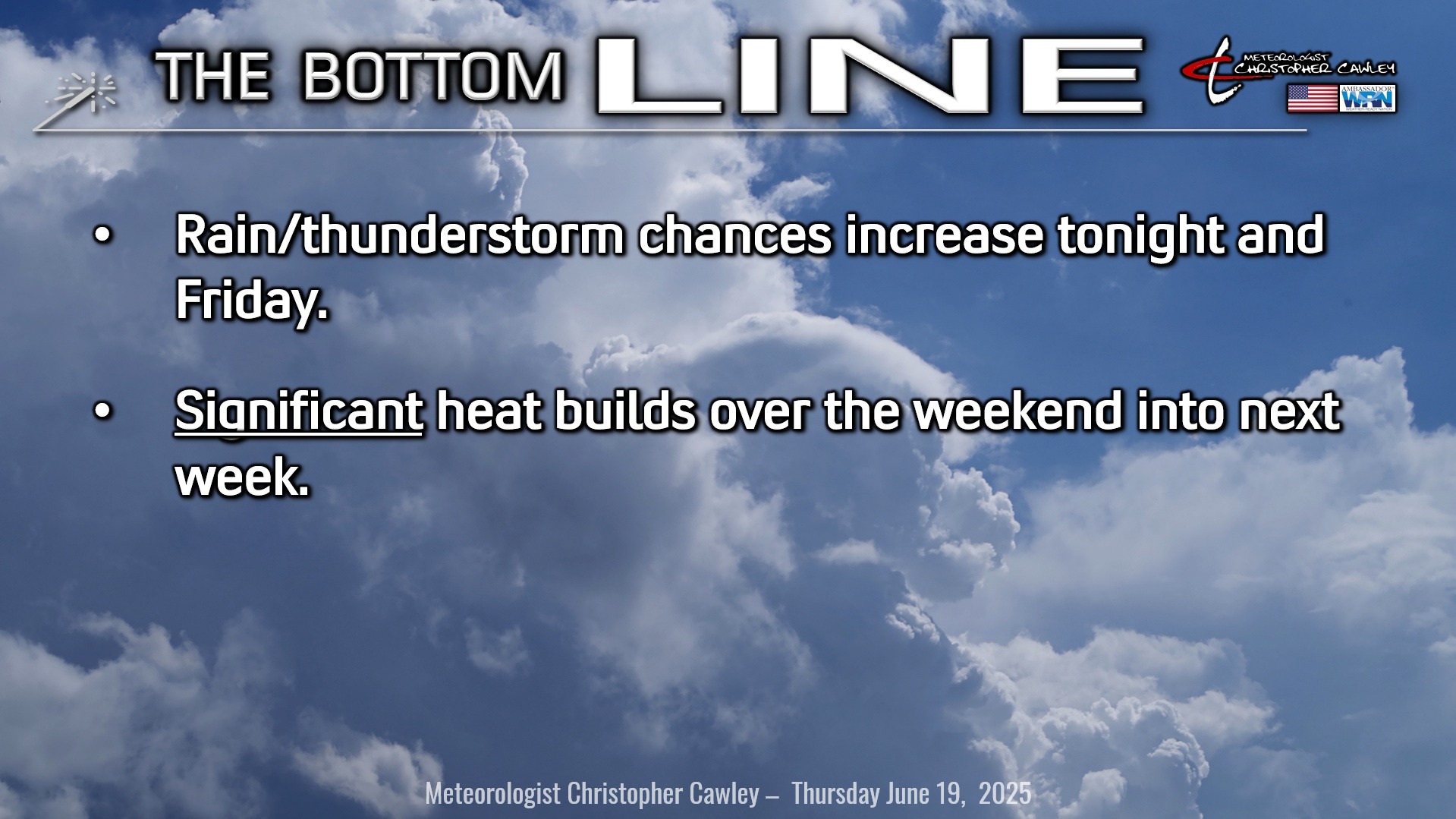
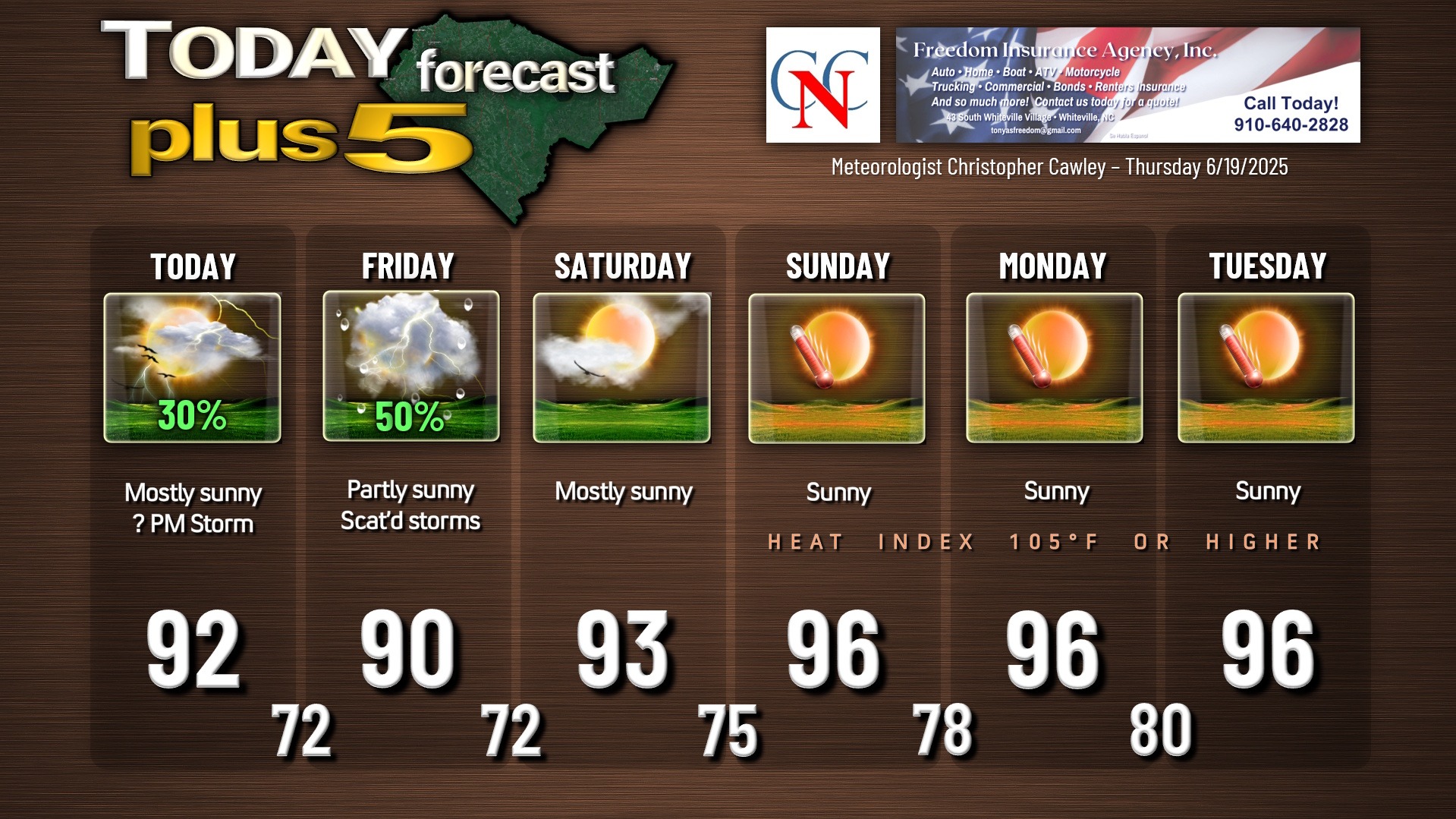
Another fantastically hot day across the area today, but we’ll likely be a degree or two cooler thanks to more in the way of cloud cover.
A Piedmont trough is going to strengthen this afternoon and I think the sea-breeze boundary could have some thunderstorms popping up as well. I’m not overly confident, but I’m going with a 30% chance for storms this afternoon. We probably won’t get anything at all, but it’s there just in case.
A weak cold front moves through the area late tonight through Friday morning. This may bring a line of showers and thunderstorms across the county during the predawn hours Friday, ending by mid-morning. I’m not at all impressed with modeling’s rendition of said line of showers/storms, and we might not get much of anything.
Then we break out into some sunshine which could destabilize the atmosphere enough such that, with the sea-breeze boundary, we see a resurgence of actual (real) thunderstorm activity in the afternoon. Again, not everywhere, it’ll be hit-or-miss, but those storms that do fire could become rather caffeinated and angry.
This is all gone by Friday night.
Highs Friday will “only” be around 90… and this will be the “coolest” day in the entire forecast.
I’m going with mostly sunny on Saturday, because that’s what it will be: MOSTLY sunny. However, there’s the slightest chance that a storm pops up on the sea-breeze boundary.
Impressive heat ridge builds in the middle- and upper-levels of the atmosphere beginning on Sunday. High pressure at the surface underneath this higher-level ridging will only amplify the sinking/compressing air. There will be no thunderstorm activity, and even clouds will be hard to come by Sunday-Tuesday other than some occasional passing cirrus floccus at about 55,000 feet (Google it).
Some of the modeling indicates low pressure developing off the South Carolina coast during the midweek period. This could potentially take on tropical characteristics — see below — as it spins slowly inland over upstate South Carolina.
TROPICAL OUTLOOK: I debated on even posting this, but modeling is hinting at an area of low pressure forming off the coast of Myrtle Beach during the middle of next week. I want to see this trend repeated on additional guidance before I jump on board… but it’s definitely something to be watching for tropical development. Scientifically it doesn’t make much sense for the high pressure ridge to come crashing down allowing a rogue low to spin up, but GFS says it will.
That being said, the NHC official outlook is that tropical cyclone activity is not expected during the next 7 days.
Here is your Freedom Insurance Today-plus-Five Forecast:
–Meteorologist Christopher Cawley