CCN Weather Update for Tuesday June 24, 2025.
This weather update is sponsored by Freedom Insurance of Whiteville. When severe weather strikes, with Freedom Insurance you will always be prepared. For home, car, boat, or whatever you need, Freedom can provide customized coverage to keep you and your family safe. Contact Freedom today at 910-640-2828!
FIRST TRIPLE-DIGIT HIGH SINCE 2023
High temperature at College Street in Whiteville on Wednesday was 100.6°F. The highest heat index was 112.4°F.
Here’s today’s Bottom Line
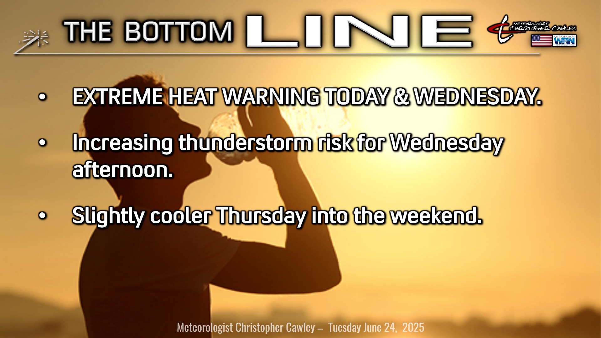
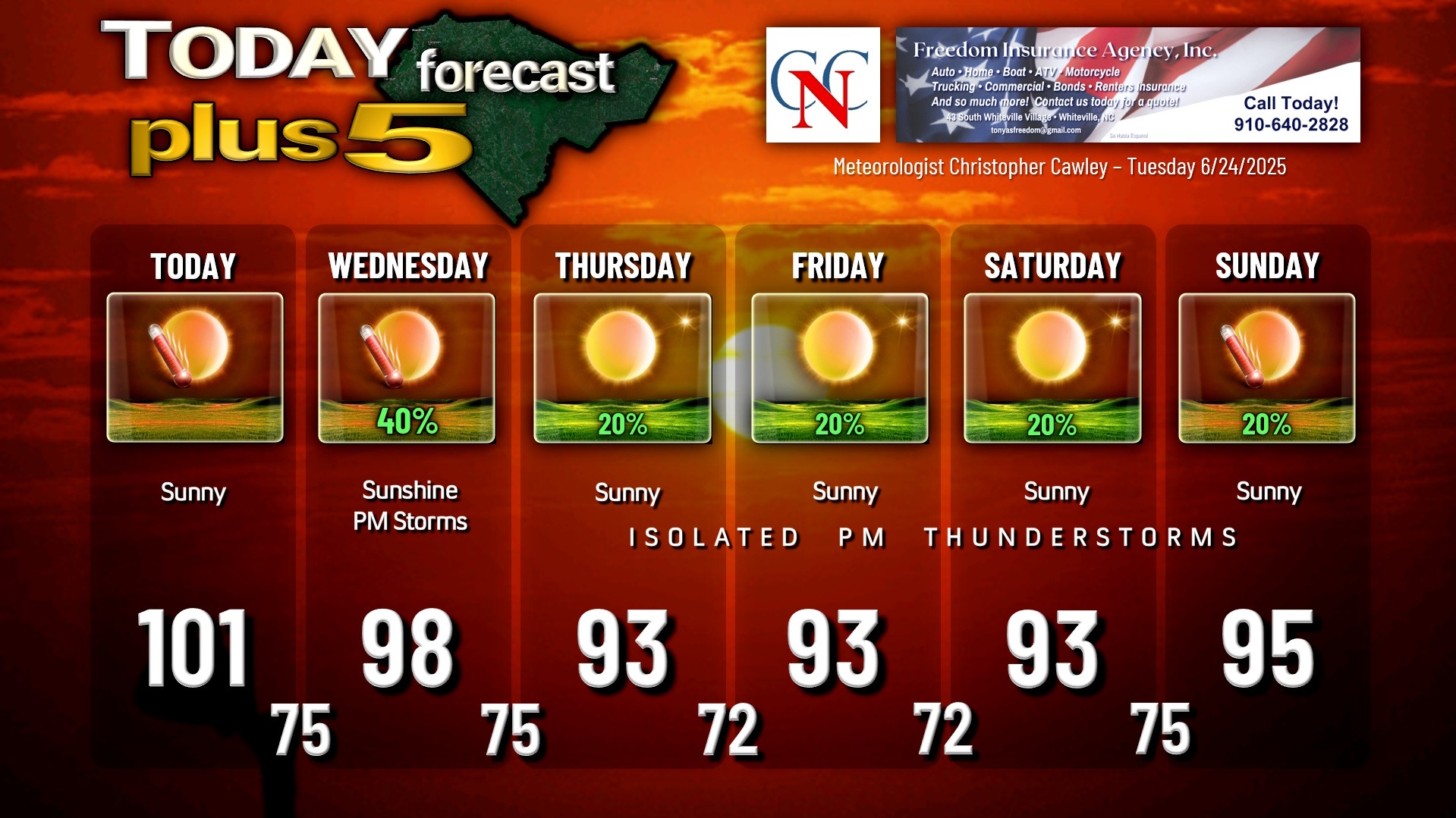
EXTREME HEAT WARNING for today and Wednesday. Highs (not the heat index) will be in the 100-102 range today, with airport heat index values possibly touching 110°F; downtown heat index values may be as high as 112-115. This is very dangerous even for the most fit, even for the most “old school,” for everyone.
Outdoor activities between 11 AM and 7 PM today should be avoided if all possible. If you must be outdoors, please take frequent breaks, drink plenty of water or Gatorade, and wear loose-fitting, lightweight clothing.
Tomorrow will not be quite as hot with regard to actual high temperatures… but humidity values will be even higher, therefore the Extreme Heat Warning will remain in place.
The high pressure dome/ridge breaks down and shifts a little bit north and east as an upper level low pressure center moves toward the east coast of Florida. This “pinches” the high pressure ridge and allows the seabreeze and Piedmont trough to be the trigger points for thunderstorm activity. The SPC has the county under a marginal risk for tomorrow… any storm that develops in the hot and exceptionally unstable air mass (forecast CAPE values eye-popping, greater than 6,000!!) can become severe in very short order.
As the upper low pushes into Florida it kind of wobbles northward into the southeast states as we go toward the end of the week. This helps lower our temps just a touch Thursday through Saturday, and there are slight thunderstorm chances (20% each day). We bump back up into the mid 90s for the end of the weekend.
TROPICAL OUTLOOK: The fairly disorganized system east-northeast of Bermuda continues to encounter increasingly unfavorable environmental conditions, which will end any opportunity for further development. No other tropical activity is anticipated.
Here is your Freedom Insurance Today-plus-Five Forecast:
Stay cool!!
–Meteorologist Christopher Cawley