CCN Weather Update for Thursday July 17, 2025.
This weather update is sponsored by Freedom Insurance of Whiteville. No weather worries with Freedom Insurance. For home, car, boat, or whatever you need, Freedom can provide customized coverage to keep you and your family safe. Contact Freedom today at 910-640-2828!
View real-time data from the weather station at College Street Weather Station.
Here’s today’s Bottom Line

Bermuda high pressure ridge stretching a bit west over the area means compressing (sinking) air, low to near-zero precipitation chances, and hot temperatures the next several days.
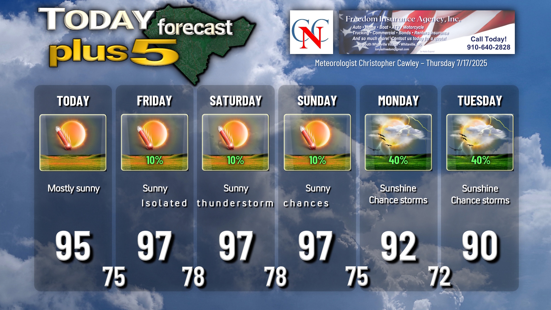
Highs will jump deep into the 90s… the middle and upper 90s today through Sunday. The hottest temps are likely to occur Friday and Saturday, and some backyard or car thermometers may break the 100-degree mark both afternoons.
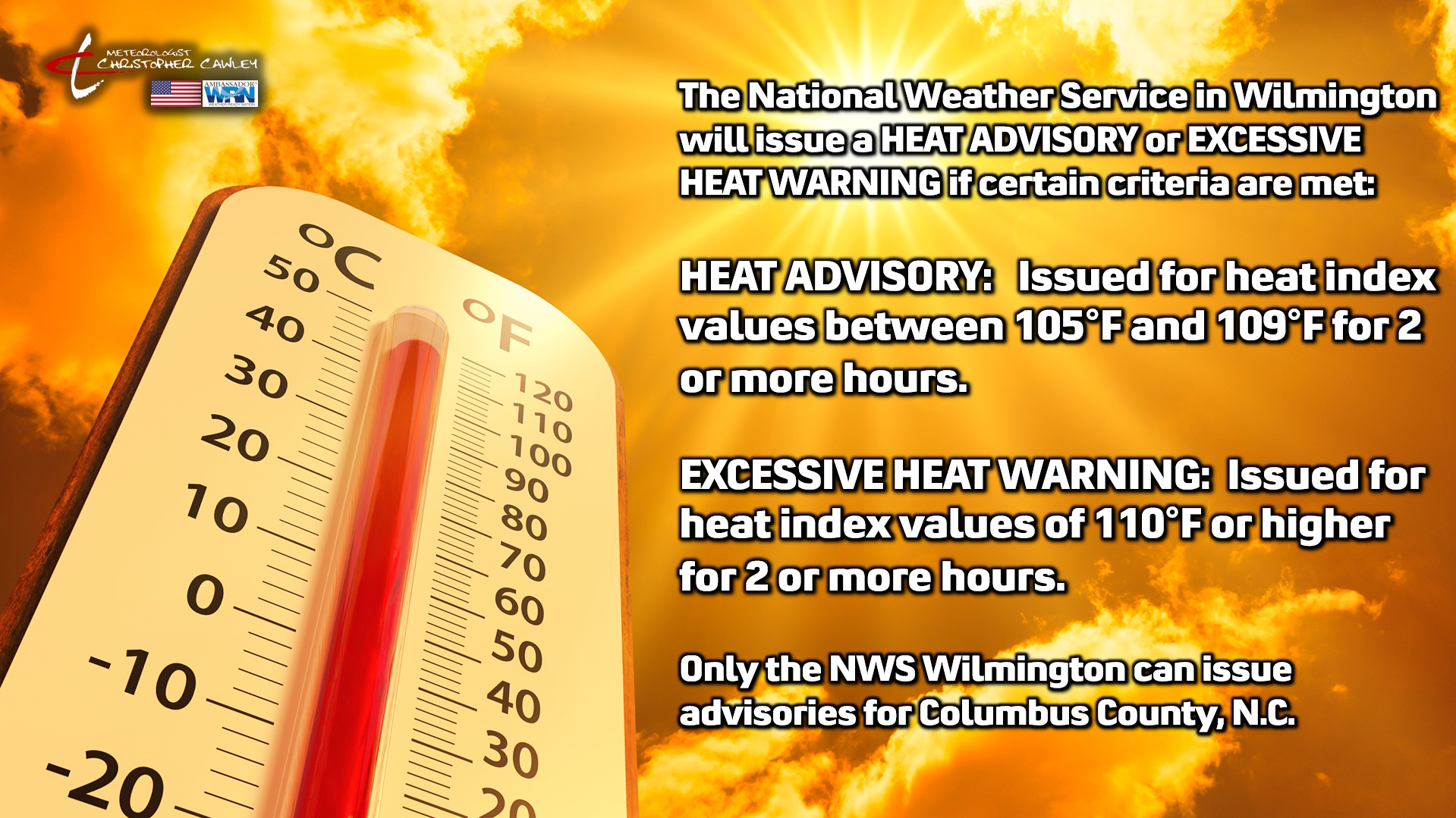
Heat index values will likely be in the 105°F-110°F range at least on Friday and Saturday, if not on Sunday as well. Should this occur, the NWS will likely issue Heat Advisories for the area.
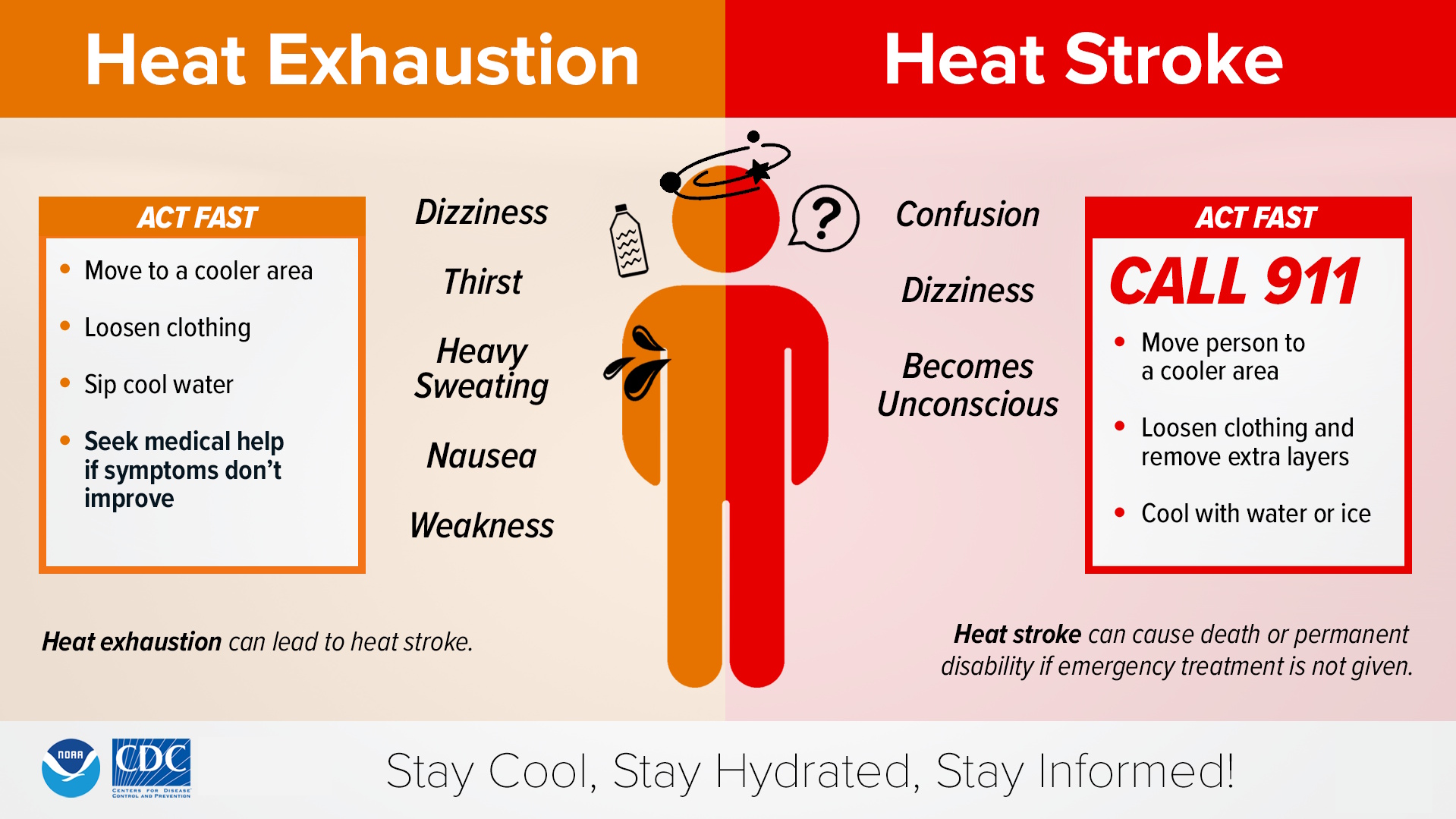
Heat risk will be very high through the period. Heat exposure is one of the leading weather-related killers. Understand the symptoms of heat exhaustion and heat stroke — heat stroke is a medical emergency for which to call 911.
Thunderstorm chances increase early next week as the high-pressure ridge pushes a touch offshore once again allowing a westerly wind flow and remnants from Invest-93 to enter the area.
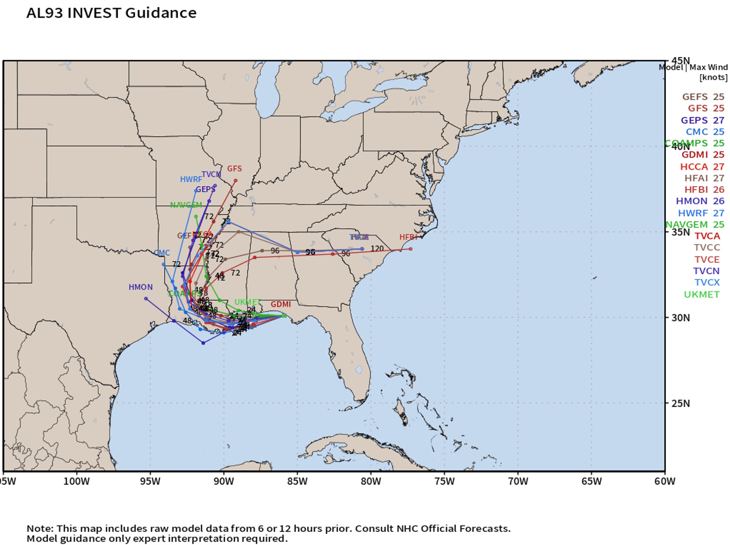
TROPICAL OUTLOOK: Low pressure along the northern Gulf coast (Invest 93) will move inland over southern Louisiana or southern Alabama today and take a turn to the north and then northeast. This will be the end of Invest 93. Remnants from this system may increase our thunderstorm chances early next week.
Here is your Freedom Insurance Today-plus-Five Forecast:
–Meteorologist Christopher Cawley