CCN Weather Update for Friday July 18, 2025.
This weather update is sponsored by Freedom Insurance of Whiteville. No weather worries with Freedom Insurance. For home, car, boat, or whatever you need, Freedom can provide customized coverage to keep you and your family safe. Contact Freedom today at 910-640-2828!
Here’s today’s Bottom Line
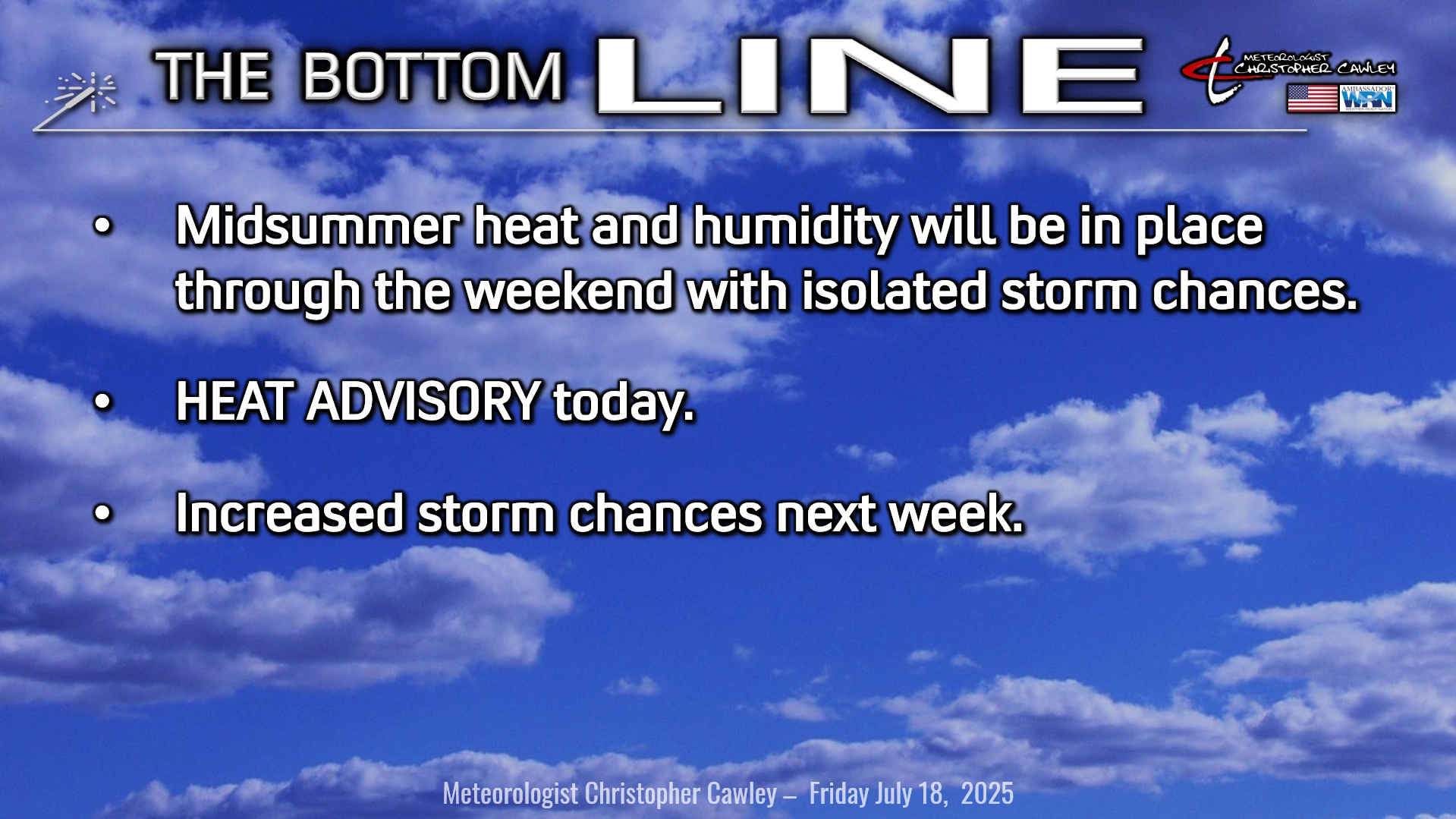
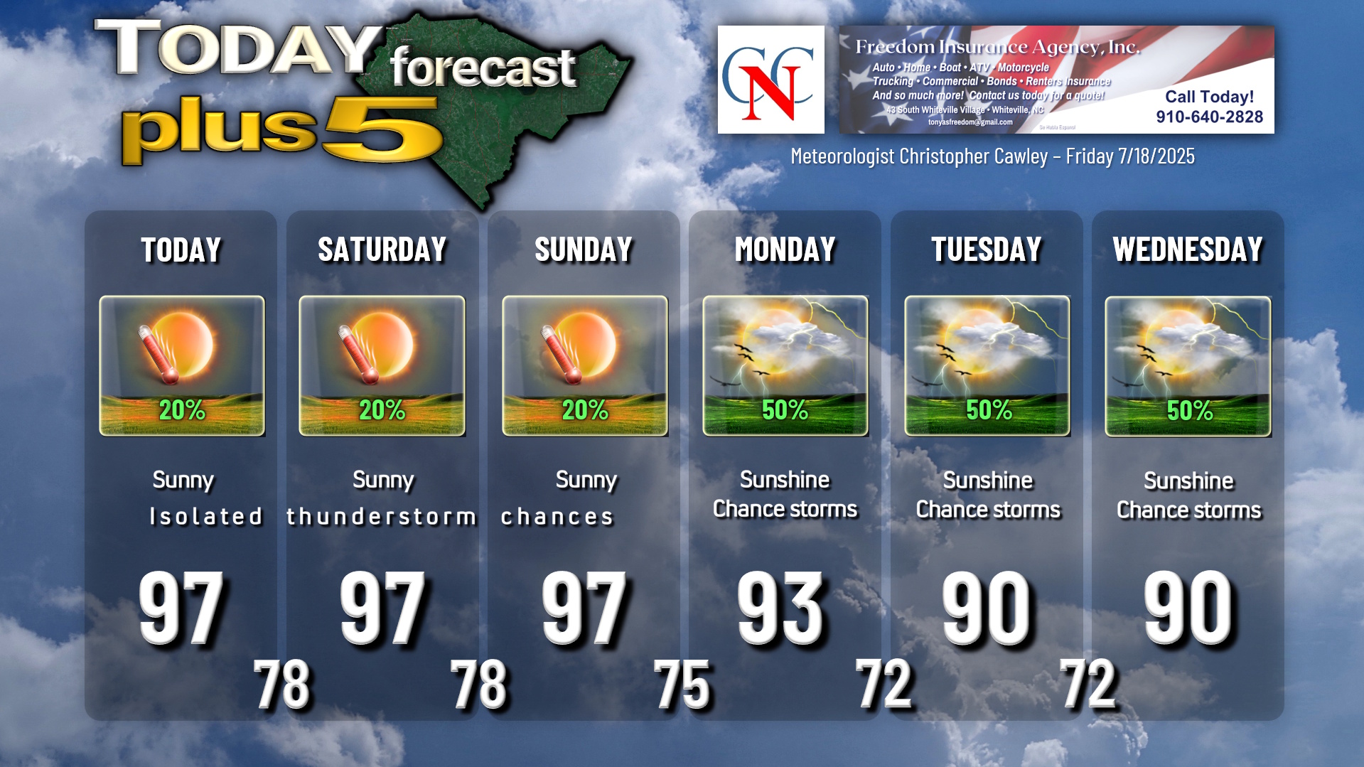
Bermuda high pressure ridge will remain in place through the weekend, with a dangerous combination of heat and humidity. Widely scattered thunderstorms are possible today and through the weekend.
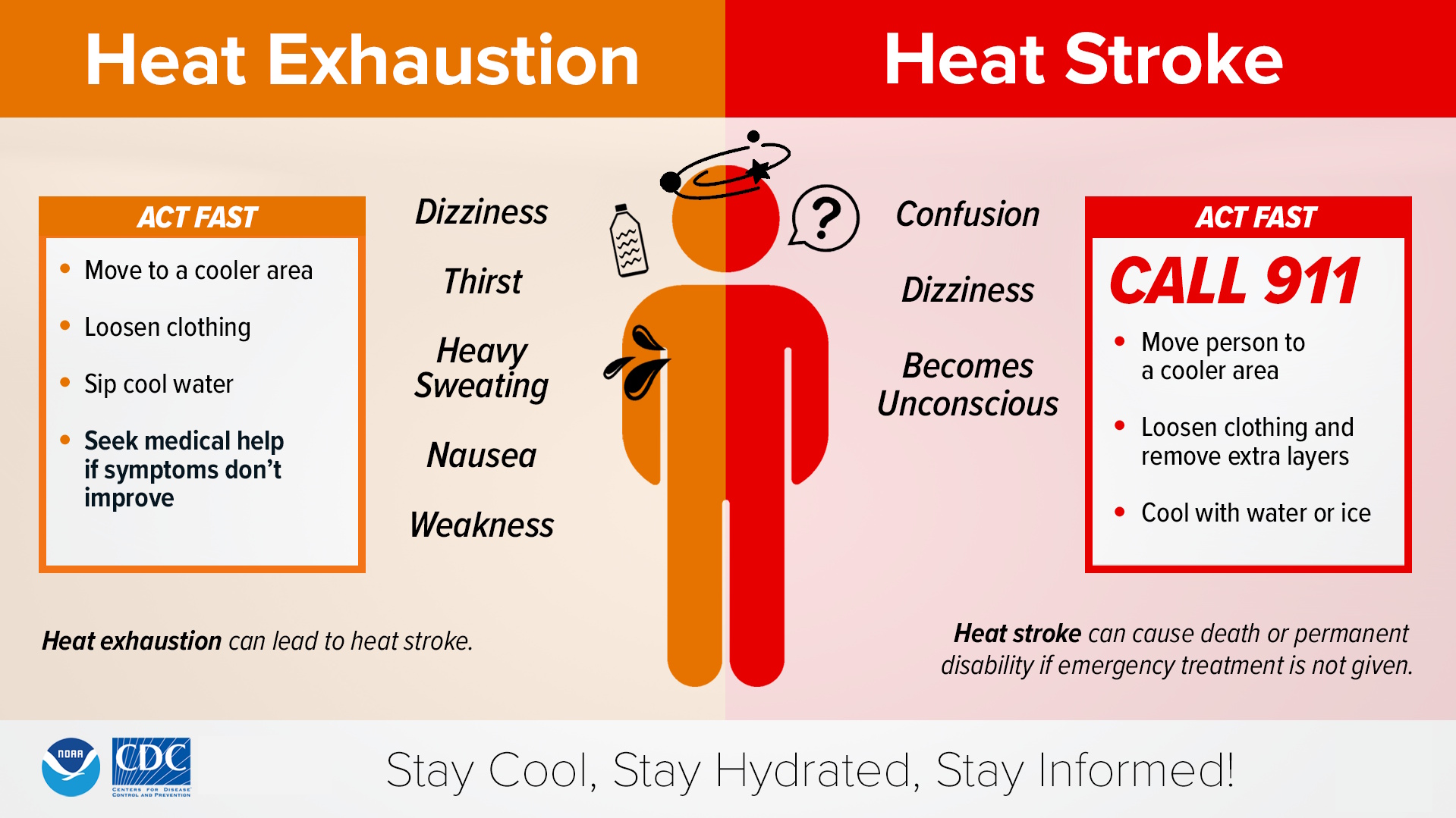
A HEAT ADVISORY is up for today, as airport heat index values reach between 105°F and 109°F. Heat index values downtown, where people actually live and work, will be higher this afternoon. Actual high temperatures in the 95°F to 98°F range.
Much of the same for temperatures Saturday and Sunday with plenty of sunshine and isolated to widely scattered thunderstorms.
Heat advisories are probable for the weekend. Remember, heat stroke symptoms are a medical emergency.
Thunderstorm chances increase early next week as the high pressure ridge pushes a touch offshore once again. Modeling suggests a backdoor cold front drops down across the state Tuesday into Wednesday.
TROPICAL OUTLOOK: Low pressure near New Orleans will continue to lift north over land, ending any tropical threat. No further tropical development is anticipated in the near future.
Here is your Freedom Insurance Today-plus-Five Forecast:
–Meteorologist Christopher Cawley