CCN Weather Update for Friday July 4, 2025.
This weather update is sponsored by Freedom Insurance of Whiteville. Declare independence from your worries with Freedom Insurance. For home, car, boat, or whatever you need, Freedom can provide customized coverage to keep you and your family safe. Contact Freedom today at 910-640-2828!
Here’s today’s Bottom Line
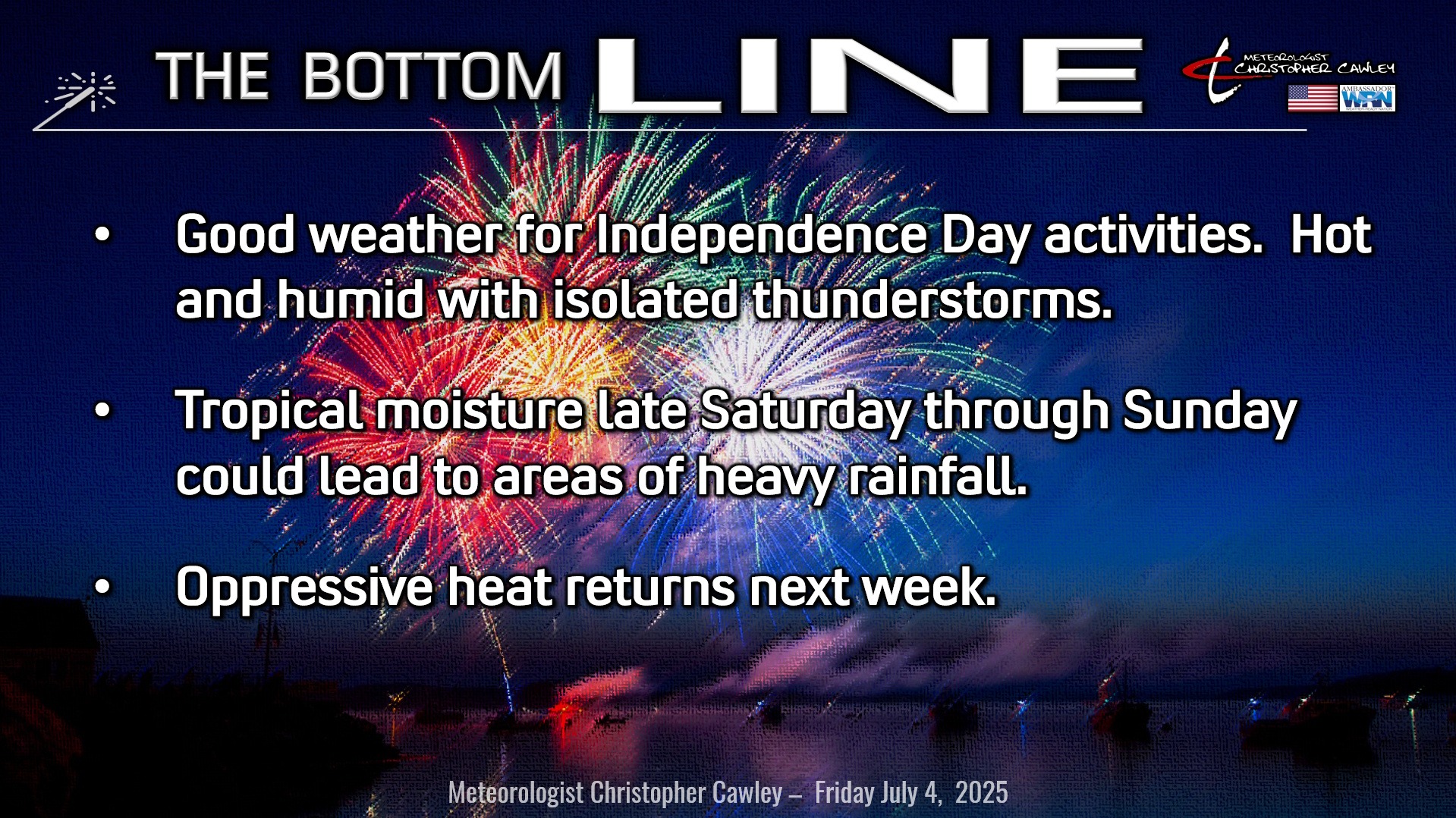
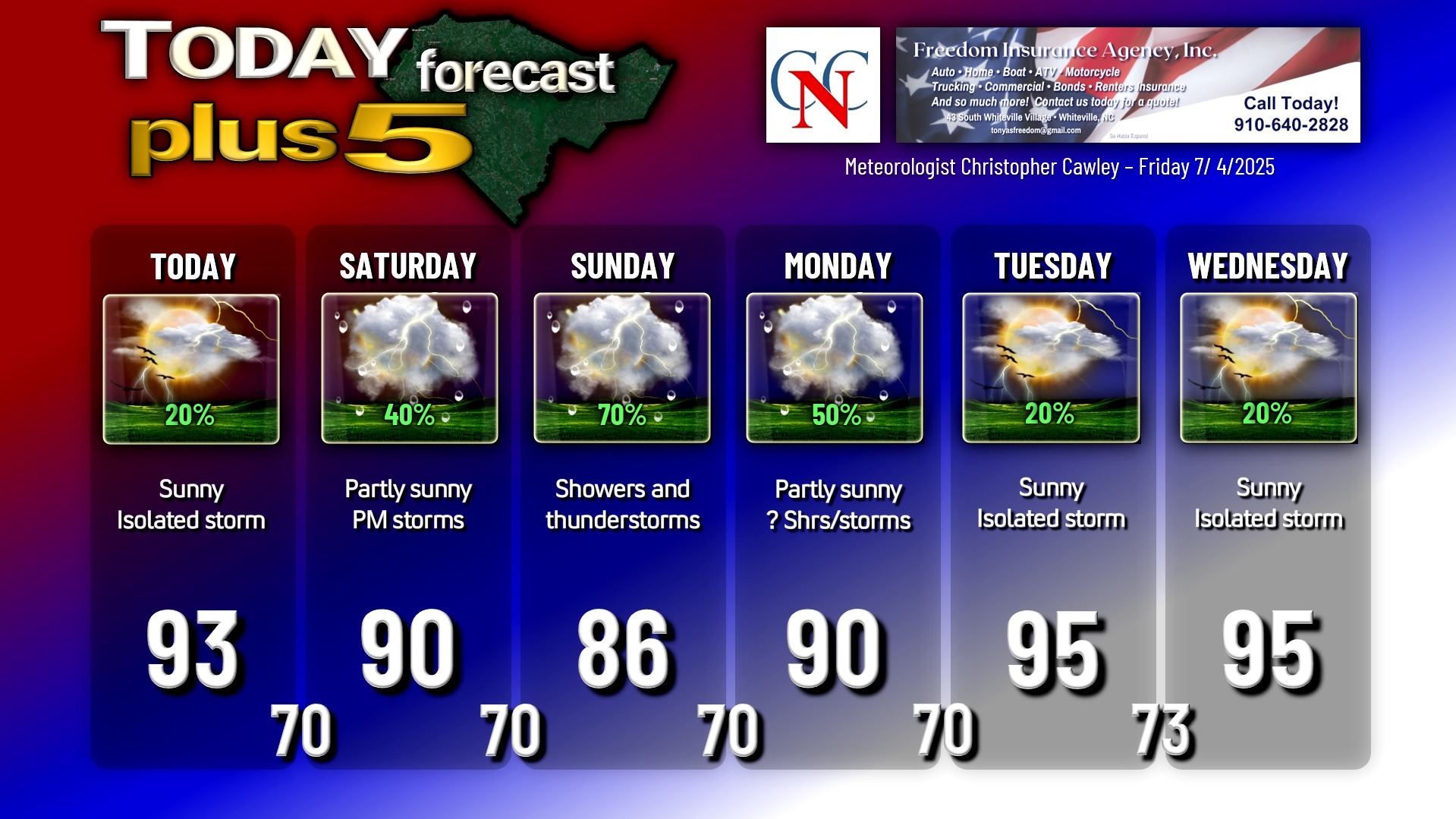
A “cold front” lies offshore as high pressure will build in from the north today. With dry air in place higher in the atmosphere, our chances for showers and thunderstorms today are quite low — not zero, but definitely will be of the isolated variety. So natural fireworks seem to be at a minimum for this evening’s Independence Day activities. Sunshine, heat, humidity at the surface will be the rule for whatever you want to do. Pack the sunscreen, the UV index will be off-the-charts.
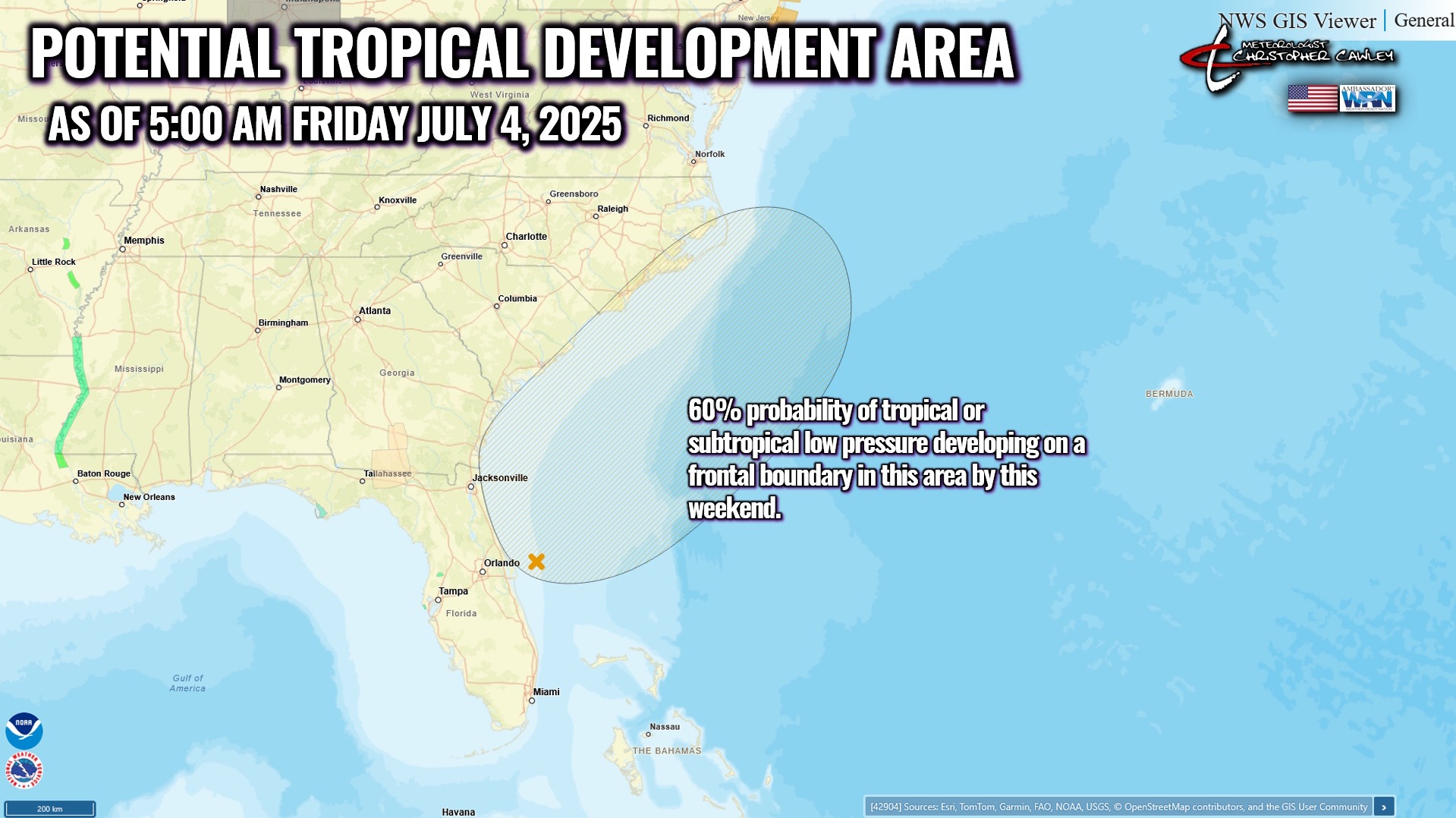
Deep tropical moisture arrives into the area Saturday into Saturday night. There is still a significant amount of uncertainty in the forecast for Saturday evening through Monday. The expected development of a surface low along the aforementioned frontal boundary is causing significant differences in the model guidance. There will likely be a very healthy plume of tropical moisture, but where it ends up developing and then heading will depend on when / where the low itself actually forms. The low will be slow to develop and move, likely wandering around somewhere in the vicinity of the northern Florida/southern Georgia coast.
Until the low actually develops, it’s almost impossible to nail down any specifics. Impacts from the low could range from lots of clouds but very little rainfall… to heavy rain along the immediate coast and not much rain here… to heavy rain and storms throughout Columbus County.
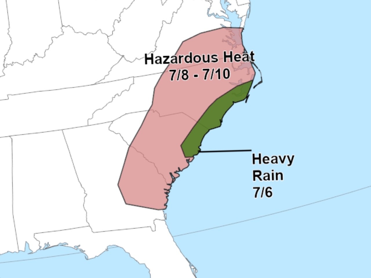
The axis of heaviest rainfall would be the biggest concern, and again, is impossible to pinpoint since we’re talking about a low that hasn’t even developed. Until it does, and until new data can get ingested into the modeling, it’s all speculation. The overall environment will be very supportive of intense rainfall, especially later Saturday through Sunday and Sunday night. Slow storm motions could also come into play with “training” storms.
I see the potential for one plume to become established, sort of a fire-hose, with eye-popping rainfall totals and flooding concerns. Outside of the plume, little to nothing. This is speculation, of course, as I’ve said a couple of times, as the storm hasn’t even developed.
After this is all done with, Bermuda high pressure reasserts control in the Tuesday-Thursday timeframe with hot temperatures and isolated thunderstorm chances.
TROPICAL OUTLOOK: As mentioned above, an area of low pressure is likely to develop somewhere in the vicinity of the northern Florida coast by this weekend. When the low forms and where it actually moves remains highly uncertain at this time; however, significant rainfall is possible along the coastal Carolinas Saturday night through Sunday.
Here is your Freedom Insurance Today-plus-Five Forecast:
–Meteorologist Christopher Cawley