CCN Weather Update for Monday July 21, 2025
This weather update is sponsored by Freedom Insurance of Whiteville. No weather worries with Freedom Insurance. For home, car, boat, or whatever you need, Freedom can provide customized coverage to keep you and your family safe. Contact Freedom today at 910-640-2828!
The heat continued on Sunday… high temperature reached 98.5°F at 5:08 PM, after a morning low of 78.9°F at 6:08 AM.
View real-time data from the weather station at College Street Weather Station.
Here’s today’s Bottom Line
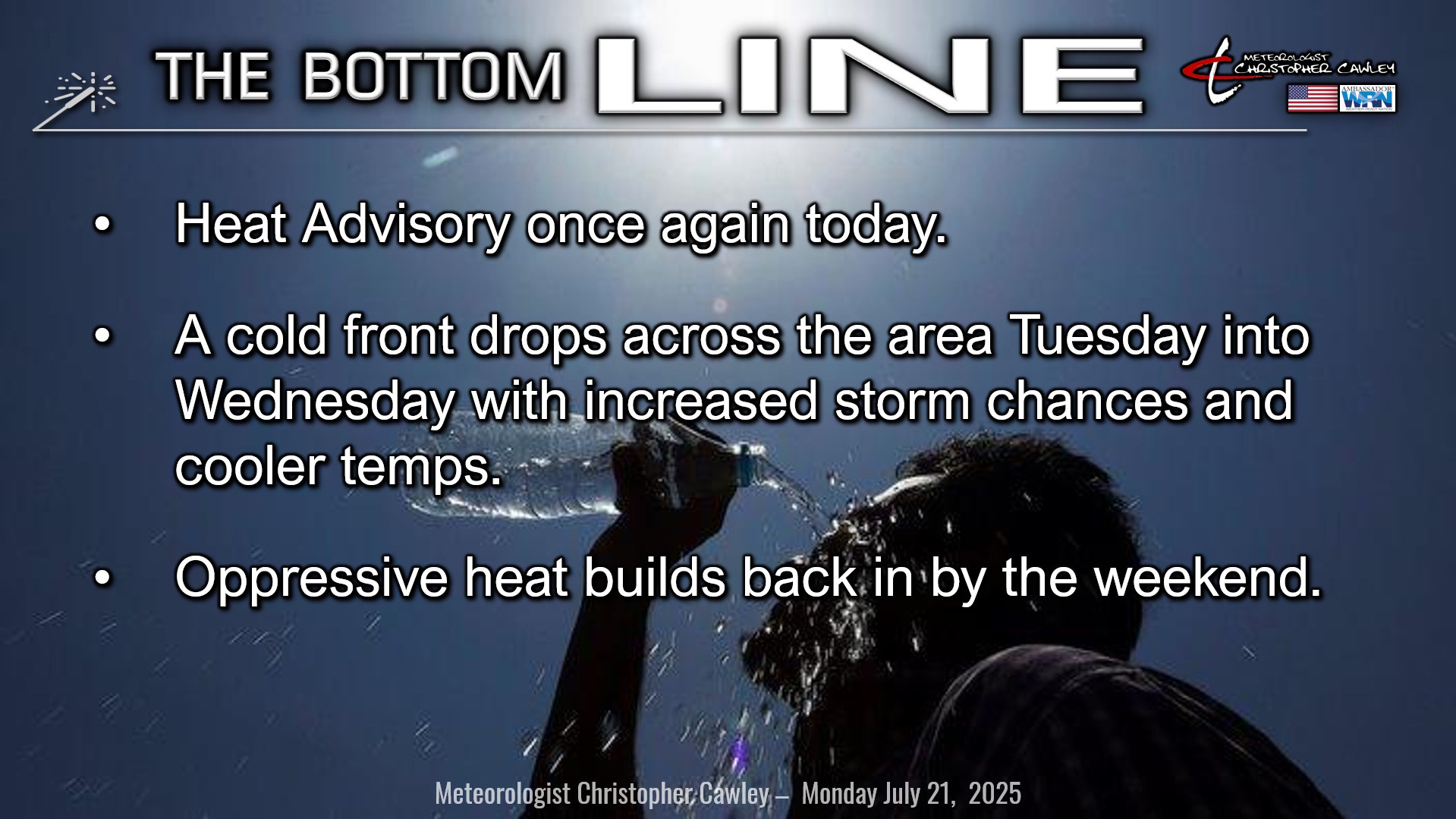
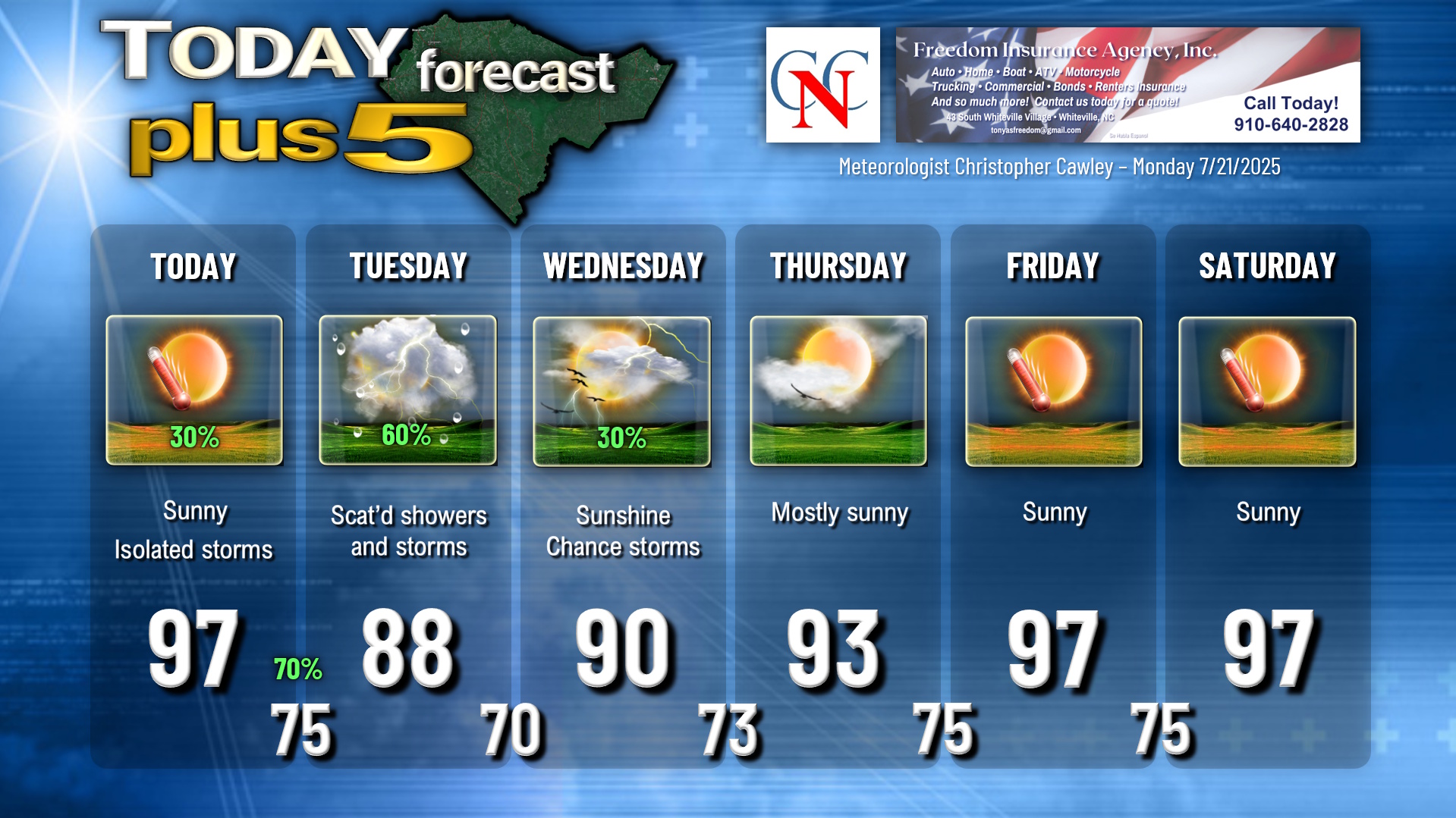
Heat advisory in place for one more day as Bermuda high pressure starts to lose its influence on our area. Our weather today will be quite similar to our weekend with lots of sunshine and the threat for an isolated storm this afternoon. It’ll be hot — highs in the 96°F to 100°F range.
A backdoor cold front drops down from the north tonight, and a little wave of low-pressure forms along the front. (It’s called “backdoor” because instead of moving west to east — or left to right on a map — it moves from north to south — or top to bottom on a map.)
Thunderstorm activity originating in the higher terrain of the Piedmont should shift southeastward into our area by this evening, with greater coverage possible into the nighttime hours. Strong instability (3000+ CAPE for all you nerds out there) suggests that heavy thunderstorms can be expected, and at least isolated damaging wind gusts are possible. Stay alert for possible watches and warnings late this afternoon through the evening and into the overnight. Storms will be slow movers and therefore have the potential to produce localized flooding.
So again, quiet and hot through the day… but the evening hours could be quite active indeed.
Cold front pushes south of the area on Tuesday. More thunderstorm activity is expected throughout the day, with little organization. Slow-moving storms with torrential rainfall and lots of lightning appear to be on the docket … and while it won’t be raining everywhere all the time, it’s best to plan on a showery-and-thunderstormy kind of day on Tuesday.
With the front lingering somewhat into Wednesday, I did put on the chart a continued chance for thunderstorms. I think the chances are much lower than on Tuesday but still best to keep that in the forecast.
Then it all shuts off as the front dissipates and the Bermuda ridge says, “I’m baaack.” If we get any storm activity Thursday through the weekend, it’ll be isolated to the sea-breeze, one or two storms, not even enough to make mention on the graphic below. And the heat… this oppressive seemingly never-ending heat… returns in full-force by the weekend. NWS has implied that another multi-day round of Heat Advisories will likely be needed.
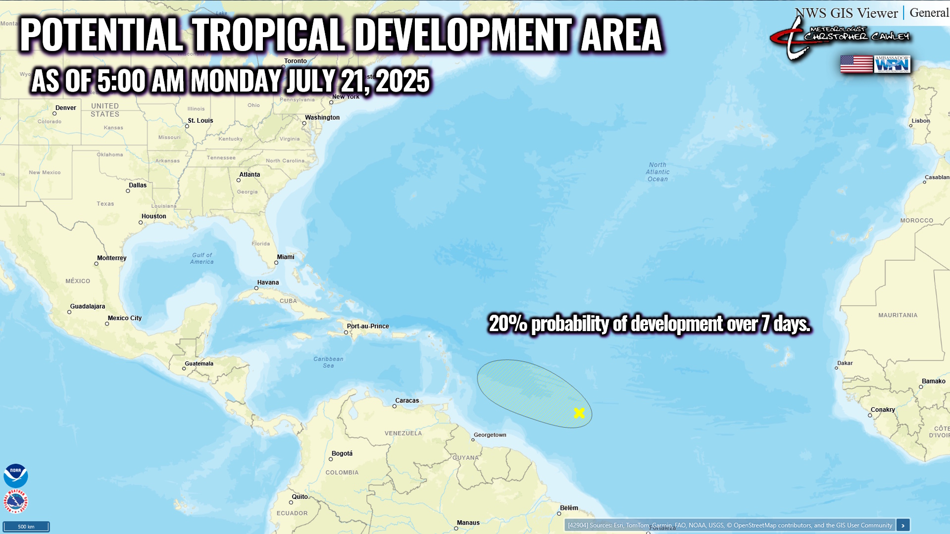
TROPICAL OUTLOOK: From the National Hurricane Center, “A small area of low pressure has developed from a tropical wave in the Central Tropical Atlantic, about 900 miles east-southeast of the Lesser Antilles. Shower and thunderstorm activity has recently become more concentrated near the center, and environmental conditions are generally favorable for some additional development over the next day or so while the system moves west-northwestward at 10 to 15 mph. By the middle of this week, environmental conditions are forecast to become unfavorable for further development.” This will obviously have no impact on the Carolinas.
Here is your Freedom Insurance Today-plus-Five Forecast:
–Meteorologist Christopher Cawley