CCN Weather Update for Monday July 28, 2025.
This weather update is sponsored by Freedom Insurance of Whiteville. No weather worries with Freedom Insurance. For home, car, boat, or whatever you need, Freedom can provide customized coverage to keep you and your family safe. Contact Freedom today at 910-640-2828!
Here’s today’s Bottom Line
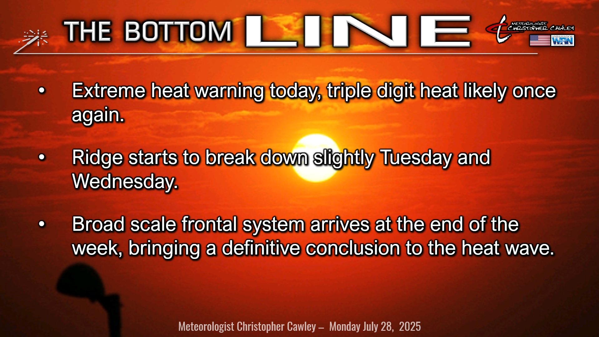
DANGEROUS HEAT WAVE CONTINUES.
Both Saturday and Sunday broke the 100-degree mark, and heat index values peaked at a miserable 119°F on Sunday.
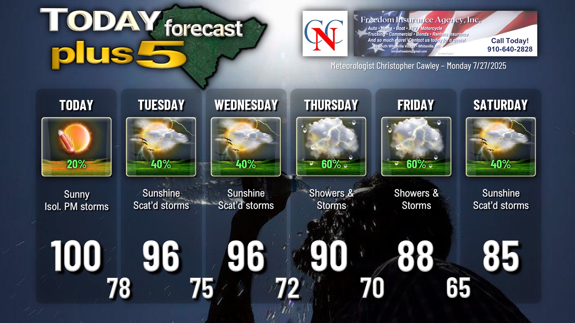
Extreme heat warning remains in place today as a strong high pressure ridge both at the surface and in the middle and upper levels of the atmosphere keep a “heat dome” over the area. The high pressure ridge is shifting ever-so-slightly to the west today, which opens the door for a thunderstorm potential this afternoon. But before that, I’m expecting triple digit temps this afternoon, with a high 99°F to 102°F. That’ll be 3 days in a row over 100 degrees. Heat index values will be in the 115°F to 119°F range in the city of Whiteville, with a range of 112°F to 117°F over much of the rest of the county.
The upper-level part of the ridge starts to move away from our area late tonight into Tuesday, and a bit of a low pressure trough starts to set up along the coast. This may help us get an increase in shower/storm activity Tuesday afternoon and again on Wednesday afternoon. Highs will still be in the mid to upper 90s, so NWS will likely issue heat advisories for Tuesday and Wednesday.
Then things really start to break down. A broad-scale frontal system starts to approach on Thursday, with a cold front expected to finally push across the area on Friday. Scattered to numerous showers and thunderstorms are likely Thursday and Friday with this frontal system. By Saturday, the front pushes south of the area… but WPC charts still have some shower/storm activity close to our area, so I put that on the graphic. The bigger news is the cool-down that we can expect … temperatures will peak in the mid 80s Saturday. Modeling shows temps staying in the 80s Sunday and next Monday before starting to warm back into the 90s.
TROPICAL OUTLOOK: There is nothing of interest or potential development in the tropics at this time.
Here is your Freedom Insurance Today-plus-Five Forecast:
–Meteorologist Christopher Cawley