CCN Weather Update for Monday July 7, 2025.
This weather update is sponsored by Freedom Insurance of Whiteville. No weather worries with Freedom Insurance. For home, car, boat, or whatever you need, Freedom can provide customized coverage to keep you and your family safe. Contact Freedom today at 910-640-2828!
Here’s today’s Bottom Line
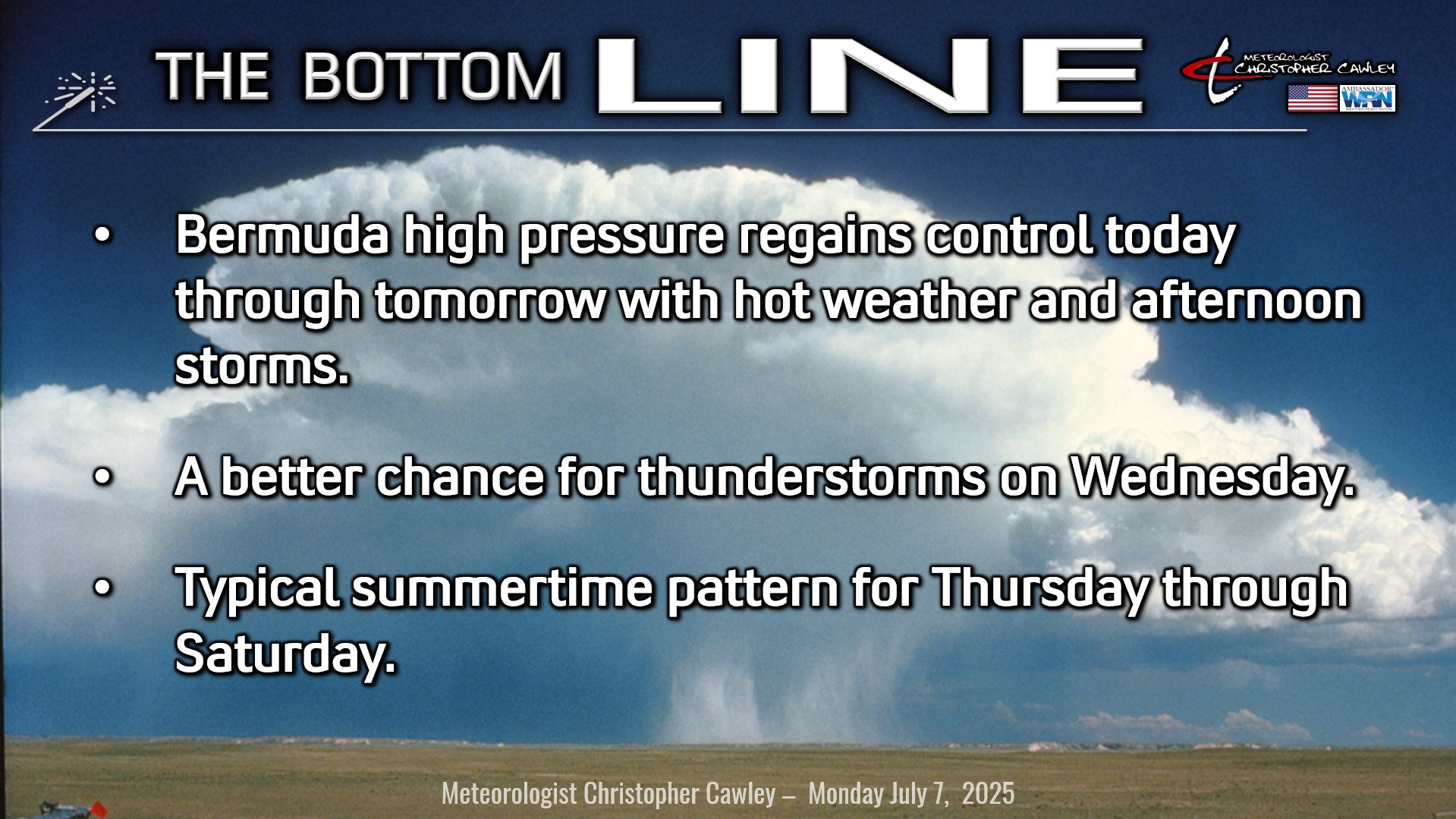
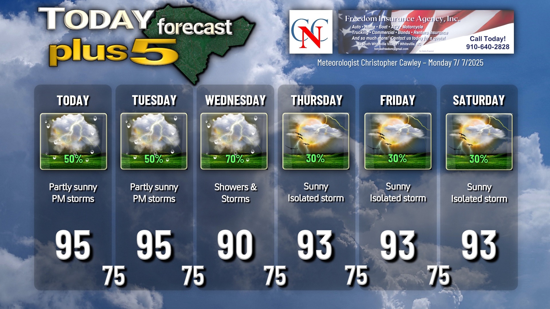
Today’s weather map will feature a Piedmont trough taking up residence, along with a little weak shortwave in the middle levels of the atmosphere. The bigger picture is the Bermuda high pressure ridge retaking control. The Piedmont trough and the weak shortwave could be the foci for thunderstorm development this afternoon into early this evening. Not everyone will see a storm, but any storm that does develop could produce intense rainfall, frequent lightning, and a damaging wind gust or two. Keep a watchful eye and ear to the sky.
Tuesday features the Bermuda high building overhead which gets rid of the weak shortwave. The Piedmont trough remains in place, and again, this could be a focus point for thunderstorms Tuesday afternoon, though coverage should be a bit less.
Heat index values may reach heat advisory criteria this afternoon, more likely on Tuesday afternoon. There are no advisories up as of this writing.
Another shortwave comes to visit on Wednesday, with the strong Bermuda ridge to our east, and another strong ridge to our west. The shortwave will bring the likelihood of thunderstorms Wednesday afternoon, and severe weather isn’t out of the question.
The shortwave is gone by Thursday through Saturday with high pressure in control. Thunderstorm coverage will be a little less, but hot temperatures continue.
TROPICAL UPDATE: No tropical weather is anticipated in the next 5-7 days.
Here is your Freedom Insurance Today-plus-Five Forecast:
–Meteorologist Christopher Cawley