CCN Weather Update for Thursday July 24, 2025.
This weather update is sponsored by Freedom Insurance of Whiteville. No weather worries with Freedom Insurance. For home, car, boat, or whatever you need, Freedom can provide customized coverage to keep you and your family safe. Contact Freedom today at 910-640-2828!
Here’s today’s Bottom Line
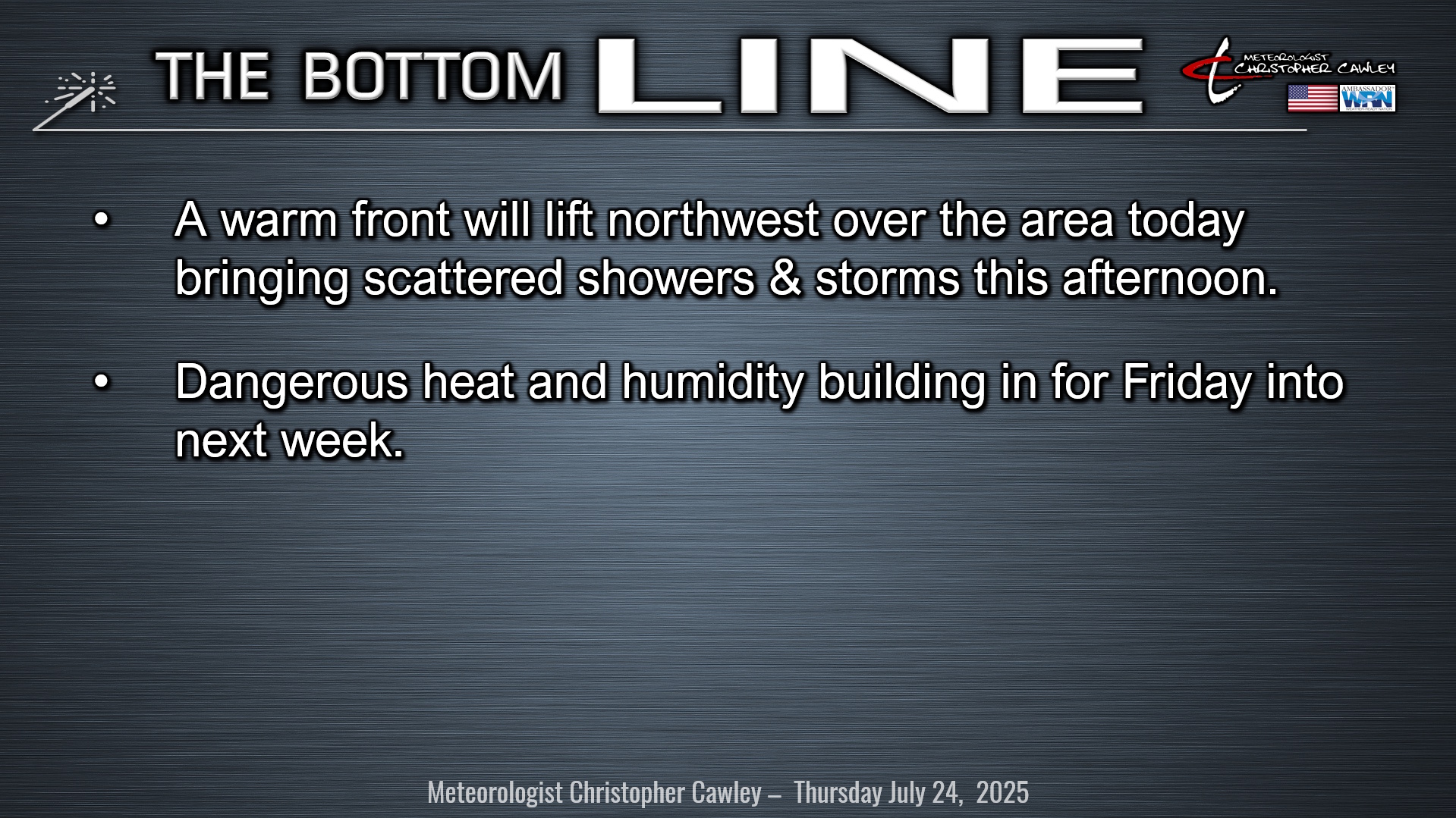
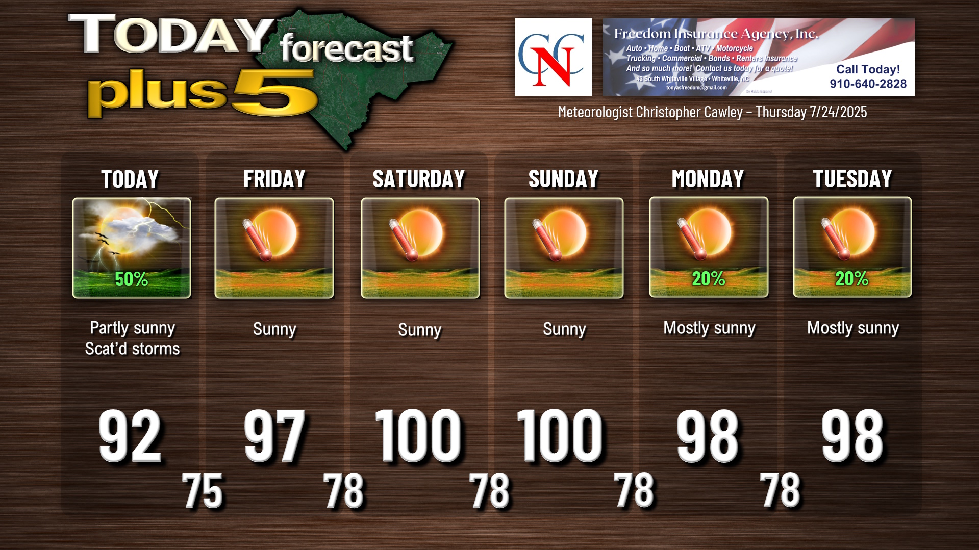
A warm front will lift north/west over the area late this morning into this afternoon. This will be a focus for some scattered showers and thunderstorms, especially during the afternoon hours as the sea-breeze pushes inland. No severe weather is anticipated, but storms that develop will have the potential to produce intense rainfall and localized flooding of poor-drainage areas. Not everyone will see showers/storms, but the coverage is expected to be pretty good.
The front moves well north and west of the area by tonight leaving us with a marked increase in humidity. Lows will only drop to the mid 70s with gradually clearing skies after an evening thunderstorm threat.
Then the heat is on. Strong, and I do mean STRONG high pressure ridging takes hold on Friday and lasts well into next week. This will lead to triple-digit heat Saturday and Sunday, and possibly Monday and Tuesday next week. Very low to near-zero thunderstorm chances Friday through the weekend as we bake. The NWS hazardous weather outlook highlights the likelihood for heat advisories, and possible extreme heat warnings.
The heat will be unrelenting at least into Tuesday. Some of the modeling hints that the ridge tries to break down a little bit toward the middle of next week…. one can only hope.
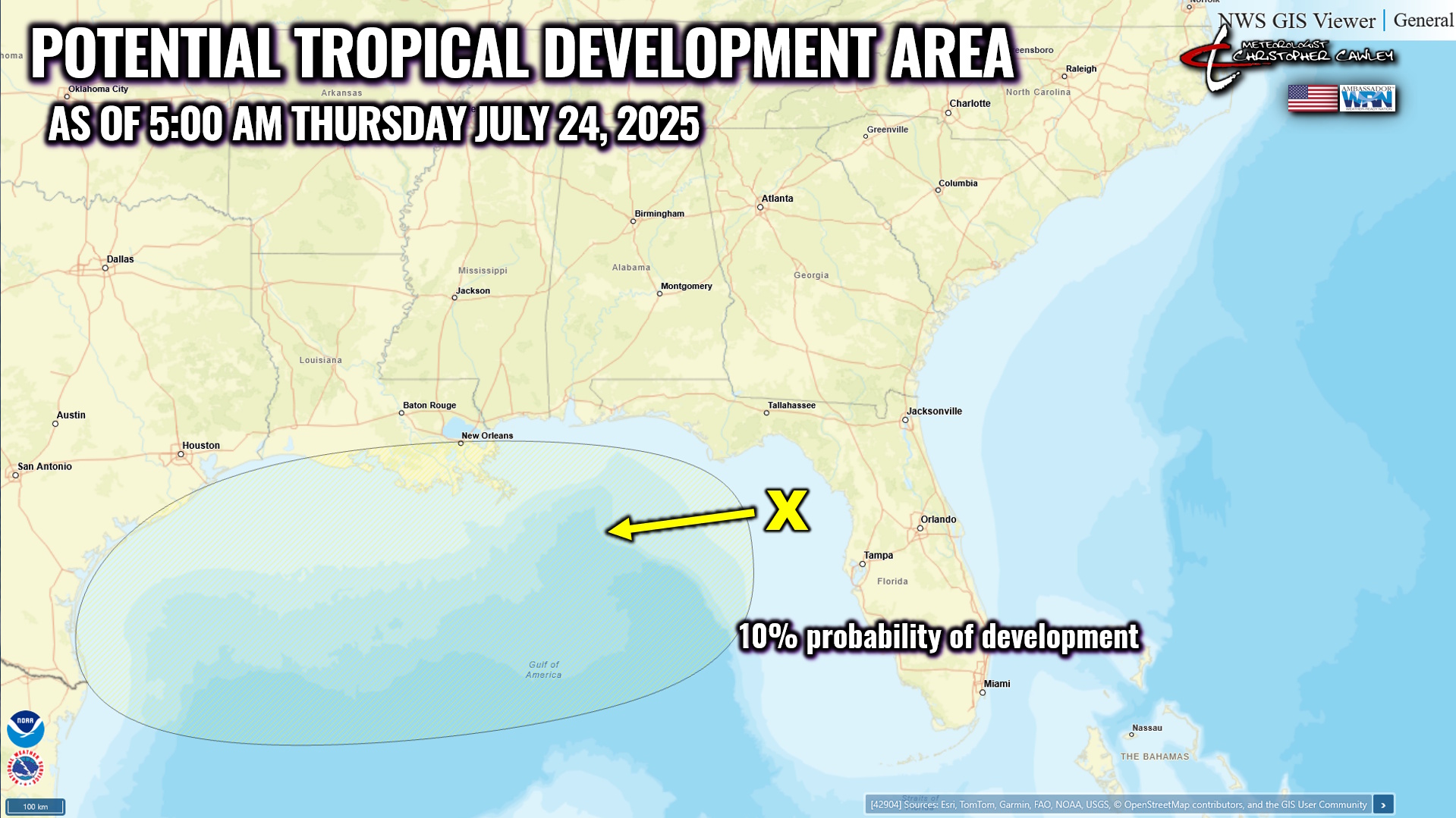
TROPICAL OUTLOOK: A weak area of low pressure will impact the northern Gulf of America over the next several days, bringing tropical rainfall along the Gulf coast. This system has a 10% chance of developing into a tropical system, according to the National Hurricane Center.
Here is your Freedom Insurance Today-plus-Five Forecast:
–Meteorologist Christopher Cawley