CCN Weather Update for Tuesday July 15, 2025.
This weather update is sponsored by Freedom Insurance of Whiteville. For home, car, boat, or whatever you need, you won’t need to sweat the details with Freedom Insurance on your side. Contact Freedom today at 910-640-2828!
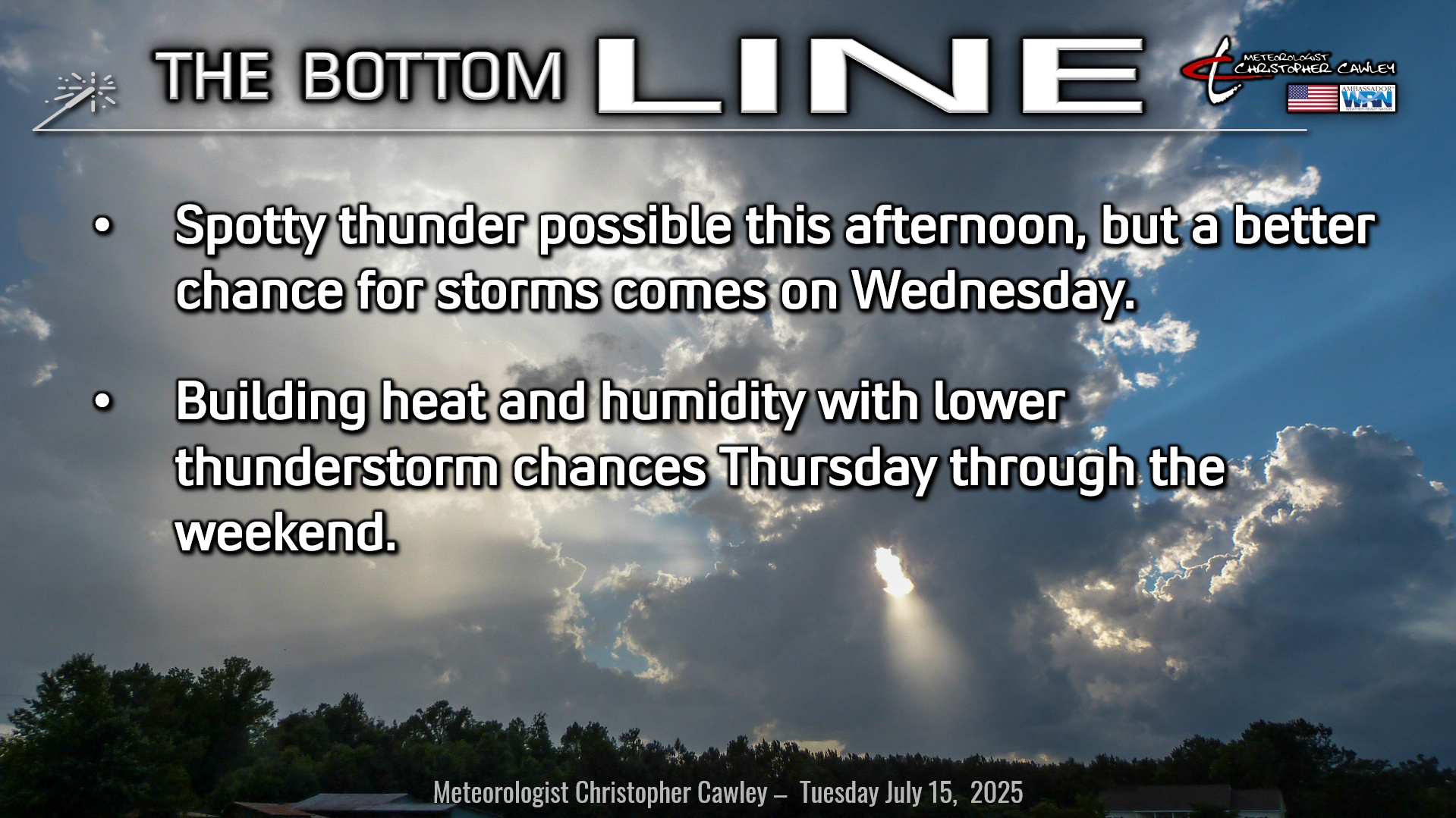
Here’s today’s Bottom Line
Busted forecast for yesterday, no storms developed anywhere near the local area.
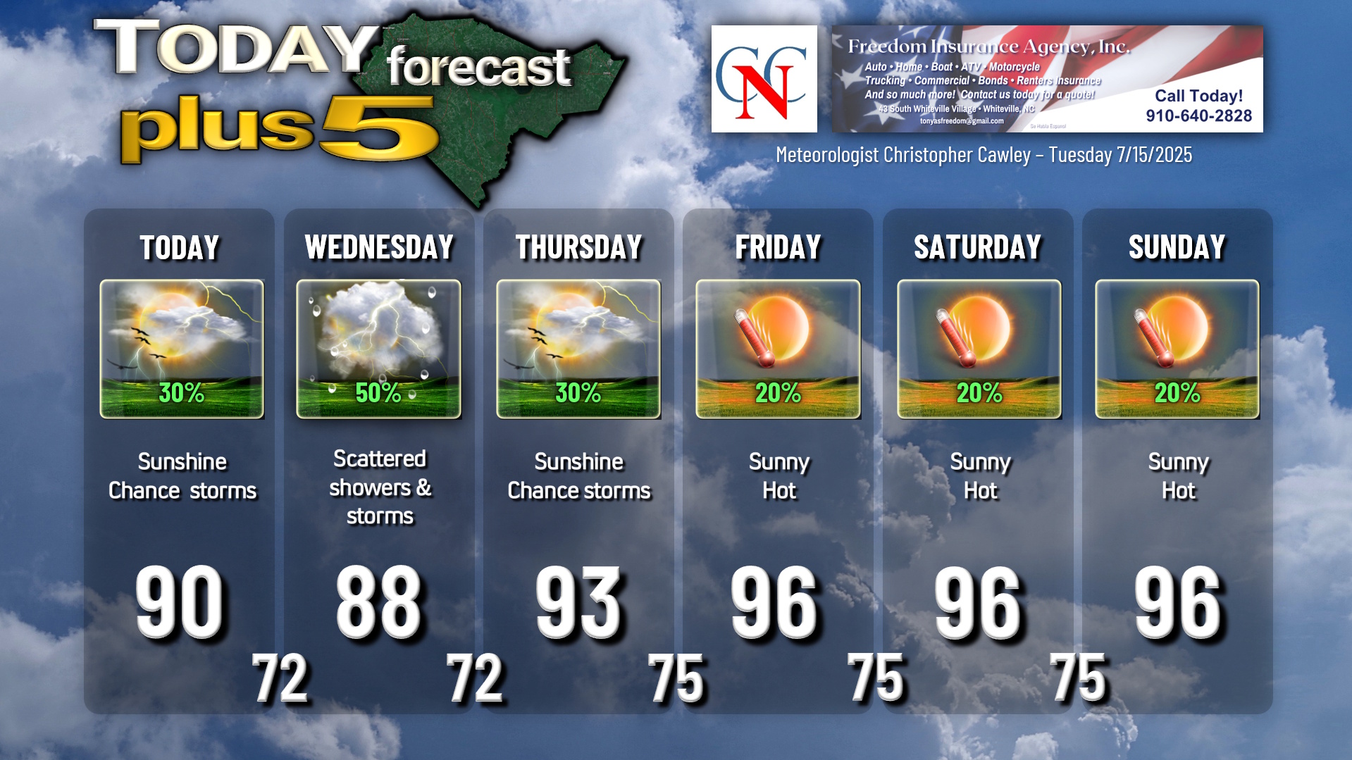
The overall weather pattern remains essentially the same, though, with a strengthening high pressure ridge off to our west, and a weak frontal boundary trying to drop down across the state. I’m going with 30% storm chances for this afternoon… I think we’ll largely be dry but I can’t make that promise. It appears primarily a sea-breeze event with the band moving well inland this afternoon. Our highs will be around 90.
The weak frontal boundary will be a focus for better thunderstorm coverage on Wednesday, but with yesterday’s forecast bust, my confidence is a little bit lower. Thus, I have lowered my percent chance on the graphic to 50%. There’s the potential that the county receives absolutely nothing, and there’s the equal potential that we get rocked with storms. There will be a lot of deep layer moisture in place, a lot of surface-based instability, and that frontal boundary to act as a spark.
Then our storm chances dwindle and the heat cranks up as we head toward the weekend. High pressure ridging to our south (steering the potential tropical cyclone toward the Gulf coast), combined with an inland “thermal trough,” and the Bermuda high, will result in very hot temps through the weekend. Thunderstorm chances are at about 20% Friday through Sunday but the heat risk will be high, and NWS heat advisories are possible over the weekend.
TROPICAL OUTLOOK: From the National Hurricane Center, an area of low pressure located off the east coast of Florida continues to produce disorganized showers and thunderstorms primarily south of the center. This system is likely to move westward across Florida today through tonight, eventually moving into the northeastern Gulf by the middle part of this week. Environmental conditions appear favorable for additional development if the system remains offshore, and a tropical depression could form as the system moves across the north-central Gulf by the middle to latter part of this week.
Meteorologist Noah Bergren, of Fox35 in Orlando, FL, has a good graphic detailing the possible scenarios with this system.
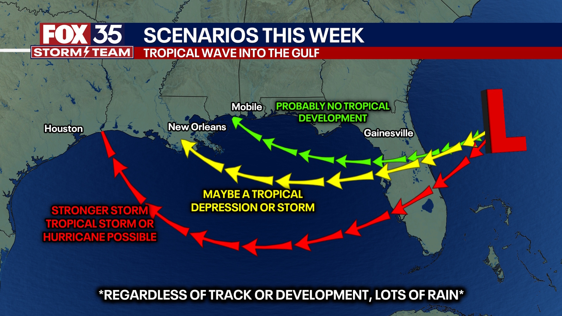
Graphic courtesy of Meteorologist Noah Bergren, Fox35 Orlando, FL.
Regardless of formation, this system will have NO IMPACT on our weather.
Here is your Freedom Insurance Today-plus-Five Forecast:
–Meteorologist Christopher Cawley