CCN Weather Update for Saturday August 16, 2025.
This weather update is sponsored by Freedom Insurance of Whiteville. No weather worries with Freedom Insurance. For home, car, boat, or whatever you need, Freedom can provide customized coverage to keep you and your family safe. Contact Freedom today at 910-640-2828!
Here’s Today’s Bottom Line
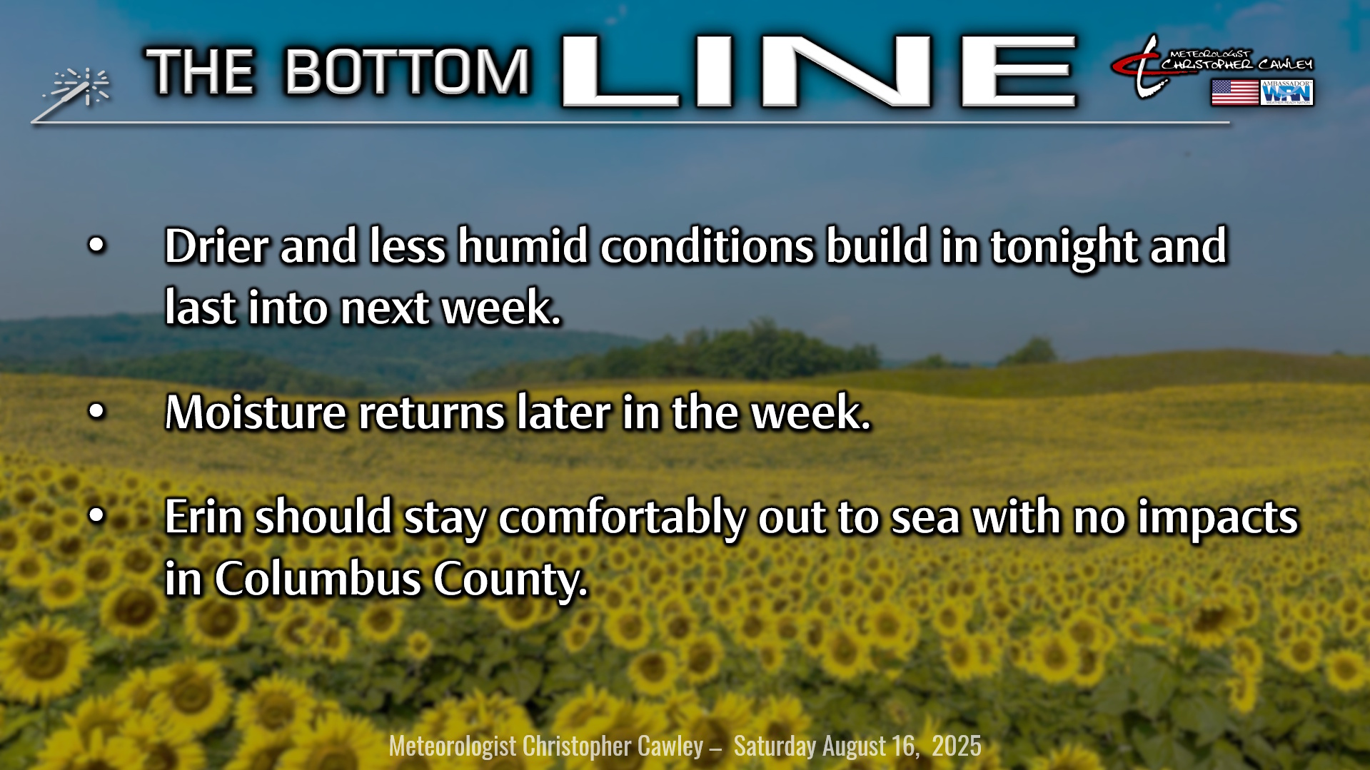
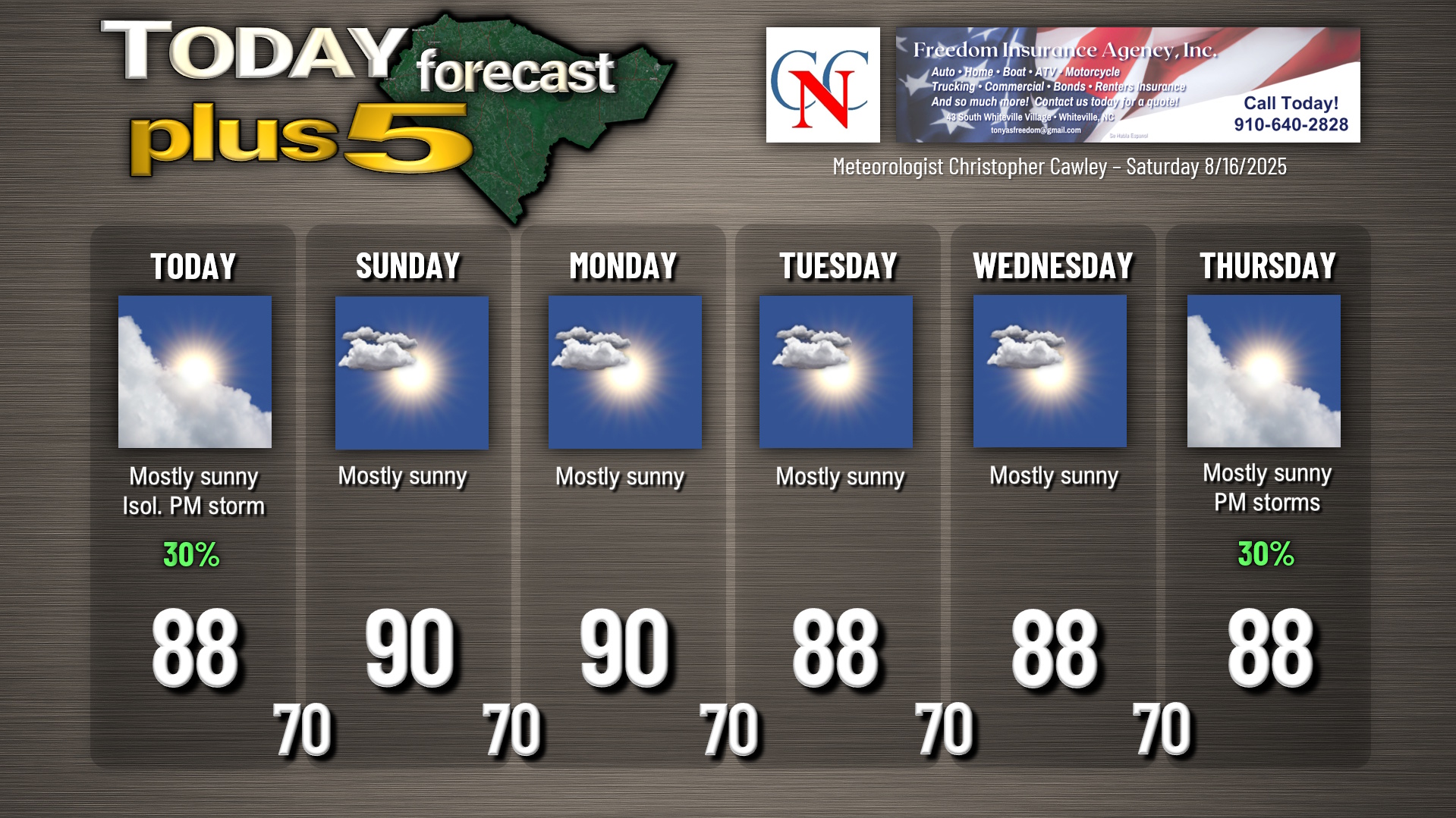
A dissipating “cold front” has spawned a weak area of low pressure off of the Outer Banks which may or may not take on some tropical characteristics as it moves away. The remnants of the front exist over our area and this will lead to enough moisture and instability that I can’t rule out an isolated thunderstorm this afternoon or early this evening.
High pressure ridging over the Mississippi Valley will extend into our area Sunday through the middle of next week with mainly dry weather, seasonable temps, and tolerable humidity values. A cold front will begin to approach our area by the latter part of the work week; this increases the southerly moisture again leading to higher humidity and thunderstorm chances Thursday and Friday.
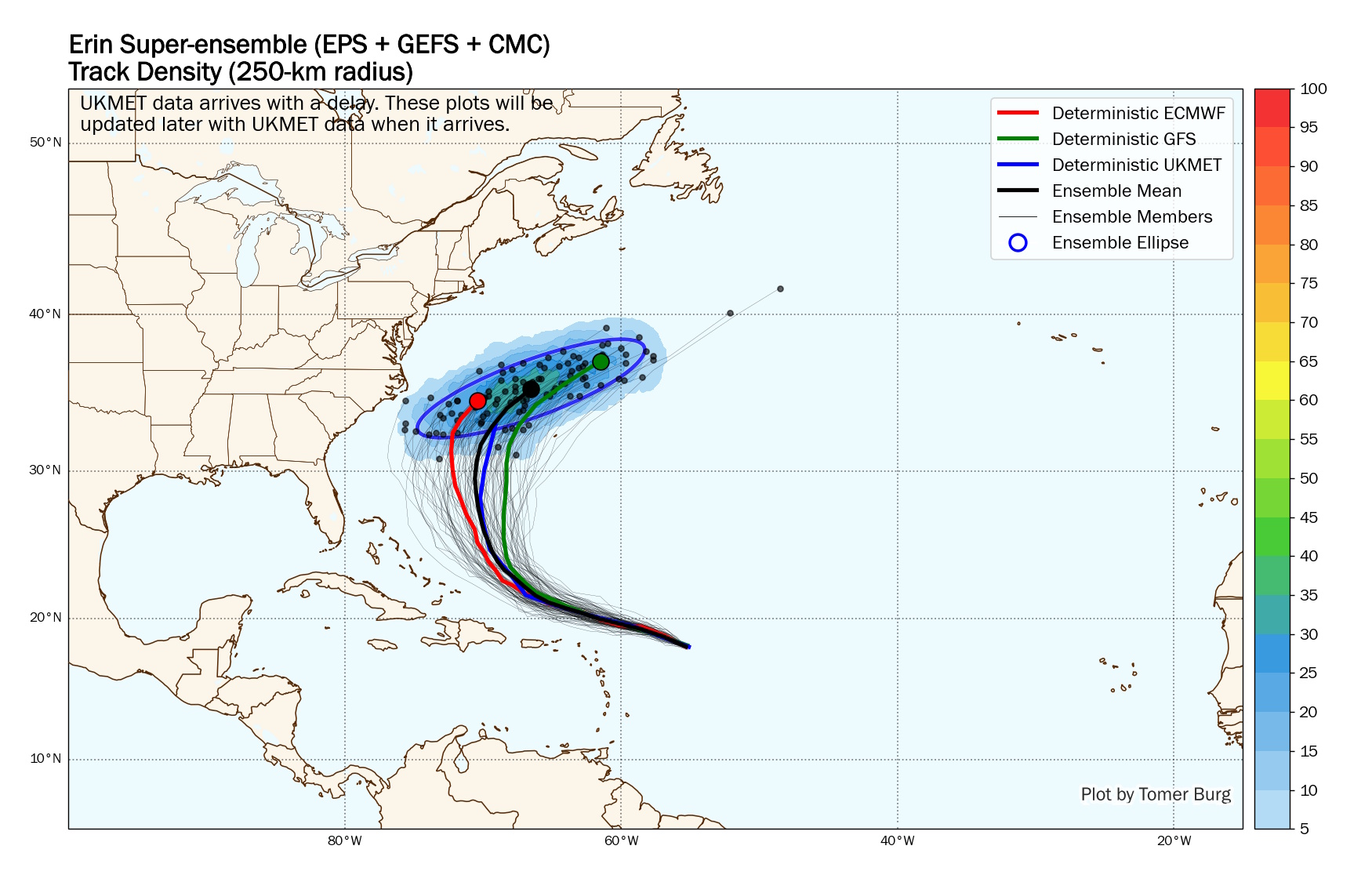
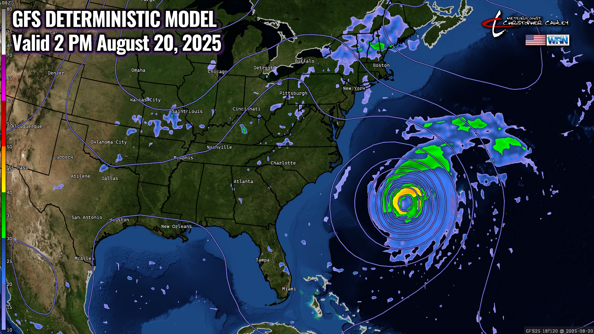
Tropics: Hurricane Erin will continue a west-northwest track, eventually curving to the north and then north-northeast, comfortably away from the US east coast.
Erin will become a “major” (category 3 or higher) storm as she lifts northward splitting the goalposts perfectly between the US east coast and Bermuda.
Erin will be a colossal, huge storm spanning several hundred miles across, but will have no impacts at all here in Columbus County, given the current forecast track.
Impacts along the beaches will be significant with deadly rip currents and some pretty big waves… along with maybe an occasional wind gust or two… but that’ll be that for Erin.
Attached are the latest model plots and the GFS deterministic. Remember, these are models and not official forecasts. You can view the latest National Hurricane Center forecasts HERE.
Here is your Freedom Insurance Today-plus-Five Forecast:
–Meteorologist Christopher Cawley