CCN Weather Update for Thursday August 21, 2025.
This weather update is sponsored by Freedom Insurance of Whiteville. No weather worries with Freedom Insurance. For home, car, boat, or whatever you need, Freedom can provide customized coverage to keep you and your family safe. Contact Freedom today at 910-640-2828!
Here’s today’s Bottom Line
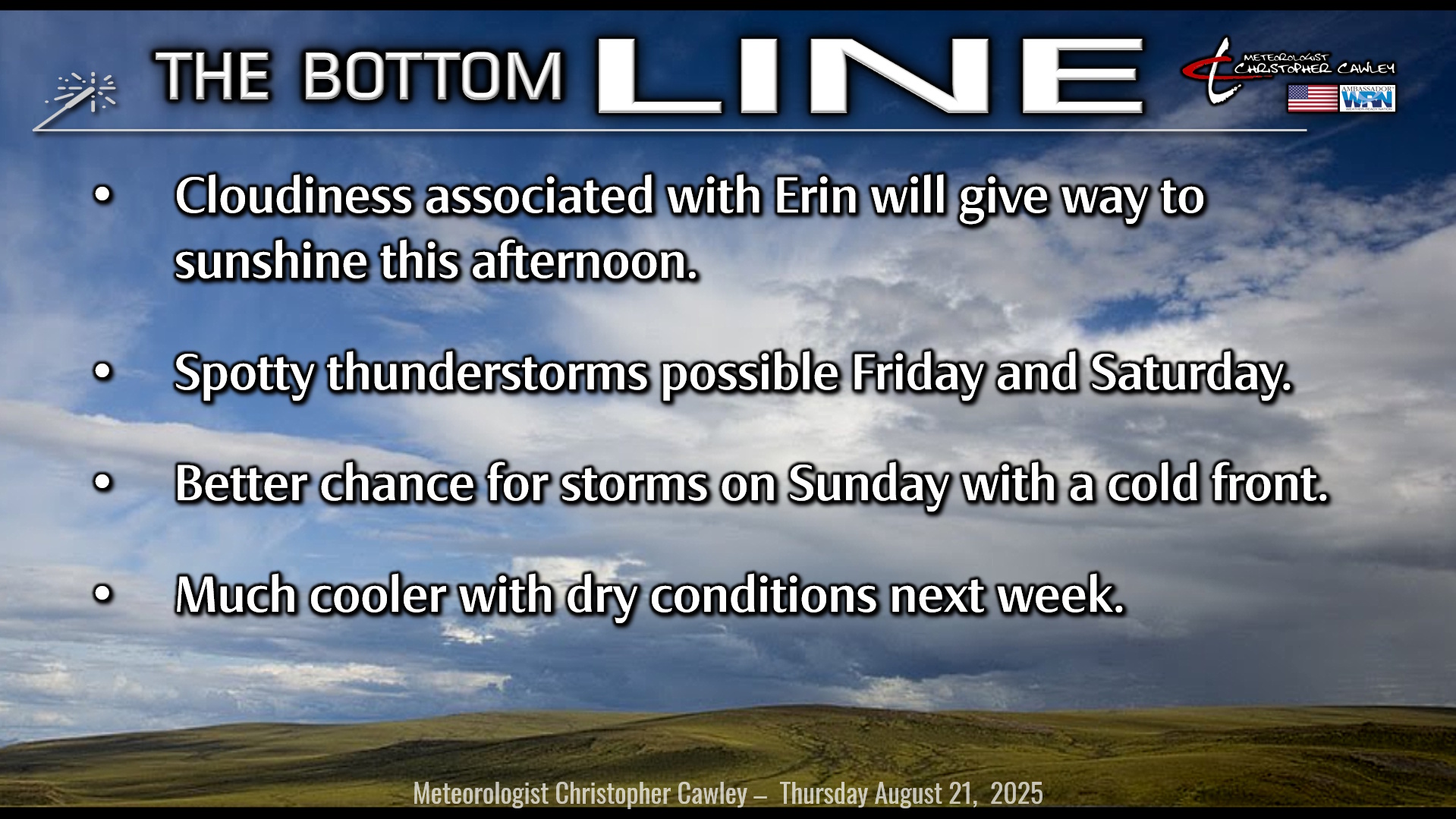
Hurricane Erin will hit the gas pedal today and accelerate off to the northeast, and by late this afternoon we’ll be saying bye-bye.
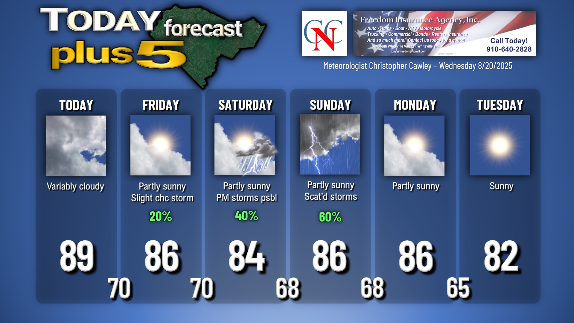
In the meantime, expect some cloudiness today, some breezy conditions at times (especially this morning), with increasing periods of sunshine this afternoon. It’s going to be a warm one, highs up near 90.
A backdoor cold front drops south over the area later this afternoon and this evening, this may spark a shower or thunderstorm but that’ll be more the exception than the rule. The front sinks far to the south for your Friday and we should see quite a bit of sunshine….. but since this is the summer of 2025 in Columbus County, I’m going to put a little thunderstorm mention in there as well. We probably won’t see anything, but again, this is the summer of 2025 and it likes to rain.
By the way, August rainfall to date on my weather station is 8.71 inches.
Low pressure organizes just off the South Carolina coast for Saturday … NON-TROPICAL as it will be attached to a frontal boundary. Meanwhile, another (stronger) cold front begins to approach from the west. We’ll be pinched in a moist southerly flow between these two systems, and scattered thunderstorms will likely be the result on Saturday afternoon and Saturday night. The cold front clears the coast early Monday morning and a large, sprawling area of Canadian high pressure (!) starts to become well established over the eastern half of the country. This will bring refreshingly cooler temps to the area for much of next week. That’ll be nice.
Tropics: Two areas to watch in the Atlantic, but at this time neither are likely to be threats to the mainland U.S.
The first area of low pressure will likely become a tropical depression or tropical storm within the next few days and begin a northerly track over the central Atlantic. No threats.
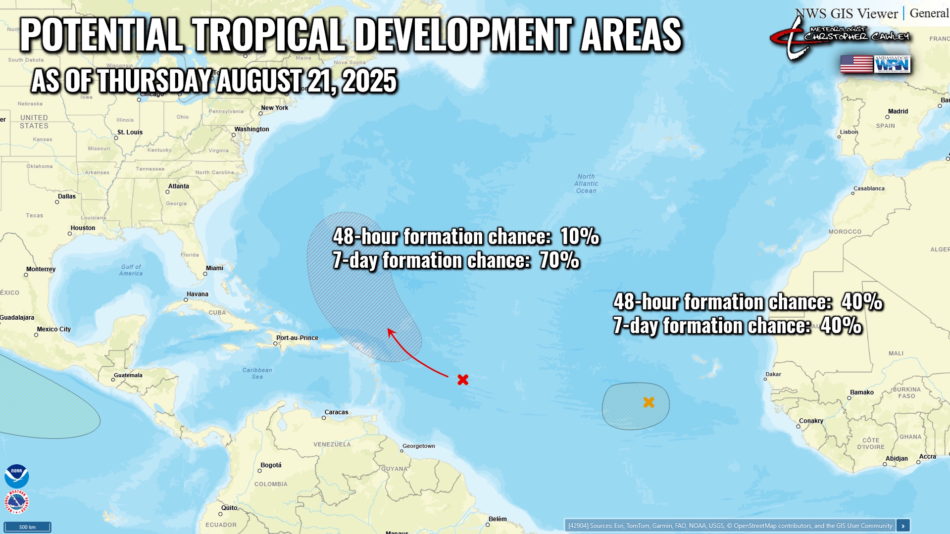
The second wave now has a 40% chance of developing into a tropical system over the next few days. The modeling implies that this will stay farther to the south as it takes on tropical characteristics, but we’ve got all kinds of time to watch the evolution of this system.
Here is your Freedom Insurance Today-plus-Five Forecast:
–-Meteorologist Christopher Cawley