


CCN Weather Update for Thursday August 7, 2025.
This weather update is sponsored by Freedom Insurance of Whiteville. No weather worries with Freedom Insurance. For home, car, boat, or whatever you need, Freedom can provide customized coverage to keep you and your family safe. Contact Freedom today at 910-640-2828!
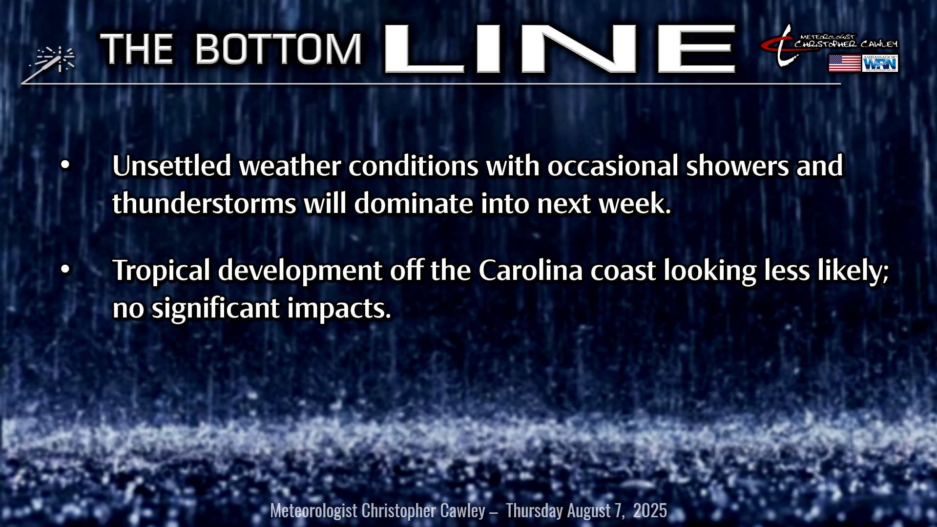
Here’s today’s Bottom Line
3.53″ rainfall yesterday, about 2.5″ of that came in the space of 2 hours. Listen, I know a lot is said about the flooding in Whiteville and the infrastructure, etc., but when that much rain falls in such a short amount of time, I don’t care how good things are, it’s going to flood.
A persistent deep southerly flow of moist air will continue over the area today through the weekend before Bermuda high pressure starts to win control over our weather as we move into next week.
The threat for showers and thunderstorms will continue at just about any point in time, but will be most favored through the afternoon and evening hours running through the weekend. Additional heavy rainfall is possible, and it’s essentially impossible to predict precisely where these showers and storms will become established. On the other hand, I don’t think they’ll ne quite as widespread this afternoon as they were yesterday… but I can’t promise that. Be prepared for additional significant rainfall.
As stated, the pattern doesn’t change much at all going through the weekend. The National Hurricane Center is still monitoring an area off the coast where low pressure might spin up along the old frontal boundary. The chances are less, and in looking at modeling, the guidance ranges from a weak low center well off to our north/east, to just general troughiness. In terms of real-world impacts, nothing will change here. Occasional showers and thunderstorms will be the rule Friday, Saturday, and Sunday with a few breaks of sunshine here and there as well.
Bermuda high pressure starts to take more control as we move into next week. This will work to suppress thunderstorm chances (though not ending them entirely)… Monday and Tuesday will be a case of mostly sunny skies but afternoon thunderstorm threats continue.
The NHC is also watching the central Atlantic ocean for likely development in the next few days or by the weekend. Whatever develops here is highly likely to curve to the north and stay largely out to sea. I know that runs contrary to what people have been posting on social media, but that’s the reality of the situation. I might be watching the south-central Atlantic in the intertropical convergence zone NEXT week for possible development, but that’s not even on the NHC’s map at this point.
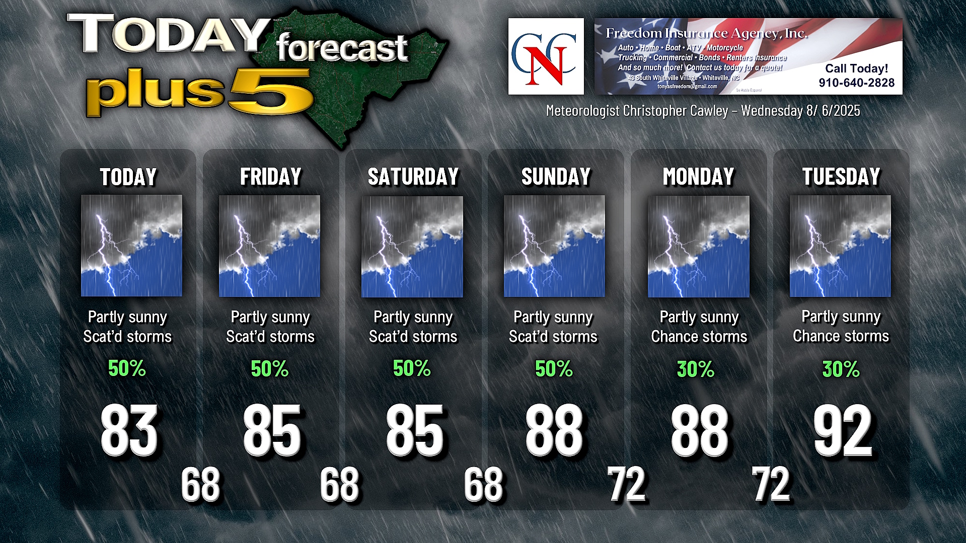
Here is your Freedom Insurance Today-plus-Five Forecast:
–Meteorologist Christopher Cawley


