CCN Weather Update for Wednesday August 20, 2025.
This weather update is sponsored by Freedom Insurance of Whiteville. No weather worries with Freedom Insurance. For home, car, boat, or whatever you need, Freedom can provide customized coverage to keep you and your family safe. Contact Freedom today at 910-640-2828!
Here’s today’s Bottom Line
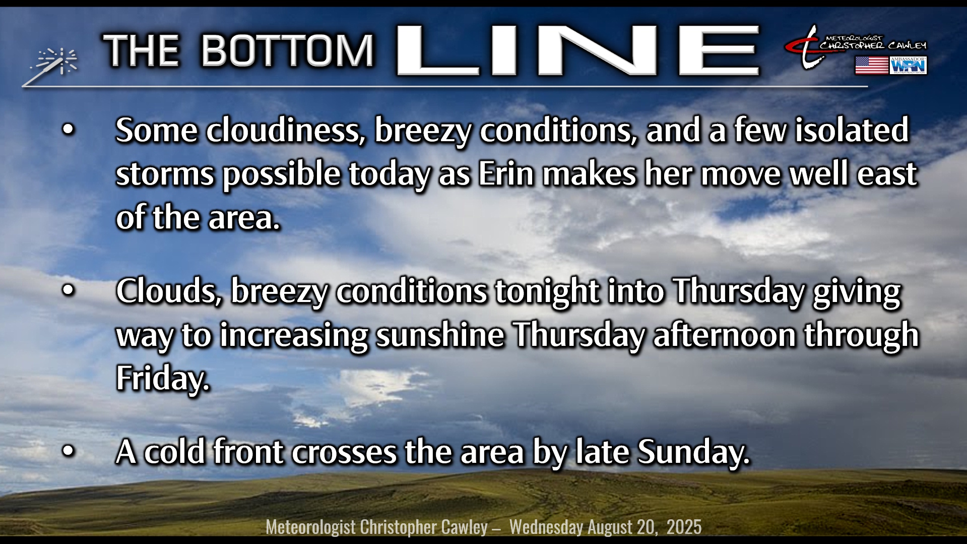
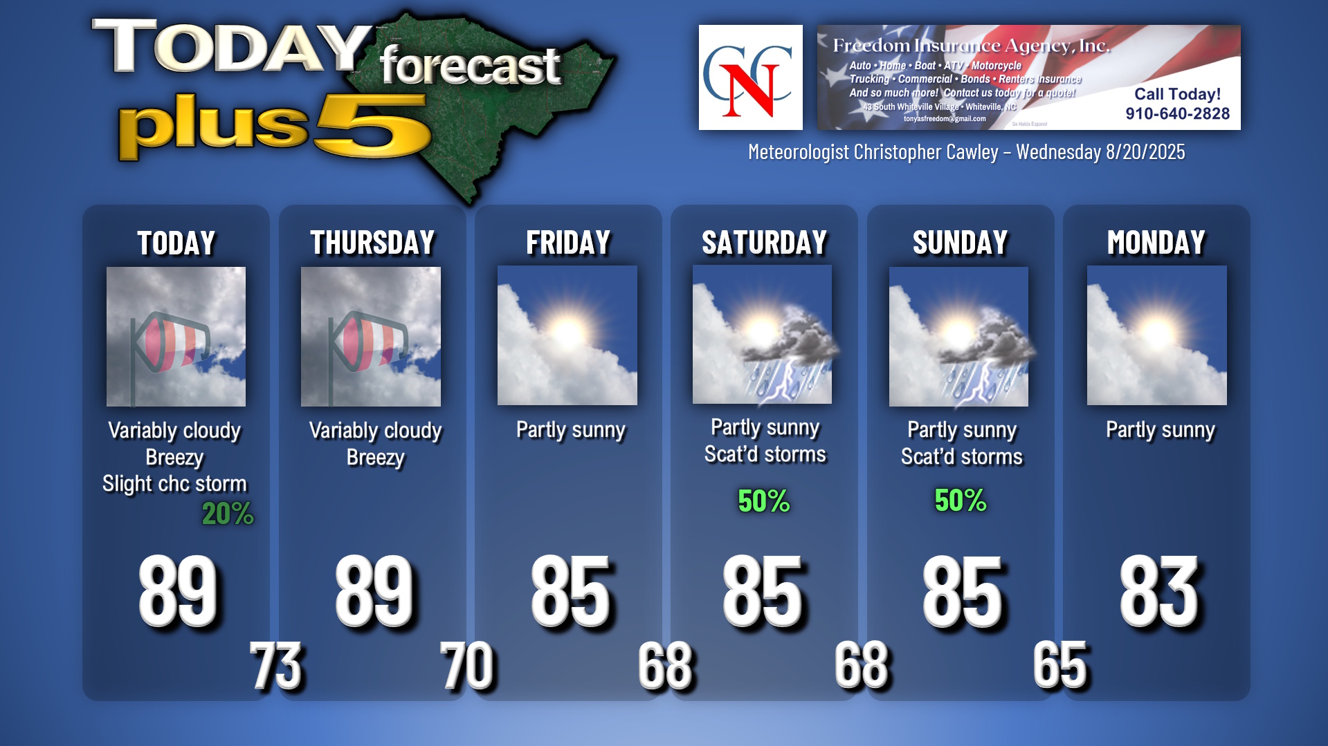
Hurricane Erin makes her long-awaited fly-by starting this afternoon through Thursday morning. The most we’re going to see here in Columbus County is some cloudiness this afternoon through tonight and Thursday morning, breezy conditions this afternoon, tonight, and Thursday, and a few spotty showers or a thunderstorm this afternoon. Winds should average 15-25 mph with occasional gusts to 30 mph, especially over the eastern half of the county, beginning later this afternoon and lasting through Thursday morning.
Beach conditions will be horrendous this afternoon through Thursday and probably into Friday as well with crashing waves, significant deadly rip currents, and some minor beach erosion. Watch out for a bit of flooding around the high tides as well.
Erin is quickly “yesterday’s news” by Thursday afternoon.
We’ll enjoy quiet weather Thursday night through Friday thanks to high pressure remaining in place. By Saturday morning, an area of low pressure along the Georgia coast, combined with a southerly flow ahead of a strong cold front to our northwest, leads to increased chances for showers and thunderstorms. The aforementioned front moves through late Sunday night/early Monday bringing an end to thunderstorms and a refreshing period of below-normal temperatures.
Tropics: There are still two areas to watch in the Atlantic. For yesterday’s report I expressed a little concern about one of those two areas, but the concern is much, much less today as the NHC (and most of the available modeling) now expects whatever develops to stay over the open ocean. It’s still worth watching, and of course I’ll be doing just that.
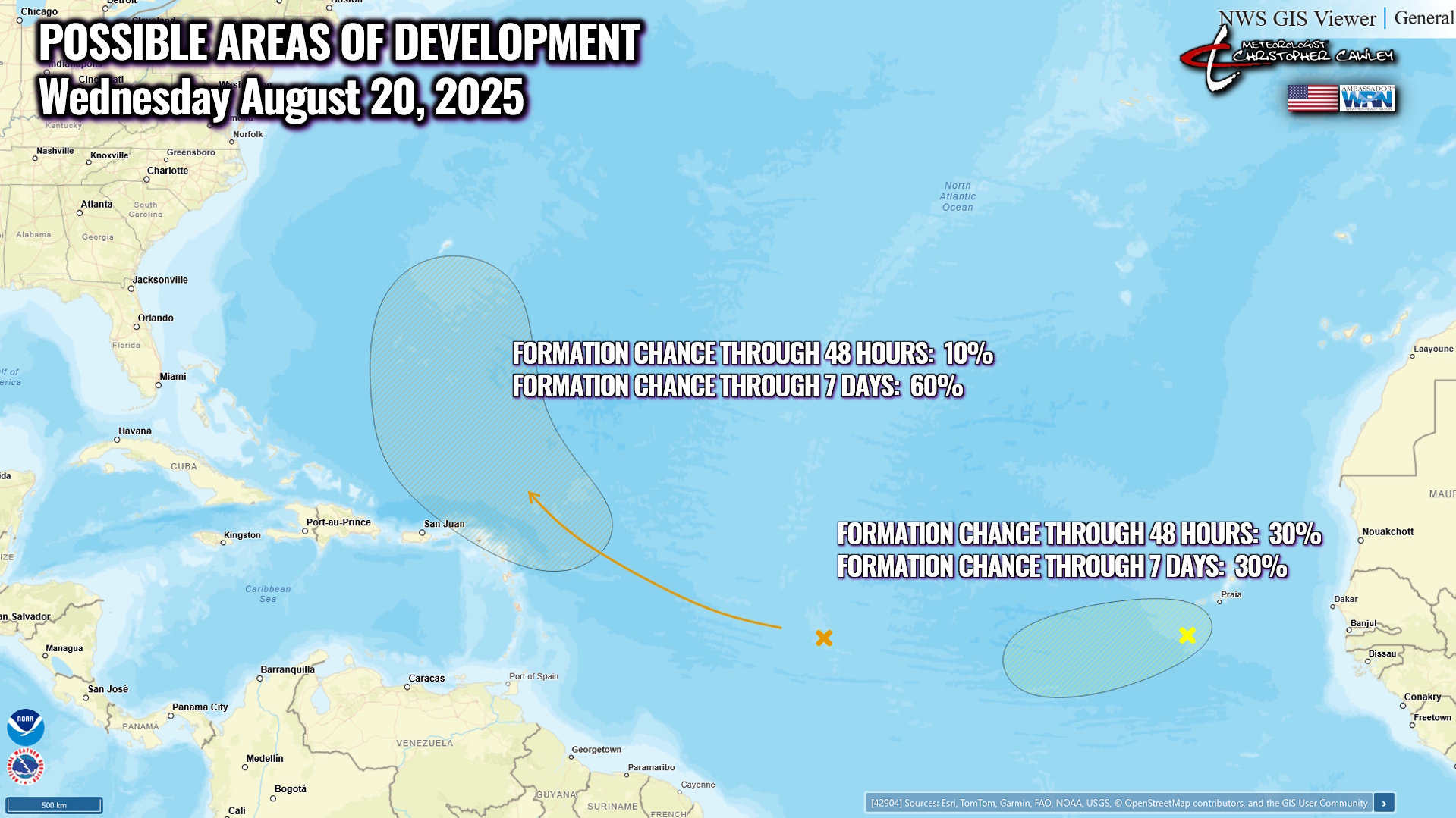
The second area is a wave moving off the African coast and this has a 30% chance of developing into a tropical system over the next few days. The modeling implies that this will stay close to the intertropical convergence zone… we’ll see what becomes of this one but for now, nothing over which to lose any sleep.
Here is your Freedom Insurance Today-plus-Five Forecast:
–Meteorologist Christopher Cawley