CCN Weather Update for Friday August 1, 2025.
This weather update is sponsored by Freedom Insurance of Whiteville. No weather worries with Freedom Insurance. For home, car, boat, or whatever you need, Freedom can provide customized coverage to keep you and your family safe. Contact Freedom today at 910-640-2828!
Here’s today’s Bottom Line
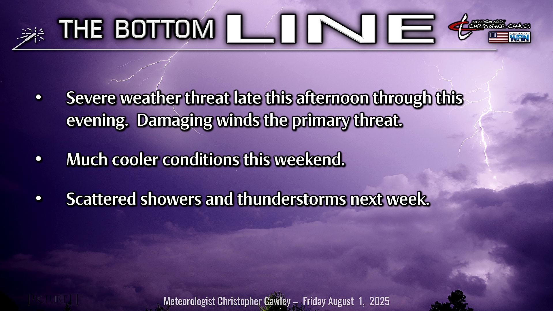
Cold front sags south over the area later this afternoon into this evening. Thunderstorms start to develop by early- to mid-afternoon. Significant moisture profiles and high instability will no doubt lead to rather aggressive thunderstorms. Wet microbursts are possible within the stronger storms and thus a severe threat exists mainly after 2 PM today. Before the front gets here, high temps should jump into the lower 90s with borderline heat index values up over 100… but once the front arrives and thunderstorm debris clouds overspread the area, heat index values and temps will begin to drop.
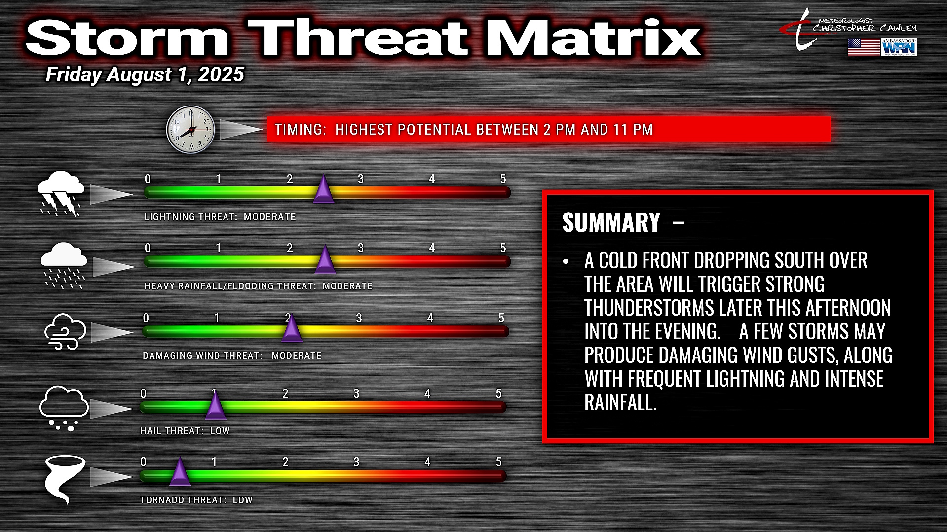
The heat wave definitively ends tonight as the front pushes through. Showers and thunderstorms will be the rule through about midnight, tapering off after midnight. Once again, isolated damaging winds / wet microbursts are possible through the evening hours, and some localized flooding is also possible.
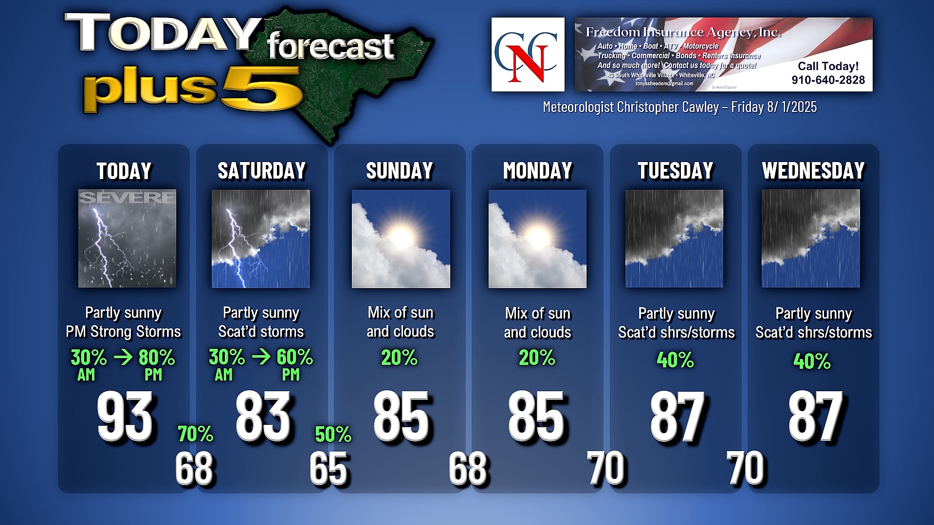
Saturday will remain rather unsettled, though not as rainy/cloudy as I had originally thought. The front will drop south to about Savannah and along the coastal waters as a wave of low-pressure rides along it. I’m going with a mix of clouds and sunshine locally with some afternoon showers and storms — similar to what we’ve experienced the past few days. The front remains in pretty much the same place Sunday and Monday. I think our rain chances will be much less (20%) those days, and I think we’ll see more sunshine than anything else.
The front starts to lift back north as a warm front as we go into Tuesday and Wednesday. The front will be slow to move thanks to stronger high pressure off to the north, but I think that as we get toward the end of the week we’ll be back up at or above 90 for highs, so enjoy the cooler temps while we have them!
You may have noticed some subtle changes to the forecast graphic. I have split the precipitation percent chance to AM and PM for the first two days and will go with that moving forward. Overnight precipitation chances for nights 1 and 2 are included over the low temp. I will only post precipitation percent chance if the chance is 20% or greater.
TROPICAL OUTLOOK: No concerning activity in the tropics at this time.
Here is your Freedom Insurance Today-plus-Five Forecast:
–Meteorologist Christopher Cawley