CCN Weather Update for Friday September 5, 2025.
This weather update is sponsored by Freedom Insurance of Whiteville. No weather worries with Freedom Insurance. For home, car, boat, or whatever you need, Freedom can provide customized coverage to keep you and your family safe. Contact Freedom today at 910-640-2828!
Here’s today’s Bottom Line
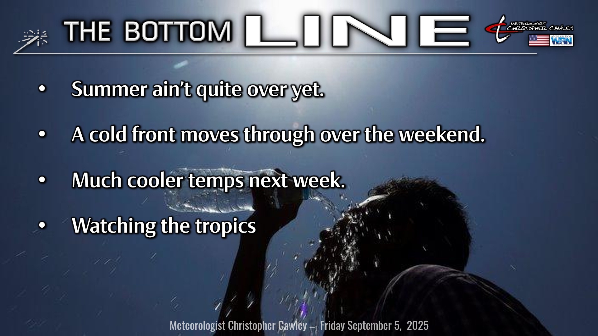
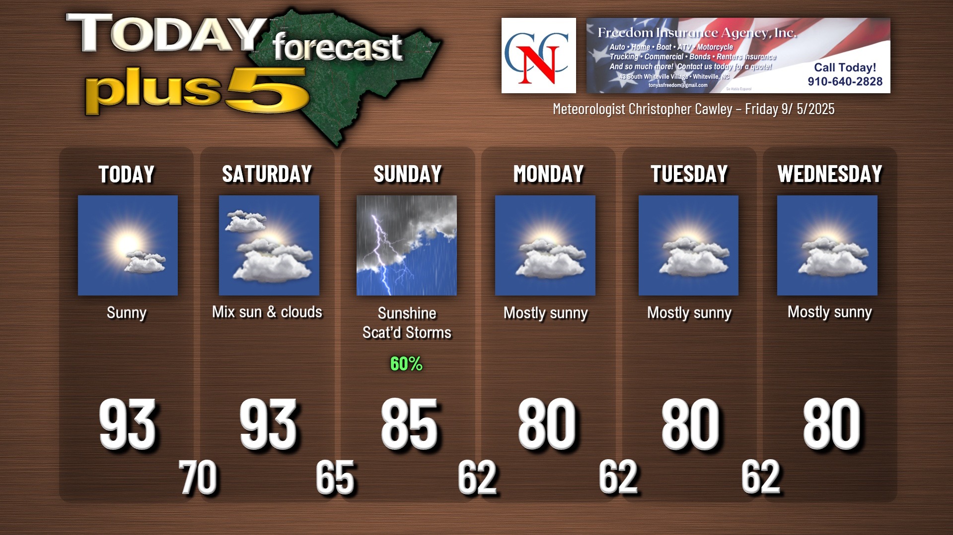
Two unseasonably hot days today and tomorrow thanks to high pressure releasing its grip on our area. By Saturday, a warm front will extend just offshore from the Outer Banks southward to central Florida, while a cold front approaches the area from the west. We’ll be “pinched” in a southerly flow of hot and humid air, but we should remain dry. We’ll be well into the 90s both today and tomorrow, and heat index values will be around 100 degrees. Summer ain’t quite over yet.
Models have slowed down the progression of the frontal boundary to where I initially thought it would be… crossing our area late Saturday night or early Sunday. Fortunately the nighttime passage means less of a chance for strong thunderstorms; in fact, I believe storm chances hold off until Sunday afternoon and Sunday evening as cooler air starts to push in from the northwest.
The front hangs up off the coast by Monday as STRONG high pressure drifts down from the Ohio valley bringing dramatically cooler temps in here for the first part of next week.
Weak waves of low pressure develop on that frontal boundary well offshore, but at this time it appears they will be far enough offshore that we won’t see much more than just some cloudiness during the midweek period.
The frontal boundary location will also play a big role in our tropical scenario as we move through next week…
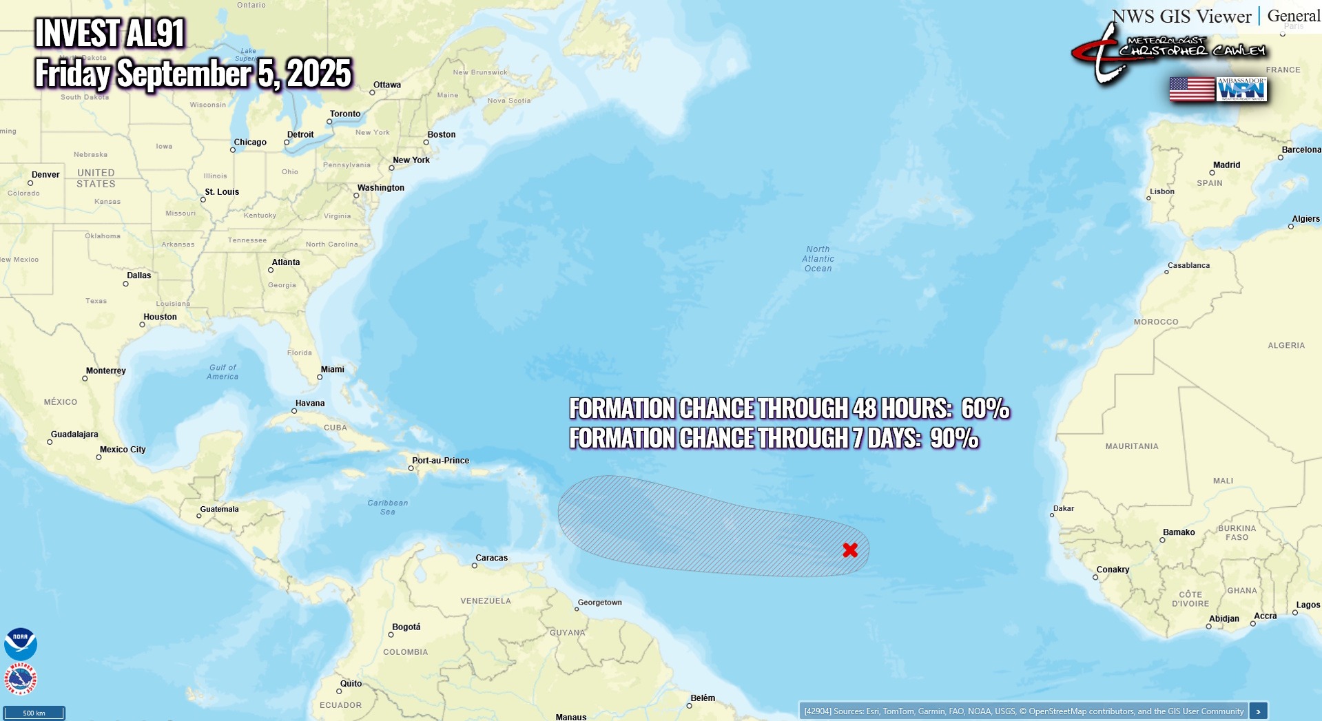
TROPICS: All eyes are on Atlantic Invest AL91 quickly coming together over the central Atlantic ocean just north of the Intertropical Convergence Zone. This area is very favorable for tropical development and this will likely become a depression or tropical storm by the weekend. The NHC now gives this a 60%/90% chance of developing.
Where does the future Gabrielle go from here? The latest European ensemble plot has that familiar and reassuring north turn but there’s a very wide spread in the guidance. Other ensembles carry her into the Caribbean with eyes on the Gulf. The chart below shows the European ensemble guidance as of Thursday evening.
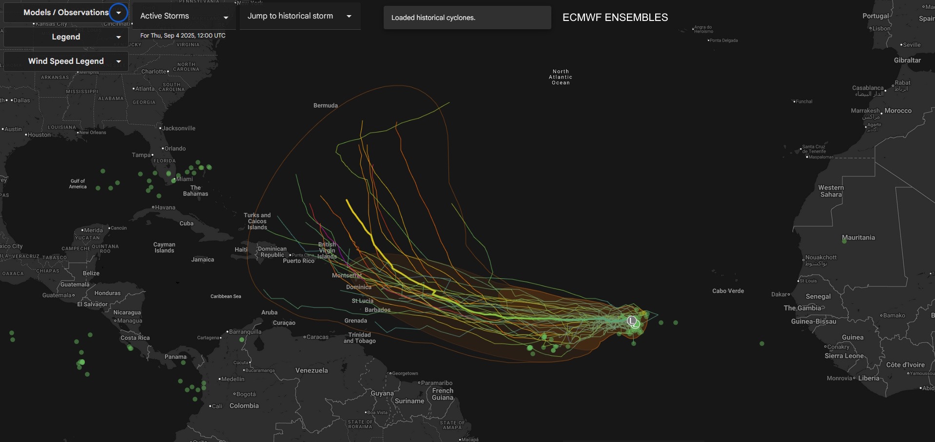
I’m sure you’ve seen some of the posts on social media of a monster hurricane taking aim on the Carolina coast once again. There is zero scientific value in what these people are posting as they amount to one snapshot from one model at one moment in time … a model that’s going to change a multitude of times over the next week to 10 days.
I will watch this carefully. Don’t trust no-name social media pages claiming to be experts. Trust local DEGREED meteorologists… folks like Jamie, Ed, Gannon, Eric, and others will tell it to you straight, without the hype or the scary end-of-the-world charts that people find on the interwebs.
I don’t think a coastal run is likely with this system, but no, I can’t rule it out yet. The frontal boundary and it’s final location will play a big role in steering the future-Gabrielle. We’re a week out from having to worry. Again, trust your local meteorologists, not some anonymous person on social media looking to frighten you.
Here is your Freedom Insurance Today-plus-Five Forecast:
–Meteorologist Christopher Cawley