CCN Weather Update for Monday September 1, 2025.
This weather update is sponsored by Freedom Insurance of Whiteville. No weather worries with Freedom Insurance. For home, car, boat, or whatever you need, Freedom can provide customized coverage to keep you and your family safe. Contact Freedom today at 910-640-2828!
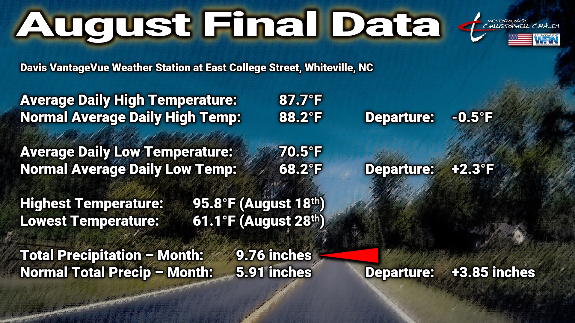
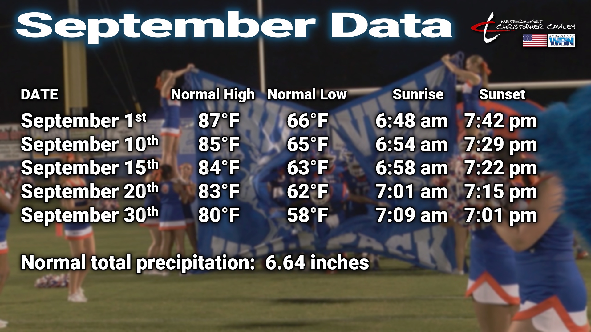
Here’s a look at the final August climatological numbers from my weather station, and what we can expect for normal values for September.
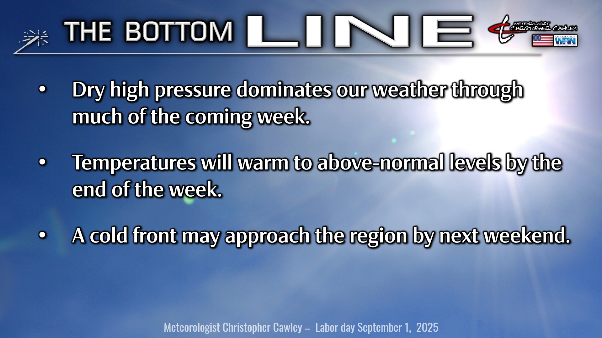
Here’s today’s Bottom Line
Welcome to the start of Meteorological Autumn, which runs from today, September 1st through Sunday November 30th.
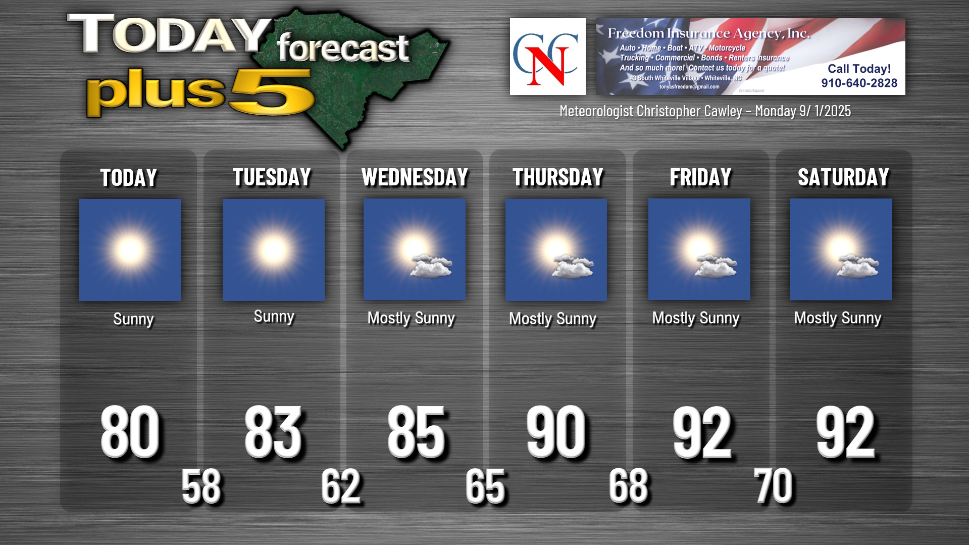
It certainly feels like a touch of fall is in the air with the cool temps this morning. Today is going to be about as close to a “Perfect Ten” as you’re going to get for Columbus County weather with bright blue sunny skies, low humidity, and highs around 80 degrees. Seriously… get out and enjoy it.
We’ll drop back to the upper 50s to around 60 tonight with clear skies.
Dry high pressure remains in control through much of the work week. A weak area of low pressure may form off the coast for the midweek period, but I think the impacts from this will stay to our south/east… but I may have to put more clouds in the forecast for the Wednesday-Thursday timeframe. For now I’m going with mostly sunny skies.
A cold front starts to approach the area by the weekend but ahead of that, temperatures really warm up (and the humidity ramps up quite a bit) Thursday through Saturday as we’re back above the 90-degree mark. Shower/thunderstorm chances should hold off until next Sunday.
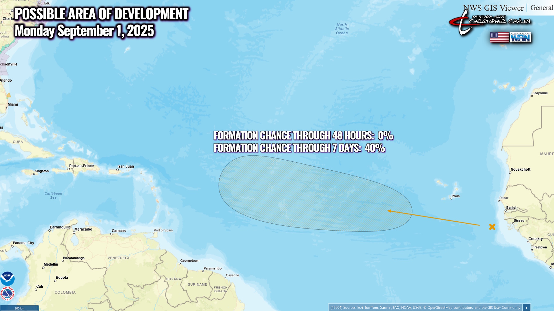
TROPICS: A tropical wave just off the coast of Africa is still somewhat disorganized, but will move into an area where conditions are favorable for slow development. The NHC gives this area a 40% chance of development over the next 7 days. It’ll need to be watched, but we’re still at least 10 days to 2 weeks away from anything to worry about.
Here is your Freedom Insurance Today-plus-Five Forecast:
–Meteorologist Christopher Cawley